|
 CAMPING IN SWEDEN 2016 - Lund, Göteborg,
Kungälv, Bohuslän
Bronze Age rock engravings,
Trollhättan,
Dalsland Canal and Håverud
Aqueduct: CAMPING IN SWEDEN 2016 - Lund, Göteborg,
Kungälv, Bohuslän
Bronze Age rock engravings,
Trollhättan,
Dalsland Canal and Håverud
Aqueduct:
 The journey out to
Sweden: after a long winter, and delayed start to this year's travels
with health concerns, it was a moment to be savoured sitting beer in hand as the
Harwich~Hook of Holland ferry pulled away from the dock; our 2016 trip
to Sweden was finally underway. Again this year we had the long 550 mile
transcontinental drive to reach Sweden, across
Holland and Northern Germany, the Puttgarden~Rødby ferry to Denmark, and finally
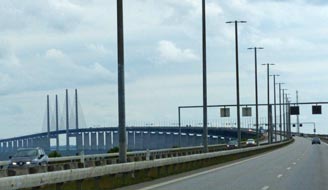
across the Öresund Bridge with the straits this time sullenly grey; the crossing of that magnificent engineering structure (see left), though expensive
now at €54, is always a thrilling experience (Photo 1 - Crossing the Öresund Bridge).
At the Swedish side of the bridge, we had expected traffic queues with the re-introduction of border checks to control
levels of illegal immigrants entering Sweden, but a cursory glance at our
passports caused no delays; the border guard appreciated our supportive words
for Sweden's tougher line to protect its borders, and wished us a good stay in
this year's host country. The journey out to
Sweden: after a long winter, and delayed start to this year's travels
with health concerns, it was a moment to be savoured sitting beer in hand as the
Harwich~Hook of Holland ferry pulled away from the dock; our 2016 trip
to Sweden was finally underway. Again this year we had the long 550 mile
transcontinental drive to reach Sweden, across
Holland and Northern Germany, the Puttgarden~Rødby ferry to Denmark, and finally
across the Öresund Bridge with the straits this time sullenly grey; the crossing of that magnificent engineering structure (see left), though expensive
now at €54, is always a thrilling experience (Photo 1 - Crossing the Öresund Bridge).
At the Swedish side of the bridge, we had expected traffic queues with the re-introduction of border checks to control
levels of illegal immigrants entering Sweden, but a cursory glance at our
passports caused no delays; the border guard appreciated our supportive words
for Sweden's tougher line to protect its borders, and wished us a good stay in
this year's host country.
|
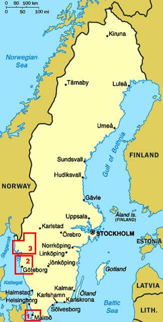
Click on the 3 highlighted areas of map
for
details of
South-West Sweden |
 |
We planned to spend a day in the University
city of Lund after a first night's camp at Lomma, but having crossed the Öresund
at 2-00pm, we had time this afternoon for a preliminary visit for more
functional jobs such as buying a Swedish SIM card for our mobile phone. Around
Malmö on the motorway to approach Lund from the south, we eventually found
Lund's Phone Shop and a paying car park in nearby Märtens Torget which we knew
 from
our 2013 visit to Lund. At this stage we had no Swedish coins, and when the
automat would not accept our credit card, a local man in a generous act of
kindness paid our hour's parking charge. Having secured our Telia SIM card, we
still had time to walk through to the Tourist Information Centre in Stortorget
for a city plan. Having already experienced the helpfulness of Lund's
citizens, the girl at the TIC told us that Lund so prides itself on helpfulness
and good service that it operates a helpfulness competition: she gave us a pin
badge to present to the Lundite whom we judged to be most helpful, though it was
not clear at this stage what the recipient should do with the badge or how the
recognition was awarded. But we accepted the challenge, and collected our city
plan and the usual crop of leaflets ready for tomorrow. Having extricated
ourselves from Lund centre in the late afternoon traffic, we headed for Lomma
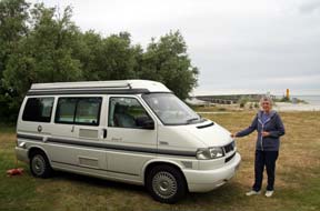
for provisions from the ICA supermarket, and our first night camp at Habo-Ljung
Camping on the shore of the Öresund (see left). It was a gloomy evening with a chill wind
blowing from across an equally grey Öresund. We were back in Sweden and could
relax at last. from
our 2013 visit to Lund. At this stage we had no Swedish coins, and when the
automat would not accept our credit card, a local man in a generous act of
kindness paid our hour's parking charge. Having secured our Telia SIM card, we
still had time to walk through to the Tourist Information Centre in Stortorget
for a city plan. Having already experienced the helpfulness of Lund's
citizens, the girl at the TIC told us that Lund so prides itself on helpfulness
and good service that it operates a helpfulness competition: she gave us a pin
badge to present to the Lundite whom we judged to be most helpful, though it was
not clear at this stage what the recipient should do with the badge or how the
recognition was awarded. But we accepted the challenge, and collected our city
plan and the usual crop of leaflets ready for tomorrow. Having extricated
ourselves from Lund centre in the late afternoon traffic, we headed for Lomma
for provisions from the ICA supermarket, and our first night camp at Habo-Ljung
Camping on the shore of the Öresund (see left). It was a gloomy evening with a chill wind
blowing from across an equally grey Öresund. We were back in Sweden and could
relax at last.
The University city of Lund: on another dull, grey morning, we drove
back into Lund and found the parking area recommended by the TIC and close to the city centre. But now came further problems with payment: the machine
refused to accept non-Swedish credit cards and we sought
 help from an elderly
gentleman who also failed to make it read our card. In the true spirit of
Helpful Lund however, and to our acute embarrassment, he also insisted on paying
our parking charge with his card; we were overwhelmed at this generosity and
explained Lund's pin-badge award for excellent service which we insisted on
awarding to him. In complete puzzlement at these strange English people, he took
the badge along with our insistent thanks, and went on his way! This was the
second such act of helpful kindness we had received in Helpful Lund, and we came
to the conclusion that, while Lundites are by nature courteous and helpful, the
town's parking automats are cussedly uncooperative towards overseas visitors. help from an elderly
gentleman who also failed to make it read our card. In the true spirit of
Helpful Lund however, and to our acute embarrassment, he also insisted on paying
our parking charge with his card; we were overwhelmed at this generosity and
explained Lund's pin-badge award for excellent service which we insisted on
awarding to him. In complete puzzlement at these strange English people, he took
the badge along with our insistent thanks, and went on his way! This was the
second such act of helpful kindness we had received in Helpful Lund, and we came
to the conclusion that, while Lundites are by nature courteous and helpful, the
town's parking automats are cussedly uncooperative towards overseas visitors.
Lund is a delightful University city, and its
student population gives it a lively youthful air; see
Log of our 2013 visit to Lund. Today there were hints of drizzle in the air
for our re-visit, but taking no waterproofs with foolhardy bravado we set out to walk around to the
 Cathedral through Lund's quaint old street's lined with cottages charmingly
a-blossom with scented roses. We reached the Cathedral just as the
Astronomical Clock's midday performance was coming to an end and a service was
beginning in the nave; we should have to return later to see the magnificent
Romanesque architecture. We had last visited Lund in gloriously spring
sunshine in May 2013, and still being term time then, the beautiful gardens of Lundagård were filled with young undergraduates sitting on the lawns under the
trees. Today in mid-June, term had finished; it was cold with the beginnings of
drizzle, the sky was a lifeless grey with little light Cathedral through Lund's quaint old street's lined with cottages charmingly
a-blossom with scented roses. We reached the Cathedral just as the
Astronomical Clock's midday performance was coming to an end and a service was
beginning in the nave; we should have to return later to see the magnificent
Romanesque architecture. We had last visited Lund in gloriously spring
sunshine in May 2013, and still being term time then, the beautiful gardens of Lundagård were filled with young undergraduates sitting on the lawns under the
trees. Today in mid-June, term had finished; it was cold with the beginnings of
drizzle, the sky was a lifeless grey with little light
 for photography, and the
gardens were deserted. Our plan for today was for lunch at the students' union
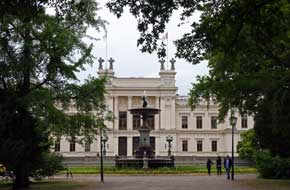
cafeteria, and we walked up past the magnificent classically styled Universitets
Huset building (see above left) heading for the Akademinska Föreningen for lunch. Normally during
term time, visitors could use the cafeteria, but today out of term a conference
was taking place and the cafeteria was reserved for delegates. We were however
given details of another student cafeteria near the University library. Along
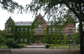
Sandgatan, set amid tall, noble trees and beautiful gardens rose the magnificent
red-brick Gothic University Library (see right) (Photo
2 - Lund University Library), and just behind this in the more
modest languages library building we found the Sol cafeteria for a good value
lunch. for photography, and the
gardens were deserted. Our plan for today was for lunch at the students' union
cafeteria, and we walked up past the magnificent classically styled Universitets
Huset building (see above left) heading for the Akademinska Föreningen for lunch. Normally during
term time, visitors could use the cafeteria, but today out of term a conference
was taking place and the cafeteria was reserved for delegates. We were however
given details of another student cafeteria near the University library. Along
Sandgatan, set amid tall, noble trees and beautiful gardens rose the magnificent
red-brick Gothic University Library (see right) (Photo
2 - Lund University Library), and just behind this in the more
modest languages library building we found the Sol cafeteria for a good value
lunch.
After lunch we headed for the University
Botanical Gardens (Botaniska Trädgården), the sky now threateningly dark with
the beginnings of rain in the air as we hurried along Biskopsgatan under the
dark trees past various university institutes. By the time we reached the
Gardens, rain was falling, and having secured a layout plan, we headed for the
greenhouses.
 Founded in the 1690s as a study garden for medical students, the
University Botanical Museum was established at its present location, then the
outskirts of Lund, in the mid-19th century by the botanist Jacob Georg Agardh. who designed the gardens' layout and greenhouses. Today the 8 hectares of
gardens grow over 7,000 plant species and still supports the University's Botany
studies. As we entered the greenhouses, pouring rain began; we had just reached
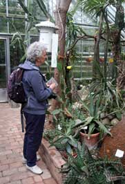
shelter in time. The Conservatory greenhouses contain both wild and cultivated
species from all over the world, and as the pouring rain hammered on the glass roofs, we spent the next hour examining these exotic plants (Photo
3 - Lund Botanical Gardens) (see left), including those from tropical rain forests,
huge arid-adapted desert cactus, plants from Mediterranean climates including
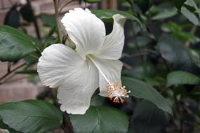
Papyrus, Hibiscus (see right) and insectivorous Pitcher Plants, exotic ferns, and a
greenhouse full of tropical orchids which bore little resemblance to the orchid
flowers we were accustomed to seeing in the Arctic. Founded in the 1690s as a study garden for medical students, the
University Botanical Museum was established at its present location, then the
outskirts of Lund, in the mid-19th century by the botanist Jacob Georg Agardh. who designed the gardens' layout and greenhouses. Today the 8 hectares of
gardens grow over 7,000 plant species and still supports the University's Botany
studies. As we entered the greenhouses, pouring rain began; we had just reached
shelter in time. The Conservatory greenhouses contain both wild and cultivated
species from all over the world, and as the pouring rain hammered on the glass roofs, we spent the next hour examining these exotic plants (Photo
3 - Lund Botanical Gardens) (see left), including those from tropical rain forests,
huge arid-adapted desert cactus, plants from Mediterranean climates including
Papyrus, Hibiscus (see right) and insectivorous Pitcher Plants, exotic ferns, and a
greenhouse full of tropical orchids which bore little resemblance to the orchid
flowers we were accustomed to seeing in the Arctic.
 The rain eased at last to a heavy drizzle, and
we walked around to the rear of the greenhouses to see the Gardens' centrepiece,
the Tulip Trees whose huge blossom forms the Botanic Garden's emblem. But in
mid-June the trees' flowering was past, and with just one small umbrella to shelter both of us from the still persistent rain, we headed back towards the
Cathedral, really not having done justice to the Botanical Gardens. In sunny
weather, you could easily spend a half-day in these lovely surroundings. Back
through narrow streets, past Lund's old brick buildings, we reached the rear of
the 12th century Romanesque Cathedral, its 3 storey high apse crowned by an
impressive gallery. Inside, we had 15 minutes before the 3-00pm performance of
the Astronomical Clock, to photograph the huge gilded mosaic figure of Christ in
Glory lining the dome of the apse above the high altar triptych (Photo
4 - Gilded mosaic at Lund Cathedral). As 3-00pm approached, we joined the group of
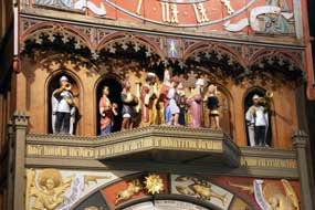
tourists waiting to see the Astronomical Clock's working: 2 mounted knights atop
struck swords 3 times, the little wooden doors on the front panel opened, and a
procession of mechanical figures led by the Magi paraded around past the Virgin
and infant to the tune of In Dulce Jubilo (see left). It was all over in a moment,
and as the lights went on again, we went down into the crypt to see again the
figures of Finn the legendary giant builder of the Cathedral with his wife and
child clinging to the pillars. It was such a pity that today the dull, wet weather had meant we
had not seen Lund at its best, as 3 years ago, especially around the University
and Cathedral. But we had met some generously helpful Lundites and duly awarded
our badge for good service to the kindly gent who had paid for our parking; we
had also secured our Swedish SIM card. The rain eased at last to a heavy drizzle, and
we walked around to the rear of the greenhouses to see the Gardens' centrepiece,
the Tulip Trees whose huge blossom forms the Botanic Garden's emblem. But in
mid-June the trees' flowering was past, and with just one small umbrella to shelter both of us from the still persistent rain, we headed back towards the
Cathedral, really not having done justice to the Botanical Gardens. In sunny
weather, you could easily spend a half-day in these lovely surroundings. Back
through narrow streets, past Lund's old brick buildings, we reached the rear of
the 12th century Romanesque Cathedral, its 3 storey high apse crowned by an
impressive gallery. Inside, we had 15 minutes before the 3-00pm performance of
the Astronomical Clock, to photograph the huge gilded mosaic figure of Christ in
Glory lining the dome of the apse above the high altar triptych (Photo
4 - Gilded mosaic at Lund Cathedral). As 3-00pm approached, we joined the group of
tourists waiting to see the Astronomical Clock's working: 2 mounted knights atop
struck swords 3 times, the little wooden doors on the front panel opened, and a
procession of mechanical figures led by the Magi paraded around past the Virgin
and infant to the tune of In Dulce Jubilo (see left). It was all over in a moment,
and as the lights went on again, we went down into the crypt to see again the
figures of Finn the legendary giant builder of the Cathedral with his wife and
child clinging to the pillars. It was such a pity that today the dull, wet weather had meant we
had not seen Lund at its best, as 3 years ago, especially around the University
and Cathedral. But we had met some generously helpful Lundites and duly awarded
our badge for good service to the kindly gent who had paid for our parking; we
had also secured our Swedish SIM card.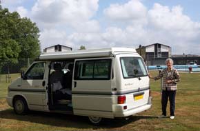
A curious but good value overnight camp at
Kvidinge: in very heavy
evening traffic and with rain beginning again, we headed north on the E6/E20
motorway towards Helsingborg, and turned east on E4 to find tonight's campsite
in the village of Kvidinge. Along a side lane just off the village main street,
Kvidinge-badets Camping, far from being the crowded, holiday-making venue which
its name suggested, turned out to be a curiously old-fashioned open-air swimming
pool with an adjacent, deserted camping area. The friendly girl at reception
welcomed us with a surprised smile: we don't have many visitors from England,
she said in fluent English, and in a sense you could understand why; for what
reason would anyone come here! She explained that it was run by the local
municipality primarily as a swimming facility for local school children, with a
flat, grassy camping area as an added extra on the neighbouring land. But it
would serve us well as a peaceful overnight stay, and good value at just 180 SEK
which included use of the pool had the chill weather allowed. It fact it was a
thoroughly miserable evening and despite being early June, we needed the heater
on for warmth. The following morning, we
woke to hazy sun as local school children arrived for their swimming lesson, all
very quiet and well-behaved (see right).
 A curious monument at Kvidinge, and
excellent VW service yet again at Ångelholm:
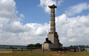
leaving Kvidinge, we paused at the village outskirts to investigate a curious
monument; this turned out to commemorate an obscure piece of early 19th century
Swedish history, which doubtless few Swedes would be able to explain. The
reforming and enlightened Gustav III was assassinated by disgruntled aristocrats
in 1792, and was succeeded by his young and inept son Gustav IV. After the
disastrous war with Imperial Russia resulting in the loss of Finland in 1809,
Gustav was deposed and his elderly and infirm uncle was proclaimed king as Karl
XIII; he died childless soon after. Everything was now arranged for the Danish
Prince Karl-August to assume the Swedish monarchy, but again fate intervened:
while on military manoeuvres in Skåne, Karl-August fell from his horse here at
Kvidinge, dying from a stroke it was said. The monument was erected in his
honour at the place of his death, but the column's plinth was never completed
with his statue; and here the topless monument to Karl-August remains to this day
at the edge of the village (see left). Meanwhile the frustrated Swedes continued
scratching around for a monarch, and invited Napoleon's little known marshal,
Jean-Baptiste Bernadotte, to become king of Sweden; he accepted, establishing
the Bernadotte dynasty which continues to this day, and the rest of
course is history. A curious monument at Kvidinge, and
excellent VW service yet again at Ångelholm:
leaving Kvidinge, we paused at the village outskirts to investigate a curious
monument; this turned out to commemorate an obscure piece of early 19th century
Swedish history, which doubtless few Swedes would be able to explain. The
reforming and enlightened Gustav III was assassinated by disgruntled aristocrats
in 1792, and was succeeded by his young and inept son Gustav IV. After the
disastrous war with Imperial Russia resulting in the loss of Finland in 1809,
Gustav was deposed and his elderly and infirm uncle was proclaimed king as Karl
XIII; he died childless soon after. Everything was now arranged for the Danish
Prince Karl-August to assume the Swedish monarchy, but again fate intervened:
while on military manoeuvres in Skåne, Karl-August fell from his horse here at
Kvidinge, dying from a stroke it was said. The monument was erected in his
honour at the place of his death, but the column's plinth was never completed
with his statue; and here the topless monument to Karl-August remains to this day
at the edge of the village (see left). Meanwhile the frustrated Swedes continued
scratching around for a monarch, and invited Napoleon's little known marshal,
Jean-Baptiste Bernadotte, to become king of Sweden; he accepted, establishing
the Bernadotte dynasty which continues to this day, and the rest of
course is history.
We turned north to Ångelholm, knowing that
there was VW garage there that in 2013 had replaced (without charge) a faulty
reversing light on our camper. This year we had been faced with a potentially
more serious problem: a problemsome turbo-charger on our outward drive seemed to
have corrected itself, but we wanted to have this checked. At the Ångelholm VW
garage, the receptionist spoke good English and a mechanic took an immediate
look: the engine diagnostics confirmed that the initial failure was now corrected
and assured us all was well. Again no charge was made, and they wished us a safe
journey in Sweden. Once more we were grateful for the excellent VW service which
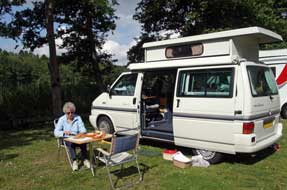
we have consistently enjoyed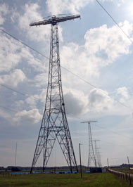 the length and breadth of Europe. the length and breadth of Europe.
The Varberg Radio Station UNESCO World
Heritage Site: rejoining the E6 motorway, we made good progress
northward, with George's turbo now performing normally on the gradients. The
weather varied between dark threatening storm clouds and dazzlingly bright sunny
spells, and we paused for lunch at a beautifully landscaped picnic-aire near to
Falkenberg. At Junction 53, we turned off to visit the UNESCO World Heritage
Site of Varberg Radio Station. WW1 had isolated Sweden and showed
 how
vulnerable the undersea telegraphic cable link to America was, given the numbers
of Swedish émigrés in USA. As a result, in 1922 the Swedish Parliament decided
to build a Very Low Frequency radio station as a transatlantic radio-telegraphy link to the RCA
Radio Central Station in New York, as part of an emerging world-wide
radio-telegraphic network. The station was built at Varberg in SW Sweden,
equipped with an Alexanderson rotating armature electro-mechanical
transmitter, designed by the Swedish-American Ernst Frederick Alexanderson
(1879~1975), a creative pioneer of electrical engineering, radio and electronics
who during his lifetime registered over 300 patents. With a radio power output
of 200Kw, the Varberg station (call sign SAQ) achieved transatlantic
transmissions at 17.2Khz (17,400m wave length) by means of an
incredible 2.2km long antenna mounted on a linear series of 6 127m high pylons
spread across the countryside (see right). The station was opened in 1924 by King Gustav V,
and continued working until the 1950s when the
Alexanderson electro-mechanical rotary transmitter was replaced with modern
electronic short wave transmitters for transatlantic telecommunications. The
original Alexanderson equipment and antenna array are preserved and are now
recognised as a World Heritage Site. how
vulnerable the undersea telegraphic cable link to America was, given the numbers
of Swedish émigrés in USA. As a result, in 1922 the Swedish Parliament decided
to build a Very Low Frequency radio station as a transatlantic radio-telegraphy link to the RCA
Radio Central Station in New York, as part of an emerging world-wide
radio-telegraphic network. The station was built at Varberg in SW Sweden,
equipped with an Alexanderson rotating armature electro-mechanical
transmitter, designed by the Swedish-American Ernst Frederick Alexanderson
(1879~1975), a creative pioneer of electrical engineering, radio and electronics
who during his lifetime registered over 300 patents. With a radio power output
of 200Kw, the Varberg station (call sign SAQ) achieved transatlantic
transmissions at 17.2Khz (17,400m wave length) by means of an
incredible 2.2km long antenna mounted on a linear series of 6 127m high pylons
spread across the countryside (see right). The station was opened in 1924 by King Gustav V,
and continued working until the 1950s when the
Alexanderson electro-mechanical rotary transmitter was replaced with modern
electronic short wave transmitters for transatlantic telecommunications. The
original Alexanderson equipment and antenna array are preserved and are now
recognised as a World Heritage Site.
 Reaching
the radio station site in the heart of the countryside, its enormous antenna
pylons visible for miles around, we learnt more about its history and details of
its technical working. The guide explained that, in the early days of the station's
working, members of the Swedish public would write messages to relatives in USA
on telegram forms at a local post office; these were relayed by land-line
telegraphy to a central office in Göteborg, where the message in morse was
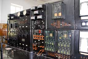
converted to punched paper-tape and transmitted by wire to Varberg. Here
electro-mechanical devices converted the morse at far greater speed than a human
operator could key (see right), for transmission by the Alexanderson generator
and enormous antenna array across the Atlantic. In New York, the received morse
signal was re-converted to plain text and delivered to the recipient by telegram
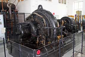
boy. A tour of the station enabled us to see the huge electro-mechanical rotary
transmitting apparatus (see above left) (Photo
5 - Alexanderson electro-mechanical transmitter) which is still operational and transmits 3
times each year. Outside, we followed the transmitting cables out to the antenna
link, and walked over to stand under the nearest of the 127m high aerial pylons, which
were themselves a remarkable piece of Reaching
the radio station site in the heart of the countryside, its enormous antenna
pylons visible for miles around, we learnt more about its history and details of
its technical working. The guide explained that, in the early days of the station's
working, members of the Swedish public would write messages to relatives in USA
on telegram forms at a local post office; these were relayed by land-line
telegraphy to a central office in Göteborg, where the message in morse was
converted to punched paper-tape and transmitted by wire to Varberg. Here
electro-mechanical devices converted the morse at far greater speed than a human
operator could key (see right), for transmission by the Alexanderson generator
and enormous antenna array across the Atlantic. In New York, the received morse
signal was re-converted to plain text and delivered to the recipient by telegram
boy. A tour of the station enabled us to see the huge electro-mechanical rotary
transmitting apparatus (see above left) (Photo
5 - Alexanderson electro-mechanical transmitter) which is still operational and transmits 3
times each year. Outside, we followed the transmitting cables out to the antenna
link, and walked over to stand under the nearest of the 127m high aerial pylons, which
were themselves a remarkable piece of
 construction for the 1920s. In these days
of worldwide satellite telecommunications, our visit to the Varberg Radio Station was a
fascinating insight into both the technical working and social history of early
long distance communications by telegrams and wireless telegraphy. construction for the 1920s. In these days
of worldwide satellite telecommunications, our visit to the Varberg Radio Station was a
fascinating insight into both the technical working and social history of early
long distance communications by telegrams and wireless telegraphy.
Kungälv Vandrarhem (hostel)-Camping:
continuing north on E6/20 motorway in an horrendous downpour, we passed through
the Göteborg conurbation in busy evening rush hour traffic. Beyond the city, we
turned off to Kungälv where we had reserved a space at the Vandrarhem
(hostel)-Camping with the expected approaching Midsummer holiday weekend. As we
sat in slow-moving Göteborg traffic congestion, the warden thoughtfully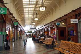 sent us
a welcoming text message with the camping access code since she finished work at 6-00pm. Crossing the river
at the approach to the town, past Kungälv's over-towering hill-top medieval fortress, the Bohus Fästning,
our first stop was the ICA-Maxi supermarket for provisions and bus tickets for
tomorrow's journey into Göteborg by bus from Kungälv. Back at the small
campsite, we settled into our reserved riverside spot (see above left); it was by
now almost 8-00pm and we were exhausted after a busy but interesting day and
long drive in stressful traffic. sent us
a welcoming text message with the camping access code since she finished work at 6-00pm. Crossing the river
at the approach to the town, past Kungälv's over-towering hill-top medieval fortress, the Bohus Fästning,
our first stop was the ICA-Maxi supermarket for provisions and bus tickets for
tomorrow's journey into Göteborg by bus from Kungälv. Back at the small
campsite, we settled into our reserved riverside spot (see above left); it was by
now almost 8-00pm and we were exhausted after a busy but interesting day and
long drive in stressful traffic.
 A re-visit to Göteborg:
the following morning we walked the 500m across the river bridge to the bus stop
at Eriksdal to catch the Grön Express bus which ran every 10 minutes into
Göteborg (see
Log of our 2013 visit to Göteborg). Following the stops on the bus' illuminated display during the 20
minute ride into the city, we got off at the Nordstan shopping centre, and
crossed to the Central Railway Station (Photo
6 - Göteborg's Central Railway Station). The country's oldest station built in 1856
still retained its grand façade and elegant ticket hall (see right). Our
Scandinavian city visits always seem to start in a railway station ticket hall
and end in the buffet-bar! On the far side of Nordstan shopping centre, we
crossed Östra Hamngatan to Gustav Adolfs Torg to re-visit the statue of Gustav
II Adolphus pointing imperiously to A re-visit to Göteborg:
the following morning we walked the 500m across the river bridge to the bus stop
at Eriksdal to catch the Grön Express bus which ran every 10 minutes into
Göteborg (see
Log of our 2013 visit to Göteborg). Following the stops on the bus' illuminated display during the 20
minute ride into the city, we got off at the Nordstan shopping centre, and
crossed to the Central Railway Station (Photo
6 - Göteborg's Central Railway Station). The country's oldest station built in 1856
still retained its grand façade and elegant ticket hall (see right). Our
Scandinavian city visits always seem to start in a railway station ticket hall
and end in the buffet-bar! On the far side of Nordstan shopping centre, we
crossed Östra Hamngatan to Gustav Adolfs Torg to re-visit the statue of Gustav
II Adolphus pointing imperiously to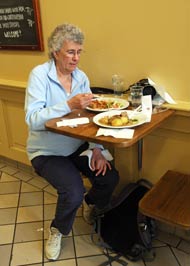 the spot where he wished his new port-city to
be founded in 1621 at the mouth of the Göta Älv river. Today's
weather forecast was not good, and although it was not yet raining, the sky was
gloomily overcast for His Imperial Majesty's photograph (Photo
7 - Statue of King Gustav II Adolphus). We walked the zigzag course of
the Rosenlunds-kanalen, which once formed the moat of the original city's
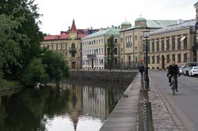
fortified perimeter (see left), bringing us around to Kungsportsplatsen where city trams
crossed the bridge (Photo
8 - Göteborg city trams). Across the square in the
barrel-roofed 1880 market hall of Stora Saluhallen, we bought a filling lunch at
one of the food stalls whose popularity with locals indicated its good value
food (see right), and after lunch ambled around the attractive market stalls (Photo
9 - Stora Saluhallen market hall). the spot where he wished his new port-city to
be founded in 1621 at the mouth of the Göta Älv river. Today's
weather forecast was not good, and although it was not yet raining, the sky was
gloomily overcast for His Imperial Majesty's photograph (Photo
7 - Statue of King Gustav II Adolphus). We walked the zigzag course of
the Rosenlunds-kanalen, which once formed the moat of the original city's
fortified perimeter (see left), bringing us around to Kungsportsplatsen where city trams
crossed the bridge (Photo
8 - Göteborg city trams). Across the square in the
barrel-roofed 1880 market hall of Stora Saluhallen, we bought a filling lunch at
one of the food stalls whose popularity with locals indicated its good value
food (see right), and after lunch ambled around the attractive market stalls (Photo
9 - Stora Saluhallen market hall).
 Along Kungsports-avenyn, where trams
trundled along the elegant
boulevard, we turned off into Vasagatan, admiring the impressive red-brick art
nouveau buildings which lined the street and opposite Vasa-Platsen Göteborg
University's main building (Photo
10 - Göteborg University). At the far end by the University library, the
small park by the 19th century Haga Kyrkan church contains a moving memorial to Raoul Wallenberg, the Swedish businessman-diplomat who in 1944 secured the
rescue of 1000s of Hungarian Jews from German extermination by issuing Swedish
passports, Schutz Passes (Protection Pass) identifying the bearers as Swedish
subjects awaiting repatriation. Across the far side of the
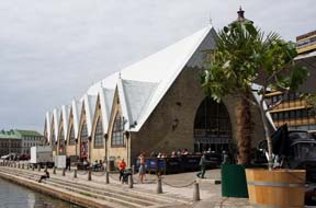
canal, the Feskekörka indoor fish-market resembles from the outside a Neo-Gothic
church (see left); inside however the stalls are laden with every kind of
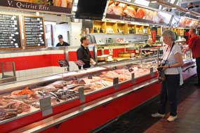
fish and shellfish, all looking mouth-wateringly attractive (Photo
11 - Feskekörka fish-market) (see below left), but at prices way beyond our pocket. Along Kungsports-avenyn, where trams
trundled along the elegant
boulevard, we turned off into Vasagatan, admiring the impressive red-brick art
nouveau buildings which lined the street and opposite Vasa-Platsen Göteborg
University's main building (Photo
10 - Göteborg University). At the far end by the University library, the
small park by the 19th century Haga Kyrkan church contains a moving memorial to Raoul Wallenberg, the Swedish businessman-diplomat who in 1944 secured the
rescue of 1000s of Hungarian Jews from German extermination by issuing Swedish
passports, Schutz Passes (Protection Pass) identifying the bearers as Swedish
subjects awaiting repatriation. Across the far side of the
canal, the Feskekörka indoor fish-market resembles from the outside a Neo-Gothic
church (see left); inside however the stalls are laden with every kind of
fish and shellfish, all looking mouth-wateringly attractive (Photo
11 - Feskekörka fish-market) (see below left), but at prices way beyond our pocket.
Re-crossing the bridge, we ambled back
through the delightful canal-side parkland of Kungspark, photographing passing
trams and students lolling on the grassy canal embankment (Photo
12 - City trams at Kungspark). After a cursory look inside the
distinctly inelegant Neo-classical Domkyrkan,
whose flower gardens were more attractive than the cathedral itself, we headed across Norra Hamngatan up
towards the Lilla Hamn marina. During the day, the sky had progressively
brightened with a bright but sultry
hot sun, but now threateningly dark cloud was gathering; the forecast for heavy rain looked
likely to be accurate. The rain began as we photographed the lip-stick shaped
 skyscraper of Utsiken which towered over the marina and sailing clipper moored
in the harbour (Photo
13 - Lip-stick shaped skyscraper of Utsiken) and took shelter from the
rain in the foyer of Göteborg's harbour-side opera house; the eye can so
easily pass over such unattractively unimpressive skyscraper of Utsiken which towered over the marina and sailing clipper moored
in the harbour (Photo
13 - Lip-stick shaped skyscraper of Utsiken) and took shelter from the
rain in the foyer of Göteborg's harbour-side opera house; the eye can so
easily pass over such unattractively unimpressive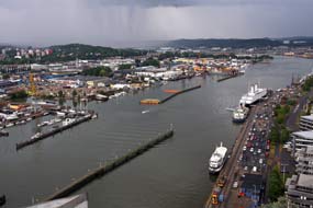 modern buildings. Braving the
now persistent light rain, we threaded a way through the equally unimpressive
office blocks which overshadowed the marina, to find the entrance to the Utsiken
tower, suddenly realising we were standing right outside it as it towered over
us. It cost an expensive 40kr each to ascend in the lift the 22 storeys of the
86m high tower, but the viewing gallery gave a bird's eye panorama over
Göteborg's industrial city skyline (see right). The most impressive view was along the wide Göta Älv
river, with its docks and ship-yards (Photo
14 - Göteborg panorama viewed from Utsiken); from this viewpoint, you could see why
this river highway from the sea was chosen as the location for Sweden's west
coast maritime trading centre. Inland, particularly with gloomily grey rain
squall clouds now obscuring the view, the city-scape revealed Göteborg's gritty
industrial origins. We took our photos, descended in the lift and, weary from
our day of walking the city streets, returned to Central Station for an
expensive beer in the buffet-bar where multi-screen TVs relayed UEFA
Cup football matches. A Grön Express bus was waiting at the Nordstan bus-stands and
with traffic now less congested, we were soon back at Eriksdal to walk back
across the bridge below Kungälv's medieval fortress to the campsite. modern buildings. Braving the
now persistent light rain, we threaded a way through the equally unimpressive
office blocks which overshadowed the marina, to find the entrance to the Utsiken
tower, suddenly realising we were standing right outside it as it towered over
us. It cost an expensive 40kr each to ascend in the lift the 22 storeys of the
86m high tower, but the viewing gallery gave a bird's eye panorama over
Göteborg's industrial city skyline (see right). The most impressive view was along the wide Göta Älv
river, with its docks and ship-yards (Photo
14 - Göteborg panorama viewed from Utsiken); from this viewpoint, you could see why
this river highway from the sea was chosen as the location for Sweden's west
coast maritime trading centre. Inland, particularly with gloomily grey rain
squall clouds now obscuring the view, the city-scape revealed Göteborg's gritty
industrial origins. We took our photos, descended in the lift and, weary from
our day of walking the city streets, returned to Central Station for an
expensive beer in the buffet-bar where multi-screen TVs relayed UEFA
Cup football matches. A Grön Express bus was waiting at the Nordstan bus-stands and
with traffic now less congested, we were soon back at Eriksdal to walk back
across the bridge below Kungälv's medieval fortress to the campsite.
 The Blomsholm Stone Ship-setting
burial mound:
on a sunny morning, we re-joined the E6 to head north through Bohuslän. Despite
fears of aggressively speeding Norwegians heading for the border, the motorway
was surprisingly quiet making for a relaxed drive north through increasingly
hilly terrain, magnificently forested and with bare rocky outcrops; we were now
seeing our first pine and spruces. Over the last 3 years since we had last
driven this road, the motorway had been completed and a huge new shopping
complex built near to Tanumshede to attract Norwegian cross-border The Blomsholm Stone Ship-setting
burial mound:
on a sunny morning, we re-joined the E6 to head north through Bohuslän. Despite
fears of aggressively speeding Norwegians heading for the border, the motorway
was surprisingly quiet making for a relaxed drive north through increasingly
hilly terrain, magnificently forested and with bare rocky outcrops; we were now
seeing our first pine and spruces. Over the last 3 years since we had last
driven this road, the motorway had been completed and a huge new shopping
complex built near to Tanumshede to attract Norwegian cross-border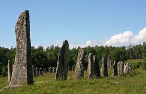 shoppers. By
mid-afternoon we turned off close to Strömstad and followed a rural lane to the
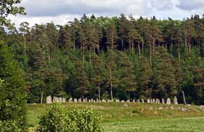
farmstead at Blomsholm where the Iron Age stone ship-setting could be seen
standing proud on a hillock amid fields of cereals, and lit by the afternoon
sun (see left). The stone ship was erected in the late Iron Age around 500~11050
AD, 40m long and made up of 49 standing stones arranged in the shape of a long
boat, the prow and stern-post stones standing 4m high. Although it is the
largest such boat-grave in Sweden, little is known of its history. Boats clearly
were of ritual importance to prehistoric northern peoples as rock art shows,
symbolising the passage from life to death. The hillock forming the tumulus
beneath the stone-circle has never been excavated, but at a time when sea levels
were higher than now and the lower ground near the grave would have been the
shore-line of an inlet from a fjord. the ship-setting's scale and prominent
position indicates it marked the burial site of a powerful chieftain. On a warm,
sunny afternoon, we followed the pathway leading up onto the burial mound, and
looking along the length of the stone ship at close range, you gained a full
impression of its 40m length (see right) (Photo
15 - Blomsholm Stone Ship-setting). shoppers. By
mid-afternoon we turned off close to Strömstad and followed a rural lane to the
farmstead at Blomsholm where the Iron Age stone ship-setting could be seen
standing proud on a hillock amid fields of cereals, and lit by the afternoon
sun (see left). The stone ship was erected in the late Iron Age around 500~11050
AD, 40m long and made up of 49 standing stones arranged in the shape of a long
boat, the prow and stern-post stones standing 4m high. Although it is the
largest such boat-grave in Sweden, little is known of its history. Boats clearly
were of ritual importance to prehistoric northern peoples as rock art shows,
symbolising the passage from life to death. The hillock forming the tumulus
beneath the stone-circle has never been excavated, but at a time when sea levels
were higher than now and the lower ground near the grave would have been the
shore-line of an inlet from a fjord. the ship-setting's scale and prominent
position indicates it marked the burial site of a powerful chieftain. On a warm,
sunny afternoon, we followed the pathway leading up onto the burial mound, and
looking along the length of the stone ship at close range, you gained a full
impression of its 40m length (see right) (Photo
15 - Blomsholm Stone Ship-setting).
 The Massleberg Bronze Age
rock-engravings: this whole area had clearly been a significant burial
ground with some 40 Iron Age graves and stone circles on the hillside across the
lane, but there was no time to explore these if we were The Massleberg Bronze Age
rock-engravings: this whole area had clearly been a significant burial
ground with some 40 Iron Age graves and stone circles on the hillside across the
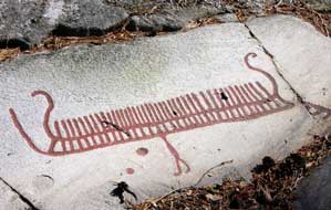
lane, but there was no time to explore these if we were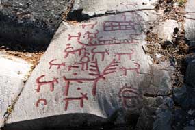 to find the nearby Massleberg Bronze Age rock-engravings. From the village of Skee, we
followed a single-track lane to a farmstead at Massleberg, and just along a
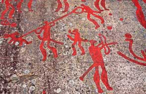
trackway we found a rock-outcrop panel with the red-painted rock-engravings (hällristningar
in Swedish). The most prominent depiction showed a human figure holding up a
whole boat; these 'boat-lifter' figures occur throughout Bohuslän Bronze Age
rock-engravings, and are thought to symbolise some unknown legend, perhaps boat
sacrifice (see left). Another boat carried a stag with star-shaped antlers and 2
lur players; 2 superimposed boats were shown carrying warriors fighting with
spears (Photo
16 - Massleberg Bronze Age rock-engravings), and another depicted a hunting scene with an
antlered deer surrounded by dogs and the figure of a hunter (see right). to find the nearby Massleberg Bronze Age rock-engravings. From the village of Skee, we
followed a single-track lane to a farmstead at Massleberg, and just along a
trackway we found a rock-outcrop panel with the red-painted rock-engravings (hällristningar
in Swedish). The most prominent depiction showed a human figure holding up a
whole boat; these 'boat-lifter' figures occur throughout Bohuslän Bronze Age
rock-engravings, and are thought to symbolise some unknown legend, perhaps boat
sacrifice (see left). Another boat carried a stag with star-shaped antlers and 2
lur players; 2 superimposed boats were shown carrying warriors fighting with
spears (Photo
16 - Massleberg Bronze Age rock-engravings), and another depicted a hunting scene with an
antlered deer surrounded by dogs and the figure of a hunter (see right).
Tanums Camping near Tanumshede: we returned down the motorway
passing through beautiful forested hill-country with its flat-panelled rocky
outcrops, just inviting rock-engraving, we turned off to the village of
Tanumshede and Tanums Camping. This was the sort of small, peaceful and
straightforward campsite we favour, with just a couple of tents as neighbours.
All looked perfect
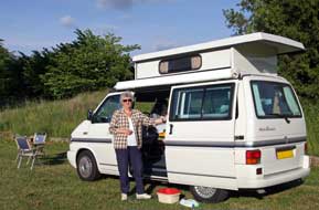 until
it came to the price: 280kr and extra coins for showers and washing-up hot water
was ludicrously OTT for a simple site with basic facilities and no wi-fi
internet. It was no wonder the place was almost empty even at almost midsummer,
but we negotiated a lower price with the curious Chilean warden who would
certainly win no prizes at a grace and charm contest. We pitched at the top end of the camping area to enjoy the full evening until
it came to the price: 280kr and extra coins for showers and washing-up hot water
was ludicrously OTT for a simple site with basic facilities and no wi-fi
internet. It was no wonder the place was almost empty even at almost midsummer,
but we negotiated a lower price with the curious Chilean warden who would
certainly win no prizes at a grace and charm contest. We pitched at the top end of the camping area to enjoy the full evening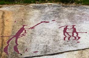 sun in these wonderful forested surroundings (see left) and a supper of Swedish
meatballs (kötbullar) in lingonberry sauce. Later that evening, one of
those ludicrously monstrous mega-buses arrived, a veritable apartment block on 6
wheels, with en-suite ballroom, billiards room and indoor swimming pool judging
by its size 4 times the length and twice the height of a VW camper; here was the
subject of much ridicule and contempt, accommodating just 2 people who
immediately began twirling their over-sized satellite dish in search of soap
operas to satisfy a limited intellect. The fact that they were in the midst of
the most wonderful natural surroundings seemed to have gone unnoticed.
The Tanum-Vitlyke Bronze Age rock-engravings:
our reason for coming here was to spend the day exploring the World Heritage
site of the Tanum Bronze Age rock-engravings. The panels of rock art around
North Bohuslän, dating from the mid-late Bronze Age around 1500~500 BC, were
chiselled onto flat bed-rock granite using flint tools. At that
time, sea levels were higher than today so that most of the panels were along
fjord shore-lines. The Tanum rock-engravings were created by settled
agriculturalists who supplemented their pastoral existence keeping sheep, pigs
and cattle and working the land to grow barley and rye, with hunting in the
surrounding forests. Bronze was bartered from Europe for skins and local
produce, and smelted for weapons and ceremonial ornaments. Although difficult to
interpret, the art-work of some 300 human and animal figures, boats and other
symbols is thought
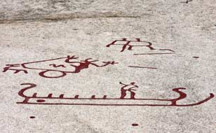 to represent religious ceremonial ritual, fertility rites and
representation of the passage from life to death, and the engravings have
controversially been coloured in with red paint to make them more visible to
modern day visitors. The carved rock-art figures supported by archaeological
finds show a continuity of occupation and land use for over 1000 years. There
are 4 areas of rock to represent religious ceremonial ritual, fertility rites and
representation of the passage from life to death, and the engravings have
controversially been coloured in with red paint to make them more visible to
modern day visitors. The carved rock-art figures supported by archaeological
finds show a continuity of occupation and land use for over 1000 years. There
are 4 areas of rock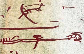 engravings, and the panel at Tanum-Vitlycke was clearly
visible on the opposite hillside, and we were able to enjoy an undisturbed hour
examining these in close detail
(Photo
17 - Tanum-Vitlyke Bronze Age rock-engravings) and marvelling at these
expressive pieces ritual art-work created 3,000 years ago. There were spear-men
(see below left), axe-men, and
bow-men, and a suppliant worshipping beside a snake-like bolt of lightning
representing a deity; a Bronze Age forerunner of a horned helmeted Thor, god of
thunder, is shown riding in his chariot pulled by a he-goat with an accompanying
bolt of lightning (see left). There were many boats with their notional crew-men
(Photo
18 - Engraved boat with crew and axe-men) thought to represent ritually
the passage from this life to the kingdom of the dead, with one carrying
multiple lur players. At the top of the panel, the most renowned of
the images, a ritual marriage scene with the officiating priest holding an axe
over the embracing couple (see above right). Lower down the pane, a grieving female figure with
her distinctive plait appears kneeling in mourning beside a deceased male lying
before her (see right). engravings, and the panel at Tanum-Vitlycke was clearly
visible on the opposite hillside, and we were able to enjoy an undisturbed hour
examining these in close detail
(Photo
17 - Tanum-Vitlyke Bronze Age rock-engravings) and marvelling at these
expressive pieces ritual art-work created 3,000 years ago. There were spear-men
(see below left), axe-men, and
bow-men, and a suppliant worshipping beside a snake-like bolt of lightning
representing a deity; a Bronze Age forerunner of a horned helmeted Thor, god of
thunder, is shown riding in his chariot pulled by a he-goat with an accompanying
bolt of lightning (see left). There were many boats with their notional crew-men
(Photo
18 - Engraved boat with crew and axe-men) thought to represent ritually
the passage from this life to the kingdom of the dead, with one carrying
multiple lur players. At the top of the panel, the most renowned of
the images, a ritual marriage scene with the officiating priest holding an axe
over the embracing couple (see above right). Lower down the pane, a grieving female figure with
her distinctive plait appears kneeling in mourning beside a deceased male lying
before her (see right).
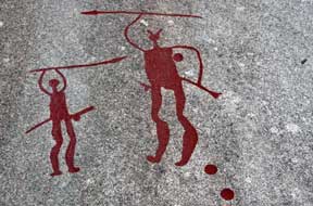 Litsleby
rock-engravings: 4 kms away, the Litsleby group of rock-engravings is
set among delightful pine woodland and contains some 80 simple bier-like
representations of boats, with just upturned lines of gunwale and keel connected
by vertical lines and shields. But the entire panel is dominated by Litsleby
rock-engravings: 4 kms away, the Litsleby group of rock-engravings is
set among delightful pine woodland and contains some 80 simple bier-like
representations of boats, with just upturned lines of gunwale and keel connected
by vertical lines and shields. But the entire panel is dominated by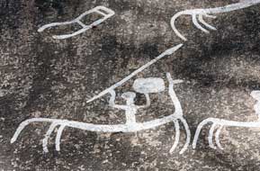 the 2.3m
high figure of a giant spear-brandishing deity
(Photo
19 - Litsleby spear god), dating from around 1200~1000 BC, a time in the
middle Bronze Age when burial customs changed from inhumation in burial chambers with grave goods to cremation. The spear god depicted at Litsleby is perhaps a
forerunner of the god Odin. A track led up through the pine woods, to another
panel of engraved horse riding warriors carrying spear and rectangular shield
(see right). The consistency of design suggested the work of one artist.
Archaeological evidence shows that such rectangular Celtic shields came into
currency in the early Iron Age, replacing the rounded shields of the Bronze Age;
this helps to date these engraving to around 300 BC, making them the latest of
the Tanum rock-art, and one of the world's oldest depictions of horsemen bearing
lance and shield
(Photo
20 - Mounted warrior engravings). The peaceful setting of the pine
woods, the scent of the pine trees and the forest floor of Bilberry and
Lingonberry, gave the Litsleby engravings a magical, mysterious air, the most
memorable of the Tanum rock-art sites. the 2.3m
high figure of a giant spear-brandishing deity
(Photo
19 - Litsleby spear god), dating from around 1200~1000 BC, a time in the
middle Bronze Age when burial customs changed from inhumation in burial chambers with grave goods to cremation. The spear god depicted at Litsleby is perhaps a
forerunner of the god Odin. A track led up through the pine woods, to another
panel of engraved horse riding warriors carrying spear and rectangular shield
(see right). The consistency of design suggested the work of one artist.
Archaeological evidence shows that such rectangular Celtic shields came into
currency in the early Iron Age, replacing the rounded shields of the Bronze Age;
this helps to date these engraving to around 300 BC, making them the latest of
the Tanum rock-art, and one of the world's oldest depictions of horsemen bearing
lance and shield
(Photo
20 - Mounted warrior engravings). The peaceful setting of the pine
woods, the scent of the pine trees and the forest floor of Bilberry and
Lingonberry, gave the Litsleby engravings a magical, mysterious air, the most
memorable of the Tanum rock-art sites.
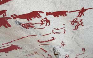 The Aspeberget rock-engravings:
the nearby panels of rock-engravings at Aspeberget show some of the only
depictions of everyday work in Bronze Age pastoralist society: a farmer
ploughing with an ard (predecessor of the plough) pulled by a pair of oxen,
perhaps an invocation for a good The Aspeberget rock-engravings:
the nearby panels of rock-engravings at Aspeberget show some of the only
depictions of everyday work in Bronze Age pastoralist society: a farmer
ploughing with an ard (predecessor of the plough) pulled by a pair of oxen,
perhaps an invocation for a good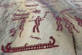 harvest; above this a line of bulls driven
by a herdsman reflects the importance of oxen and cattle at this time, as draught
animals, and providing leather, milk, meat and manure (see left). The bull as a
ritual symbol of strength, courage and fertility is found across all Europe in contemporary
Bronze Age culture and mythology. A group of axe-men holding shields suggests a
ritual battle scene, and below this a boat engraving with inward-curved prow and stern carries a
huge crew of rowers and a lur player (see right); boats needing a crew of this size were
beyond the technology of this time, and clearly were only of ritual
significance symbolising the passage from life to death. At the top of the
panel, a large solar symbol shows the sun being adored by 2 women with plaits.
The next panel shows a curious human figure with over-sized hands bearing a
group of 29 cup-marks arranged in 4 groups of 7, thought to represent a calendar (Photo
21 - Calendar figure). Above this was an engraving showing a perfect
representation of a 4-wheeled chariot or wagon. A further panel showed a procession of dancing
figures including one female with her plaited hair among the line of males (see
below left). But
of particular interest below these was an engraving of a bull with a small
axe-bearing figure leaping between the harvest; above this a line of bulls driven
by a herdsman reflects the importance of oxen and cattle at this time, as draught
animals, and providing leather, milk, meat and manure (see left). The bull as a
ritual symbol of strength, courage and fertility is found across all Europe in contemporary
Bronze Age culture and mythology. A group of axe-men holding shields suggests a
ritual battle scene, and below this a boat engraving with inward-curved prow and stern carries a
huge crew of rowers and a lur player (see right); boats needing a crew of this size were
beyond the technology of this time, and clearly were only of ritual
significance symbolising the passage from life to death. At the top of the
panel, a large solar symbol shows the sun being adored by 2 women with plaits.
The next panel shows a curious human figure with over-sized hands bearing a
group of 29 cup-marks arranged in 4 groups of 7, thought to represent a calendar (Photo
21 - Calendar figure). Above this was an engraving showing a perfect
representation of a 4-wheeled chariot or wagon. A further panel showed a procession of dancing
figures including one female with her plaited hair among the line of males (see
below left). But
of particular interest below these was an engraving of a bull with a small
axe-bearing figure leaping between the
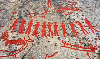 bull's horns, so reminiscent of the
bull-leaping frescoes from contemporary Minoan Crete
(Photo
22 - Bull-leaping figure). bull's horns, so reminiscent of the
bull-leaping frescoes from contemporary Minoan Crete
(Photo
22 - Bull-leaping figure).
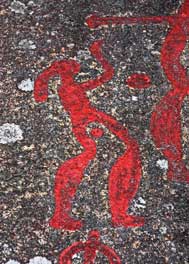 Fossum rock-engravings:
on the far side of Tanumshede village, another
group of rock-engravings at Fossum at the foot of an outcrop facing the sun
looked out across the valley surrounded by hills, a typical location for Bohuslän
rock-engravings. The engravings begin with the
depiction of a woman with long plaited hair and arm raised in adoration (see
right). A hunter stabs a deer with his spear, another raises his bow towards
prey (see below left), and a group of 3 hunters with axes is shown with a pack of hunting dogs;
such portrayal of hunting scenes is thought to be an invocation for success in the hunt for
food. A group of 3 axe-men shows the distinctly detailed weapons which, when
compared with archaeological finds, enabled the Fossum panel to be dated to
around 600 BC (Photo
23 - Fossum axe-men engravings). A curious group with a pair of figures wearing what appears to
be bird beak masks and carrying staffs is portrayed as mirrored reversed images
of each other in ritual dance. Fossum rock-engravings:
on the far side of Tanumshede village, another
group of rock-engravings at Fossum at the foot of an outcrop facing the sun
looked out across the valley surrounded by hills, a typical location for Bohuslän
rock-engravings. The engravings begin with the
depiction of a woman with long plaited hair and arm raised in adoration (see
right). A hunter stabs a deer with his spear, another raises his bow towards
prey (see below left), and a group of 3 hunters with axes is shown with a pack of hunting dogs;
such portrayal of hunting scenes is thought to be an invocation for success in the hunt for
food. A group of 3 axe-men shows the distinctly detailed weapons which, when
compared with archaeological finds, enabled the Fossum panel to be dated to
around 600 BC (Photo
23 - Fossum axe-men engravings). A curious group with a pair of figures wearing what appears to
be bird beak masks and carrying staffs is portrayed as mirrored reversed images
of each other in ritual dance.
A disappointment at Klädesholmen fishing
harbour: the following
morning we returned south on the E6 motorway, with the weather now heavily
overcast with drizzly rain.
Our plan was to cross the Bohuslän islands of Orust and Tjörn and to camp again
at the guest-harbour on the western tip of Klädesholmen, the outer island of
 the Tjörn
archipelago. Since we were here 3 years ago, what had then been a quiet road was
now festooned with speed cameras and the pleasant rural environment contaminated
with building sites. With all this, plus road works and gloomy wet weather, it
was now a tedious drive. Finally reaching Klädesholmen, we threaded our way
through the village's narrow street and across onto the outer islet and
fishing harbour where we had enjoyed a peaceful wild-camp among the fishing
boats in 2013. By now the south-westerly gusty wind was driving rain from the sea;
the guest-harbour was deserted and harbour master's office locked, but worse still,
a sign now forbade camping. The harbour master drew up in his car, and made it
quite clear that our presence was no longer welcome: No camping, he insisted,
you have to go! So that was that. In pouring rain the Tjörn
archipelago. Since we were here 3 years ago, what had then been a quiet road was
now festooned with speed cameras and the pleasant rural environment contaminated
with building sites. With all this, plus road works and gloomy wet weather, it
was now a tedious drive. Finally reaching Klädesholmen, we threaded our way
through the village's narrow street and across onto the outer islet and
fishing harbour where we had enjoyed a peaceful wild-camp among the fishing
boats in 2013. By now the south-westerly gusty wind was driving rain from the sea;
the guest-harbour was deserted and harbour master's office locked, but worse still,
a sign now forbade camping. The harbour master drew up in his car, and made it
quite clear that our presence was no longer welcome: No camping, he insisted,
you have to go! So that was that. In pouring rain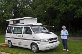 we took stock. The nearest
acceptable campsite was Stenrösets Camping near to Trollhätten, and we phoned to
check, since it was approaching the Midsummer holiday; they had space for
tonight but would be full at the weekend. Back over Tjörn bridge to the
mainland, we made our way on uncertain back roads in pouring rain, eventually
reaching Stenrösets at 6-00pm. The owner welcomed us hospitably after our long drive, and
we found a quiet corner looking out into dark woodland (see right); at least we had a viable
campsite for tonight. It was so miserably dark and chill that, even in mid summer, we had heating on. we took stock. The nearest
acceptable campsite was Stenrösets Camping near to Trollhätten, and we phoned to
check, since it was approaching the Midsummer holiday; they had space for
tonight but would be full at the weekend. Back over Tjörn bridge to the
mainland, we made our way on uncertain back roads in pouring rain, eventually
reaching Stenrösets at 6-00pm. The owner welcomed us hospitably after our long drive, and
we found a quiet corner looking out into dark woodland (see right); at least we had a viable
campsite for tonight. It was so miserably dark and chill that, even in mid summer, we had heating on.
 A day in Trollhätten: overnight the rain had stopped but the weather was still dismally
gloomy; some Midsummer Day! The sky gradually brightened, but it was one of
those mornings when time moved faster than we did. Facilities at Stenrösets were
excellent, and the site-wide wi-fi enabled us to keep check on the weather
forecast. Today had begun with only the vaguest plan of walking the Halleberg
nature trail, but after re-stocking with provisions at an ICA supermarket in the western
suburbs of Trollhätten, with no conscious effort today gradually evolved into a
day in Trollhätten, a town which developed on the banks of the Göta River/Canal
with a fascinating industrial history. We parked down at the southern side of the Trollhätten Canal
by the flight of locks which lowers the navigable waterway down to the level of
the ongoing Götälven river after bypassing the Trollhätten rapids gorge.
Crossing the top-lock A day in Trollhätten: overnight the rain had stopped but the weather was still dismally
gloomy; some Midsummer Day! The sky gradually brightened, but it was one of
those mornings when time moved faster than we did. Facilities at Stenrösets were
excellent, and the site-wide wi-fi enabled us to keep check on the weather
forecast. Today had begun with only the vaguest plan of walking the Halleberg
nature trail, but after re-stocking with provisions at an ICA supermarket in the western
suburbs of Trollhätten, with no conscious effort today gradually evolved into a
day in Trollhätten, a town which developed on the banks of the Göta River/Canal
with a fascinating industrial history. We parked down at the southern side of the Trollhätten Canal
by the flight of locks which lowers the navigable waterway down to the level of
the ongoing Götälven river after bypassing the Trollhätten rapids gorge.
Crossing the top-lock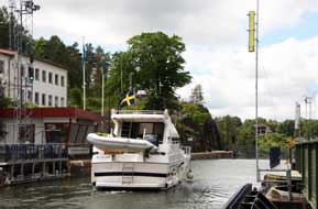 footbridge, we were just in time to watch 2 leisure craft
pass into the lock basin (see right); the lock drained, the lower gates opened and the boats
sailed on towards the remaining flight of locks towards Göteborg
(Photo
24 - Göta Canal locks at Trollhätten). After
eating our lunch sandwiches in the now brightly shining sunshine, we watched 2
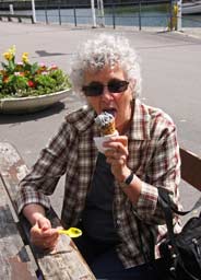
more boats make the upward passage through the locks, and enjoyed a salt-lakrits
(liquorice) ice-cream (Swedish delicacy) from the kiosk (see left). We needed to find the
VW garage in Trollhätten to replace a blown rear-brake light bulb, and the fluently
English-speaking lad at the Tourist Information Centre (TIC) marked on a town
plan the garage's location. Armed with this, we headed for an industrial estate
in north Trollhätten just off the E45 ring-road; it was hard to imagine this was
the same road which, as the Inlandsvägen, stretched the entire length of
Sweden northwards as far as Karesuando. At the garage, we explained our need, but
all the mechanics were busy today; could we come back in the morning? footbridge, we were just in time to watch 2 leisure craft
pass into the lock basin (see right); the lock drained, the lower gates opened and the boats
sailed on towards the remaining flight of locks towards Göteborg
(Photo
24 - Göta Canal locks at Trollhätten). After
eating our lunch sandwiches in the now brightly shining sunshine, we watched 2
more boats make the upward passage through the locks, and enjoyed a salt-lakrits
(liquorice) ice-cream (Swedish delicacy) from the kiosk (see left). We needed to find the
VW garage in Trollhätten to replace a blown rear-brake light bulb, and the fluently
English-speaking lad at the Tourist Information Centre (TIC) marked on a town
plan the garage's location. Armed with this, we headed for an industrial estate
in north Trollhätten just off the E45 ring-road; it was hard to imagine this was
the same road which, as the Inlandsvägen, stretched the entire length of
Sweden northwards as far as Karesuando. At the garage, we explained our need, but
all the mechanics were busy today; could we come back in the morning?
The excellent Trollhätten Camping:
by now it was approaching 4-00pm, and it seemed
sensible to stay tonight at Trollhätten Camping, the admirable local campsite we had
used in 2013 (see log of our 2013 visit to Trollhätten), before the busy Midsummer holiday weekend. We
received the
 same smiling hospitably welcoming reception as before, and in fact
the site was remarkably quiet; why would anyone want to come to Trollhätten for
the holiday? the managing couple exclaimed in surprise; we could suggest a dozen
and one reasons for admiring Trollhätten's industrial heritage and the
magnificent Göta Canal and hydro-generating infrastructure. They suggested a pitch that
would enjoy evening sun, and we settled in. There was time this afternoon to walk
into town on the lovely footpath along same smiling hospitably welcoming reception as before, and in fact
the site was remarkably quiet; why would anyone want to come to Trollhätten for
the holiday? the managing couple exclaimed in surprise; we could suggest a dozen
and one reasons for admiring Trollhätten's industrial heritage and the
magnificent Göta Canal and hydro-generating infrastructure. They suggested a pitch that
would enjoy evening sun, and we settled in. There was time this afternoon to walk
into town on the lovely footpath along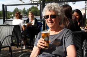 the causeway dividing the dredged
navigable canal-channel from the natural course of the Göta Älv. From the
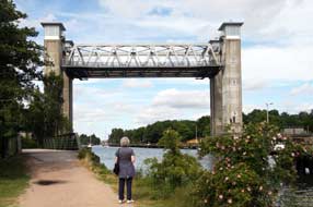
campsite, the path led along the canal bank and crossed the magnificent lifting
railway bridge, the central section of which raises complete with electrified
railway track 27m between the pair of towers to allow boats to pass below the
bridge along the
canal.
As we started along the causeway footpath on the far side of the bridge,
the warning bells began sounding and to our amazement the bridge's central
decking began lifting to allow 2 yachts to move forward and pass beneath along
the canal (see left); once through, the decking re-lowered, and a train duly
passed across the railway bridge, all a tribute to Trollhätten's traditional
engineering prowess. We continued along the Spiköstigan causeway, created
originally from silt dredged out to deepen this section of the canal, as a
divide from the shallower natural river on the far side. Now landscaped with
trees and parkland, it makes a pleasant approach to the city centre especially
on a sunny afternoon. We ambled along past
 the gest-hamn marina to reach the
Kraff-bron and Spikon-bron,
which together form Trollhätten's main city crossing of the Göta Canal and River
and must cause traffic chaos when the bridge lifts to allow boats to pass. Back
along cobbled Strandgatan, and on a bright sunny afternoon, the canal-side
terrace of the Trollhättens Arbetarförening (Working-mens) pub was one
temptation too many; we sat for an hour enjoying the ambience, sunshine and
Pripps Blå draught beer (brewed in Göteborg) (see above right), before walking back along the
canal to the campsite. We had observed at our 2013 stay how, for a city
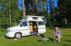
campsite, the woodland setting of Trollhätten Camping created a green oasis of
peacefulness among the city's industrial surroundings and traffic (see left), with just the
sound of birdsong and occasional
trains trundling across the lifting bridge. Facilities were faultlessly modern
and clean and second to none; the only lacking feature was wi-fi internet the gest-hamn marina to reach the
Kraff-bron and Spikon-bron,
which together form Trollhätten's main city crossing of the Göta Canal and River
and must cause traffic chaos when the bridge lifts to allow boats to pass. Back
along cobbled Strandgatan, and on a bright sunny afternoon, the canal-side
terrace of the Trollhättens Arbetarförening (Working-mens) pub was one
temptation too many; we sat for an hour enjoying the ambience, sunshine and
Pripps Blå draught beer (brewed in Göteborg) (see above right), before walking back along the
canal to the campsite. We had observed at our 2013 stay how, for a city
campsite, the woodland setting of Trollhätten Camping created a green oasis of
peacefulness among the city's industrial surroundings and traffic (see left), with just the
sound of birdsong and occasional
trains trundling across the lifting bridge. Facilities were faultlessly modern
and clean and second to none; the only lacking feature was wi-fi internet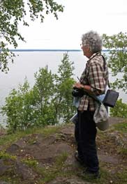 which
the warden was trying to get the owners, Trollhätten Commune, to install. Even
so with all its positive features, the site certainly still merited our top
rating as one of the trip's finest campsites. Tonight the
campsite was remarkably empty for the Midsummer holiday week, leaving us to
enjoy the company of just a few like-minded neighbours in tents or small campers
like ours. After today's gloomy, wet start, with uncertain plans and even more
uncertain camping options with campsites being so busy, the day had evolved into
a thoroughly enjoyable time in Trollhätten; we now had clear plans for the rest
of the week and the Midsummer holiday weekend. And as we sat enjoying the last
of the sun in the peace of the evening, 2 large hares were scooting around under
the campsite trees. which
the warden was trying to get the owners, Trollhätten Commune, to install. Even
so with all its positive features, the site certainly still merited our top
rating as one of the trip's finest campsites. Tonight the
campsite was remarkably empty for the Midsummer holiday week, leaving us to
enjoy the company of just a few like-minded neighbours in tents or small campers
like ours. After today's gloomy, wet start, with uncertain plans and even more
uncertain camping options with campsites being so busy, the day had evolved into
a thoroughly enjoyable time in Trollhätten; we now had clear plans for the rest
of the week and the Midsummer holiday weekend. And as we sat enjoying the last
of the sun in the peace of the evening, 2 large hares were scooting around under
the campsite trees.
 Excellent
VW service yet again and a walk on the Halleberg Plateau Nature Reserve: today's first appointment was
at Toveks Bil VW garage to get George's rear/brake light bulb replaced. The
mechanic fitted the bulb, and in line with the usual standard of VW service, no
charge was made. After a provisions stock-up, we headed around the E45 ring-road
towards Vännersborg and Värgön and up to the Halleberg Plateau Nature Reserve.
The sun was still bright, and we set off with the intention of walking the
circular nature trail on the densely wooded plateau out to the Predikstolen
look-out point on the northern edge of the rocky escarpment overlooking Lake
Vänern. Despite having a detailed map from our 2013 visit, familiarity-bred
overconfidence caused us carelessly to ignore obvious navigational features in
the dense woodland, and we set off down a steep rocky pathway above the
escarpment believing this was the start of the eastern loop of the route we had
followed last time. More careful examination of the map would have shown that
our intended path in fact began higher up, but we blithely pressed on regardlessly with the
route becoming less and less distinct ending in pathless forest. Only then, duly
chastened by a wasted hour's random wandering through the lower forest, did we
bother to consult our map; there was nothing for it but to turn back to find the
regular path out to Predikstolen (see left). We continued ahead on the
now clear and way-marked path out to the look-out point from where we could look
across the breadth of Lake Vänern to the northern shore (see above right). On our last
visit to the attractive Halleberg forests in May 2013, we had seen lots of
spring time flora, but today the Excellent
VW service yet again and a walk on the Halleberg Plateau Nature Reserve: today's first appointment was
at Toveks Bil VW garage to get George's rear/brake light bulb replaced. The
mechanic fitted the bulb, and in line with the usual standard of VW service, no
charge was made. After a provisions stock-up, we headed around the E45 ring-road
towards Vännersborg and Värgön and up to the Halleberg Plateau Nature Reserve.
The sun was still bright, and we set off with the intention of walking the
circular nature trail on the densely wooded plateau out to the Predikstolen
look-out point on the northern edge of the rocky escarpment overlooking Lake
Vänern. Despite having a detailed map from our 2013 visit, familiarity-bred
overconfidence caused us carelessly to ignore obvious navigational features in
the dense woodland, and we set off down a steep rocky pathway above the
escarpment believing this was the start of the eastern loop of the route we had
followed last time. More careful examination of the map would have shown that
our intended path in fact began higher up, but we blithely pressed on regardlessly with the
route becoming less and less distinct ending in pathless forest. Only then, duly
chastened by a wasted hour's random wandering through the lower forest, did we
bother to consult our map; there was nothing for it but to turn back to find the
regular path out to Predikstolen (see left). We continued ahead on the
now clear and way-marked path out to the look-out point from where we could look
across the breadth of Lake Vänern to the northern shore (see above right). On our last
visit to the attractive Halleberg forests in May 2013, we had seen lots of
spring time flora, but today the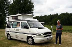 forest floor was the 'flat' green of midsummer
with little flora to be seen other than bushes of unripe Bilberries. forest floor was the 'flat' green of midsummer
with little flora to be seen other than bushes of unripe Bilberries.
A rural escape from Midsummer madness at
peaceful Dalskogs Camping:
with all other campsites in the area likely to be overfull for the holiday
weekend, we had found a small site tucked away safely from Midsummer madness at
the tiny rural hamlet of Dalskogs, well away inland from the west coast near
Mellerud; this should at least be peaceful. In busy late afternoon traffic, we
passed through Vännersborg,
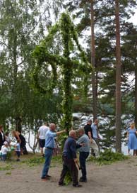 crossed the Göta Canal where locks controlled its
emergence from Lake Vänern, and headed north on E45. Contrary to expectations
that E45 would be
highway standard, this stretch turned out to be single carriageway with 70kph
limits, passing through a series of small settlements with a regular succession
of speed cameras, making for a slow and tedious drive up to Mellerud; we turned
off inland from here to find Dalskogs. All we could find was a deserted stugby
(huts encampment) and hostel, and knocking at the neighbouring house produced no
answer. Phone calls brought response, but the elderly owner spoke not a word of
English, and no understanding of our attempt to speak Swedish; neither he nor we
could understand a word the other was saying resulting in frustrating impasse.
We were about to give up, when an elderly neighbour appeared, this time
English-speaking; he led us along the village street to a small camping area
tucked away behind a barn. The campsite owner had called him and asked him to
help us. He showed us round, and checked that the WC/showers and antique power
supplies were operable; thankful for his help, we settled into what had once
been Dalskogs Camping (see above right). It was all now rather passé, and we
speculated as to the place's history: it had clearly once been a crossed the Göta Canal where locks controlled its
emergence from Lake Vänern, and headed north on E45. Contrary to expectations
that E45 would be
highway standard, this stretch turned out to be single carriageway with 70kph
limits, passing through a series of small settlements with a regular succession
of speed cameras, making for a slow and tedious drive up to Mellerud; we turned
off inland from here to find Dalskogs. All we could find was a deserted stugby
(huts encampment) and hostel, and knocking at the neighbouring house produced no
answer. Phone calls brought response, but the elderly owner spoke not a word of
English, and no understanding of our attempt to speak Swedish; neither he nor we
could understand a word the other was saying resulting in frustrating impasse.
We were about to give up, when an elderly neighbour appeared, this time
English-speaking; he led us along the village street to a small camping area
tucked away behind a barn. The campsite owner had called him and asked him to
help us. He showed us round, and checked that the WC/showers and antique power
supplies were operable; thankful for his help, we settled into what had once
been Dalskogs Camping (see above right). It was all now rather passé, and we
speculated as to the place's history: it had clearly once been a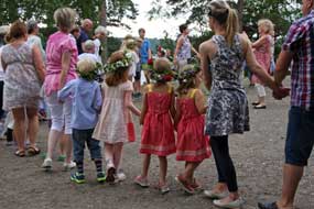 functioning
campsite-stugby, but perhaps the owner had now grown old and could no longer
maintain it; the hostel and stugby were now closed, and the campsite
seemed unlikely to survive for much longer. Dalskogs village was certainly a
peaceful place, and its campsite a curiously antiquated enigma, but it would
serve its purpose for our rest day tomorrow in pleasant rural surroundings, and
later as the evening grew dusky, a mother muntjac deer with 3 fawns grazed their
way across the neighbouring pastures. functioning
campsite-stugby, but perhaps the owner had now grown old and could no longer
maintain it; the hostel and stugby were now closed, and the campsite
seemed unlikely to survive for much longer. Dalskogs village was certainly a
peaceful place, and its campsite a curiously antiquated enigma, but it would
serve its purpose for our rest day tomorrow in pleasant rural surroundings, and
later as the evening grew dusky, a mother muntjac deer with 3 fawns grazed their
way across the neighbouring pastures.
Return to Trollhätten Camping for Midsummer weekend: the following
morning, the helpful neighbour came round again to ensure all was well and for
us to pay him the 250kr for our 2 nights' camping to pass on to the owner with
our thanks. His news, which was headlines in all the Swedish morning newspapers,
was that Brexit (as he called it) had triumphed in the UK EU-referendum with a
poll of 52%, and as a result Cameron was to resign as PM. All of this would need
verifying with the BBC, but it was an intriguing start to our Midsummer Eve. We
returned to Trollhätten to reserve our place for the weekend at Trollhätten
Camping, and drove out to the
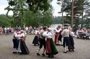 huge commercial park at Översby, hoping the shops
would be open on what was a national holiday for us to stock up with provisions
and hunt for a replacement electric kettle to replace ours which had died a
death last evening. Fortunately the ICA supermarket was open but the electrical
stores were closed for the weekend. huge commercial park at Översby, hoping the shops
would be open on what was a national holiday for us to stock up with provisions
and hunt for a replacement electric kettle to replace ours which had died a
death last evening. Fortunately the ICA supermarket was open but the electrical
stores were closed for the weekend.
A traditional Swedish Midsummer festival:
from the TIC we had details of a traditional Midsommar-firande event with
dressing and raising of the Midsummer Pole and traditional music and dancing, near
to Sjuntorp, a village south of Trollhätten.
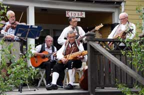 Along an unsurfaced rural lane,
people were gathering by a lake-side café where the Midsummer Pole was awaiting
its floral dressing. The local pastor gave a few words of welcome, and families
joined in the dressing of the pole and its hanging hoops with birch greenery and
ferns (Photo
25 - Dressing the Midsummer Pole). Within a short time the garlanded pole
was raised in the centre of the cleared dancing area (see above left), and a group of singers and
musicians led families and children, all with garlands of flowers on their
heads, in traditional ring-dancing around the Midsummer Pole (Stången)
(see above right).
Another group of musicians took over playing traditional folk music (see right)
for a
performance of Swedish folk dancing around the Midsummer Pole (see left). We were
particularly interested in one of the traditional instruments being played, the Nyckel-harpa (key-fiddle), which we had seen in 2013 being played so very
competently by young buskers (Photo
26 - Nyckel-harpa - key-fiddle). Along an unsurfaced rural lane,
people were gathering by a lake-side café where the Midsummer Pole was awaiting
its floral dressing. The local pastor gave a few words of welcome, and families
joined in the dressing of the pole and its hanging hoops with birch greenery and
ferns (Photo
25 - Dressing the Midsummer Pole). Within a short time the garlanded pole
was raised in the centre of the cleared dancing area (see above left), and a group of singers and
musicians led families and children, all with garlands of flowers on their
heads, in traditional ring-dancing around the Midsummer Pole (Stången)
(see above right).
Another group of musicians took over playing traditional folk music (see right)
for a
performance of Swedish folk dancing around the Midsummer Pole (see left). We were
particularly interested in one of the traditional instruments being played, the Nyckel-harpa (key-fiddle), which we had seen in 2013 being played so very
competently by young buskers (Photo
26 - Nyckel-harpa - key-fiddle).
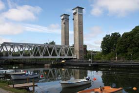 A
day of exploration of Trollhätten's industrial heritage: as the sun
broke through this morning, there was more wildlife to enjoy at Trollhätten
Camping, with a red squirrel scampering busily between the trees, and a spotted
woodpecker tapping away for his breakfast grubs on a pine trunk. We had timed
our main visit to Trollhätten for a Saturday when at 3-00pm the sluice gates of
the Hojums hydro-electric dam are opened to create of fiercesomely impressive
waterfall cascade; this floods down briefly re-filling the now normally dry gorge of A
day of exploration of Trollhätten's industrial heritage: as the sun
broke through this morning, there was more wildlife to enjoy at Trollhätten
Camping, with a red squirrel scampering busily between the trees, and a spotted
woodpecker tapping away for his breakfast grubs on a pine trunk. We had timed
our main visit to Trollhätten for a Saturday when at 3-00pm the sluice gates of
the Hojums hydro-electric dam are opened to create of fiercesomely impressive
waterfall cascade; this floods down briefly re-filling the now normally dry gorge of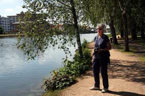 the Göta
River which is harnessed by Trollhätten's 2 hydro-electric power (HEP) generating stations. We had
been so impressed by this spectacle on our 2013 visit that we wanted to see it
again. There were 2 aspects of Trollhätten's industrial heritage to see today:
it was an opportunity to explore again the Göta Canal created by Sweden's brilliant
19th century civil engineer Nils Ericson (1802~70), and to visit the Olidan HEP
generating station built in 1910 to harness the power of the Göta River falls. the Göta
River which is harnessed by Trollhätten's 2 hydro-electric power (HEP) generating stations. We had
been so impressed by this spectacle on our 2013 visit that we wanted to see it
again. There were 2 aspects of Trollhätten's industrial heritage to see today:
it was an opportunity to explore again the Göta Canal created by Sweden's brilliant
19th century civil engineer Nils Ericson (1802~70), and to visit the Olidan HEP
generating station built in 1910 to harness the power of the Göta River falls.
Nil
Ericson's Trollhätten Canal: this morning we again crossed the lifting
railway bridge (see above left) and walked into town on the Spiköstigan causeway path alongside
the canal (see right). The sky had virtually cleared and the sun shone brightly; it looked
to be a lovely Midsummer Day. Unlike yesterday when everywhere was deserted,
today there were lots of families out for a morning stroll in the parkland.
Reaching the Kraffbron, we continued ahead on the footpath through the
beautifully landscaped
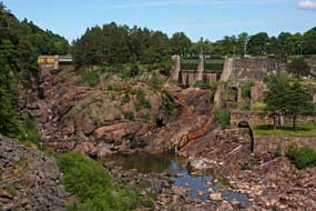 strip of land separating
Ericson's 1844 Göta Canal and
the artificial channel which, when the HEP generating stations were built in the
early 20th century, diverted the river water from the gorge to feed the turbines
of the Olidan power plant. The path passed the huge sluice gate which controlled
the Olidan water intake, and which in its early days took 8 men 2 hours to lift
manually. The path brought us out by Trollhätten's church, the land for which
along with cost of building and maintenance had been donated by the canal
company whose director was Nils Ericson, in compensation for disruption to the
early town caused by the canal's construction. We continued down Kyrkbrogatan
and followed the towpath above the canal. This showed Ericson's creative
genius in bypassing strip of land separating
Ericson's 1844 Göta Canal and
the artificial channel which, when the HEP generating stations were built in the
early 20th century, diverted the river water from the gorge to feed the turbines
of the Olidan power plant. The path passed the huge sluice gate which controlled
the Olidan water intake, and which in its early days took 8 men 2 hours to lift
manually. The path brought us out by Trollhätten's church, the land for which
along with cost of building and maintenance had been donated by the canal
company whose director was Nils Ericson, in compensation for disruption to the
early town caused by the canal's construction. We continued down Kyrkbrogatan
and followed the towpath above the canal. This showed Ericson's creative
genius in bypassing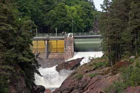 the line of the totally impassable gorge of the natural
river with its huge height drop and rapids by cutting his 1844 canal on a
parallel course but further uphill along a shelf through the bedrock for almost 4kms (see log of our 2013 visit to Göta Canal).
It was as daring a solution as his similarly shelved canal and bridging aqueduct
for the Dalsland Canal at Håverud which we should see later in the week.
Ericson was as creatively brilliant a civil and mechanical engineer as Brunel
and went on to develop the early Swedish railway network. the line of the totally impassable gorge of the natural
river with its huge height drop and rapids by cutting his 1844 canal on a
parallel course but further uphill along a shelf through the bedrock for almost 4kms (see log of our 2013 visit to Göta Canal).
It was as daring a solution as his similarly shelved canal and bridging aqueduct
for the Dalsland Canal at Håverud which we should see later in the week.
Ericson was as creatively brilliant a civil and mechanical engineer as Brunel
and went on to develop the early Swedish railway network.
In bright sunshine, we followed the canal
footpath around to the basin at the head of Trollhätten's flight of locks which
lowered the canal 150 feet to rejoin the Göta Älv where it became navigable
again below the rapids. We sat under the shade of trees in the beautifully
landscaped gardens by the locks to eat our lunch sandwiches; today there were
many more locals about enjoying a Midsummer
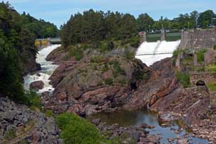 Day ice cream in the sunshine. We
walked back around the lane past pleasant cottage gardens to reach the Insikten
exhibition centre run by Vattenfall, the Swedish power generating company. The
young staff were welcoming and helpfully informative, suggesting that after seeing
the exhibition here, we view the 3-00 pm opening of the sluice gates and resultant
waterfalls then go on the 3-30 visit to Olidan HEP generating station. Although
largely Vattenfall propaganda, the Insikten displays showed Day ice cream in the sunshine. We
walked back around the lane past pleasant cottage gardens to reach the Insikten
exhibition centre run by Vattenfall, the Swedish power generating company. The
young staff were welcoming and helpfully informative, suggesting that after seeing
the exhibition here, we view the 3-00 pm opening of the sluice gates and resultant
waterfalls then go on the 3-30 visit to Olidan HEP generating station. Although
largely Vattenfall propaganda, the Insikten displays showed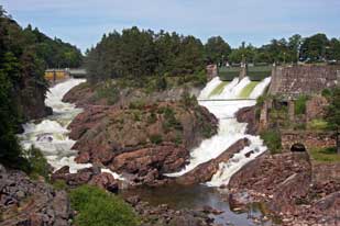 Sweden's energy consumption is produced 44% by nuclear power, 46% by hydro-generation, but only 1% by wind
power. So for all the visual pollution that vast numbers of giant
wind-turbines make on the natural environment across the country, their
contribution to meeting energy demand is minimal, a lesson that UK would do well
to note.
Trollhättan's dam sluice-gate waterfalls spectacle: anticipating crowds and competition for spaces
at the vantage point on the Oscar Bridge for viewing the waterfalls spectacle
with the weekly sluice gates opening this afternoon, we hurried along Kraftwerksväg (Power Station Street) and up the step-way by the Hojum HEP
plant onto Oscarbron to chose a spot on the high-arching bridge above the gorge
for optimal view of the waterfalls filling the presently dry gorge (see log of our 2013 viewing of the sluice gates waterfalls).
Visitors gathered gradually, and as 3-0pm approached, a Swedish/English
introductory commentary was relayed over the Hojums PA system. We readied
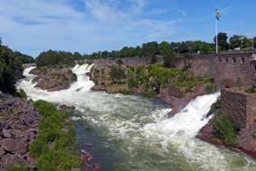 cameras, focussing on the 2 sets of sluice gates of the Hojums dam 800m
along high above the dry rocky gorge bed
(Photo
27 - Dry gorge before Hojums dam sluice gate opening) (see above left). Suddenly tongues of white cascade
appeared at the distant left-hand sluice, gradually spreading down the narrow
rocky channel (see above right). As the advancing cascade of water reached the junction of the
divided gorge below, the second and larger sluice opened with the wider cascade
surging down to fill the gorge
(Photo
28 - Main sluice gates open creating second cascade), the advancing body of white water cameras, focussing on the 2 sets of sluice gates of the Hojums dam 800m
along high above the dry rocky gorge bed
(Photo
27 - Dry gorge before Hojums dam sluice gate opening) (see above left). Suddenly tongues of white cascade
appeared at the distant left-hand sluice, gradually spreading down the narrow
rocky channel (see above right). As the advancing cascade of water reached the junction of the
divided gorge below, the second and larger sluice opened with the wider cascade
surging down to fill the gorge
(Photo
28 - Main sluice gates open creating second cascade), the advancing body of white water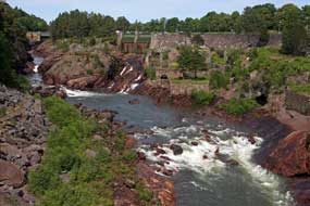 merging with
the first and advancing into the wider body of the main gorge below us (see
above left and right)
(Photo
29 - 2 cascades merging into torrent filling formerly dry gorge). This
year, a third cascade was added emerging in a torrent from an outflow beneath
the Hojums power plant, augmenting further the surging body of water now
filling the lower gorge 150 feet below the bridge where we stood (Photo
30 - Third cascade merging into torrent filling the gorge). The entire
length of the formerly dry rocky bed of the gorge was now totally filled by the
white water torrent from the opened sluices, re-creating the image of what the
Göta Älv rapids falls would have been like before the era of 20th century HEP
exploitation (Photo
31 - Gorge now fully flooded by torrent) (see left). We continued to
take our photos over the 5 minutes from the first appearance of the cascades
below the opened sluices, advancing in apparent slow motion as the merged
surging white water torrent filled the entire gorge. Then equally suddenly, the
sluices were closed shutting off merging with
the first and advancing into the wider body of the main gorge below us (see
above left and right)
(Photo
29 - 2 cascades merging into torrent filling formerly dry gorge). This
year, a third cascade was added emerging in a torrent from an outflow beneath
the Hojums power plant, augmenting further the surging body of water now
filling the lower gorge 150 feet below the bridge where we stood (Photo
30 - Third cascade merging into torrent filling the gorge). The entire
length of the formerly dry rocky bed of the gorge was now totally filled by the
white water torrent from the opened sluices, re-creating the image of what the
Göta Älv rapids falls would have been like before the era of 20th century HEP
exploitation (Photo
31 - Gorge now fully flooded by torrent) (see left). We continued to
take our photos over the 5 minutes from the first appearance of the cascades
below the opened sluices, advancing in apparent slow motion as the merged
surging white water torrent filled the entire gorge. Then equally suddenly, the
sluices were closed shutting off
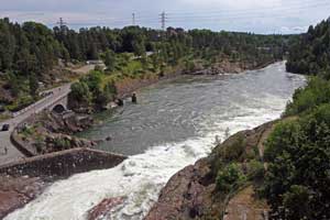 the water flow, the higher torrent ceased and
gradually the tidal current within the gorge drained away down the upper
channel, but still filling what 10 minutes earlier had been the entirely dry
rocky bed of the main gorge below us (Photo
32 - Sluice gates now closed and torrent draining away) (see above right).
The view from the opposite side of the bridge showed the torrent still flowing
downstream in full spate (see left). Having achieved our set of photos of the
sluice gates waterfalls spectacle, we now walked back down to Insikten for the
visit to the Olidan hydro-electric generating station the water flow, the higher torrent ceased and
gradually the tidal current within the gorge drained away down the upper
channel, but still filling what 10 minutes earlier had been the entirely dry
rocky bed of the main gorge below us (Photo
32 - Sluice gates now closed and torrent draining away) (see above right).
The view from the opposite side of the bridge showed the torrent still flowing
downstream in full spate (see left). Having achieved our set of photos of the
sluice gates waterfalls spectacle, we now walked back down to Insikten for the
visit to the Olidan hydro-electric generating station
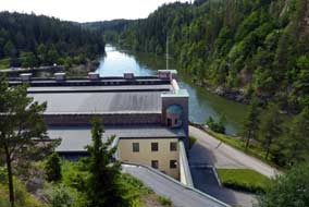 20th
Century exploitation of the Göta River
falls and rapids for hydro-electric power generation: with the
increase in freight traffic along the Göta Canal during the second half of the
19th century, the town of Trollhätten grew along the banks of the canal. Small
scale engineering works driven by water power developed along the fall of the
natural gorge of the Göta Älv at Trollhätten. The Göta River carries more water
than any other Swedish river, falling 44m in the short stretch from the river's
exit from Lake Vänern down to the sea at Göteborg; 32m of this fall occurs at
the gorges of Trollhätten. What had been such a formidable navigation obstacle
to the early 19th century canal builders, became a source of industrial power in
the second half of the 19th century with water-powered engineering industry
developing along the gorge at Trollhätten. The stone remains of these early
industrial sites and factories can still be seen in the Göta gorge below the
Hojums power plant. Then as the demand for electricity increased, work began in
1909 on Sweden's first Hydro-electric power (HEP) generating plant at Olidan,
harnessing the 32m fall in the Göta River at this point. 20th
Century exploitation of the Göta River
falls and rapids for hydro-electric power generation: with the
increase in freight traffic along the Göta Canal during the second half of the
19th century, the town of Trollhätten grew along the banks of the canal. Small
scale engineering works driven by water power developed along the fall of the
natural gorge of the Göta Älv at Trollhätten. The Göta River carries more water
than any other Swedish river, falling 44m in the short stretch from the river's
exit from Lake Vänern down to the sea at Göteborg; 32m of this fall occurs at
the gorges of Trollhätten. What had been such a formidable navigation obstacle
to the early 19th century canal builders, became a source of industrial power in
the second half of the 19th century with water-powered engineering industry
developing along the gorge at Trollhätten. The stone remains of these early
industrial sites and factories can still be seen in the Göta gorge below the
Hojums power plant. Then as the demand for electricity increased, work began in
1909 on Sweden's first Hydro-electric power (HEP) generating plant at Olidan,
harnessing the 32m fall in the Göta River at this point.
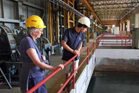 The plant opened in
1910 with a capacity of 77 Mw, remarkably meeting the entire country's
electricity needs at that time, particularly for railways. The Porjus dam and
hydro-electric generating plant was built 5 years later in 1915 in the far north
to power the Malmbanan railway line transporting iron ore from the mines at
Gällivare and Kiruna to the ports of Luleå and Narvik. Three further HEP plants
were built in the first half of the 20th century to harness the Göta River's 44m
fall from Lake Vänern: Lilla Edet (1926-43 Mw), Vargön (1934-34
Mw), and Hojums also at Trollhätten (1941-172 Mw). The plant opened in
1910 with a capacity of 77 Mw, remarkably meeting the entire country's
electricity needs at that time, particularly for railways. The Porjus dam and
hydro-electric generating plant was built 5 years later in 1915 in the far north
to power the Malmbanan railway line transporting iron ore from the mines at
Gällivare and Kiruna to the ports of Luleå and Narvik. Three further HEP plants
were built in the first half of the 20th century to harness the Göta River's 44m
fall from Lake Vänern: Lilla Edet (1926-43 Mw), Vargön (1934-34
Mw), and Hojums also at Trollhätten (1941-172 Mw).
A tour of the Olidan HEP generating plant:
there were only 3 others along with us on the 3-30pm tour of the Olden
hydro-electric generating plant, which Vattenfall offers free of charge during
the summer months as part of its PR programme. The young Vattenfall guide issued
us with hard-hats and led us down firstly to see the upper water-intake control
plant above the red granite clad, fortress-like Olidan power station (see above
right). The
sturdiness of the plant's building had been further reinforced in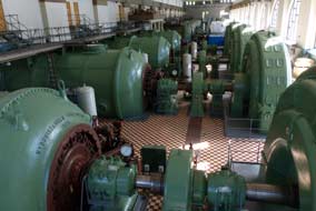 1940 against
the threat of aerial bombing if the Germans had attacked Sweden after the
invasion of Norway. Water for the 13 intakes is fed from the dammed river
upstream along the artificial channel we had followed earlier (see left). We were then led
steeply downhill to the machine hall where we could stand above the row of 8
horizontal turbines each with their drive shafts connecting to the huge
generators (see right) (Photo
33 - Turbines and generators at Olidan HEP station). On the day of our visit, only one of the generators was supplying
the grid with electricity, the others either idling or static. But the
remarkable fact was that the entire plant was still powered by the original 1909
turbines and generators, all still generating power for the grid. Above the
noise of the working machinery, we stood questioning the guide on the plant's
working and taking our photos, full of admiration at this display of fully operational early 20th century electro-mechanical engineering. Plaques on the
turbines with the date 1909 showed that the plant had been manufactured here in Trollhätten. 1940 against
the threat of aerial bombing if the Germans had attacked Sweden after the
invasion of Norway. Water for the 13 intakes is fed from the dammed river
upstream along the artificial channel we had followed earlier (see left). We were then led
steeply downhill to the machine hall where we could stand above the row of 8
horizontal turbines each with their drive shafts connecting to the huge
generators (see right) (Photo
33 - Turbines and generators at Olidan HEP station). On the day of our visit, only one of the generators was supplying
the grid with electricity, the others either idling or static. But the
remarkable fact was that the entire plant was still powered by the original 1909
turbines and generators, all still generating power for the grid. Above the
noise of the working machinery, we stood questioning the guide on the plant's
working and taking our photos, full of admiration at this display of fully operational early 20th century electro-mechanical engineering. Plaques on the
turbines with the date 1909 showed that the plant had been manufactured here in Trollhätten.
On the way back up the lane, we passed one
of Hojums generating station's original huge vertical turbines set up for demonstration, and
below the station, the remains of Pelhams locks, a brave but almost foolhardy
attempt in the mid-18th century to construct a short length of canal cutting
through the steepest part of the Göta falls, way beyond the lock technology of
the day. By a huge manual effort, the canal was partly cut through forming a
narrow
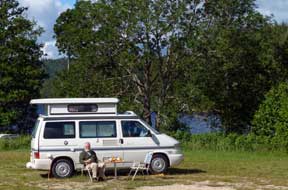 but incredibly high cleft in the bedrock, but unsurprisingly it never
came into usage. A viable route bypassing the falls had to wait another 90
years for Ericson's genius to devise a route further from the river's natural
course. In hot afternoon sunshine, we walked back through a shady park alongside
the reservoir which now holds back the upper section of the river to form a head
of water to feed the Hojums generating plant. Out onto the footbridge above the
dam whose sluice gates earlier had been opened to create the waterfalls, in the
shady distance we could look back to our vantage point on the Oscarbron. Back
across the main town bridge and along the Strandgatan canal embankment, we again
stopped for a beer on the pub terrace, watching a trio of yachts waiting for the
Kraffbron to lift to allow them to pass along the canal towards the slussar
(locks). Sitting here in the sunshine was a fitting climax of a highly
successful day spent around Trollhätten's industrial heritage of canal and
hydro-electric exploitation of the Göta River falls' power. Back along to the
campsite, Sheila put on a load of laundry in the campsite washing machine, and
as we sat after supper, distant rumbles of thunder threatened a storm and change
in weather. but incredibly high cleft in the bedrock, but unsurprisingly it never
came into usage. A viable route bypassing the falls had to wait another 90
years for Ericson's genius to devise a route further from the river's natural
course. In hot afternoon sunshine, we walked back through a shady park alongside
the reservoir which now holds back the upper section of the river to form a head
of water to feed the Hojums generating plant. Out onto the footbridge above the
dam whose sluice gates earlier had been opened to create the waterfalls, in the
shady distance we could look back to our vantage point on the Oscarbron. Back
across the main town bridge and along the Strandgatan canal embankment, we again
stopped for a beer on the pub terrace, watching a trio of yachts waiting for the
Kraffbron to lift to allow them to pass along the canal towards the slussar
(locks). Sitting here in the sunshine was a fitting climax of a highly
successful day spent around Trollhätten's industrial heritage of canal and
hydro-electric exploitation of the Göta River falls' power. Back along to the
campsite, Sheila put on a load of laundry in the campsite washing machine, and
as we sat after supper, distant rumbles of thunder threatened a storm and change
in weather.
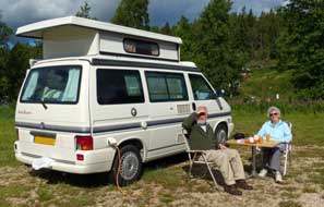 Högsbyn Camping: first stop on
leaving Trollhätten was the shopping centre at Överby, hoping the electrical
shops would be open for us buy a replacement kettle. We need not have worried:
shopping was clearly what Swedes liked to do on a dreary Midsummer holiday
Sunday morning since today the huge parking areas were full. Harald Nyberg was
the sort of shop that stocked everything from toasters to cement mixers, and we
got exactly the kettle needed. Having re-stocked with provisions, we extricated
ourselves from the parking chaos and re-joined E45 NE-wards. Traffic in the
opposite direction was nose-to-tail with Swedish holiday-makers returning from their weekend at the coast. Just after Mellerud, we turned off on a minor road
through Åsenbruk, the -bruk ending of the name indicating that this had once
been a Dalsland iron-smelting village; there was still extensive industry down
by the railway line. Beyond Håverud we crossed the high bridge over the canal
and aqueduct which we should visit tomorrow, and continued into deepest rural
Dalsland towards Tisselskogs. The single-track lane wound a switchback course
through gloomy forests for some 10 kms, eventually reaching Högsbyn where we
turned off down to Högsbyn Camping. The view from the terrace up by the service
house was magnificent looking out over Lake Råvarpen, part of the Dalsland Canal
system, with its forested backdrop, exactly as recalled from our stay here in
2013 (see above left). Högsbyn Camping: first stop on
leaving Trollhätten was the shopping centre at Överby, hoping the electrical
shops would be open for us buy a replacement kettle. We need not have worried:
shopping was clearly what Swedes liked to do on a dreary Midsummer holiday
Sunday morning since today the huge parking areas were full. Harald Nyberg was
the sort of shop that stocked everything from toasters to cement mixers, and we
got exactly the kettle needed. Having re-stocked with provisions, we extricated
ourselves from the parking chaos and re-joined E45 NE-wards. Traffic in the
opposite direction was nose-to-tail with Swedish holiday-makers returning from their weekend at the coast. Just after Mellerud, we turned off on a minor road
through Åsenbruk, the -bruk ending of the name indicating that this had once
been a Dalsland iron-smelting village; there was still extensive industry down
by the railway line. Beyond Håverud we crossed the high bridge over the canal
and aqueduct which we should visit tomorrow, and continued into deepest rural
Dalsland towards Tisselskogs. The single-track lane wound a switchback course
through gloomy forests for some 10 kms, eventually reaching Högsbyn where we
turned off down to Högsbyn Camping. The view from the terrace up by the service
house was magnificent looking out over Lake Råvarpen, part of the Dalsland Canal
system, with its forested backdrop, exactly as recalled from our stay here in
2013 (see above left).
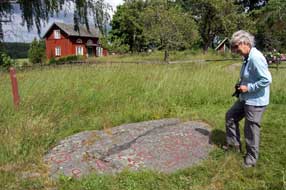 Högsbyn Nature Reserve and Bronze Age rock engravings: the cloud
had broken the following morning to give bright sun; there was still a lot of
broken cloud but a cool breeze kept the cloud moving so that we were able
to sit our for breakfast in the lee of George (see above right). Our Högsbyn Nature Reserve and Bronze Age rock engravings: the cloud
had broken the following morning to give bright sun; there was still a lot of
broken cloud but a cool breeze kept the cloud moving so that we were able
to sit our for breakfast in the lee of George (see above right). Our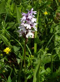 plan for
today was to walk the circuit of the Högsbyn Nature Reserve to see the less
well-known Bronze Age rock engravings which exist here by the lake shore on
bedrock panels. Leaving George at the campsite, we walked up past Högsbyn
farm, over the railway line and along the lane. Earlier a freight train had
passed around the forested hill-side above the lake, whistling at every farm
crossing. We found the first of the Högsbyn rock engravings (hällristningar
in Swedish) at the start of the walk (see left) (Photo
34 - Högsbyn rock engravings). The motifs here were quite different from
those seen elsewhere: there was a range of boats some with elaborate prows,
sun-wheels, cup-marks, sandal footprints some with strap marks, snake deities of
varying lengths, but most intriguing of all, the procession of figures with
spear-carrier and lur player all advancing behind a boat over which an acrobat
performed a backward somersault
(Photo
35 - Backward somersaulting acrobat engraving); this uncannily resembled the acrobatic
bull-leaper portrayed on the almost contemporary frescoes in the Bronze Age
Minoan palace at Knossos in Crete. We sat to eat our sandwiches, a spot which
must rate as one of the trip's most memorable lunch spots looking out across a
panel of 3,000 year old rock engravings and grassy meadows against the
magnificent backdrop of Lake Råvarpen. And nearby we found among the long meadow
grass a whole cluster of the most beautiful Heath Spotted Orchids (see right) (Photo
36 - Heath Spotted Orchid). plan for
today was to walk the circuit of the Högsbyn Nature Reserve to see the less
well-known Bronze Age rock engravings which exist here by the lake shore on
bedrock panels. Leaving George at the campsite, we walked up past Högsbyn
farm, over the railway line and along the lane. Earlier a freight train had
passed around the forested hill-side above the lake, whistling at every farm
crossing. We found the first of the Högsbyn rock engravings (hällristningar
in Swedish) at the start of the walk (see left) (Photo
34 - Högsbyn rock engravings). The motifs here were quite different from
those seen elsewhere: there was a range of boats some with elaborate prows,
sun-wheels, cup-marks, sandal footprints some with strap marks, snake deities of
varying lengths, but most intriguing of all, the procession of figures with
spear-carrier and lur player all advancing behind a boat over which an acrobat
performed a backward somersault
(Photo
35 - Backward somersaulting acrobat engraving); this uncannily resembled the acrobatic
bull-leaper portrayed on the almost contemporary frescoes in the Bronze Age
Minoan palace at Knossos in Crete. We sat to eat our sandwiches, a spot which
must rate as one of the trip's most memorable lunch spots looking out across a
panel of 3,000 year old rock engravings and grassy meadows against the
magnificent backdrop of Lake Råvarpen. And nearby we found among the long meadow
grass a whole cluster of the most beautiful Heath Spotted Orchids (see right) (Photo
36 - Heath Spotted Orchid).
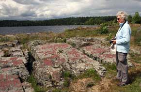 We followed the pathway down towards the lake,
where on a small promontory right by the water's edge, tucked away from
immediate view, we found more panels covered with a large variety of engraved
motifs, some totally mystifying, including grid patterns of unknown
significance, and what could be interpreted as Tree of Life symbols. There were
2 large boats with elaborate prow elevations, surrounded by a bewildering
variety of mysterious symbols, sandal footprints some with straps, and
sun-wheels (see right). Being set at a distance right by the water's edge in this glorious
setting added to the mystique of this ritual site, particularly when lit by the
bright sun against a backdrop of grimly dark clouds (Photo
37 - Lake-side rock engravings) (see left). Leaving the lake shore, we
followed We followed the pathway down towards the lake,
where on a small promontory right by the water's edge, tucked away from
immediate view, we found more panels covered with a large variety of engraved
motifs, some totally mystifying, including grid patterns of unknown
significance, and what could be interpreted as Tree of Life symbols. There were
2 large boats with elaborate prow elevations, surrounded by a bewildering
variety of mysterious symbols, sandal footprints some with straps, and
sun-wheels (see right). Being set at a distance right by the water's edge in this glorious
setting added to the mystique of this ritual site, particularly when lit by the
bright sun against a backdrop of grimly dark clouds (Photo
37 - Lake-side rock engravings) (see left). Leaving the lake shore, we
followed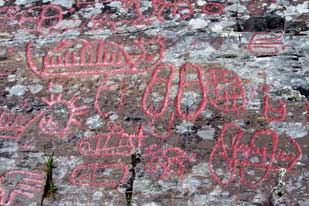 the footpath up through beautiful woodland, just as a heavy shower
began. The pine wood floor was covered with Bilberry, Lingonberry and Lily
of the Valley, with oak and rowan saplings. The shower soon passed and sun broke
through again, enabling us fully to appreciate the beauty of this lovely
woodland as sunlight filtered down through the trees. The path passed a headland
above the lake, topped with the remains of an Iron Age burial mound; how lucky
the man whose final resting place this had been. We emerged from the wood on the far
side above pastures where sheep grazed and a path led back to the Högsbyn
campsite by the lake-side. It had been a thoroughly enjoyable afternoon's walk,
past rock engravings with an intriguing air of mystery about the reason for
their creation by Bronze Age pastoralists 3,000 years ago. The miracle of this
ritual artwork's survival added further to its mystical nature. the footpath up through beautiful woodland, just as a heavy shower
began. The pine wood floor was covered with Bilberry, Lingonberry and Lily
of the Valley, with oak and rowan saplings. The shower soon passed and sun broke
through again, enabling us fully to appreciate the beauty of this lovely
woodland as sunlight filtered down through the trees. The path passed a headland
above the lake, topped with the remains of an Iron Age burial mound; how lucky
the man whose final resting place this had been. We emerged from the wood on the far
side above pastures where sheep grazed and a path led back to the Högsbyn
campsite by the lake-side. It had been a thoroughly enjoyable afternoon's walk,
past rock engravings with an intriguing air of mystery about the reason for
their creation by Bronze Age pastoralists 3,000 years ago. The miracle of this
ritual artwork's survival added further to its mystical nature.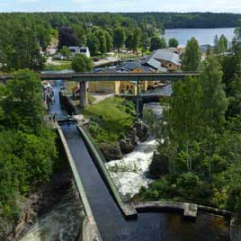
We woke to a clear sky and bright, early sun, the overnight wind having cleared
last night's cloud mass. It was a lovely peaceful morning, looking out over
breakfast from the camper's open slider with the sun glistening across the lake
and the air filled with the sound of birdsong and wind rustling the trees. What
more could you ask for than this?
More of the engineering genius of Nils Ericson
at Håverud:
we planned to spend today by the Dalsland Canal locks at
Håverud, exploring the wonderful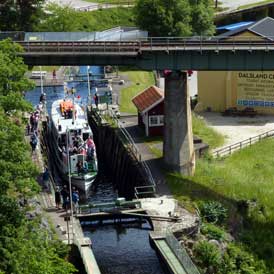 engineering of the Håverud aqueduct. The
sheer-sided, narrow, precipitous gorge and river-rapids, with the 10m height
difference between the upper and lower lakes at Håverud, presented the early
19th century canal builders with a seemingly impassable obstacle. But again
enter engineer supreme, Nils Ericson, who was given responsibility for the
project of overcoming the obstacle at Håverud. Ericson, a remarkable engineer,
much respected for his other achievements including the work to bypass the gorge
at Trollhättan, conceived a brilliantly far-sighted and audacious solution. The
problem at Håverud in the confined gorge was more complex than at Trollhättan: despite the
narrow, sheer-sided gorge, Ericson however managed to squeeze his
new cut alongside the river falls with an artificial 'shelf' chopped into the
gorge side-face on the inner side
and buttressed on the outer side by a man-made wall above the falls. But his pièce
do résistance was to span the gorge itself with a 32.5m long steel trough
aqueduct to link the 2 sections of his new cut along which conventional locks
could manage the 10m height drop between the upper and lower lakes (see above left) (Photo
38 - Håverud gorge spanned by Nils Ericson's Aqueduct). This
brilliant design concept won approval. Sections of the steel trough were
fabricated in Stockholm and assembled on site to be slid into position engineering of the Håverud aqueduct. The
sheer-sided, narrow, precipitous gorge and river-rapids, with the 10m height
difference between the upper and lower lakes at Håverud, presented the early
19th century canal builders with a seemingly impassable obstacle. But again
enter engineer supreme, Nils Ericson, who was given responsibility for the
project of overcoming the obstacle at Håverud. Ericson, a remarkable engineer,
much respected for his other achievements including the work to bypass the gorge
at Trollhättan, conceived a brilliantly far-sighted and audacious solution. The
problem at Håverud in the confined gorge was more complex than at Trollhättan: despite the
narrow, sheer-sided gorge, Ericson however managed to squeeze his
new cut alongside the river falls with an artificial 'shelf' chopped into the
gorge side-face on the inner side
and buttressed on the outer side by a man-made wall above the falls. But his pièce
do résistance was to span the gorge itself with a 32.5m long steel trough
aqueduct to link the 2 sections of his new cut along which conventional locks
could manage the 10m height drop between the upper and lower lakes (see above left) (Photo
38 - Håverud gorge spanned by Nils Ericson's Aqueduct). This
brilliant design concept won approval. Sections of the steel trough were
fabricated in Stockholm and assembled on site to be slid into position
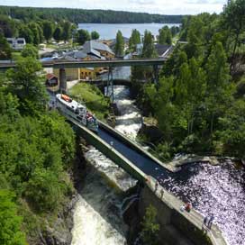 bridging
the gorge in the most confined space above the rapids. The sections were joined
by some 33,000 rivets, and such was the craftsmanship that not one has ever needed
replacement. Construction of the Dalsland Canal took 4 years and it was
officially opened on 19 September 1868 by King Carl XV. Despite the brilliance
of Ericson's solution for overcoming the Håverud obstacle, the Dalsland Canal
was short-lived as a commercial trade route. Within decades Sweden's late-built
railways caught up fast, and the line through Dalsland, ironically passing over
Ericson's aqueduct on a steel trestle bridge, quickly took over
the transport of goods and materials, leaving the canal to pleasure boats and
holiday craft. bridging
the gorge in the most confined space above the rapids. The sections were joined
by some 33,000 rivets, and such was the craftsmanship that not one has ever needed
replacement. Construction of the Dalsland Canal took 4 years and it was
officially opened on 19 September 1868 by King Carl XV. Despite the brilliance
of Ericson's solution for overcoming the Håverud obstacle, the Dalsland Canal
was short-lived as a commercial trade route. Within decades Sweden's late-built
railways caught up fast, and the line through Dalsland, ironically passing over
Ericson's aqueduct on a steel trestle bridge, quickly took over
the transport of goods and materials, leaving the canal to pleasure boats and
holiday craft.
A day at the Dalsland Canal locks and aqueduct at Håverud: we had scheduled our day around the times at
which the tourist boats departed or arrived at the dock at Håverud, and
therefore passed through the flight of canal locks and over the aqueduct,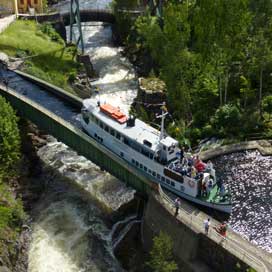 and
the times of Mellerud~Bengtsfors trains crossing the gorge on the railway
trestle-bridge. We left camp at Högsbyn early to drive back along the lane
through the forests which glowed in the morning sunlight. Down at Håverud canal
basin, the tour-boat M/S Dalslandia was filling with passengers, ready to
depart up through the flight of locks. We drove up to the modern road bridge
high above the village, which gave a perfect aerial panorama of the entire
setting of the river's natural course down the gorge, the canal with its 4
locks, the railway bridge passing over the whole ensemble, and of course
Ericson's aqueduct elegantly centre stage spanning the gorge. The natural and
man-made marvels were spread out below us, and from this vantage point we
watched as the boat left its mooring at the distant dock, and advanced up
through the sequence of lower locks (see above right).
(Photo
39 - Boat passing through Håverud lower locks) When the waters of the third lock levelled,
the top gates opened and M/S Dalslandia edged slowly forward to cross the
magnificent steel trough of Ericson's aqueduct
(see above left) (Photo
40 - Boat passing across Håverud Aqueduct) , and turned skilfully into the
buttressed upper canal shelved along the gorge (Photo
41 - Crossing Aqueduct into buttressed canal) (see right). and
the times of Mellerud~Bengtsfors trains crossing the gorge on the railway
trestle-bridge. We left camp at Högsbyn early to drive back along the lane
through the forests which glowed in the morning sunlight. Down at Håverud canal
basin, the tour-boat M/S Dalslandia was filling with passengers, ready to
depart up through the flight of locks. We drove up to the modern road bridge
high above the village, which gave a perfect aerial panorama of the entire
setting of the river's natural course down the gorge, the canal with its 4
locks, the railway bridge passing over the whole ensemble, and of course
Ericson's aqueduct elegantly centre stage spanning the gorge. The natural and
man-made marvels were spread out below us, and from this vantage point we
watched as the boat left its mooring at the distant dock, and advanced up
through the sequence of lower locks (see above right).
(Photo
39 - Boat passing through Håverud lower locks) When the waters of the third lock levelled,
the top gates opened and M/S Dalslandia edged slowly forward to cross the
magnificent steel trough of Ericson's aqueduct
(see above left) (Photo
40 - Boat passing across Håverud Aqueduct) , and turned skilfully into the
buttressed upper canal shelved along the gorge (Photo
41 - Crossing Aqueduct into buttressed canal) (see right).
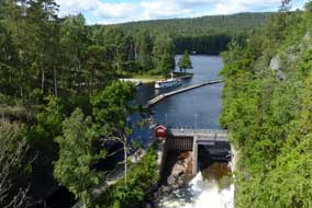 We crossed to the far side of
the upper bridge, and with the sun shining to perfection, we had a similar
aerial view of the boat passing along the upper section of Ericson's canal for her passage out
through the top lock, and picking up speed into the distant Lake Åkläng (see left). We crossed to the far side of
the upper bridge, and with the sun shining to perfection, we had a similar
aerial view of the boat passing along the upper section of Ericson's canal for her passage out
through the top lock, and picking up speed into the distant Lake Åkläng (see left).
We followed the foot path down under the
railway trellis-bridge to reach the tow path and crossed the narrow metal
walkway above the aqueduct's 2m deep trough (see below right). Standing here so matter of
factly today, the brilliance of the aqueduct's visionary design and the skill of its
construction might so easily be taken for granted. From this position, we had a
closer understanding of the sturdily buttressed, artificially-constructed wall
which contained the outer side of Ericson's wide shelf to contain the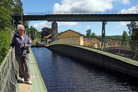 canal's
on-going passage on the far side of the aqueduct (Photo
42 - Towpath by Aqueduct and buttressed canal above natural gorge). All during the day as we
explored the canal and aqueduct, the sluice gates controlling the natural
outflow of water from Lake Åkläng into the Håverud gorge were left open. As a
result this wild torrent surged down the bed of the lower gorge, filling the air
with the constant roar of rushing white water. The tow-path gave a close
quarters appreciation of the scale of problem which Ericson's daringly
conceived canal and aqueduct had been designed to bypass (Photo
43 - Håverud gorge torrent). We continued ahead
above the river's rocky natural gorge to the sluice gates through which water
cascaded (see left). Crossing the canal on the lock-gates enabled us to examine canal's
on-going passage on the far side of the aqueduct (Photo
42 - Towpath by Aqueduct and buttressed canal above natural gorge). All during the day as we
explored the canal and aqueduct, the sluice gates controlling the natural
outflow of water from Lake Åkläng into the Håverud gorge were left open. As a
result this wild torrent surged down the bed of the lower gorge, filling the air
with the constant roar of rushing white water. The tow-path gave a close
quarters appreciation of the scale of problem which Ericson's daringly
conceived canal and aqueduct had been designed to bypass (Photo
43 - Håverud gorge torrent). We continued ahead
above the river's rocky natural gorge to the sluice gates through which water
cascaded (see left). Crossing the canal on the lock-gates enabled us to examine
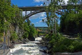 how the
shelf had been cut out of the gorge's sheer rock face, where drill marks from
the original blasting showed the scale of construction required. how the
shelf had been cut out of the gorge's sheer rock face, where drill marks from
the original blasting showed the scale of construction required.
It was now time for the second boat of the day,
and this time we stayed down at canal tow path level to follow its passage up
through the locks and across the aqueduct (Photo
44 - Håverud lower locks and dock basin). We photographed M/S Nils Ericson
as she left the dock (Photo
45 - M/S Nils Ericson leaving dock) and passed through the 2nd and 3rd locks
(see below right), and re-crossing
the aqueduct ourselves, we followed her progress across the steel trough and on
through Ericson's artificially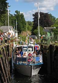 buttressed section of canal towards the top lock
(Photo
46 - Crossing Aqueduct).
After watching an early afternoon train cross the railway trestle-bridge high
above the aqueduct, it was then that we noticed the deck of the bridge had
lifted (see below left). To our surprise, this massive structure was hand-cranked to pivot
upwards by means of a counter-weight (Photo
47 - Lifting railway bridge). The bridge had been raised to allow a
small yacht to pass through the canal locks, its tall mast-top just clearing the
lifted bridge. The yacht moved forward to cross the aqueduct (Photo
48 - Yacht crossing Aqueduct), and the railway
bridge was hand-cranked down into position, which was just as well since an up
train was due to cross northwards shortly. We positioned ourselves on the top
road bridge to photograph the railcar move slowly across the trestle-bridge into Håverud
station (Photo
49 - Railcar crossing trestle-bridge). buttressed section of canal towards the top lock
(Photo
46 - Crossing Aqueduct).
After watching an early afternoon train cross the railway trestle-bridge high
above the aqueduct, it was then that we noticed the deck of the bridge had
lifted (see below left). To our surprise, this massive structure was hand-cranked to pivot
upwards by means of a counter-weight (Photo
47 - Lifting railway bridge). The bridge had been raised to allow a
small yacht to pass through the canal locks, its tall mast-top just clearing the
lifted bridge. The yacht moved forward to cross the aqueduct (Photo
48 - Yacht crossing Aqueduct), and the railway
bridge was hand-cranked down into position, which was just as well since an up
train was due to cross northwards shortly. We positioned ourselves on the top
road bridge to photograph the railcar move slowly across the trestle-bridge into Håverud
station (Photo
49 - Railcar crossing trestle-bridge).
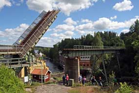 On the far side of the road bridge, we followed
the nature trail which climbed steeply up the rocky hillside high above the
sheer rock wall of the Håverud gorge. As Sheila clambered up, a small black
grass snake which had been sunning itself on the rocks slowly uncoiled and
slithered away. The path led across the forested hill-top and dropped steeply on
wooden steps down into the upper gorge to the level of the natural water course where this emerged from Lake Åkläng
and on the far side Ericson's upper canal cut. We
crossed the footbridge above the sluice gate which was still partially open allowing
the roaring torrent to surge down into the natural gorge below the massively
buttressed retaining wall of Ericson's canal and on under the aqueduct. Along
the top tow-path, 2 of the young lock-keepers were waiting to allow the
returning tour-boat to pass through the locks. We waited and followed M/S Nils Ericson
down through the top lock in the dark, narrow confines of the gorge, re-cross the
aqueduct (Photo
50 - Re-crossing the Aqueduct), clear the aqueduct trough and on under the high railway trellis-bridge
(see below right)
(Photo
51 - Beginning descent of lower locks), and down through the lower 3
locks to the dock basin by the lower Lake Övre Upperudshöljen. Back up the rocky
footpath under the railway bridge for the final time, we returned to the car
park by the little café after a thoroughly enjoyable day amid the natural
surroundings of Håverud. Back along the winding single-track lane through On the far side of the road bridge, we followed
the nature trail which climbed steeply up the rocky hillside high above the
sheer rock wall of the Håverud gorge. As Sheila clambered up, a small black
grass snake which had been sunning itself on the rocks slowly uncoiled and
slithered away. The path led across the forested hill-top and dropped steeply on
wooden steps down into the upper gorge to the level of the natural water course where this emerged from Lake Åkläng
and on the far side Ericson's upper canal cut. We
crossed the footbridge above the sluice gate which was still partially open allowing
the roaring torrent to surge down into the natural gorge below the massively
buttressed retaining wall of Ericson's canal and on under the aqueduct. Along
the top tow-path, 2 of the young lock-keepers were waiting to allow the
returning tour-boat to pass through the locks. We waited and followed M/S Nils Ericson
down through the top lock in the dark, narrow confines of the gorge, re-cross the
aqueduct (Photo
50 - Re-crossing the Aqueduct), clear the aqueduct trough and on under the high railway trellis-bridge
(see below right)
(Photo
51 - Beginning descent of lower locks), and down through the lower 3
locks to the dock basin by the lower Lake Övre Upperudshöljen. Back up the rocky
footpath under the railway bridge for the final time, we returned to the car
park by the little café after a thoroughly enjoyable day amid the natural
surroundings of Håverud. Back along the winding single-track lane through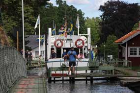 the
forests to Tisselskogs and down to Högsbyn Camping, George settled back into
his space up on the terrace overlooking the lake, with the afternoon sun shining
directly into his slider; it was gloriously peaceful. We had enjoyed an excellent
day, watching the boats pass through the Håverud locks and over the aqueduct; we
were full of admiration at Nils Ericson's creative and daring genius in
engineering his canal and aqueduct through the narrow gorge. It was all still
going strong after 150 years, giving pleasure to 1000s of boating folk on
the Dalsland Canal, even though in its day its life as a commercial enterprise
was brief. the
forests to Tisselskogs and down to Högsbyn Camping, George settled back into
his space up on the terrace overlooking the lake, with the afternoon sun shining
directly into his slider; it was gloriously peaceful. We had enjoyed an excellent
day, watching the boats pass through the Håverud locks and over the aqueduct; we
were full of admiration at Nils Ericson's creative and daring genius in
engineering his canal and aqueduct through the narrow gorge. It was all still
going strong after 150 years, giving pleasure to 1000s of boating folk on
the Dalsland Canal, even though in its day its life as a commercial enterprise
was brief.
Moving on northwards through Bergslagen to Lake Siljan, Idre,
Funäsdalen and Åredalen: tomorrow we should leave the rural solitude of Dalsland to move on northwards around the shore of Lake Vänern. We turned off at Åsensbruk but before joining the E45 for the start of our northward drive to
Karlstad, we diverted briefly into the hamlet of Köppmannebro to watch a boat
leaving Lake Österbrosjön through the bottom lock of the Dalsland Canal to sail
on into the inland sea of Lake Vänern (Photo
52 - Köppmannebro locks). The next phase of our trip would take us
across the iron working region of Bergslagen to spend a day or 2 around Lake Siljan, then northward over high country for fell walking above the Österdalälven
valley at Idre, and at Funäsdalen, and onwards to camp alongside the Indalsälven
river in Åredalen. But that's all for the next edition which will follow
shortly.
Next edition
to be published quite soon
|
Sheila and Paul |
Published: 31 August 2016
at Wikegårds Camping, Öland |
|

 CAMPING IN SWEDEN 2016 - Lund, Göteborg,
Kungälv, Bohuslän
Bronze Age rock engravings,
Trollhättan,
Dalsland Canal and Håverud
Aqueduct:
 The journey out to
Sweden: after a long winter, and delayed start to this year's travels
with health concerns, it was a moment to be savoured sitting beer in hand as the
Harwich~Hook of Holland ferry pulled away from the dock; our 2016 trip
to Sweden was finally underway. Again this year we had the long 550 mile
transcontinental drive to reach Sweden, across
Holland and Northern Germany, the Puttgarden~Rødby ferry to Denmark, and finally
across the Öresund Bridge with the straits this time sullenly grey; the crossing of that magnificent engineering structure (see left), though expensive
now at €54, is always a thrilling experience (
 from
our 2013 visit to Lund. At this stage we had no Swedish coins, and when the
automat would not accept our credit card, a local man in a generous act of
kindness paid our hour's parking charge. Having secured our Telia SIM card, we
still had time to walk through to the Tourist Information Centre in Stortorget
for a city plan. Having already experienced the helpfulness of Lund's
citizens, the girl at the TIC told us that Lund so prides itself on helpfulness
and good service that it operates a helpfulness competition: she gave us a pin
badge to present to the Lundite whom we judged to be most helpful, though it was
not clear at this stage what the recipient should do with the badge or how the
recognition was awarded. But we accepted the challenge, and collected our city
plan and the usual crop of leaflets ready for tomorrow. Having extricated
ourselves from Lund centre in the late afternoon traffic, we headed for Lomma
for provisions from the ICA supermarket, and our first night camp at Habo-Ljung
Camping on the shore of the Öresund (see left). It was a gloomy evening with a chill wind
blowing from across an equally grey Öresund. We were back in Sweden and could
relax at last.
 help from an elderly
gentleman who also failed to make it read our card. In the true spirit of
Helpful Lund however, and to our acute embarrassment, he also insisted on paying
our parking charge with his card; we were overwhelmed at this generosity and
explained Lund's pin-badge award for excellent service which we insisted on
awarding to him. In complete puzzlement at these strange English people, he took
the badge along with our insistent thanks, and went on his way! This was the
second such act of helpful kindness we had received in Helpful Lund, and we came
to the conclusion that, while Lundites are by nature courteous and helpful, the
town's parking automats are cussedly uncooperative towards overseas visitors.
 Cathedral through Lund's quaint old street's lined with cottages charmingly
a-blossom with scented roses. We reached the Cathedral just as the
Astronomical Clock's midday performance was coming to an end and a service was
beginning in the nave; we should have to return later to see the magnificent
Romanesque architecture. We had last visited Lund in gloriously spring
sunshine in May 2013, and still being term time then, the beautiful gardens of Lundagård were filled with young undergraduates sitting on the lawns under the
trees. Today in mid-June, term had finished; it was cold with the beginnings of
drizzle, the sky was a lifeless grey with little light
 for photography, and the
gardens were deserted. Our plan for today was for lunch at the students' union
cafeteria, and we walked up past the magnificent classically styled Universitets
Huset building (see above left) heading for the Akademinska Föreningen for lunch. Normally during
term time, visitors could use the cafeteria, but today out of term a conference
was taking place and the cafeteria was reserved for delegates. We were however
given details of another student cafeteria near the University library. Along
Sandgatan, set amid tall, noble trees and beautiful gardens rose the magnificent
red-brick Gothic University Library (see right) (
 Founded in the 1690s as a study garden for medical students, the
University Botanical Museum was established at its present location, then the
outskirts of Lund, in the mid-19th century by the botanist Jacob Georg Agardh. who designed the gardens' layout and greenhouses. Today the 8 hectares of
gardens grow over 7,000 plant species and still supports the University's Botany
studies. As we entered the greenhouses, pouring rain began; we had just reached
shelter in time. The Conservatory greenhouses contain both wild and cultivated
species from all over the world, and as the pouring rain hammered on the glass roofs, we spent the next hour examining these exotic plants (
 The rain eased at last to a heavy drizzle, and
we walked around to the rear of the greenhouses to see the Gardens' centrepiece,
the Tulip Trees whose huge blossom forms the Botanic Garden's emblem. But in
mid-June the trees' flowering was past, and with just one small umbrella to shelter both of us from the still persistent rain, we headed back towards the
Cathedral, really not having done justice to the Botanical Gardens. In sunny
weather, you could easily spend a half-day in these lovely surroundings. Back
through narrow streets, past Lund's old brick buildings, we reached the rear of
the 12th century Romanesque Cathedral, its 3 storey high apse crowned by an
impressive gallery. Inside, we had 15 minutes before the 3-00pm performance of
the Astronomical Clock, to photograph the huge gilded mosaic figure of Christ in
Glory lining the dome of the apse above the high altar triptych (
 A curious monument at Kvidinge, and
excellent VW service yet again at Ångelholm:
leaving Kvidinge, we paused at the village outskirts to investigate a curious
monument; this turned out to commemorate an obscure piece of early 19th century
Swedish history, which doubtless few Swedes would be able to explain. The
reforming and enlightened Gustav III was assassinated by disgruntled aristocrats
in 1792, and was succeeded by his young and inept son Gustav IV. After the
disastrous war with Imperial Russia resulting in the loss of Finland in 1809,
Gustav was deposed and his elderly and infirm uncle was proclaimed king as Karl
XIII; he died childless soon after. Everything was now arranged for the Danish
Prince Karl-August to assume the Swedish monarchy, but again fate intervened:
while on military manoeuvres in Skåne, Karl-August fell from his horse here at
Kvidinge, dying from a stroke it was said. The monument was erected in his
honour at the place of his death, but the column's plinth was never completed
with his statue; and here the topless monument to Karl-August remains to this day
at the edge of the village (see left). Meanwhile the frustrated Swedes continued
scratching around for a monarch, and invited Napoleon's little known marshal,
Jean-Baptiste Bernadotte, to become king of Sweden; he accepted, establishing
the Bernadotte dynasty which continues to this day, and the rest of
course is history.
 the length and breadth of Europe.
 how
vulnerable the undersea telegraphic cable link to America was, given the numbers
of Swedish émigrés in USA. As a result, in 1922 the Swedish Parliament decided
to build a Very Low Frequency radio station as a transatlantic radio-telegraphy link to the RCA
Radio Central Station in New York, as part of an emerging world-wide
radio-telegraphic network. The station was built at Varberg in SW Sweden,
equipped with an Alexanderson rotating armature electro-mechanical
transmitter, designed by the Swedish-American Ernst Frederick Alexanderson
(1879~1975), a creative pioneer of electrical engineering, radio and electronics
who during his lifetime registered over 300 patents. With a radio power output
of 200Kw, the Varberg station (call sign SAQ) achieved transatlantic
transmissions at 17.2Khz (17,400m wave length) by means of an
incredible 2.2km long antenna mounted on a linear series of 6 127m high pylons
spread across the countryside (see right). The station was opened in 1924 by King Gustav V,
and continued working until the 1950s when the
Alexanderson electro-mechanical rotary transmitter was replaced with modern
electronic short wave transmitters for transatlantic telecommunications. The
original Alexanderson equipment and antenna array are preserved and are now
recognised as a World Heritage Site.
 Reaching
the radio station site in the heart of the countryside, its enormous antenna
pylons visible for miles around, we learnt more about its history and details of
its technical working. The guide explained that, in the early days of the station's
working, members of the Swedish public would write messages to relatives in USA
on telegram forms at a local post office; these were relayed by land-line
telegraphy to a central office in Göteborg, where the message in morse was
converted to punched paper-tape and transmitted by wire to Varberg. Here
electro-mechanical devices converted the morse at far greater speed than a human
operator could key (see right), for transmission by the Alexanderson generator
and enormous antenna array across the Atlantic. In New York, the received morse
signal was re-converted to plain text and delivered to the recipient by telegram
boy. A tour of the station enabled us to see the huge electro-mechanical rotary
transmitting apparatus (see above left) (
 construction for the 1920s. In these days
of worldwide satellite telecommunications, our visit to the Varberg Radio Station was a
fascinating insight into both the technical working and social history of early
long distance communications by telegrams and wireless telegraphy.
 sent us
a welcoming text message with the camping access code since she finished work at 6-00pm. Crossing the river
at the approach to the town, past Kungälv's over-towering hill-top medieval fortress, the Bohus Fästning,
our first stop was the ICA-Maxi supermarket for provisions and bus tickets for
tomorrow's journey into Göteborg by bus from Kungälv. Back at the small
campsite, we settled into our reserved riverside spot (see above left); it was by
now almost 8-00pm and we were exhausted after a busy but interesting day and
long drive in stressful traffic.
 A re-visit to Göteborg:
the following morning we walked the 500m across the river bridge to the bus stop
at Eriksdal to catch the Grön Express bus which ran every 10 minutes into
Göteborg (see
 the spot where he wished his new port-city to
be founded in 1621 at the mouth of the Göta Älv river. Today's
weather forecast was not good, and although it was not yet raining, the sky was
gloomily overcast for His Imperial Majesty's photograph (
 Along Kungsports-avenyn, where trams
trundled along the elegant
boulevard, we turned off into Vasagatan, admiring the impressive red-brick art
nouveau buildings which lined the street and opposite Vasa-Platsen Göteborg
University's main building (
 skyscraper of Utsiken which towered over the marina and sailing clipper moored
in the harbour (
 modern buildings. Braving the
now persistent light rain, we threaded a way through the equally unimpressive
office blocks which overshadowed the marina, to find the entrance to the Utsiken
tower, suddenly realising we were standing right outside it as it towered over
us. It cost an expensive 40kr each to ascend in the lift the 22 storeys of the
86m high tower, but the viewing gallery gave a bird's eye panorama over
Göteborg's industrial city skyline (see right). The most impressive view was along the wide Göta Älv
river, with its docks and ship-yards (
 The Blomsholm Stone Ship-setting
burial mound:
on a sunny morning, we re-joined the E6 to head north through Bohuslän. Despite
fears of aggressively speeding Norwegians heading for the border, the motorway
was surprisingly quiet making for a relaxed drive north through increasingly
hilly terrain, magnificently forested and with bare rocky outcrops; we were now
seeing our first pine and spruces. Over the last 3 years since we had last
driven this road, the motorway had been completed and a huge new shopping
complex built near to Tanumshede to attract Norwegian cross-border
 shoppers. By
mid-afternoon we turned off close to Strömstad and followed a rural lane to the
farmstead at Blomsholm where the Iron Age stone ship-setting could be seen
standing proud on a hillock amid fields of cereals, and lit by the afternoon
sun (see left). The stone ship was erected in the late Iron Age around 500~11050
AD, 40m long and made up of 49 standing stones arranged in the shape of a long
boat, the prow and stern-post stones standing 4m high. Although it is the
largest such boat-grave in Sweden, little is known of its history. Boats clearly
were of ritual importance to prehistoric northern peoples as rock art shows,
symbolising the passage from life to death. The hillock forming the tumulus
beneath the stone-circle has never been excavated, but at a time when sea levels
were higher than now and the lower ground near the grave would have been the
shore-line of an inlet from a fjord. the ship-setting's scale and prominent
position indicates it marked the burial site of a powerful chieftain. On a warm,
sunny afternoon, we followed the pathway leading up onto the burial mound, and
looking along the length of the stone ship at close range, you gained a full
impression of its 40m length (see right) (
 The Massleberg Bronze Age
rock-engravings: this whole area had clearly been a significant burial
ground with some 40 Iron Age graves and stone circles on the hillside across the
lane, but there was no time to explore these if we were
 to find the nearby Massleberg Bronze Age rock-engravings. From the village of Skee, we
followed a single-track lane to a farmstead at Massleberg, and just along a
trackway we found a rock-outcrop panel with the red-painted rock-engravings (hällristningar
in Swedish). The most prominent depiction showed a human figure holding up a
whole boat; these 'boat-lifter' figures occur throughout Bohuslän Bronze Age
rock-engravings, and are thought to symbolise some unknown legend, perhaps boat
sacrifice (see left). Another boat carried a stag with star-shaped antlers and 2
lur players; 2 superimposed boats were shown carrying warriors fighting with
spears (
 until
it came to the price: 280kr and extra coins for showers and washing-up hot water
was ludicrously OTT for a simple site with basic facilities and no wi-fi
internet. It was no wonder the place was almost empty even at almost midsummer,
but we negotiated a lower price with the curious Chilean warden who would
certainly win no prizes at a grace and charm contest. We pitched at the top end of the camping area to enjoy the full evening
 sun in these wonderful forested surroundings (see left) and a supper of Swedish
meatballs (kötbullar) in lingonberry sauce. Later that evening, one of
those ludicrously monstrous mega-buses arrived, a veritable apartment block on 6
wheels, with en-suite ballroom, billiards room and indoor swimming pool judging
by its size 4 times the length and twice the height of a VW camper; here was the
subject of much ridicule and contempt, accommodating just 2 people who
immediately began twirling their over-sized satellite dish in search of soap
operas to satisfy a limited intellect. The fact that they were in the midst of
the most wonderful natural surroundings seemed to have gone unnoticed.
 to represent religious ceremonial ritual, fertility rites and
representation of the passage from life to death, and the engravings have
controversially been coloured in with red paint to make them more visible to
modern day visitors. The carved rock-art figures supported by archaeological
finds show a continuity of occupation and land use for over 1000 years. There
are 4 areas of rock
 engravings, and the panel at Tanum-Vitlycke was clearly
visible on the opposite hillside, and we were able to enjoy an undisturbed hour
examining these in close detail
(
 Litsleby
rock-engravings: 4 kms away, the Litsleby group of rock-engravings is
set among delightful pine woodland and contains some 80 simple bier-like
representations of boats, with just upturned lines of gunwale and keel connected
by vertical lines and shields. But the entire panel is dominated by
 the 2.3m
high figure of a giant spear-brandishing deity
(
 The Aspeberget rock-engravings:
the nearby panels of rock-engravings at Aspeberget show some of the only
depictions of everyday work in Bronze Age pastoralist society: a farmer
ploughing with an ard (predecessor of the plough) pulled by a pair of oxen,
perhaps an invocation for a good
 harvest; above this a line of bulls driven
by a herdsman reflects the importance of oxen and cattle at this time, as draught
animals, and providing leather, milk, meat and manure (see left). The bull as a
ritual symbol of strength, courage and fertility is found across all Europe in contemporary
Bronze Age culture and mythology. A group of axe-men holding shields suggests a
ritual battle scene, and below this a boat engraving with inward-curved prow and stern carries a
huge crew of rowers and a lur player (see right); boats needing a crew of this size were
beyond the technology of this time, and clearly were only of ritual
significance symbolising the passage from life to death. At the top of the
panel, a large solar symbol shows the sun being adored by 2 women with plaits.
The next panel shows a curious human figure with over-sized hands bearing a
group of 29 cup-marks arranged in 4 groups of 7, thought to represent a calendar (
 bull's horns, so reminiscent of the
bull-leaping frescoes from contemporary Minoan Crete
(
 Fossum rock-engravings:
on the far side of Tanumshede village, another
group of rock-engravings at Fossum at the foot of an outcrop facing the sun
looked out across the valley surrounded by hills, a typical location for Bohuslän
rock-engravings. The engravings begin with the
depiction of a woman with long plaited hair and arm raised in adoration (see
right). A hunter stabs a deer with his spear, another raises his bow towards
prey (see below left), and a group of 3 hunters with axes is shown with a pack of hunting dogs;
such portrayal of hunting scenes is thought to be an invocation for success in the hunt for
food. A group of 3 axe-men shows the distinctly detailed weapons which, when
compared with archaeological finds, enabled the Fossum panel to be dated to
around 600 BC (
 the Tjörn
archipelago. Since we were here 3 years ago, what had then been a quiet road was
now festooned with speed cameras and the pleasant rural environment contaminated
with building sites. With all this, plus road works and gloomy wet weather, it
was now a tedious drive. Finally reaching Klädesholmen, we threaded our way
through the village's narrow street and across onto the outer islet and
fishing harbour where we had enjoyed a peaceful wild-camp among the fishing
boats in 2013. By now the south-westerly gusty wind was driving rain from the sea;
the guest-harbour was deserted and harbour master's office locked, but worse still,
a sign now forbade camping. The harbour master drew up in his car, and made it
quite clear that our presence was no longer welcome: No camping, he insisted,
you have to go! So that was that. In pouring rain
 we took stock. The nearest
acceptable campsite was Stenrösets Camping near to Trollhätten, and we phoned to
check, since it was approaching the Midsummer holiday; they had space for
tonight but would be full at the weekend. Back over Tjörn bridge to the
mainland, we made our way on uncertain back roads in pouring rain, eventually
reaching Stenrösets at 6-00pm. The owner welcomed us hospitably after our long drive, and
we found a quiet corner looking out into dark woodland (see right); at least we had a viable
campsite for tonight. It was so miserably dark and chill that, even in mid summer, we had heating on.
  A day in Trollhätten: overnight the rain had stopped but the weather was still dismally
gloomy; some Midsummer Day! The sky gradually brightened, but it was one of
those mornings when time moved faster than we did. Facilities at Stenrösets were
excellent, and the site-wide wi-fi enabled us to keep check on the weather
forecast. Today had begun with only the vaguest plan of walking the Halleberg
nature trail, but after re-stocking with provisions at an ICA supermarket in the western
suburbs of Trollhätten, with no conscious effort today gradually evolved into a
day in Trollhätten, a town which developed on the banks of the Göta River/Canal
with a fascinating industrial history. We parked down at the southern side of the Trollhätten Canal
by the flight of locks which lowers the navigable waterway down to the level of
the ongoing Götälven river after bypassing the Trollhätten rapids gorge.
Crossing the top-lock
 footbridge, we were just in time to watch 2 leisure craft
pass into the lock basin (see right); the lock drained, the lower gates opened and the boats
sailed on towards the remaining flight of locks towards Göteborg
(
 same smiling hospitably welcoming reception as before, and in fact
the site was remarkably quiet; why would anyone want to come to Trollhätten for
the holiday? the managing couple exclaimed in surprise; we could suggest a dozen
and one reasons for admiring Trollhätten's industrial heritage and the
magnificent Göta Canal and hydro-generating infrastructure. They suggested a pitch that
would enjoy evening sun, and we settled in. There was time this afternoon to walk
into town on the lovely footpath along
 the causeway dividing the dredged
navigable canal-channel from the natural course of the Göta Älv. From the
campsite, the path led along the canal bank and crossed the magnificent lifting
railway bridge, the central section of which raises complete with electrified
railway track 27m between the pair of towers to allow boats to pass below the
bridge along the
canal.
  the gest-hamn marina to reach the
Kraff-bron and Spikon-bron,
which together form Trollhätten's main city crossing of the Göta Canal and River
and must cause traffic chaos when the bridge lifts to allow boats to pass. Back
along cobbled Strandgatan, and on a bright sunny afternoon, the canal-side
terrace of the Trollhättens Arbetarförening (Working-mens) pub was one
temptation too many; we sat for an hour enjoying the ambience, sunshine and
Pripps Blå draught beer (brewed in Göteborg) (see above right), before walking back along the
canal to the campsite. We had observed at our 2013 stay how, for a city
campsite, the woodland setting of Trollhätten Camping created a green oasis of
peacefulness among the city's industrial surroundings and traffic (see left), with just the
sound of birdsong and occasional
trains trundling across the lifting bridge. Facilities were faultlessly modern
and clean and second to none; the only lacking feature was wi-fi internet
 which
the warden was trying to get the owners, Trollhätten Commune, to install. Even
so with all its positive features, the site certainly still merited our top
rating as one of the trip's finest campsites. Tonight the
campsite was remarkably empty for the Midsummer holiday week, leaving us to
enjoy the company of just a few like-minded neighbours in tents or small campers
like ours. After today's gloomy, wet start, with uncertain plans and even more
uncertain camping options with campsites being so busy, the day had evolved into
a thoroughly enjoyable time in Trollhätten; we now had clear plans for the rest
of the week and the Midsummer holiday weekend. And as we sat enjoying the last
of the sun in the peace of the evening, 2 large hares were scooting around under
the campsite trees.
 Excellent
VW service yet again and a walk on the Halleberg Plateau Nature Reserve: today's first appointment was
at Toveks Bil VW garage to get George's rear/brake light bulb replaced. The
mechanic fitted the bulb, and in line with the usual standard of VW service, no
charge was made. After a provisions stock-up, we headed around the E45 ring-road
towards Vännersborg and Värgön and up to the Halleberg Plateau Nature Reserve.
The sun was still bright, and we set off with the intention of walking the
circular nature trail on the densely wooded plateau out to the Predikstolen
look-out point on the northern edge of the rocky escarpment overlooking Lake
Vänern. Despite having a detailed map from our 2013 visit, familiarity-bred
overconfidence caused us carelessly to ignore obvious navigational features in
the dense woodland, and we set off down a steep rocky pathway above the
escarpment believing this was the start of the eastern loop of the route we had
followed last time. More careful examination of the map would have shown that
our intended path in fact began higher up, but we blithely pressed on regardlessly with the
route becoming less and less distinct ending in pathless forest. Only then, duly
chastened by a wasted hour's random wandering through the lower forest, did we
bother to consult our map; there was nothing for it but to turn back to find the
regular path out to Predikstolen (see left). We continued ahead on the
now clear and way-marked path out to the look-out point from where we could look
across the breadth of Lake Vänern to the northern shore (see above right). On our last
visit to the attractive Halleberg forests in May 2013, we had seen lots of
spring time flora, but today the
 forest floor was the 'flat' green of midsummer
with little flora to be seen other than bushes of unripe Bilberries.
 crossed the Göta Canal where locks controlled its
emergence from Lake Vänern, and headed north on E45. Contrary to expectations
that E45 would be
highway standard, this stretch turned out to be single carriageway with 70kph
limits, passing through a series of small settlements with a regular succession
of speed cameras, making for a slow and tedious drive up to Mellerud; we turned
off inland from here to find Dalskogs. All we could find was a deserted stugby
(huts encampment) and hostel, and knocking at the neighbouring house produced no
answer. Phone calls brought response, but the elderly owner spoke not a word of
English, and no understanding of our attempt to speak Swedish; neither he nor we
could understand a word the other was saying resulting in frustrating impasse.
We were about to give up, when an elderly neighbour appeared, this time
English-speaking; he led us along the village street to a small camping area
tucked away behind a barn. The campsite owner had called him and asked him to
help us. He showed us round, and checked that the WC/showers and antique power
supplies were operable; thankful for his help, we settled into what had once
been Dalskogs Camping (see above right). It was all now rather passé, and we
speculated as to the place's history: it had clearly once been a
 functioning
campsite-stugby, but perhaps the owner had now grown old and could no longer
maintain it; the hostel and stugby were now closed, and the campsite
seemed unlikely to survive for much longer. Dalskogs village was certainly a
peaceful place, and its campsite a curiously antiquated enigma, but it would
serve its purpose for our rest day tomorrow in pleasant rural surroundings, and
later as the evening grew dusky, a mother muntjac deer with 3 fawns grazed their
way across the neighbouring pastures.
 huge commercial park at Översby, hoping the shops
would be open on what was a national holiday for us to stock up with provisions
and hunt for a replacement electric kettle to replace ours which had died a
death last evening. Fortunately the ICA supermarket was open but the electrical
stores were closed for the weekend.
 Along an unsurfaced rural lane,
people were gathering by a lake-side café where the Midsummer Pole was awaiting
its floral dressing. The local pastor gave a few words of welcome, and families
joined in the dressing of the pole and its hanging hoops with birch greenery and
ferns (
 A
day of exploration of Trollhätten's industrial heritage: as the sun
broke through this morning, there was more wildlife to enjoy at Trollhätten
Camping, with a red squirrel scampering busily between the trees, and a spotted
woodpecker tapping away for his breakfast grubs on a pine trunk. We had timed
our main visit to Trollhätten for a Saturday when at 3-00pm the sluice gates of
the Hojums hydro-electric dam are opened to create of fiercesomely impressive
waterfall cascade; this floods down briefly re-filling the now normally dry gorge of
 the Göta
River which is harnessed by Trollhätten's 2 hydro-electric power (HEP) generating stations. We had
been so impressed by this spectacle on our 2013 visit that we wanted to see it
again. There were 2 aspects of Trollhätten's industrial heritage to see today:
it was an opportunity to explore again the Göta Canal created by Sweden's brilliant
19th century civil engineer Nils Ericson (1802~70), and to visit the Olidan HEP
generating station built in 1910 to harness the power of the Göta River falls.
 strip of land separating
Ericson's 1844 Göta Canal and
the artificial channel which, when the HEP generating stations were built in the
early 20th century, diverted the river water from the gorge to feed the turbines
of the Olidan power plant. The path passed the huge sluice gate which controlled
the Olidan water intake, and which in its early days took 8 men 2 hours to lift
manually. The path brought us out by Trollhätten's church, the land for which
along with cost of building and maintenance had been donated by the canal
company whose director was Nils Ericson, in compensation for disruption to the
early town caused by the canal's construction. We continued down Kyrkbrogatan
and followed the towpath above the canal. This showed Ericson's creative
genius in bypassing
 the line of the totally impassable gorge of the natural
river with its huge height drop and rapids by cutting his 1844 canal on a
parallel course but further uphill along a shelf through the bedrock for almost 4kms (
 Day ice cream in the sunshine. We
walked back around the lane past pleasant cottage gardens to reach the Insikten
exhibition centre run by Vattenfall, the Swedish power generating company. The
young staff were welcoming and helpfully informative, suggesting that after seeing
the exhibition here, we view the 3-00 pm opening of the sluice gates and resultant
waterfalls then go on the 3-30 visit to Olidan HEP generating station. Although
largely Vattenfall propaganda, the Insikten displays showed
 Sweden's energy consumption is produced 44% by nuclear power, 46% by hydro-generation, but only 1% by wind
power. So for all the visual pollution that vast numbers of giant
wind-turbines make on the natural environment across the country, their
contribution to meeting energy demand is minimal, a lesson that UK would do well
to note.
 cameras, focussing on the 2 sets of sluice gates of the Hojums dam 800m
along high above the dry rocky gorge bed
(
 merging with
the first and advancing into the wider body of the main gorge below us (see
above left and right)
(
 the water flow, the higher torrent ceased and
gradually the tidal current within the gorge drained away down the upper
channel, but still filling what 10 minutes earlier had been the entirely dry
rocky bed of the main gorge below us (
 20th
Century exploitation of the Göta River
falls and rapids for hydro-electric power generation: with the
increase in freight traffic along the Göta Canal during the second half of the
19th century, the town of Trollhätten grew along the banks of the canal. Small
scale engineering works driven by water power developed along the fall of the
natural gorge of the Göta Älv at Trollhätten. The Göta River carries more water
than any other Swedish river, falling 44m in the short stretch from the river's
exit from Lake Vänern down to the sea at Göteborg; 32m of this fall occurs at
the gorges of Trollhätten. What had been such a formidable navigation obstacle
to the early 19th century canal builders, became a source of industrial power in
the second half of the 19th century with water-powered engineering industry
developing along the gorge at Trollhätten. The stone remains of these early
industrial sites and factories can still be seen in the Göta gorge below the
Hojums power plant. Then as the demand for electricity increased, work began in
1909 on Sweden's first Hydro-electric power (HEP) generating plant at Olidan,
harnessing the 32m fall in the Göta River at this point.
 The plant opened in
1910 with a capacity of 77 Mw, remarkably meeting the entire country's
electricity needs at that time, particularly for railways. The Porjus dam and
hydro-electric generating plant was built 5 years later in 1915 in the far north
to power the Malmbanan railway line transporting iron ore from the mines at
Gällivare and Kiruna to the ports of Luleå and Narvik. Three further HEP plants
were built in the first half of the 20th century to harness the Göta River's 44m
fall from Lake Vänern: Lilla Edet (1926-43 Mw), Vargön (1934-34
Mw), and Hojums also at Trollhätten (1941-172 Mw).
  1940 against
the threat of aerial bombing if the Germans had attacked Sweden after the
invasion of Norway. Water for the 13 intakes is fed from the dammed river
upstream along the artificial channel we had followed earlier (see left). We were then led
steeply downhill to the machine hall where we could stand above the row of 8
horizontal turbines each with their drive shafts connecting to the huge
generators (see right) (
 but incredibly high cleft in the bedrock, but unsurprisingly it never
came into usage. A viable route bypassing the falls had to wait another 90
years for Ericson's genius to devise a route further from the river's natural
course. In hot afternoon sunshine, we walked back through a shady park alongside
the reservoir which now holds back the upper section of the river to form a head
of water to feed the Hojums generating plant. Out onto the footbridge above the
dam whose sluice gates earlier had been opened to create the waterfalls, in the
shady distance we could look back to our vantage point on the Oscarbron. Back
across the main town bridge and along the Strandgatan canal embankment, we again
stopped for a beer on the pub terrace, watching a trio of yachts waiting for the
Kraffbron to lift to allow them to pass along the canal towards the slussar
(locks). Sitting here in the sunshine was a fitting climax of a highly
successful day spent around Trollhätten's industrial heritage of canal and
hydro-electric exploitation of the Göta River falls' power. Back along to the
campsite, Sheila put on a load of laundry in the campsite washing machine, and
as we sat after supper, distant rumbles of thunder threatened a storm and change
in weather.
  Högsbyn Camping: first stop on
leaving Trollhätten was the shopping centre at Överby, hoping the electrical
shops would be open for us buy a replacement kettle. We need not have worried:
shopping was clearly what Swedes liked to do on a dreary Midsummer holiday
Sunday morning since today the huge parking areas were full. Harald Nyberg was
the sort of shop that stocked everything from toasters to cement mixers, and we
got exactly the kettle needed. Having re-stocked with provisions, we extricated
ourselves from the parking chaos and re-joined E45 NE-wards. Traffic in the
opposite direction was nose-to-tail with Swedish holiday-makers returning from their weekend at the coast. Just after Mellerud, we turned off on a minor road
through Åsenbruk, the -bruk ending of the name indicating that this had once
been a Dalsland iron-smelting village; there was still extensive industry down
by the railway line. Beyond Håverud we crossed the high bridge over the canal
and aqueduct which we should visit tomorrow, and continued into deepest rural
Dalsland towards Tisselskogs. The single-track lane wound a switchback course
through gloomy forests for some 10 kms, eventually reaching Högsbyn where we
turned off down to Högsbyn Camping. The view from the terrace up by the service
house was magnificent looking out over Lake Råvarpen, part of the Dalsland Canal
system, with its forested backdrop, exactly as recalled from our stay here in
2013 (see above left).
 Högsbyn Nature Reserve and Bronze Age rock engravings: the cloud
had broken the following morning to give bright sun; there was still a lot of
broken cloud but a cool breeze kept the cloud moving so that we were able
to sit our for breakfast in the lee of George (see above right). Our
 plan for
today was to walk the circuit of the Högsbyn Nature Reserve to see the less
well-known Bronze Age rock engravings which exist here by the lake shore on
bedrock panels. Leaving George at the campsite, we walked up past Högsbyn
farm, over the railway line and along the lane. Earlier a freight train had
passed around the forested hill-side above the lake, whistling at every farm
crossing. We found the first of the Högsbyn rock engravings (hällristningar
in Swedish) at the start of the walk (see left) (
 We followed the pathway down towards the lake,
where on a small promontory right by the water's edge, tucked away from
immediate view, we found more panels covered with a large variety of engraved
motifs, some totally mystifying, including grid patterns of unknown
significance, and what could be interpreted as Tree of Life symbols. There were
2 large boats with elaborate prow elevations, surrounded by a bewildering
variety of mysterious symbols, sandal footprints some with straps, and
sun-wheels (see right). Being set at a distance right by the water's edge in this glorious
setting added to the mystique of this ritual site, particularly when lit by the
bright sun against a backdrop of grimly dark clouds (
 the footpath up through beautiful woodland, just as a heavy shower
began. The pine wood floor was covered with Bilberry, Lingonberry and Lily
of the Valley, with oak and rowan saplings. The shower soon passed and sun broke
through again, enabling us fully to appreciate the beauty of this lovely
woodland as sunlight filtered down through the trees. The path passed a headland
above the lake, topped with the remains of an Iron Age burial mound; how lucky
the man whose final resting place this had been. We emerged from the wood on the far
side above pastures where sheep grazed and a path led back to the Högsbyn
campsite by the lake-side. It had been a thoroughly enjoyable afternoon's walk,
past rock engravings with an intriguing air of mystery about the reason for
their creation by Bronze Age pastoralists 3,000 years ago. The miracle of this
ritual artwork's survival added further to its mystical nature.
 engineering of the Håverud aqueduct. The
sheer-sided, narrow, precipitous gorge and river-rapids, with the 10m height
difference between the upper and lower lakes at Håverud, presented the early
19th century canal builders with a seemingly impassable obstacle. But again
enter engineer supreme, Nils Ericson, who was given responsibility for the
project of overcoming the obstacle at Håverud. Ericson, a remarkable engineer,
much respected for his other achievements including the work to bypass the gorge
at Trollhättan, conceived a brilliantly far-sighted and audacious solution. The
problem at Håverud in the confined gorge was more complex than at Trollhättan: despite the
narrow, sheer-sided gorge, Ericson however managed to squeeze his
new cut alongside the river falls with an artificial 'shelf' chopped into the
gorge side-face on the inner side
and buttressed on the outer side by a man-made wall above the falls. But his pièce
do résistance was to span the gorge itself with a 32.5m long steel trough
aqueduct to link the 2 sections of his new cut along which conventional locks
could manage the 10m height drop between the upper and lower lakes (see above left) (
 bridging
the gorge in the most confined space above the rapids. The sections were joined
by some 33,000 rivets, and such was the craftsmanship that not one has ever needed
replacement. Construction of the Dalsland Canal took 4 years and it was
officially opened on 19 September 1868 by King Carl XV. Despite the brilliance
of Ericson's solution for overcoming the Håverud obstacle, the Dalsland Canal
was short-lived as a commercial trade route. Within decades Sweden's late-built
railways caught up fast, and the line through Dalsland, ironically passing over
Ericson's aqueduct on a steel trestle bridge, quickly took over
the transport of goods and materials, leaving the canal to pleasure boats and
holiday craft.
 and
the times of Mellerud~Bengtsfors trains crossing the gorge on the railway
trestle-bridge. We left camp at Högsbyn early to drive back along the lane
through the forests which glowed in the morning sunlight. Down at Håverud canal
basin, the tour-boat M/S Dalslandia was filling with passengers, ready to
depart up through the flight of locks. We drove up to the modern road bridge
high above the village, which gave a perfect aerial panorama of the entire
setting of the river's natural course down the gorge, the canal with its 4
locks, the railway bridge passing over the whole ensemble, and of course
Ericson's aqueduct elegantly centre stage spanning the gorge. The natural and
man-made marvels were spread out below us, and from this vantage point we
watched as the boat left its mooring at the distant dock, and advanced up
through the sequence of lower locks (see above right).
(
 We crossed to the far side of
the upper bridge, and with the sun shining to perfection, we had a similar
aerial view of the boat passing along the upper section of Ericson's canal for her passage out
through the top lock, and picking up speed into the distant Lake Åkläng (see left).
 canal's
on-going passage on the far side of the aqueduct (
 how the
shelf had been cut out of the gorge's sheer rock face, where drill marks from
the original blasting showed the scale of construction required.
 buttressed section of canal towards the top lock
(
 On the far side of the road bridge, we followed
the nature trail which climbed steeply up the rocky hillside high above the
sheer rock wall of the Håverud gorge. As Sheila clambered up, a small black
grass snake which had been sunning itself on the rocks slowly uncoiled and
slithered away. The path led across the forested hill-top and dropped steeply on
wooden steps down into the upper gorge to the level of the natural water course where this emerged from Lake Åkläng
and on the far side Ericson's upper canal cut. We
crossed the footbridge above the sluice gate which was still partially open allowing
the roaring torrent to surge down into the natural gorge below the massively
buttressed retaining wall of Ericson's canal and on under the aqueduct. Along
the top tow-path, 2 of the young lock-keepers were waiting to allow the
returning tour-boat to pass through the locks. We waited and followed M/S Nils Ericson
down through the top lock in the dark, narrow confines of the gorge, re-cross the
aqueduct (
 the
forests to Tisselskogs and down to Högsbyn Camping, George settled back into
his space up on the terrace overlooking the lake, with the afternoon sun shining
directly into his slider; it was gloriously peaceful. We had enjoyed an excellent
day, watching the boats pass through the Håverud locks and over the aqueduct; we
were full of admiration at Nils Ericson's creative and daring genius in
engineering his canal and aqueduct through the narrow gorge. It was all still
going strong after 150 years, giving pleasure to 1000s of boating folk on
the Dalsland Canal, even though in its day its life as a commercial enterprise
was brief.
the
forests to Tisselskogs and down to Högsbyn Camping, George settled back into
his space up on the terrace overlooking the lake, with the afternoon sun shining
directly into his slider; it was gloriously peaceful. We had enjoyed an excellent
day, watching the boats pass through the Håverud locks and over the aqueduct; we
were full of admiration at Nils Ericson's creative and daring genius in
engineering his canal and aqueduct through the narrow gorge. It was all still
going strong after 150 years, giving pleasure to 1000s of boating folk on
the Dalsland Canal, even though in its day its life as a commercial enterprise
was brief.