|
 CAMPING IN SWEDEN 2016 - Småland Kingdom of Glass (Glasriket), Baltic island of Öland,
Kalmar, Southern coastline of Skåne, Kristianstad, Kivik, Ystad, Trelleborg,
Falsterbo sand-spit, Öresund Bridge to Denmark for
journey home: CAMPING IN SWEDEN 2016 - Småland Kingdom of Glass (Glasriket), Baltic island of Öland,
Kalmar, Southern coastline of Skåne, Kristianstad, Kivik, Ystad, Trelleborg,
Falsterbo sand-spit, Öresund Bridge to Denmark for
journey home:
 The Småland Glasriket (Kingdom of Glass) and
Målerås Glass Works:
clear skies and warm autumn sunshine for the morning we drove back along the
Oknö peninsula, past the holiday homes and marinas into Mönsterås, to rejoin the
E22 highway. 12 kms south at Ålem we turned off onto a quiet rural lane through
the Småland pine forests (click here for detailed map of route).
The sandy heath-land forest floor was covered with large clumps of
ground-hugging Bearberry with its ripe red berries
(Photo 1 - Ripening Bearberry). This was clearly logging
country judging by the number of timber trucks thundering through these
attractive villages. Reaching Nybro, we made first for the Pukeberg Glassworks,
visited in 2013, hoping today again to witness a demonstration of
glass-blowing. Now however Pukeberg at Nybro was only a glass-making school,
with just one student being taught the skills; to see a glass-working
demonstration, we should need to go to the Målerås glass factory (Glasbruk) 30
kms north up Route 31. A 20 minute drive brought us to the turning into Målerås
village clustered around its surprisingly small glassworks. The Småland Glasriket (Kingdom of Glass) and
Målerås Glass Works:
clear skies and warm autumn sunshine for the morning we drove back along the
Oknö peninsula, past the holiday homes and marinas into Mönsterås, to rejoin the
E22 highway. 12 kms south at Ålem we turned off onto a quiet rural lane through
the Småland pine forests (click here for detailed map of route).
The sandy heath-land forest floor was covered with large clumps of
ground-hugging Bearberry with its ripe red berries
(Photo 1 - Ripening Bearberry). This was clearly logging
country judging by the number of timber trucks thundering through these
attractive villages. Reaching Nybro, we made first for the Pukeberg Glassworks,
visited in 2013, hoping today again to witness a demonstration of
glass-blowing. Now however Pukeberg at Nybro was only a glass-making school,
with just one student being taught the skills; to see a glass-working
demonstration, we should need to go to the Målerås glass factory (Glasbruk) 30
kms north up Route 31. A 20 minute drive brought us to the turning into Målerås
village clustered around its surprisingly small glassworks.
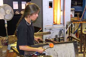
Inside the workshops, we found two
glass-blowers working, and spent an hour watching one of the craftsmen creating
ornate vases and paperweights.
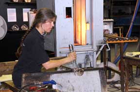 She introduced herself as Marianne Degener who
had herself trained at Målerås in the 1980s; she now had her own studio and
taught glass-making skills to students at the Målerås workshops. It was totally
fascinating watching her take a red hot gobbet of molten glass from the furnace,
slowly work it into shape, then skilfully chop off the finished product into the annealing oven for slow overnight cooling. She readily answered our
questions and demonstrated the technique, explaining the stages of glass-working
(see left and above) (Photo 2 - Glass-blowing at Målerås). She introduced herself as Marianne Degener who
had herself trained at Målerås in the 1980s; she now had her own studio and
taught glass-making skills to students at the Målerås workshops. It was totally
fascinating watching her take a red hot gobbet of molten glass from the furnace,
slowly work it into shape, then skilfully chop off the finished product into the annealing oven for slow overnight cooling. She readily answered our
questions and demonstrated the technique, explaining the stages of glass-working
(see left and above) (Photo 2 - Glass-blowing at Målerås).
|
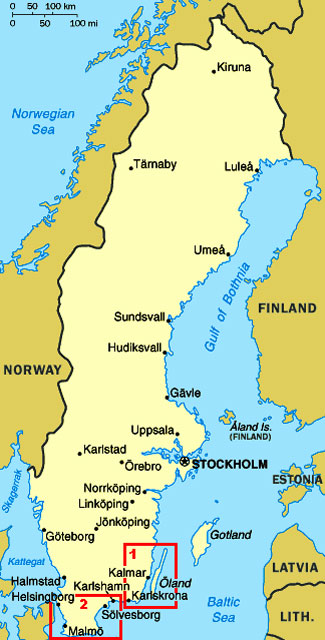
Click on 2 highlighted areas of
map
for
details of
Southern Sweden |
 |
Joelskogens Camping at Nybro:
back into Nybro, we parked by the station to use the public library wi-fi to
check next week's forecast for Öland. After a provisions re-stock at the ICA Kvantum, we drove around to Joelskogens Camping. An earlier phone call had
assured us that, although the reception was closed out of season, keys for the
facilities were available. Despite seemingly situated on a pleasant pine-covered
hillock
alongside the
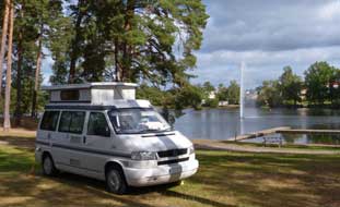 town lake (see left), the municipal campsite was set in open public
parkland, with local people walking through and children playing down by the
lake, and immediately by a busy main road with the constant noise of passing
traffic. With some misgivings, we settled in but there was scarcely a flat spot
to camp, and as darkness fell the numbers of people still loitering in the open
parkland gave concerns about security. Joelskogens was certainly not a comfortable place
to camp. town lake (see left), the municipal campsite was set in open public
parkland, with local people walking through and children playing down by the
lake, and immediately by a busy main road with the constant noise of passing
traffic. With some misgivings, we settled in but there was scarcely a flat spot
to camp, and as darkness fell the numbers of people still loitering in the open
parkland gave concerns about security. Joelskogens was certainly not a comfortable place
to camp.
Across the bridge to Öland: the following morning, we headed south for the 26kms drive
down to Kalmar, and turned off onto Route 137 to cross the 6kms high-arching
toll-free bridge over the Kalmar Sound to the Baltic island of Öland which was
to be our home for the next 5 days (click here for detailed map of route).
Traffic was busy but we were able to get photos on the downward slope from the
bridge's brow towards the distant shore of Öland
(Photo 3 - Crossing Öland bridge). The slender island is a 120kms long
limestone plateau, scoured by the last Ice Age's retreating ice, leaving a
unique geology and flora. Öland had been a royal hunting ground from the
mid-16th century until 1801, ruled with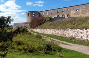 scant regard for its native peasant
farmers who were barred from chopping wood, hunting animals or selling their
produce on the open market. Danish attacks added to the Ölanders' miseries, and
a series of disastrous harvests in mid-19th century led to a quarter of the
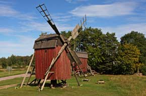
population emigrating to seek a new life in America. Wooden windmills dating
from the 18th century still cover Öland, and as we drove northwards from the
bridge towards the island's main town of Borgholm, we immediately began
to pass classically characteristic features of Öland: conserved post-windmills, dry
limestone walls, and blue chicory flowers at the roadside. scant regard for its native peasant
farmers who were barred from chopping wood, hunting animals or selling their
produce on the open market. Danish attacks added to the Ölanders' miseries, and
a series of disastrous harvests in mid-19th century led to a quarter of the
population emigrating to seek a new life in America. Wooden windmills dating
from the 18th century still cover Öland, and as we drove northwards from the
bridge towards the island's main town of Borgholm, we immediately began
to pass classically characteristic features of Öland: conserved post-windmills, dry
limestone walls, and blue chicory flowers at the roadside.
Borgholm Castle:
the surviving ruins of Borgholm Slott (Castle) were silhouetted on the cliff
tops as we approached the southern outskirts of the town. Construction of the
original fortress was begun in the late 12th century by King Knut Eriksson, and
it had seen much action during 14~16th Swedish~Danish wars. When Gustav Vasa
secured Swedish independence in 1523, he strengthened the huge castle to protect
his new realm, and the castle had enjoyed a brief renaissance as a royal palace
under
 the Vasa dynasty. In the mid-17th century Tessin the Elder further
enlarged the royal palace, but by the 18th century the disused castle fell into
ruins, finally being destroyed by fire in 1806. Today the roofless ruins still
stand proudly atop the cliffs near to one of the Swedish royal family's summer
residences, and we walked across the limestone scrubland meadows, where standing
under the stark towers and redoubts showed the castle's fearsome scale (Photo 4 - Borgholm Castle)
(see above right). In
bright afternoon sunshine, we ambled among blackthorn bushes laden with huge sloes, to
the 30m high escarpment which still protects the fortress-palace's seaward side
facing the Kalmar Sound. the Vasa dynasty. In the mid-17th century Tessin the Elder further
enlarged the royal palace, but by the 18th century the disused castle fell into
ruins, finally being destroyed by fire in 1806. Today the roofless ruins still
stand proudly atop the cliffs near to one of the Swedish royal family's summer
residences, and we walked across the limestone scrubland meadows, where standing
under the stark towers and redoubts showed the castle's fearsome scale (Photo 4 - Borgholm Castle)
(see above right). In
bright afternoon sunshine, we ambled among blackthorn bushes laden with huge sloes, to
the 30m high escarpment which still protects the fortress-palace's seaward side
facing the Kalmar Sound.
Blå Rör Bronze Age burial mound:
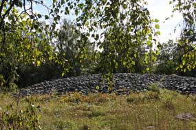
just north of Borgholm, we turned off to find the late Bronze Age burial mound
of Blå Rör. 40m in diameter and 3m high, the stone-covered tumulus is hidden
away among brambles and scrub-covered sheep pastures behind suburban houses in
the northern outskirts of Borgholm (see left). The cist tomb which the huge cairn covers
had been plundered in antiquity, but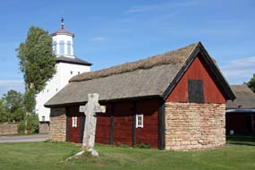 archaeological finds at the site date the grave-mound to around 1,000 BC. We took our photos of the burial-mound,
and of the Dewberries growing among brambles, then continued north passing an exposed
section of Öland's classic limestone escarpment. archaeological finds at the site date the grave-mound to around 1,000 BC. We took our photos of the burial-mound,
and of the Dewberries growing among brambles, then continued north passing an exposed
section of Öland's classic limestone escarpment.
Föra medieval church:
we turned off at Vässby to the farming hamlet of Föra. The original church,
built here in the early 11th century soon after Öland's conversion to
Christianity, was a simple wooden stave structure; this was replaced by a more
substantial stone church in the 12th century, and
 as times became more
unsettled, with attacks from across the Baltic, the church's tower was fortified
as a defensive refuge. Although the church was extended in later years, this
sturdy west end tower remains, evidence of these violent times (Photo 5 - Föra church).
The church, lit by a bright afternoon sun, was unfortunately locked, but nearby
close to a wooden barn, a large stone cross marked the grave of Martinus (see
right), a
priest killed accidentally in 1431. A tax collecting bailiff, expecting trouble,
thought the steelyard the clergyman was carrying was a weapon; jerking it from
his hand, the bailiff killed him on the spot, which only goes to show that tax
collectors can get away with murder! as times became more
unsettled, with attacks from across the Baltic, the church's tower was fortified
as a defensive refuge. Although the church was extended in later years, this
sturdy west end tower remains, evidence of these violent times (Photo 5 - Föra church).
The church, lit by a bright afternoon sun, was unfortunately locked, but nearby
close to a wooden barn, a large stone cross marked the grave of Martinus (see
right), a
priest killed accidentally in 1431. A tax collecting bailiff, expecting trouble,
thought the steelyard the clergyman was carrying was a weapon; jerking it from
his hand, the bailiff killed him on the spot, which only goes to show that tax
collectors can get away with murder!
Sandvik mill and fishing harbour:
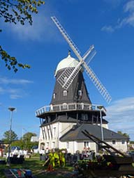
continuing north, we turned off to revisit the huge Dutch windmill at Sandvik.
Unlike the smaller Öland post-mills, where the whole body of the mill is turned
manually into the wind, the larger Dutch mills' sails are fitted to a revolving
cap. The smaller post-mills tended to meet local domestic needs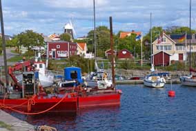 on farms,
whereas the larger Dutch mills were operated as toll mills by a miller, with
payment for grinding farmers' corn either in cash or a share of the grain. The
Sandvik mill was built originally in Småland in 1856; it was sold in 1885 and
transported piecemeal and reassembled here at Sandvik on a 2-storey sandstone
base, and remained in use as a working mill until 1950. It was later converted
to a café, serving traditional Öland peasant meals such as Lufsa and Kroppkakor,
potato dumplings filled with chopped pork and onion. Having photographed the
mill (see above left) (Photo
6 - Sandvik Mill), we moved down to Sandvik's
little fishing harbour where boats were moored at the quays lit by the afternoon
sun (Photo
7 - Sandvik fishing harbour) (see right). on farms,
whereas the larger Dutch mills were operated as toll mills by a miller, with
payment for grinding farmers' corn either in cash or a share of the grain. The
Sandvik mill was built originally in Småland in 1856; it was sold in 1885 and
transported piecemeal and reassembled here at Sandvik on a 2-storey sandstone
base, and remained in use as a working mill until 1950. It was later converted
to a café, serving traditional Öland peasant meals such as Lufsa and Kroppkakor,
potato dumplings filled with chopped pork and onion. Having photographed the
mill (see above left) (Photo
6 - Sandvik Mill), we moved down to Sandvik's
little fishing harbour where boats were moored at the quays lit by the afternoon
sun (Photo
7 - Sandvik fishing harbour) (see right).
 Knisa Mosse
Nature Reserve: back
at the main Route 136, a single-track lane led out to the Knisa Mosse Nature
Reserve. These coastal wetlands were spared the 19th century drainage ditching
when as much land as possible on Öland was cultivated to feed a growing
population (see left). The area was used for cutting reeds as roofing material and hay and
for grazing cattle, and conserved as a nature reserve in the mid 20th century
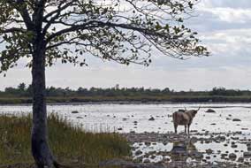
for its birdlife and flora. From the parking area, we followed a faint track through scrubland pastures rather hesitantly past a small herd of large-horned
highland cattle across to an oak copse to the bird observation tower overlooking
the marshes. Low blackthorn bushes full of sloes grew alongside Knisa Mosse
Nature Reserve: back
at the main Route 136, a single-track lane led out to the Knisa Mosse Nature
Reserve. These coastal wetlands were spared the 19th century drainage ditching
when as much land as possible on Öland was cultivated to feed a growing
population (see left). The area was used for cutting reeds as roofing material and hay and
for grazing cattle, and conserved as a nature reserve in the mid 20th century
for its birdlife and flora. From the parking area, we followed a faint track through scrubland pastures rather hesitantly past a small herd of large-horned
highland cattle across to an oak copse to the bird observation tower overlooking
the marshes. Low blackthorn bushes full of sloes grew alongside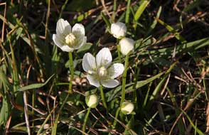 the path and, crossing
a board-walk we found a patch of
Grass of Parnassus flowers in the moist land (see right); we had seen this
beautiful flower from way up in the Arctic right down to here in the very
south of Scandinavia. The tower overlooked the Knisa Mosse wetlands where ducks
gathered on the waters, gulls flew around and swallows soared overhead dipping
to feed in the shallows the path and, crossing
a board-walk we found a patch of
Grass of Parnassus flowers in the moist land (see right); we had seen this
beautiful flower from way up in the Arctic right down to here in the very
south of Scandinavia. The tower overlooked the Knisa Mosse wetlands where ducks
gathered on the waters, gulls flew around and swallows soared overhead dipping
to feed in the shallows
Wikegårds Camping overlooking the Baltic
shore-line: we returned to the main road and at Hörlösa turned along
the lane, past two post-mills, out to the island's east coast ending at
Wikegårds Farm-Camping. Set on a 19th century croft-farm with the camping areas
spread among the former home pastures, it was a truly delightful place, but
with a tragic history so typical of the desperately hard life endured by Öland's
crofting families, many of whom emigrated: the mother died early and the eldest
daughter brought up her younger siblings while
 father worked the farm. The 5
younger children eventually emigrated, and Alma the eldest daughter maintained
the farm until she died in 1959; the farm became a campsite in 1980. As in 2013,
we were again welcomed by the elderly lady owner who chatted away in a
semi-intelligible mix of Swedish and German, showing us the straightforward
facilities and suggesting spots for us to camp. The price was still 200kr/night,
good value for such an exceptional location. We selected a pitch sheltered from
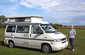
the brisk Öland wind by large juniper bushes, looking out to the magnificent
Baltic shoreline (Photo
8 - Wikegårds Camping) (see left). The evening grew dusky and cool, and as darkness fell, clouds
gathered with only a few stars shining through; in spite of the total absence of
light pollution, there would be no Milky Way tonight, just the twinkling red
lights from a distant array of wind-farms out in the Baltic. It rained heavily
overnight, and the following morning's sky, although bright, was father worked the farm. The 5
younger children eventually emigrated, and Alma the eldest daughter maintained
the farm until she died in 1959; the farm became a campsite in 1980. As in 2013,
we were again welcomed by the elderly lady owner who chatted away in a
semi-intelligible mix of Swedish and German, showing us the straightforward
facilities and suggesting spots for us to camp. The price was still 200kr/night,
good value for such an exceptional location. We selected a pitch sheltered from
the brisk Öland wind by large juniper bushes, looking out to the magnificent
Baltic shoreline (Photo
8 - Wikegårds Camping) (see left). The evening grew dusky and cool, and as darkness fell, clouds
gathered with only a few stars shining through; in spite of the total absence of
light pollution, there would be no Milky Way tonight, just the twinkling red
lights from a distant array of wind-farms out in the Baltic. It rained heavily
overnight, and the following morning's sky, although bright, was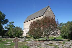 overcast for
our day in camp here at Wikegårds. Since our 2013 stay, wi-fi had now been
installed at the farmhouse and the forecast showed improving weather for our
week on Öland. We enjoyed a gloriously peaceful and restful day, and during the
afternoon, the cloud cover broke with a clear warming sun streaming in from
Wikegårds' renowned Big Baltic Sky above the farm's post-mill
(Photo
9 - Wikegårds post-windmill against Big Baltic Sky). overcast for
our day in camp here at Wikegårds. Since our 2013 stay, wi-fi had now been
installed at the farmhouse and the forecast showed improving weather for our
week on Öland. We enjoyed a gloriously peaceful and restful day, and during the
afternoon, the cloud cover broke with a clear warming sun streaming in from
Wikegårds' renowned Big Baltic Sky above the farm's post-mill
(Photo
9 - Wikegårds post-windmill against Big Baltic Sky).
Källa old church and harbour:
returning along the lane the following day, we paused to photograph post-mills
at other farms in the bright morning sunshine (Photo
10 - Öland post-mill) before setting off for our day of
exploration around the North Öland coast (click here for detailed map of route). We turned north at the main road to
the village of Källa to revisit the Gamla Kyrka (old church). The settlement of Källa grew up
around its little harbour.
 As attacks from Baltic pirate increased during the
later 12th century, the original 11th century wooden church at Källa was
destroyed by fire, and a new stone church, dedicated to St Olav, was built in
the form of a 2 storey defensive fortress, the church's tower serving as a refuge
in times of attack (see above right). The church was further enlarged in the 14th century and the
tower demolished. A new church was built at Källa in the 19th century as the
village expanded closer to the main road, and most of the old church's fitments
were moved there. The huge barn-like old church with its sturdy stone walls was
conserved as a national heritage, and in 2013 we were able to see its
magnificent interior architecture. Today in September, it was all locked but we
took our photos from the outside from the corner of the graveyard which was
filled with flat-slabbed tombs from the 1600~1700s. Just along from the church,
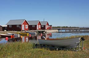
we reached Källa Hamn at the lane's end; today the little harbour was peaceful
with just a few boats moored by the fishing sheds (see left) (Photo
11 - Källa Hamn). Källa Hamn had once been one of the
busiest harbours along Öland's Baltic coast, with Öland limestone exported from
here for kiln-roasting as fertiliser. As attacks from Baltic pirate increased during the
later 12th century, the original 11th century wooden church at Källa was
destroyed by fire, and a new stone church, dedicated to St Olav, was built in
the form of a 2 storey defensive fortress, the church's tower serving as a refuge
in times of attack (see above right). The church was further enlarged in the 14th century and the
tower demolished. A new church was built at Källa in the 19th century as the
village expanded closer to the main road, and most of the old church's fitments
were moved there. The huge barn-like old church with its sturdy stone walls was
conserved as a national heritage, and in 2013 we were able to see its
magnificent interior architecture. Today in September, it was all locked but we
took our photos from the outside from the corner of the graveyard which was
filled with flat-slabbed tombs from the 1600~1700s. Just along from the church,
we reached Källa Hamn at the lane's end; today the little harbour was peaceful
with just a few boats moored by the fishing sheds (see left) (Photo
11 - Källa Hamn). Källa Hamn had once been one of the
busiest harbours along Öland's Baltic coast, with Öland limestone exported from
here for kiln-roasting as fertiliser.
 Neptuni Åkrar beach: we continued north
past the windmills at Högby, and after shopping for provisions at the ICA Nära
at Löttorp village, we turned off beyond Böda around the densely pine-forested
coast road to reach Tokenäs Camping. Just opposite the campsite, a shore-side
post-windmill stood atop a hillock overlooking the Kalmar Sound. The campsite
was virtually empty and we should return there later after our day around the
northern tip of the island. Beyond the little port-resort of Byxelkrok from
where summer ferries cross to Oskarhamn on the mainland, we stopped by the
stony, rubble-field of Neptuni Åkrar, a barren beach of wave-pounded
rubble-banks Neptuni Åkrar beach: we continued north
past the windmills at Högby, and after shopping for provisions at the ICA Nära
at Löttorp village, we turned off beyond Böda around the densely pine-forested
coast road to reach Tokenäs Camping. Just opposite the campsite, a shore-side
post-windmill stood atop a hillock overlooking the Kalmar Sound. The campsite
was virtually empty and we should return there later after our day around the
northern tip of the island. Beyond the little port-resort of Byxelkrok from
where summer ferries cross to Oskarhamn on the mainland, we stopped by the
stony, rubble-field of Neptuni Åkrar, a barren beach of wave-pounded
rubble-banks
 above the flat slabs of bed-rock limestone along the waterline. The
flat upper surface of the slabs was scored with linear Orthoceratite fossils, a
marine cephalopod with external tubular shell. Labelled 'Neptune's Fields' by
Linné after his 1741 visit, the 200m wide glacially deposited rubble embankments
have been tiered up by tidal action over aeons, and now presents a barren
appearance stretching for several miles along Öland's NW coastline. Among the
sparse vegetation that somehow manages to take root on the rubble, the
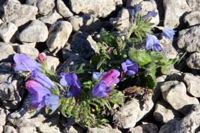
distinctive blue-purple-pink spiky flowers of Viper's Bugloss stand out (see
above right) (Photo
12 - Viper's Bugloss); not a native of Öland, the seeds of this curious plant of the borage family are
thought to have originated in a ship-load of gravel landed at Byxelkrok in the
1930s which in the absence of competition spread along the barren limestone
rubble of the Neptuni Åkrar beach. We walked across the rubble beach expecting
the Viper's Bugloss flowers to be past now, but found enough to be photographed.
Over at the shore-line, the rubble banks sloped steeply down to the mirror-still
waters of Kalmar Sound. The last time we had been here above the flat slabs of bed-rock limestone along the waterline. The
flat upper surface of the slabs was scored with linear Orthoceratite fossils, a
marine cephalopod with external tubular shell. Labelled 'Neptune's Fields' by
Linné after his 1741 visit, the 200m wide glacially deposited rubble embankments
have been tiered up by tidal action over aeons, and now presents a barren
appearance stretching for several miles along Öland's NW coastline. Among the
sparse vegetation that somehow manages to take root on the rubble, the
distinctive blue-purple-pink spiky flowers of Viper's Bugloss stand out (see
above right) (Photo
12 - Viper's Bugloss); not a native of Öland, the seeds of this curious plant of the borage family are
thought to have originated in a ship-load of gravel landed at Byxelkrok in the
1930s which in the absence of competition spread along the barren limestone
rubble of the Neptuni Åkrar beach. We walked across the rubble beach expecting
the Viper's Bugloss flowers to be past now, but found enough to be photographed.
Over at the shore-line, the rubble banks sloped steeply down to the mirror-still
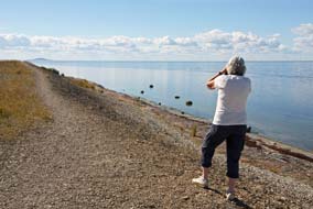
waters of Kalmar Sound. The last time we had been here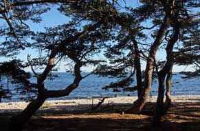 in 2013, a stiff wind was
driving a pounding surf onto the beach; today there was not a breath of breeze,
and the sun glinted across the still sea with the distant islet of Blå Jungfrau
standing out on the horizon (see left). in 2013, a stiff wind was
driving a pounding surf onto the beach; today there was not a breath of breeze,
and the sun glinted across the still sea with the distant islet of Blå Jungfrau
standing out on the horizon (see left).
Öland's northern tip and Trollskogen Nature
Reserve:
the lane continued around the northern part of the island where this tapered
away to the Norra Udde (Northern Tip), and at the small settlement of Grankulla,
a side-lane turned off onto the eastern
 of the 2 peninsulas enclosing Grankullaviken lagoon, ending at the Trollskogen Nature Reserve. Here we set off
to walk the 4.5kms way-marked Trollskogen circuit trail around the forested
Trollskogen peninsula. The path crossed the width of the peninsula, passing a
now fallen ancient oak tree, and running alongside the remains of a stone wall
which once enclosed a medieval royal hunting lodge. The path emerged on the
eastern shore-line which was normally exposed to the full force of gales blowing
across the Baltic. Today however, with virtually no wind, the sky was cloudless
with scarcely a ripple of surf on the shingle beach. It was a picture-postcard
of a view looking along the forest-fringed beach with the still sea reflecting
the blue sky and lit by bright sun
(Photo
13 - Trollskogen beach). We followed the path through
the dark forest alongside the beach looking out through the fringe of trees
towards the sun-lit shore-line (see above right). Some 800m further, we reached the wooden carcass
of the wrecked 3-masted schooner Swiks which foundered here on a stormy
December night in 1926 on its voyage home to Åland from Northern Germany. The
crew managed to get ashore in a lifeboat, and the wreck still lies here on the
stony shore like a beached whale (see left) (Photo
14 - Wreck of schooner Swicks). of the 2 peninsulas enclosing Grankullaviken lagoon, ending at the Trollskogen Nature Reserve. Here we set off
to walk the 4.5kms way-marked Trollskogen circuit trail around the forested
Trollskogen peninsula. The path crossed the width of the peninsula, passing a
now fallen ancient oak tree, and running alongside the remains of a stone wall
which once enclosed a medieval royal hunting lodge. The path emerged on the
eastern shore-line which was normally exposed to the full force of gales blowing
across the Baltic. Today however, with virtually no wind, the sky was cloudless
with scarcely a ripple of surf on the shingle beach. It was a picture-postcard
of a view looking along the forest-fringed beach with the still sea reflecting
the blue sky and lit by bright sun
(Photo
13 - Trollskogen beach). We followed the path through
the dark forest alongside the beach looking out through the fringe of trees
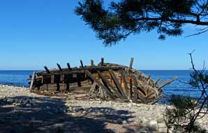
towards the sun-lit shore-line (see above right). Some 800m further, we reached the wooden carcass
of the wrecked 3-masted schooner Swiks which foundered here on a stormy
December night in 1926 on its voyage home to Åland from Northern Germany. The
crew managed to get ashore in a lifeboat, and the wreck still lies here on the
stony shore like a beached whale (see left) (Photo
14 - Wreck of schooner Swicks).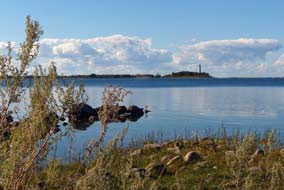
The path turned inland from the beach through
pine woods passing a venerable aged oak said to be 900 year old and still
thriving. Continuing through the forest, parallel with the eastern coastline, we
reached the grove of low pines contorted by exposure to violent gales
blowing in across the Baltic (Photo
15 - Trollskogen contorted pines); the pines' mysteriously twisted shapes
give the name Trollskogen (Trolls' Forest) to the nature reserve. The path
turned inland crossing to the trackway which runs along the spine of the eastern
peninsula; here a short diversion led to a point close to the peninsula's
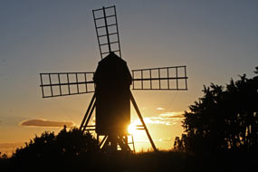 tip
looking out across the still waters of Grankullaviken lagoon towards the
distant Långe Erik lighthouse on the tip of the western side (see right). The lagoon was almost
enclosed on the seaward side by a chain of islets. The return path wound past
stone defensive works from the 14~16th century wars between Sweden and Denmark,
and Iron Age burial mounds. On the peninsula's more sheltered western side, the
lagoon was fringed with meadows where cattle grazed. The path crossed the
meadows before re-entering the forest, where spotted woodpeckers frolicked high
in the pines, to complete the circuit of the forest nature trail. tip
looking out across the still waters of Grankullaviken lagoon towards the
distant Långe Erik lighthouse on the tip of the western side (see right). The lagoon was almost
enclosed on the seaward side by a chain of islets. The return path wound past
stone defensive works from the 14~16th century wars between Sweden and Denmark,
and Iron Age burial mounds. On the peninsula's more sheltered western side, the
lagoon was fringed with meadows where cattle grazed. The path crossed the
meadows before re-entering the forest, where spotted woodpeckers frolicked high
in the pines, to complete the circuit of the forest nature trail.
Tokenäs Camping: back around the
northern tip of the island through Byxelkrok to Tokenäs Camping, a phone call
brought no response so we settled in at the open area opposite the windmill for
maximum evening sun, with the campsite bathed in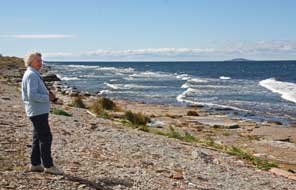 golden light. An elderly gent from one of
the static caravans called round to collect our rent; he chatted away jovially
in Swedish too quickly for us to follow, but when he wrote down '65 års', we got
the gist: 'ah rabatt!' we responded - discount for seniors - and paid the
reduced figure of 170kr, very reasonable for such a peaceful setting. As the
golden sun declined and set along the seaward horizon, we dashed over to
photograph the windmill silhouetted against the sunset across
the Kalmar Sound (Photo
16 - Tokenäs post-mill against setting sun) (see above left); it was a glorious spectacle, and later the clear evening
grew dark with a star spangled sky. golden light. An elderly gent from one of
the static caravans called round to collect our rent; he chatted away jovially
in Swedish too quickly for us to follow, but when he wrote down '65 års', we got
the gist: 'ah rabatt!' we responded - discount for seniors - and paid the
reduced figure of 170kr, very reasonable for such a peaceful setting. As the
golden sun declined and set along the seaward horizon, we dashed over to
photograph the windmill silhouetted against the sunset across
the Kalmar Sound (Photo
16 - Tokenäs post-mill against setting sun) (see above left); it was a glorious spectacle, and later the clear evening
grew dark with a star spangled sky.
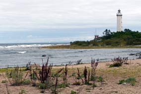 Byrums Raukar sea stacks: the
overnight cloud cleared to give another clear, sunny day but a fresh northerly
breeze kept temperatures cooler, raising white horses out in the Kalmar Sound.
We packed, re-filled George's fresh water, and set off through Byxelkrok to
pause again at Neptuni Åkrar beach where the brisk wind was today driving a
lively swell off the Sound; the contrast of white waves against the wine-dark
sea this morning made for more interesting photography than yesterday's
flat, glassy calm (see above right). We turned off onto the minor lane around to the northern tip,
and as we drove through the coastal woodland, sea eagles soared overhead and a
kestrel landed on a roadside tree. At the parking area near to Långe Erik
lighthouse, a large flock of cormorants was perched out on the rocks in the Byrums Raukar sea stacks: the
overnight cloud cleared to give another clear, sunny day but a fresh northerly
breeze kept temperatures cooler, raising white horses out in the Kalmar Sound.
We packed, re-filled George's fresh water, and set off through Byxelkrok to
pause again at Neptuni Åkrar beach where the brisk wind was today driving a
lively swell off the Sound; the contrast of white waves against the wine-dark
sea this morning made for more interesting photography than yesterday's
flat, glassy calm (see above right). We turned off onto the minor lane around to the northern tip,
and as we drove through the coastal woodland, sea eagles soared overhead and a
kestrel landed on a roadside tree. At the parking area near to Långe Erik
lighthouse, a large flock of cormorants was perched out on the rocks in the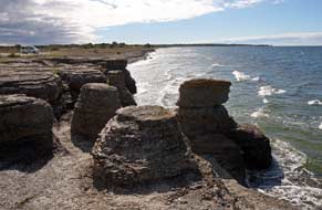 shallows of Grankullaviken lagoon. We walked over to photograph the lighthouse
against the backdrop of breakers driven in by the wind, but cloud had now
gathered giving the scene a grey, dismal air (see left).
We drove the circuit of back lanes to re-join
Route 136 down to Böda and turned off to the west coast to re-visit Byrums Raukar
sea stacks. This 600m long stretch of sea stacks, up to 5m in height, has been
carved out of the coastal bed-rock limestone by the erosive action of wind and
waves. At a time 490 million years ago, the land mass of which Öland was then a
part was located in the southern tropics on the bed of a warm, shallow tropical
sea. Limestone deposition built up on the sea bed coral reefs, which under
pressure over aeons formed the Öland limestone. It is estimated that it took
1,000 years of deposition to form a 1mm thickness of limestone;
 with today's Öland limestone layers being 40m in depth, this means that it took 40 million
years for the Öland limestone bed-rock to form. Differing content of clay
minerals in the limestone caused variations in its hardness and therefore
resistance to erosion. At Byrums, softer limestone has been eroded by wind and
wave action, leaving behind the stacks of harder, more resistant limestone. We
parked at the end of road shore-side and walked along to the first of the Byrums
stacks. The cloud cover of earlier was just beginning to break, and the sky
clearing to give bright western sun, perfect lighting conditions for
photographing the line of sea-stacks against the dark sea and white waves
breaking against the foot of the limestone cliffs, continuing with today's Öland limestone layers being 40m in depth, this means that it took 40 million
years for the Öland limestone bed-rock to form. Differing content of clay
minerals in the limestone caused variations in its hardness and therefore
resistance to erosion. At Byrums, softer limestone has been eroded by wind and
wave action, leaving behind the stacks of harder, more resistant limestone. We
parked at the end of road shore-side and walked along to the first of the Byrums
stacks. The cloud cover of earlier was just beginning to break, and the sky
clearing to give bright western sun, perfect lighting conditions for
photographing the line of sea-stacks against the dark sea and white waves
breaking against the foot of the limestone cliffs, continuing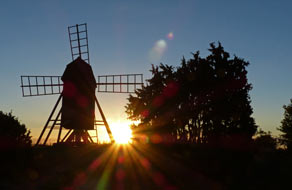 their erosive
action (see above right) (Photo
17 - Byrums Raukar sea stacks). The grey knobbly limestone surface
crumbled into pebble-sized chunks to reveal fossils of the creatures
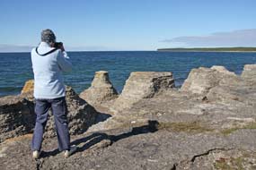
whose exoskeletons formed the limestone. We clambered from one stack's top to
the next, and down into the mini-canyons between the stacks to the water's edge (Photo
18 - Byrums Raukar sea stacks).
In such perfect conditions, particularly looking westwards with the light
silhouetting the line of stacks and adding sparkle to the waves washing onto the
base of the cliffs, the hour spent at Byrums was another of the trip's memorable
highlights (see above left) . their erosive
action (see above right) (Photo
17 - Byrums Raukar sea stacks). The grey knobbly limestone surface
crumbled into pebble-sized chunks to reveal fossils of the creatures
whose exoskeletons formed the limestone. We clambered from one stack's top to
the next, and down into the mini-canyons between the stacks to the water's edge (Photo
18 - Byrums Raukar sea stacks).
In such perfect conditions, particularly looking westwards with the light
silhouetting the line of stacks and adding sparkle to the waves washing onto the
base of the cliffs, the hour spent at Byrums was another of the trip's memorable
highlights (see above left) .
We returned to Tokenäs Camping for a third
night; it was good value and peaceful, and with the sky still clear, we could
enjoy another sunset behind the windmill. Early evening, the elderly gent came
round again to collect tonight's rent, chatting away in rapid
 Swedish with us
catching just the occasional word. Tonight, apart from his caravan as the only
other occupant, we had the campsite to ourselves, and the sun set across the
Sound once more silhouetting the windmill against a crimson sky (see above right). Swedish with us
catching just the occasional word. Tonight, apart from his caravan as the only
other occupant, we had the campsite to ourselves, and the sun set across the
Sound once more silhouetting the windmill against a crimson sky (see above right).
Eastern coast road and Gärdslösa medieval
church: after a
chill night, a dewy autumnal start to the day with clear sun rising
over the tall trees behind our camping spot. This time of year, Tokenäs Camping
had served us well, but only early or late in the season could peacefulness be
assured. Today we should travel the full 120kms length of the island from its
northern tip to explore Southern Öland. For the return drive to Borgholm, we
took the eastern coast road passing marshland and farming countryside, and after
a provisions
 restock
at Borgholm, we were ready to begin our exploration of Southern Öland (click here for detailed map of route).
Crossing the island's width past wealthy-looking farmsteads, we reached the east
coast and close to the hamlet of Störlinge, paused to photograph a line of 7
post-mills set along a roadside embankment (see above left). A further km south, we reached the
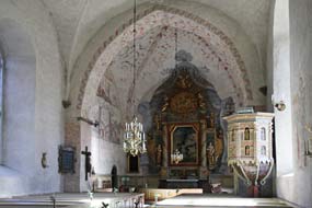
village of Gärdslösa to visit the wonderfully preserved medieval stone church,
built in the 12th century to replace an earlier wooden church. After photos from
under the trees in the lovingly maintained graveyard (Photo
19 - Gärdslösa medieval church), we admired
the interior with
its 16th century frescoes and beautifully decorative pulpit carved by 17th
century Kalmar craftsmen (see right). In the south transept, a runic graffito has been
exposed in the plasterwork, which translates as Johan made me. All along
this road, farmsteads showed their medieval layout of a series of wooden barns
running linearly along the roadside with one gateway into an enclosed courtyard
with farmhouse and gardens. restock
at Borgholm, we were ready to begin our exploration of Southern Öland (click here for detailed map of route).
Crossing the island's width past wealthy-looking farmsteads, we reached the east
coast and close to the hamlet of Störlinge, paused to photograph a line of 7
post-mills set along a roadside embankment (see above left). A further km south, we reached the
village of Gärdslösa to visit the wonderfully preserved medieval stone church,
built in the 12th century to replace an earlier wooden church. After photos from
under the trees in the lovingly maintained graveyard (Photo
19 - Gärdslösa medieval church), we admired
the interior with
its 16th century frescoes and beautifully decorative pulpit carved by 17th
century Kalmar craftsmen (see right). In the south transept, a runic graffito has been
exposed in the plasterwork, which translates as Johan made me. All along
this road, farmsteads showed their medieval layout of a series of wooden barns
running linearly along the roadside with one gateway into an enclosed courtyard
with farmhouse and gardens.
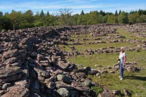 Ismantorp Iron Age ring-fortress: turning inland at Långlöt, and
passing the post-mills by the Himmelsberga skansen, we took a side-lane ending
at the parking area for Ismantorp Early Iron Age ring-fortress. The oldest of
the 20 known ring-forts on Öland and built around 200 AD, the circular limestone
block-built exterior wall, remarkably conserved at 3~4m in height, encloses an
open inner space with the stone foundation-remains of 95 dwellings (see left). Excavations
at the site have revealed no archaeological remains, and the fortress was likely
not to have been permanently occupied. It is thought to have been the fortified
headquarters for a clan chieftain and his garrison who controlled the
surrounding area, and a secure refuge for his peasant Ismantorp Iron Age ring-fortress: turning inland at Långlöt, and
passing the post-mills by the Himmelsberga skansen, we took a side-lane ending
at the parking area for Ismantorp Early Iron Age ring-fortress. The oldest of
the 20 known ring-forts on Öland and built around 200 AD, the circular limestone
block-built exterior wall, remarkably conserved at 3~4m in height, encloses an
open inner space with the stone foundation-remains of 95 dwellings (see left). Excavations
at the site have revealed no archaeological remains, and the fortress was likely
not to have been permanently occupied. It is thought to have been the fortified
headquarters for a clan chieftain and his garrison who controlled the
surrounding area, and a secure refuge for his peasant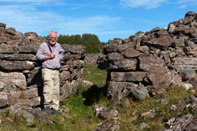 farmers in times of
danger. Nothing is known for certain about the ring-fort's history or its
occupants, but it was abandoned around 650 AD. But the scale and solidity of the
fortress' construction to have lasted so well is an indication of the power of
the chieftain who controlled Ismantorp. farmers in times of
danger. Nothing is known for certain about the ring-fort's history or its
occupants, but it was abandoned around 650 AD. But the scale and solidity of the
fortress' construction to have lasted so well is an indication of the power of
the chieftain who controlled Ismantorp.
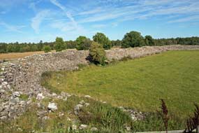
The approach on foot to Ismantorp adds to the
mystique of the place: from the parking area, a winding path leads for 200m
through a dark wood, suddenly opening into a wide meadow with the fortified
village's stone walls in the centre. It is as if you have passed through a
portal into a lost bygone age. Across to one of the 9 gates through the 4m high
perimeter wall, we entered the central protected area with its layout of stone
foundation-remains of dwellings. Clambering up onto the wall top gave a full
overview both of the extent of the enclosed area of dwellings, the
solidity of the circuit-walls' construction, and the remarkable state of its
preservation which had survived for 1,800 years
(Photo
20 - Ismantorp Iron Age ring-fortress). With no other sound
but the wind in the trees of the surrounding forests, Ismantorp is indeed a
mystical place; one could only speculate about the power exercised by the
chieftains, the lives of their clansmen, how often
 they had to take refuge in
the fortress, and the nature of the external threats they faced. Standing here in
the fortress' inner area among the ruins of dwellings, in the silence of Ismantorp's lost world, was another of the trip's memorable highlights. they had to take refuge in
the fortress, and the nature of the external threats they faced. Standing here in
the fortress' inner area among the ruins of dwellings, in the silence of Ismantorp's lost world, was another of the trip's memorable highlights.
Gråborg Iron Age~Medieval ring-fortress: we continued south along
the eastern coast road passing an area of Iron Age grave-fields and another line
of post-mills at Lerkaka with a modern-day harvester standing behind them at a
farm. At the aptly named hamlet of Runsten, the
eponymous runestone with ornately carved inscription stood by the roadside. At Norra Möckleby we again turned
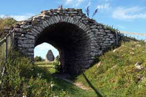 inland to find the Gråborg Iron Age~Medieval
ring-fortress. The approach pathway passed by a classic Öland farmstead with
long-barn enclosing its farmhouse courtyard. Gråborg is an even bigger ring-fort
built in the 6th century AD at a time when Ismantorp was in decline. It was
later adapted with strengthened walls as a military fortification and trade
centre in medieval times, and was even occupied as defence against Danish attacks
as late as the 17th century. Nothing of the Iron Age fortified settlement or
later medieval military works survives today other than the 7m high ring-walls
(see above left)
and a vaulted medieval gateway (see right); the vast open space enclosed by the circular walls
is now meadowland mown for hay. Nearby stand the remains of the medieval chapel
of St Knut and tax records show both the fortress and chapel were owned by Vadstena Abbey
(Photo
21 - St Knut's Chapel). We took our photos and continued our drive down the eastern
coast road passing more windmills and grave-fields. inland to find the Gråborg Iron Age~Medieval
ring-fortress. The approach pathway passed by a classic Öland farmstead with
long-barn enclosing its farmhouse courtyard. Gråborg is an even bigger ring-fort
built in the 6th century AD at a time when Ismantorp was in decline. It was
later adapted with strengthened walls as a military fortification and trade
centre in medieval times, and was even occupied as defence against Danish attacks
as late as the 17th century. Nothing of the Iron Age fortified settlement or
later medieval military works survives today other than the 7m high ring-walls
(see above left)
and a vaulted medieval gateway (see right); the vast open space enclosed by the circular walls
is now meadowland mown for hay. Nearby stand the remains of the medieval chapel
of St Knut and tax records show both the fortress and chapel were owned by Vadstena Abbey
(Photo
21 - St Knut's Chapel). We took our photos and continued our drive down the eastern
coast road passing more windmills and grave-fields.
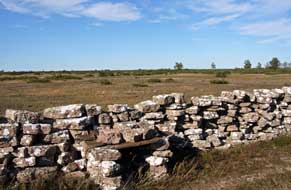 Southern Öland's Stora Alvaret limestone
plateau: at Brunneby we turned off inland to cross the semi-barren
limestone plateau of Stora Alvaret, the vast limestone plateau which
covers the bulk of Southern Öland; at 260km2 it is the largest such
limestone expanse in Europe. Southern Öland's topography showed the nature of
the island's agriculture, with the coastal strip having the most fertile, deeper
soil, cultivated as arable land and meadows, and the inland Alvar plain
with its thin soil mantle and sparse vegetation grazed by cattle and sheep. The
medieval layout of farmsteads along the line of the coastal strip, and frequency
of Iron Age grave-fields and medieval churches, show these lands to have had
continuity of human occupation for almost 2,000 years. And the number of farm
vehicles passing along the coast road, and affluence of modern farmsteads,
showed that agriculture still flourished. Southern Öland's Stora Alvaret limestone
plateau: at Brunneby we turned off inland to cross the semi-barren
limestone plateau of Stora Alvaret, the vast limestone plateau which
covers the bulk of Southern Öland; at 260km2 it is the largest such
limestone expanse in Europe. Southern Öland's topography showed the nature of
the island's agriculture, with the coastal strip having the most fertile, deeper
soil, cultivated as arable land and meadows, and the inland Alvar plain
with its thin soil mantle and sparse vegetation grazed by cattle and sheep. The
medieval layout of farmsteads along the line of the coastal strip, and frequency
of Iron Age grave-fields and medieval churches, show these lands to have had
continuity of human occupation for almost 2,000 years. And the number of farm
vehicles passing along the coast road, and affluence of modern farmsteads,
showed that agriculture still flourished.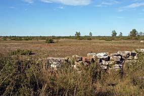
We turned off across the flat, barren waste of
the Alvar, initially passing stunted trees and then the extensive open,
featureless plain stretching away to the horizon on both sides of the road (see
left and right). The
Alvar plain had been formed following the last Ice Age when retreating
glaciers had scoured the bed-rock limestone of what became Öland as the land
rose from the Baltic, relieved of the weight of ice. Animal and human life
populated the island, migrating across the residual ice-bridge from the
mainland. Over the next millennia, the bare limestone was overlaid by a thin
mantle of soil, only 2cms at its thickest, by plant colonisation and wind-driven
deposition to create the alvar formation seen today. The term alvar
is derived from this thin soil covering and in some places the limestone
bed-rock still shows through with with no soil covering at all. During the Bronze
and Iron Ages, farming developed on the Alvar which was used to graze
animals, but in the 18~19th centuries over-exploitation of the poor soil caused
even further denuding of the surface vegetation; with insufficient arable land
to feed an increasing population, many emigrated to escape starvation and seek a
new life overseas leaving abandoned villages like Dröstorp. Driving across the
Alvar plain, we stopped a couple of times to photograph this deserted
wilderness, today criss-crossed by dry-stone walls and with just a few livestock
grazing (Photo
22 - Stora Alvaret limestone plateau).
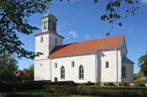 Resmo medieval church and the 10th century
Karlevi Runestone:
at the far end of the road across the Alvar, we reached Resmo village and
paused to photograph the 11th century church, said to be Öland's oldest
surviving church still in regular use (see left). It began as a private foundation Resmo medieval church and the 10th century
Karlevi Runestone:
at the far end of the road across the Alvar, we reached Resmo village and
paused to photograph the 11th century church, said to be Öland's oldest
surviving church still in regular use (see left). It began as a private foundation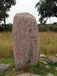 in the
11th century, endowed by a local wealthy landowner who stood to gain from his
investment in the church from fees paid by parishioners for baptisms, weddings
and funerals. Again the tower was strengthened as a defensive refuge, but the
Danish invasions of 1677 wrought havoc with the decorations, treasures and
archives of both Resmo and Vickleby churches plundered or destroyed. We turned
down the steep slope of Öland's western coastal escarpment to revisit the
Karlevi runestone set amid fields down by the Kalmar Sound. Dated to the late
10th century, the time of transition from the pagan Æsir religion to
Christianity, the runestone is unique in containing within its runic inscription
both the prose dedication to a Viking chieftain and the oldest known stanza of
Skaldic verse, and on the reverse side a later non-runic inscription with
Christian reference. The stone marks the grave of the Danish chieftain Sibbi
Fuldarsson, killed in the 985 AD battle of Fýrisvellir, and was raised in dedicatory memory by his retinue. The prose
dedication records the commemoration to Sibbi, and the honorific verse which
follows mentions a female Valkyrie deity Thrud and reference to one of the names
of Odin, perhaps an acknowledgement that Sibbi still clung to the old pagan
beliefs. The 1.4m high, rounded top stone was not Öland limestone, but harder
granite rock transported from elsewhere. The main inscription was deeply
engraved in beautiful runic characters in vertical lines covering the front face
and in the
11th century, endowed by a local wealthy landowner who stood to gain from his
investment in the church from fees paid by parishioners for baptisms, weddings
and funerals. Again the tower was strengthened as a defensive refuge, but the
Danish invasions of 1677 wrought havoc with the decorations, treasures and
archives of both Resmo and Vickleby churches plundered or destroyed. We turned
down the steep slope of Öland's western coastal escarpment to revisit the
Karlevi runestone set amid fields down by the Kalmar Sound. Dated to the late
10th century, the time of transition from the pagan Æsir religion to
Christianity, the runestone is unique in containing within its runic inscription
both the prose dedication to a Viking chieftain and the oldest known stanza of
Skaldic verse, and on the reverse side a later non-runic inscription with
Christian reference. The stone marks the grave of the Danish chieftain Sibbi
Fuldarsson, killed in the 985 AD battle of Fýrisvellir, and was raised in dedicatory memory by his retinue. The prose
dedication records the commemoration to Sibbi, and the honorific verse which
follows mentions a female Valkyrie deity Thrud and reference to one of the names
of Odin, perhaps an acknowledgement that Sibbi still clung to the old pagan
beliefs. The 1.4m high, rounded top stone was not Öland limestone, but harder
granite rock transported from elsewhere. The main inscription was deeply
engraved in beautiful runic characters in vertical lines covering the front face
and
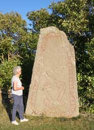 side (see right), while on the reverse face were Christian characters in Roman script,
interpreted as In Nomin[e]...Ie[su], raising the question whether this
was contemporary
with the runic inscription almost as a 'fail-safe' addendum at
time of religious transition or a later Christian defamatory graffito on a pagan
monument. Either way, our feeling was that the Karlevi monument, along with the
Rök runestone, was the most intriguing of those we had seen, a very special
monument marking the final resting place of a Viking warrior-chieftain (Photo
23 - Karlevi Runestone). side (see right), while on the reverse face were Christian characters in Roman script,
interpreted as In Nomin[e]...Ie[su], raising the question whether this
was contemporary
with the runic inscription almost as a 'fail-safe' addendum at
time of religious transition or a later Christian defamatory graffito on a pagan
monument. Either way, our feeling was that the Karlevi monument, along with the
Rök runestone, was the most intriguing of those we had seen, a very special
monument marking the final resting place of a Viking warrior-chieftain (Photo
23 - Karlevi Runestone).
A
peaceful night's camp at Gräsgårds Fiskehamn: returning through
Vickleby, we re-crossed the width of the Alvar plain on another lane,
taking us back to the east coast. It was by now 5-30pm and the low sun cast a
golden light over the grave-fields at Segestad. We paused to photograph the 3m
high 11th century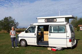 runestone by the road side at Seby (see left); the runic inscription
enclosed within scrolls translates as Ingjald, Näf and Sven erected this
stone as a memorial to their father Rodmar. The face of the limestone showed
traces of exposed Orthoceratite fossils between the lines of runes. We were
weary after a long day of exploration, and looking forward to camping again by
the fishing harbour of Gräsgårds
Hamn where we had enjoyed a peaceful stay in
2103. To our relief, the straightforward little campsite at the end of the lane
by the tiny port was not only still open but empty. The small camping area
enclosed by a ring of dilapidated huts was unchanged, as if frozen in a
time-warp, with its basic facilities and power supplies covered by a plastic
fish crate. The instructions to leave the nightly charge of 110kr (unchanged
since 2013) in an envelope at the reception hut was still there, and with the
sun declining and the dusky evening growing cool, we gladly settled in with
George's nose into the crisp breeze blowing in from the Baltic and the open
slider facing out to the fishing harbour. The sun set leaving a deep salmon glow
along the western horizon, and the evening grew dark with a thin sliver of new
moon rising over the Baltic. What a thoroughly fulsome day this had been, and
how good it was to be camping again at this wonderfully peaceful setting on the
Baltic coastline here at Gräsgårds Fiskehamn. runestone by the road side at Seby (see left); the runic inscription
enclosed within scrolls translates as Ingjald, Näf and Sven erected this
stone as a memorial to their father Rodmar. The face of the limestone showed
traces of exposed Orthoceratite fossils between the lines of runes. We were
weary after a long day of exploration, and looking forward to camping again by
the fishing harbour of Gräsgårds
Hamn where we had enjoyed a peaceful stay in
2103. To our relief, the straightforward little campsite at the end of the lane
by the tiny port was not only still open but empty. The small camping area
enclosed by a ring of dilapidated huts was unchanged, as if frozen in a
time-warp, with its basic facilities and power supplies covered by a plastic
fish crate. The instructions to leave the nightly charge of 110kr (unchanged
since 2013) in an envelope at the reception hut was still there, and with the
sun declining and the dusky evening growing cool, we gladly settled in with
George's nose into the crisp breeze blowing in from the Baltic and the open
slider facing out to the fishing harbour. The sun set leaving a deep salmon glow
along the western horizon, and the evening grew dark with a thin sliver of new
moon rising over the Baltic. What a thoroughly fulsome day this had been, and
how good it was to be camping again at this wonderfully peaceful setting on the
Baltic coastline here at Gräsgårds Fiskehamn.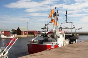
We woke the following morning to an overcast
sky with just a band of brighter light along the eastern horizon. This clearer
sky gradually spread, so that by breakfast time we could sit outside in bright,
warm sunshine (see above right) (Photo
24 - Gräsgårds Fiskehamn Camping). Before leaving Gräsgårds, we walked over to
the little fishing harbour where fewer working boats were moored than 3 years ago
on our first stay; it looked as if fishing was in decline. The boats had just
returned from their morning's work (we had seen their navigation lights as they
had set out earlier at 4-00am), but the fishermen were carrying just one iced
box of fish over to the sheds; no wonder it was a declining industry. We wished
one of them Tack för camping as he sat repairing nets on an ancient
sewing machine at one of the huts; Var så god (You're welcome) was his terse response. Photographing the boats was a lovely
conclusion to our say once more at Gräsgårds Fiskehamn, but if we ever return,
how many boats will be left, we wondered (Photo
25- Gräsgårds fishing boats) (see left).
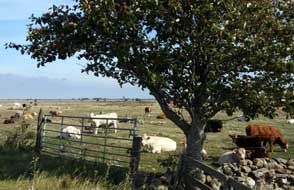 Seby
prehistoric grave-fields:
before heading down to Ottenby and the Södre Udde (Southernmost Point) of Öland,
we diverted briefly north to the Iron Age grave-fields at Seby and Segestad. The
line of Öland's south-eastern coastal road is marked by a narrow, low-lying
ridge, originally a raised beach formed as land levels rose following the last
Ice Age. The fertile soil along this ridge has been farmed and grazed for over
2,000 years of occupation, with farms and villages developing along the line of
the ridge from the early Iron Age, through Viking and medieval times, up to the
present day. Evidence for this continuity of human occupation can be Seby
prehistoric grave-fields:
before heading down to Ottenby and the Södre Udde (Southernmost Point) of Öland,
we diverted briefly north to the Iron Age grave-fields at Seby and Segestad. The
line of Öland's south-eastern coastal road is marked by a narrow, low-lying
ridge, originally a raised beach formed as land levels rose following the last
Ice Age. The fertile soil along this ridge has been farmed and grazed for over
2,000 years of occupation, with farms and villages developing along the line of
the ridge from the early Iron Age, through Viking and medieval times, up to the
present day. Evidence for this continuity of human occupation can be
 traced not
only from the farmsteads and villages along the line of the road; the ridge was
also the only place with soil deep enough for human burials, and at Seby and
Segestad, some 285 stone grave monuments have been found dating from the early
Iron Age (200 AD) to the Viking period (1,000 AD), when with conversion to
Christianity and building of churches, burials transferred to churchyards. Just
outside Segestad, some of the most prominent standing stone monoliths stood
along the line of the ridge, and opposite to the east of the road, the coastal
strip of farmland stretched away to the Baltic shore grazed by modern cattle.
Taken together, ancient standing stones marking burials and modern farming symbolised this long
continuity of human occupation. traced not
only from the farmsteads and villages along the line of the road; the ridge was
also the only place with soil deep enough for human burials, and at Seby and
Segestad, some 285 stone grave monuments have been found dating from the early
Iron Age (200 AD) to the Viking period (1,000 AD), when with conversion to
Christianity and building of churches, burials transferred to churchyards. Just
outside Segestad, some of the most prominent standing stone monoliths stood
along the line of the ridge, and opposite to the east of the road, the coastal
strip of farmland stretched away to the Baltic shore grazed by modern cattle.
Taken together, ancient standing stones marking burials and modern farming symbolised this long
continuity of human occupation.
Ottenby
bird reserve at Öland's southernmost
tip: heading south to Ottenby, we turned off along the single-track
lane leading across the treeless Alvar fields, the tail end of Southern Öland's
limestone plateau, once a royal hunting reserve and now grazed by sheep and
cattle, to the Långe Jan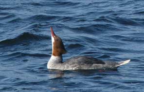 lighthouse at Öland's southernmost tip. we parked by
the bird observation station and sat to eat our sandwich lunch, entertained by
the silly antics of tourists milling around. Armed with cameras, tripod and
binoculars, we walked over past the sturdy lighthouse tower out to the shore-side
bird-watching area (Photo
26- Bird-watching at Ottenby). A hazy sun shone brightly, but today a brisk NW wind blowing
across the Sound ruffled the water's surface. Sea levels seemed higher than on
our last visit with fewer rocks visible off-shore. From the water's edge we
could see a number of mute swans gliding around just off-shore and a large flock
of cormorants lighthouse at Öland's southernmost tip. we parked by
the bird observation station and sat to eat our sandwich lunch, entertained by
the silly antics of tourists milling around. Armed with cameras, tripod and
binoculars, we walked over past the sturdy lighthouse tower out to the shore-side
bird-watching area (Photo
26- Bird-watching at Ottenby). A hazy sun shone brightly, but today a brisk NW wind blowing
across the Sound ruffled the water's surface. Sea levels seemed higher than on
our last visit with fewer rocks visible off-shore. From the water's edge we
could see a number of mute swans gliding around just off-shore and a large flock
of cormorants
 perched on rocks or
flying around (Photo
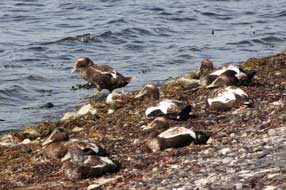
27 - Cormorants in flight). Over to the western side, many eider ducks
and goosanders (see right) sat at the water's edge or swam in the shallows. The
eiders' black and white plumage made them well camouflaged on the
pebbly shore (see above left). Further over, lines of cormorants stood in rows or flew off in
flocks, but with a brisk wind blowing and sea levels higher leaving no exposed
rocks, there were no Grey or Harbour Seals to be seen as on our 2013 visit. perched on rocks or
flying around (Photo
27 - Cormorants in flight). Over to the western side, many eider ducks
and goosanders (see right) sat at the water's edge or swam in the shallows. The
eiders' black and white plumage made them well camouflaged on the
pebbly shore (see above left). Further over, lines of cormorants stood in rows or flew off in
flocks, but with a brisk wind blowing and sea levels higher leaving no exposed
rocks, there were no Grey or Harbour Seals to be seen as on our 2013 visit.
We spent time watching and photographing the
birds, but disappointed by the apparent absence of seals, we walked back past
the lighthouse (see below right) to the
Visitor Centre to enquire further. The warden explained that with the strong
wind blowing from the NW and sea levels higher, all the seals tended to gather
further round on the more sheltered eastern side of the cape where there were more exposed
rocks for them to bask on. She advised us on a viewing hide which gave a distant
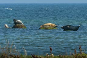
but unimpeded view of the basking seals. Bulky, hump-backed Harbour Seals,
looking like huge, glossy black slugs basked on the prominent rocks just
off-shore, with smaller, sleek Grey Seals wallowing in the shallows. We
positioned the tripod and spent a happy hour watching this colony of seals through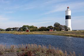 binoculars and photographing them at extreme telephoto range
(Photo
28 - Grey- and Harbour-Seals) (see above left).
Öland's south-western coast and Gettlinge
prehistoric burial grounds: further back from the Ottenby bird reserve
at the lighthouse, we walked over to another early Iron Age burial ground marked
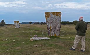
by 2 huge monoliths, the Kungsstenarna (King's Stones) (see below left), the southernmost of the
prehistoric grave-fields which extend along the length of Öland's southern tip.
It was now time to leave Ottenby to begin the return drive north up the island's
western coastal road overlooking the Kalmar Sound (click here for detailed map of route).
But by now the best of today's sun was gone and cloud gathering. We had several
possible camping options identified for tonight and would investigate these on
our way up to the Gettlinge grave-fields. The first was a ställplats by
the marina at Grönhögens Hamn, a wide, formally laid out, grassy camping aire
with full facilities, but the uncongenial company of camping-cars already parked
there was sufficient of a deterrent. We moved on to Ventlinge, a small village a
couple of miles up the coast where we had found reference to a small campsite opposite the church.
Driving through the village, sure enough there was the
sign pointing to a camping
 area in a large garden behind a cottage; this looked
ideal for this evening, particularly as it was uncontaminated by camping-cars. area in a large garden behind a cottage; this looked
ideal for this evening, particularly as it was uncontaminated by camping-cars.
For now we continued north with the road following
the line of the low western coastal ridge of fertile ground with good depth of
soil, sandwiched between the coastal Sound to the west and the bare, infertile Alvar
limestone plateau inland to the east. At Degerhamn we turned down into the
village, surprised at how steeply the land dropped away via hair-pins to
negotiate a tiered escarpment of former raised beaches down to the modern
shore-line. Degerhamn's origins were instantly evident from the huge cement
works befouling the little port: clearly Öland limestone had been ground and
roasted into cement here for export from the harbour. The ställplats at
Degerhamn had been another of our camping options, but its neglected air and
perfect view of the cement works ruled it out!
 We continued along the main road to Gettlinge; the
sky was now disappointingly overcast with a gloomy light for photographing the
impressive grave-fields. As on the Baltic coastline, there had been a continuum
of human occupation along this western coastal ridge since the Bronze Age,
through the Iron Age, Viking and Medieval times, right down to the
present, with farms, villages, burial grounds, churches and graveyards spread
along the narrow coastal strip and animals grazed on the Alvar plain
inland. The low ridge, produced originally by wave action on the residue of a
raised beach formed during the post-glacial land uplift, created a deeper layer
of fertile moraine soil along the line of the ridge than the thinner surface
layer inland across the Alvar. This deeper soil layer, running north~south between the coastal strip and western fringe of the Stora Alvaret
limestone plateau, provided the only hospitable place for dwellings, for
farming, and for burial of the dead. Both villages and grave-fields therefore
spread along the length of the ridge from over 2,000 years of human occupation.
As the land-uplift has continued over aeons, the line of the ancient ridge now
stands high above the modern shore-line which is now at the foot of a steeply
sloping escarpment. What remarkable topography Southern Öland displays. One
of the island's largest prehistoric burial grounds extends for some 2 kms along
this ridge at Gettlinge, covering the period from 1,000 BC to 1,000 AD, with
Bronze Age burial mounds, Iron Age standing stones, and stone ship-settings from
the Viking period. Just south of the modern village, we reached the most
prominent grave fields We continued along the main road to Gettlinge; the
sky was now disappointingly overcast with a gloomy light for photographing the
impressive grave-fields. As on the Baltic coastline, there had been a continuum
of human occupation along this western coastal ridge since the Bronze Age,
through the Iron Age, Viking and Medieval times, right down to the
present, with farms, villages, burial grounds, churches and graveyards spread
along the narrow coastal strip and animals grazed on the Alvar plain
inland. The low ridge, produced originally by wave action on the residue of a
raised beach formed during the post-glacial land uplift, created a deeper layer
of fertile moraine soil along the line of the ridge than the thinner surface
layer inland across the Alvar. This deeper soil layer, running north~south between the coastal strip and western fringe of the Stora Alvaret
limestone plateau, provided the only hospitable place for dwellings, for
farming, and for burial of the dead. Both villages and grave-fields therefore
spread along the length of the ridge from over 2,000 years of human occupation.
As the land-uplift has continued over aeons, the line of the ancient ridge now
stands high above the modern shore-line which is now at the foot of a steeply
sloping escarpment. What remarkable topography Southern Öland displays. One
of the island's largest prehistoric burial grounds extends for some 2 kms along
this ridge at Gettlinge, covering the period from 1,000 BC to 1,000 AD, with
Bronze Age burial mounds, Iron Age standing stones, and stone ship-settings from
the Viking period. Just south of the modern village, we reached the most
prominent grave fields
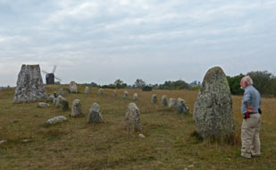
 with the close cropped turf emphasising the standing
stones. At the northern end, the stone outline of the Gettlinge ship-setting
survived with the entrance to the grave field marked by 2 prominent monoliths,
making a perfect picture even in today's poor light against the backdrop of a
19th century post-windmill on the brow of the ridge and a distant modern wind
farm (see above right) (Photo
29 - Gettlinge stone ship-setting). with the close cropped turf emphasising the standing
stones. At the northern end, the stone outline of the Gettlinge ship-setting
survived with the entrance to the grave field marked by 2 prominent monoliths,
making a perfect picture even in today's poor light against the backdrop of a
19th century post-windmill on the brow of the ridge and a distant modern wind
farm (see above right) (Photo
29 - Gettlinge stone ship-setting).
Ventlinge Camping:
our earlier investigation had left us in doubt as to where we should camp
tonight, and we returned south to Ventlinge, expecting to find just a couple of
places in the small campsite opposite the village church. To our surprise, the
driveway opened out into a large paddock behind the owner's house. We selected a
pitch over by the sturdy Öland dry-stone wall, looking out westwards across
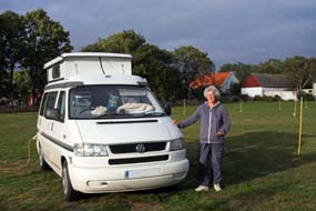
arable land towards the Kalmar Sound, and walked over to book in (see left). Facilities,
although limited, were brand new and spotlessly clean, with site-wide wi-fi, at an all-inclusive price of 150kr/night. The owner greeted us with
a smiling and helpful welcome, and a ready understanding of campers' needs,
ensuring we knew where the facilities were and producing the wi-fi details
without needed to be asked; this was the standard of hospitable welcome that
paying guests should be entitled to expect but rarely receive at campsites. On a
gloomy evening we settled in, delighted at our chance find of such a welcoming
and good value campsite at Ventlinge, by far and away the best we had found in
SW Öland.
Return to mainland and re-visit to historic Kalmar and its Castle: as forecast, the following morning
dawned gloomily overcast again, and we returned north along the west coast road
to a dreary suburb of dreary Färjestaden to find the ICA Kvantum to re-stock
with provisions. After a super 6 days on Öland, with so much fascinating natural
surroundings, so much birdlife and history to satisfy us both, and 4 excellent
campsites, we finally drove up onto the Öland bridge to return to the mainland.
Down the slope on the far side of the bridge, we turned off through the suburbs
of Kalmar, making our way into the centre to park by the railway station for a
brief re-visit to this historic city.
The light was still hazy as we walked over to the
lake-side parkland for the view of the historic Kalmar Castle set on its small
island directly opposite. The original town of Kalmar developed in the shadow of
the castle which had been built in the 12th century and fully fortified by King
Magnus Ladulås a century later to defend Sweden's SW coast. It was at Kalmar
Castle in 1397 that Queen Margareta instigated the Union of Kalmar which merged
the thrones of Norway, Denmark and Sweden into one realm. But such was the
antipathy between Swedes and Danes that the Union was a fragile arrangement.
Kalmar Castle was in the front line of confrontation, but managed to remain unscathed
 despite being subjected to 11 sieges as the 2 states rivalled for
power. When Gustav Vasa secured Sweden's independence in 1523, he strengthened
Kalmar Castle's fortifications further to protect the new kingdom, while his
degenerate sons Erik and Johann converted the Slott into a luxuriously appointed
Renaissance palace. The interior remains intact today as one of Scandinavia's
finest palaces of the period. The old town of Kalmar close to the castle was
destroyed by fire in the 1640s, and was moved to the nearby island of
Kvarnholmen and rebuilt with Baroque precision by Tessin the Elder in 1660 as a
model grid-plan with the domkyrka (cathedral) at its centre. Being vulnerable to
Danish attack during the Scanian Wars of the 1670s, the town's island was
surrounded by fortification walls. The modern city has expanded inland but
overall Kalmar remains small with a population of around 60,000. And here we
stood gazing across the lake to the magnificent castle, which still stands
guarding the straits looking like a fairy-tale fortress-palace in the
afternoon's hazy light (see above right) (Photo
30 - Kalmar Castle). despite being subjected to 11 sieges as the 2 states rivalled for
power. When Gustav Vasa secured Sweden's independence in 1523, he strengthened
Kalmar Castle's fortifications further to protect the new kingdom, while his
degenerate sons Erik and Johann converted the Slott into a luxuriously appointed
Renaissance palace. The interior remains intact today as one of Scandinavia's
finest palaces of the period. The old town of Kalmar close to the castle was
destroyed by fire in the 1640s, and was moved to the nearby island of
Kvarnholmen and rebuilt with Baroque precision by Tessin the Elder in 1660 as a
model grid-plan with the domkyrka (cathedral) at its centre. Being vulnerable to
Danish attack during the Scanian Wars of the 1670s, the town's island was
surrounded by fortification walls. The modern city has expanded inland but
overall Kalmar remains small with a population of around 60,000. And here we
stood gazing across the lake to the magnificent castle, which still stands
guarding the straits looking like a fairy-tale fortress-palace in the
afternoon's hazy light (see above right) (Photo
30 - Kalmar Castle).
 We walked across to the marina, staring with
contemptuous horror at the massed camping-cars parked in sordid rows in the
town's ställplats; to think we had even considered trying to camp there!
We ambled around the Tullhamn (customs port), its distant view of the Öland
bridge scarcely visible in today's haze, and passing the moored rescue boats, we
crossed to the magnificently restored red-brick former warehouse which now
serves as the County Museum (see above left). We had thought to pay a re-visit to the Museum's
excellent exhibition of artefacts recovered from the wreck of the 17th century
Swedish warship Kronan which had been sunk in a naval action with the
Danes off Öland in 1676. But the expensive entry price of 80kr with no seniors' reductions
was enough to change our minds (see log of our 2013 to the Kronan Exhibition at Kalmar).
Instead we ambled on through Tessin's grid-pattern of streets of Kvarnholmen city
centre to reach Stor Torget. The vast, cobbled city square was dominated by the
ochre-coloured Domkyrka, We walked across to the marina, staring with
contemptuous horror at the massed camping-cars parked in sordid rows in the
town's ställplats; to think we had even considered trying to camp there!
We ambled around the Tullhamn (customs port), its distant view of the Öland
bridge scarcely visible in today's haze, and passing the moored rescue boats, we
crossed to the magnificently restored red-brick former warehouse which now
serves as the County Museum (see above left). We had thought to pay a re-visit to the Museum's
excellent exhibition of artefacts recovered from the wreck of the 17th century
Swedish warship Kronan which had been sunk in a naval action with the
Danes off Öland in 1676. But the expensive entry price of 80kr with no seniors' reductions
was enough to change our minds (see log of our 2013 to the Kronan Exhibition at Kalmar).
Instead we ambled on through Tessin's grid-pattern of streets of Kvarnholmen city
centre to reach Stor Torget. The vast, cobbled city square was dominated by the
ochre-coloured Domkyrka,
 looking more like a bauble-decked 17th century palace
than a cathedral (see right); Tessin had modelled his design for the new city's cathedral on
Baroque churches he had seen in Rome. On the SE corner of the square, the more
modest Rådhus, also designed by Tessin, paled into insignificance in comparison
with the Domkyrka though in its way no less splendid. Inside, the cathedral was
indeed a palace of Baroque extravaganza with an enormous and unsightly (no other
word is apt!) altar piece backed by a painting showing the Deposition
graphically detailing the dead Christ being hauled by ropes down from the cross
by men on ladders. Equally obscene was the over-ornate, decorated tiered
wedding-cake of a looking more like a bauble-decked 17th century palace
than a cathedral (see right); Tessin had modelled his design for the new city's cathedral on
Baroque churches he had seen in Rome. On the SE corner of the square, the more
modest Rådhus, also designed by Tessin, paled into insignificance in comparison
with the Domkyrka though in its way no less splendid. Inside, the cathedral was
indeed a palace of Baroque extravaganza with an enormous and unsightly (no other
word is apt!) altar piece backed by a painting showing the Deposition
graphically detailing the dead Christ being hauled by ropes down from the cross
by men on ladders. Equally obscene was the over-ornate, decorated tiered
wedding-cake of a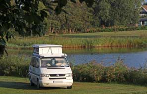 pulpit topped by a triple-decker confection of gnome-like sleeping soldiers
guarding a gilded figure of Christ. In contrast with all the Baroque exuberance,
the walls of the vast, high nave were painted in refrained plain cream but
covered with huge and ornate funerary memorial plaques of aristocratic families. Enough was enough,
and we left to buy a punnet of ripe Lingonberries from a market stall out in Stor Torget, before wandering along Storgatan past modern shops and coffee bars,
back to the railway station. Before leaving Kalmar, we walked through the town
park round to the Castle and across the moat's reconstructed drawbridge where
Gustav Vasa's bold coat of arms in limestone relief decorated the panel over the
gateway. The view from the high outer ramparts gave a full
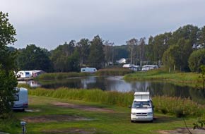 impression of the
scale of Vasa's mighty fortifications, and a line of cannons pointing out across
the misty Sound stood in readiness to repel renewed Danish attacks. impression of the
scale of Vasa's mighty fortifications, and a line of cannons pointing out across
the misty Sound stood in readiness to repel renewed Danish attacks.
Dalskärs Camping at Bergkvarva:
leaving Kalmar, we headed south on E22 for tonight's campsite Dalskärs Camping,
where we had stayed in 2013; we had telephoned this morning since the campsite
closed for the season this coming weekend, and again received welcoming response
from the owner. 40kms down the E22 (and back in sped camera-land!),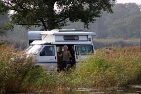 we turned
off down to the coast at Bergkvarva and along the Dalskärs peninsula lane which
divided the guest-harbour and open sea from the reed-lined lagoons around which the campsite is
set and which gives its characteristic environment (see left). The owner again welcomed us
and showed us around to the lagoon-side pitch among the reeds where we had
camped in 2013
(Photo 31 - Dalskärs Camping)
(see above right).
This year however (signs of the times) the turf on the lagoon bank was scarred
where decking of long-term statics had irrecoverably killed large areas of
grass. We pitched however looking out over the lagoon (see right); we were looking forward
to our day in camp here at Dalskärs tomorrow, hoping again to see the heron
fishing among the reeds as in 2013. we turned
off down to the coast at Bergkvarva and along the Dalskärs peninsula lane which
divided the guest-harbour and open sea from the reed-lined lagoons around which the campsite is
set and which gives its characteristic environment (see left). The owner again welcomed us
and showed us around to the lagoon-side pitch among the reeds where we had
camped in 2013
(Photo 31 - Dalskärs Camping)
(see above right).
This year however (signs of the times) the turf on the lagoon bank was scarred
where decking of long-term statics had irrecoverably killed large areas of
grass. We pitched however looking out over the lagoon (see right); we were looking forward
to our day in camp here at Dalskärs tomorrow, hoping again to see the heron
fishing among the reeds as in 2013.
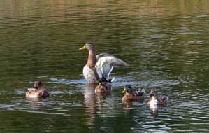 Overnight mist hung around over the lagoons and
only began to lift at 10-00am as the sun broke through to give a lovely soft
sunlight. Gradually however the mist re-settled and remained for the rest of the
day. Teal quacked around the lagoon (see left), the
heron made one brief appearance and Greater Spotted Woodpeckers drummed away high
in the campsite trees. Facilities at Dalskärs were modern and clean, the owner
was welcoming, the price was very reasonable at 215kr/night, and we were able to
complete this trip's final load of laundry; it was just a pity about the
increasing trend of profitable static caravans, reducing travelling pitches, and
attracting an alien breed of holiday-makers, regrettably a universal phenomenon.
But at the tail end of the season, we enjoyed a restfully productive day in camp
by the lagoon at Dalskärs. Overnight mist hung around over the lagoons and
only began to lift at 10-00am as the sun broke through to give a lovely soft
sunlight. Gradually however the mist re-settled and remained for the rest of the
day. Teal quacked around the lagoon (see left), the
heron made one brief appearance and Greater Spotted Woodpeckers drummed away high
in the campsite trees. Facilities at Dalskärs were modern and clean, the owner
was welcoming, the price was very reasonable at 215kr/night, and we were able to
complete this trip's final load of laundry; it was just a pity about the
increasing trend of profitable static caravans, reducing travelling pitches, and
attracting an alien breed of holiday-makers, regrettably a universal phenomenon.
But at the tail end of the season, we enjoyed a restfully productive day in camp
by the lagoon at Dalskärs.
A drive across Blekinge County to reach
Kristianstad: after a warm night, the sun rose above a bank of mist over the sea
(Photo
32- Misty autumnal sun); it was a beautiful golden autumn
morning, and as we sat having breakfast the heron at last re-appeared standing
on a landing stage at the far side of the lagoon patiently awaiting the chance
to catch his fishy breakfast
(Photo
33 - Heron poised to catch a fishy breakfast) (see right). First stop this morning was to turn off 10kms
west along E22 into Brömsebro village to buy smoked fish at Blömlöfs Rökeri (fish
smoke-house). With little traffic and a good road, we made easy progress westwards (click here for detailed map of route),
and as we passed Karl XII's naval fortress-port of Karlskrona (see log of our 2013 to Karlskrona naval port),
E22 became motorway standard enabling even faster progress across the width of Blekinge
County in bright morning sunshine. Soon after entering Skåne, we reached the
outskirts of Kristianstad and turned off to shop for immediate provisions and
take-home Swedish non-perishables; the girl at the check-out looked bemused
when we said it was to take back to UK!
 Christian
IV's 1614 founding of Kristianstad: Kristianstad was founded in 1614 by
King Christian IV of Denmark. The youthful Gustav II Adolfus had assumed the
Swedish throne in 1610 and one of his first acts was to conclude peace with
Denmark in 1613 recognising Denmark's control of the Skåne region of SW Sweden.
To reinforce Danish control of Skåne, Christian IV built the fortress-town of
Kristianstad at a site protected by the marshlands of the Helge å river. The
town within its fortress walls was laid out in model Renaissance form with
elegantly proportioned squares, a broad grid of streets, and fine Christian
IV's 1614 founding of Kristianstad: Kristianstad was founded in 1614 by
King Christian IV of Denmark. The youthful Gustav II Adolfus had assumed the
Swedish throne in 1610 and one of his first acts was to conclude peace with
Denmark in 1613 recognising Denmark's control of the Skåne region of SW Sweden.
To reinforce Danish control of Skåne, Christian IV built the fortress-town of
Kristianstad at a site protected by the marshlands of the Helge å river. The
town within its fortress walls was laid out in model Renaissance form with
elegantly proportioned squares, a broad grid of streets, and fine buildings, the
grandest of which was the glorious Renaissance church of Trefaldighets (Holy
Trinity) kyrkan (see right). But Danish rule lasted only for 44 years: Gustav II Adolfus
harried Skåne, and his successor Karl X forced the defeated Danes to accept the
terms of the 1658 Treaty of Roskilde which finally conceded Skåne back to
Sweden. Many of Christian IV's grandly ambitious buildings in Kristianstad were
left unfinished when the Swedes took over the fortress-town, including Holy
Trinity Church whose elegant spire never reached its intended place but finished
up decorating Copenhagen Stock Exchange instead! Christian IV's emblem, C4,
ironically however still emblazons the town's coat of arms (see left). The town
remained small during the subsequent centuries, but 19th century demolition of
the confining fortress walls enabled the growing industrial town to extend
beyond into what was formerly the wetlands. Grand buildings, the
grandest of which was the glorious Renaissance church of Trefaldighets (Holy
Trinity) kyrkan (see right). But Danish rule lasted only for 44 years: Gustav II Adolfus
harried Skåne, and his successor Karl X forced the defeated Danes to accept the
terms of the 1658 Treaty of Roskilde which finally conceded Skåne back to
Sweden. Many of Christian IV's grandly ambitious buildings in Kristianstad were
left unfinished when the Swedes took over the fortress-town, including Holy
Trinity Church whose elegant spire never reached its intended place but finished
up decorating Copenhagen Stock Exchange instead! Christian IV's emblem, C4,
ironically however still emblazons the town's coat of arms (see left). The town
remained small during the subsequent centuries, but 19th century demolition of
the confining fortress walls enabled the growing industrial town to extend
beyond into what was formerly the wetlands. Grand
 Parisian-style boulevards were
created in the late 19th century, and although the town centre still retains
many of its original Renaissance buildings, these have been sullied by sordidly
dull concrete blocks of 1960~70s infills. Parisian-style boulevards were
created in the late 19th century, and although the town centre still retains
many of its original Renaissance buildings, these have been sullied by sordidly
dull concrete blocks of 1960~70s infills.
Our visit to Kristianstad: we had
made remarkably good progress this morning with the 150km drive, and having
shopped, we found free parking by the Vattenriket Visitor Centre for our
re-visit to the lovely town of Kristianstad (pronounced locally
as Kri-shan-sta). The town was built on the banks of the Helge å river,
and the nearby Vattenriket wetlands drained by the Helge å river now form a
UNESCO World Heritage Site, renowned for its rich vegetation and extensive bird
life. The Helge å is Skåne's longest river which rises in Småland and flows for
190kms through the flat lowlands and lakes around Kristianstad to the coast at
Hanöbuken Bay; the natural outlet of the river is at Åhus, but in 1775 an
artificial channel was cut to drain the lower marshes. The shallow river is
usually just 1m above sea level but in high Spring tides can rise to over 2m,
and gales from the SE can blow salty water and sea fish up into the river. The
afternoon sun was now hot as we walked across the wooden footbridge spanning the
river from the Visitor Centre over to the town centre. Today the central square
of Stora Torg was peaceful, after the disruptive renovations to mark Kristianstad's
400th anniversary which had coincided with our first visit 3 years ago. Today we
photographed the elegant Rådhus (town hall) (see above left) on the western side of the square
and the 1840 Empire Style Kronhusut, formerly HQ of the Wende Artillery Regiment
which dominated the northern side (see right) (Photo
34 - Empire Style Kronhusut). On the eastern side, all that was built of
Christian IV's planned palace, before the Treaty of Roskilde handed Skåne back
to Sweden, was the stable block which now housed the Regional Arts Museum. This
was not only open but also free entry, although the displays illustrating Kristianstad's
400 year history outlet of the river is at Åhus, but in 1775 an
artificial channel was cut to drain the lower marshes. The shallow river is
usually just 1m above sea level but in high Spring tides can rise to over 2m,
and gales from the SE can blow salty water and sea fish up into the river. The
afternoon sun was now hot as we walked across the wooden footbridge spanning the
river from the Visitor Centre over to the town centre. Today the central square
of Stora Torg was peaceful, after the disruptive renovations to mark Kristianstad's
400th anniversary which had coincided with our first visit 3 years ago. Today we
photographed the elegant Rådhus (town hall) (see above left) on the western side of the square
and the 1840 Empire Style Kronhusut, formerly HQ of the Wende Artillery Regiment
which dominated the northern side (see right) (Photo
34 - Empire Style Kronhusut). On the eastern side, all that was built of
Christian IV's planned palace, before the Treaty of Roskilde handed Skåne back
to Sweden, was the stable block which now housed the Regional Arts Museum. This
was not only open but also free entry, although the displays illustrating Kristianstad's
400 year history
 were rather low key, as were those telling the story of the
town's part in the early history of Sweden's film industry. A wander around the
rather less distinguished back streets of modern Kristianstad's grid-plan centre
brought us through Lilla Torget across the Western Boulevard to the English
style gardens of Tivoli Park and the town's 1910 Art Nouveau theatre (see left). were rather low key, as were those telling the story of the
town's part in the early history of Sweden's film industry. A wander around the
rather less distinguished back streets of modern Kristianstad's grid-plan centre
brought us through Lilla Torget across the Western Boulevard to the English
style gardens of Tivoli Park and the town's 1910 Art Nouveau theatre (see left).
We now ambled back to re-visit what for us is Kristianstad's
highlight, the beautiful Renaissance Church of the Holy Trinity with its soaring
architecture and magnificent artwork. The church at Kristianstad was consecrated
on Holy Trinity Day (8 June) 1628, built between the river-side city-wall, now
the railway station, and Stora Torg market-place, on a diagonal to the town's
formal
 grid-plan layout to ensure its chancel faced east. The church's 7 lofty, decorated gable ends
were modelled on those at Frederiksborg Castle at Hillerød in Zealand, Denmark. The church's vaulted
ceiling was supported by 12 slender granite pillars, with light streaming in
through 26 plain glass windows which give the renaissance style church a bright air. The
most striking feature however was the 61 high carved wooden pew-ends, each one
different, some having heraldic motifs. The west end was dominated by the
magnificent 1630 gilded Renaissance organ. Around the church, both inside and out,
tombstones were set against the walls, with one macabre stone bearing the Grim
Reaper and hour-class symbolising human mortality. The north and south walls
were decorated with wealthy families' epitaphia memorials. One from 1661
commemorating the Lavesen family was particularly moving, set up by the wife in
memory of her husband who had died at the age of 42; they had been married for
15 years and had 11 children; the monument's central painting showed the whole
family with all 11 children, grid-plan layout to ensure its chancel faced east. The church's 7 lofty, decorated gable ends
were modelled on those at Frederiksborg Castle at Hillerød in Zealand, Denmark. The church's vaulted
ceiling was supported by 12 slender granite pillars, with light streaming in
through 26 plain glass windows which give the renaissance style church a bright air. The
most striking feature however was the 61 high carved wooden pew-ends, each one
different, some having heraldic motifs. The west end was dominated by the
magnificent 1630 gilded Renaissance organ. Around the church, both inside and out,
tombstones were set against the walls, with one macabre stone bearing the Grim
Reaper and hour-class symbolising human mortality. The north and south walls
were decorated with wealthy families' epitaphia memorials. One from 1661
commemorating the Lavesen family was particularly moving, set up by the wife in
memory of her husband who had died at the age of 42; they had been married for
15 years and had 11 children; the monument's central painting showed the whole
family with all 11 children,
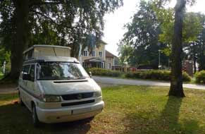 5 of whom were crowned with garlands symbolising
their deaths in infancy (see right) (Photo
35 - Lavesen family Epitaphium). The text records the hope that the family
would Joyfully meet again at the resurrection of the righteous. Of all
the large churches visited in Sweden, Holy Trinity at Kristianstad was without
doubt the most beautiful. 5 of whom were crowned with garlands symbolising
their deaths in infancy (see right) (Photo
35 - Lavesen family Epitaphium). The text records the hope that the family
would Joyfully meet again at the resurrection of the righteous. Of all
the large churches visited in Sweden, Holy Trinity at Kristianstad was without
doubt the most beautiful.
Charlottsborg Vandrarhem (hostel)-Camping at
Kristianstad: returning to the car
park across the river, we headed out to the town's western suburbs for tonight's
campsite at Charlottsborg Vandrarhem (hostel)-Camping. We had happy memories
from 2013 of a peaceful stay at Charlottsborg, and expected the campsite's
parkland setting to be almost empty late in the season as on our last stay (see
left); but
things had changed drastically. Being owned and run by the municipality, the
hostel grounds now have been virtually taken over to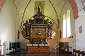 accommodate large numbers
of refugees in a static caravan immigrant encampment, taking up most the space
previously available for visiting campers. The place now has a general air of
neglect, the facilities are now grubby and uncared for, the wi-fi no longer works, the supposed warden operates a shady fruit
machine business from the site,
the parkland is open to all and sundry with dodgy-looking characters and unknown cars coming and going at all
hours. There are major security concerns. And no one seems to care. It is such a
pity to have to report, but
You now camp at Charlottsborg at your own risk. accommodate large numbers
of refugees in a static caravan immigrant encampment, taking up most the space
previously available for visiting campers. The place now has a general air of
neglect, the facilities are now grubby and uncared for, the wi-fi no longer works, the supposed warden operates a shady fruit
machine business from the site,
the parkland is open to all and sundry with dodgy-looking characters and unknown cars coming and going at all
hours. There are major security concerns. And no one seems to care. It is such a
pity to have to report, but
You now camp at Charlottsborg at your own risk.
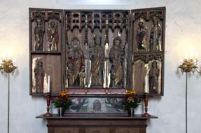 The small port of Åhus: after a tense
and uncertain night, we were glad to leave Charlottsborg, and pick up our
journey southward on
Route 118 through the flat agricultural lands of the lower Helge å river down to
the little port-village of Åhus (click here for detailed map of route).
Åhus developed as a trading settlement at the mouth of the Helge å river,
fortified with a castle to protect the flourishing port as early as Knut the
Great. The good times for Åhus came to an end in 1617 after Christian IV ordered
the town's tradesman to move to newly founded Kristianstad further inland up the
river, and Åhus lost its town status. Åhus enjoyed a new lease of life when the
arrival of the railway in the late 19th century brought the development of new
industries: the cigar factory rolled cigars from locally grown tobacco, and
locally caught smoked eels became an export commodity. The small port of Åhus: after a tense
and uncertain night, we were glad to leave Charlottsborg, and pick up our
journey southward on
Route 118 through the flat agricultural lands of the lower Helge å river down to
the little port-village of Åhus (click here for detailed map of route).
Åhus developed as a trading settlement at the mouth of the Helge å river,
fortified with a castle to protect the flourishing port as early as Knut the
Great. The good times for Åhus came to an end in 1617 after Christian IV ordered
the town's tradesman to move to newly founded Kristianstad further inland up the
river, and Åhus lost its town status. Åhus enjoyed a new lease of life when the
arrival of the railway in the late 19th century brought the development of new
industries: the cigar factory rolled cigars from locally grown tobacco, and
locally caught smoked eels became an export commodity. 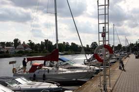 Åhus became a popular
seaside bathing resort in the 20th century and the Absolut Vodka distillery
began production here and is still a local prominent landmark now owned by the
Pernod conglomerate. We parked and walked along Köpmannagatan to the Torget
where the NW corner of the square was dominated by the red brick gabled tower of
the lovely Maria kyrka (St Mary's Church); parts of the church date from the 12th century, extended over
subsequent centuries (Photo
36 - St Mary's Church Åhus). Inside, the irregular shape of the
nave and 3 bulky pillars were evidence of the church's gradual extension.
Despite the church being despoiled of its artwork by the Lutherans at the
Reformation, the Maria Åhus became a popular
seaside bathing resort in the 20th century and the Absolut Vodka distillery
began production here and is still a local prominent landmark now owned by the
Pernod conglomerate. We parked and walked along Köpmannagatan to the Torget
where the NW corner of the square was dominated by the red brick gabled tower of
the lovely Maria kyrka (St Mary's Church); parts of the church date from the 12th century, extended over
subsequent centuries (Photo
36 - St Mary's Church Åhus). Inside, the irregular shape of the
nave and 3 bulky pillars were evidence of the church's gradual extension.
Despite the church being despoiled of its artwork by the Lutherans at the
Reformation, the Maria
 kyrka retains magnificent treasures. Its most prominent
decorations were the 16~17th century beautifully carved and decorated wooden
pulpit and altar retable (see above right). A side-chapel contained a 15th century Triptych
with carving of the Three Maries, the Virgin, Mary Cleophas and Mary Salome (see
above left).
Probably made in Lübeck, the triptych also included carvings of St Barbara with
her tower, and St Andrew with his cross. Having managed to escape Baroque and
19th century ornamentation, St Mary's at Åhus was one of Southern Sweden's
finest churches. We ambled along the Helge å waterfront where a variety of boats
were moored, past the Absolut Vodka distillery with its distinctive red brick
clock tower (see left) (reportedly ½ million bottles of the evil stuff are produced here
daily), towards the grain silos which dominate the industrial port, and returned
to the parking area to continue our journey. kyrka retains magnificent treasures. Its most prominent
decorations were the 16~17th century beautifully carved and decorated wooden
pulpit and altar retable (see above right). A side-chapel contained a 15th century Triptych
with carving of the Three Maries, the Virgin, Mary Cleophas and Mary Salome (see
above left).
Probably made in Lübeck, the triptych also included carvings of St Barbara with
her tower, and St Andrew with his cross. Having managed to escape Baroque and
19th century ornamentation, St Mary's at Åhus was one of Southern Sweden's
finest churches. We ambled along the Helge å waterfront where a variety of boats
were moored, past the Absolut Vodka distillery with its distinctive red brick
clock tower (see left) (reportedly ½ million bottles of the evil stuff are produced here
daily), towards the grain silos which dominate the industrial port, and returned
to the parking area to continue our journey.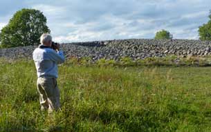
The Kivik Kungagraven Bronze Age burial mound:
from Åhus Route 118 took us around the flat lower flood plain of the Helge å and
up onto hillier countryside to join Route 9 to the little fishing port of Kivik
(pronounced Shivik). At the far end of the village, we reached the huge Bronze
Age burial mound of Kungagraven (King's Grave) (see right). The site had been exploited during the early 18th century as a source of building stone, until 1748 when local farmers
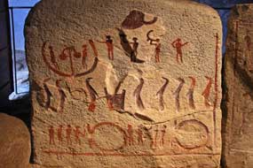 dug into the
stone-covered mound and discovered a cist-tomb lined with 10 stone slabs. Hoping
for treasure, they continued digging but found nothing and were arrested for
tomb-robbing. Quarrying continued but then it was discovered that the cist-tomb
slabs were covered with engraved petroglyphs. The site was excavated during the
1930s and 2 tombs were discovered but little in the way of remains, the tombs
having been looted over the centuries. The tombs' stone tumulus was restored and
a new artificial burial chamber created with an access tunnel cut into the side
of the mound for modern-day visitors to see the surviving engraved upright slabs
which had lined the original grave. We had visited the burial mound in 2013 and
wanted to make a re-visit today. To our dismay however, we discovered that we
had missed the café ticket office opening time by half an hour; it had closed at
4-00pm and was not open tomorrow Monday. We photographed the tumulus exterior,
and were just about to leave when the café owners dug into the
stone-covered mound and discovered a cist-tomb lined with 10 stone slabs. Hoping
for treasure, they continued digging but found nothing and were arrested for
tomb-robbing. Quarrying continued but then it was discovered that the cist-tomb
slabs were covered with engraved petroglyphs. The site was excavated during the
1930s and 2 tombs were discovered but little in the way of remains, the tombs
having been looted over the centuries. The tombs' stone tumulus was restored and
a new artificial burial chamber created with an access tunnel cut into the side
of the mound for modern-day visitors to see the surviving engraved upright slabs
which had lined the original grave. We had visited the burial mound in 2013 and
wanted to make a re-visit today. To our dismay however, we discovered that we
had missed the café ticket office opening time by half an hour; it had closed at
4-00pm and was not open tomorrow Monday. We photographed the tumulus exterior,
and were just about to leave when the café owners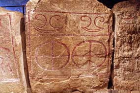 returned, and were persuaded to open the tomb for us to visit; it turned out that the lady
was the resident site archaeologist. She took us over to the winding access
dromos cut into the mound leading to a stone-lintelled doorway into the
inner chamber, where the cist-tomb lining of upright slabs were set up to give an
impression of the original grave. We were able to spend an absorbing time, not
only seeing the burial chamber petroglyphs but also hearing further
interpretation, and making comparisons with other Bronze Age sites we had
visited elsewhere in Sweden and with Paul's undergraduate studies of Bronze Age
Mycenaean art
(Photo
37 - Kungagraven cist-tomb petroglyphs ). returned, and were persuaded to open the tomb for us to visit; it turned out that the lady
was the resident site archaeologist. She took us over to the winding access
dromos cut into the mound leading to a stone-lintelled doorway into the
inner chamber, where the cist-tomb lining of upright slabs were set up to give an
impression of the original grave. We were able to spend an absorbing time, not
only seeing the burial chamber petroglyphs but also hearing further
interpretation, and making comparisons with other Bronze Age sites we had
visited elsewhere in Sweden and with Paul's undergraduate studies of Bronze Age
Mycenaean art
(Photo
37 - Kungagraven cist-tomb petroglyphs ).
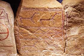 Archaeological finds had enabled the tomb to be
dated to around 1,400 BC. The grave had received 6 bodies of young adolescents,
probably priests, over a period of 600 years before finally being sealed. 6 sets
of skeletal remains along with some bronze grave-goods had been found, but most
had been plundered in antiquity. The petroglyphs had been partially coloured in
with red paint to make them more visible. The most evident engravings showed
figures playing lurs and drums, a funeral procession of cloak-wearing figures,
2 mysterious Ω symbols (see above left), sun emblems and a pair of axe symbols, so closely resembling the
Minoan double axes from Bronze age Knossos in Crete (see above right) (bronze was traded from
Southern Europe in the form of axe-shaped ingots). But the most significant
engraving showed a 2-horse chariot with 4-spoked wheels and a charioteer holding
the reins, exactly as from contemporary Mycenaean vase paintings
(Photo
38 - Charioteer engraving). On the other side, the upright slabs showed
engravings of pairs of elongated horses which drew the sun god's chariot across
the sky, and snake deity symbols (see left). This had been a wonderfully serendipitous
opportunity to spent time in the gloom of the chamber, hearing informed
commentary on the engravings, and marvelling at this ancient artwork so
remarkably preserved. Archaeological finds had enabled the tomb to be
dated to around 1,400 BC. The grave had received 6 bodies of young adolescents,
probably priests, over a period of 600 years before finally being sealed. 6 sets
of skeletal remains along with some bronze grave-goods had been found, but most
had been plundered in antiquity. The petroglyphs had been partially coloured in
with red paint to make them more visible. The most evident engravings showed
figures playing lurs and drums, a funeral procession of cloak-wearing figures,
2 mysterious Ω symbols (see above left), sun emblems and a pair of axe symbols, so closely resembling the
Minoan double axes from Bronze age Knossos in Crete (see above right) (bronze was traded from
Southern Europe in the form of axe-shaped ingots). But the most significant
engraving showed a 2-horse chariot with 4-spoked wheels and a charioteer holding
the reins, exactly as from contemporary Mycenaean vase paintings
(Photo
38 - Charioteer engraving). On the other side, the upright slabs showed
engravings of pairs of elongated horses which drew the sun god's chariot across
the sky, and snake deity symbols (see left). This had been a wonderfully serendipitous
opportunity to spent time in the gloom of the chamber, hearing informed
commentary on the engravings, and marvelling at this ancient artwork so
remarkably preserved.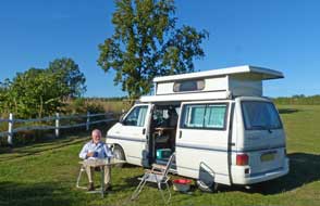 Our thanks go to the site archaeologist for the time she spent with us.
Ängdala Vandrarhem (hostel)-Camping:
back into Kivik, we returned along Route 9 to find tonight's campsite, Ängdala
Vandrahem (hostel)-Camping. We had earlier telephoned and been told by the owner to
make ourselves at home; she would come round later for payment. The place was
unchanged from our last stay with the few statics largely unoccupied, and we
pitched over by the far corner of the camping area which spread across the
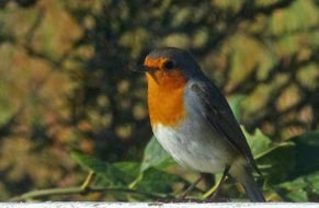 gently sloping hillside looking out over the Österlen coastal downs. Ängdala was
a wonderfully peaceful site after last night's uncertain camp, and we were
looking forward to a day in camp here tomorrow and hopefully the opportunity
to see Red Kites soaring over the down-land as in 2013. We celebrated a long and
fruitful day by cooking a creamy beef and lingonberry supper, one of the most
delicious of the trip. gently sloping hillside looking out over the Österlen coastal downs. Ängdala was
a wonderfully peaceful site after last night's uncertain camp, and we were
looking forward to a day in camp here tomorrow and hopefully the opportunity
to see Red Kites soaring over the down-land as in 2013. We celebrated a long and
fruitful day by cooking a creamy beef and lingonberry supper, one of the most
delicious of the trip.
On a beautiful autumn morning, we breakfasted
outside in warm sunshine (Photo
39 - Ängdala Camping) (see right). The setting was magnificently
peaceful and facilities at Ängdala were first class with
modern, impeccably clean WC/showers and a well-equipped kitchen/wash-up. The
only disappointment was that the wi-fi failed to connect, preventing us from
researching features of Skåne and campsites for our final few days. But even so
we enjoyed a restful and peaceful day at this lovely setting, with the company
of a friendly robin (see left) and 2 sightings
of a large bird of prey soaring over the downs, this year a buzzard. The sun
declined rapidly and sank below the tree-lined horizon before 7-00pm; tomorrow
we should begin the final stage of this year's trip, around the southern Skåne
coastline.
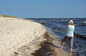 The Österlen coast of southern Skåne to Sandhammaren beach: setting off the
following morning, we paused in Kivik to buy another smoked fish supper from
Buhres Rökeri down at the little fishing harbour, and a bag of local apples,
together with cider from the Kivik Musteri apple-juice producer; all around Kivik
apple orchards fill every field and cottage garden, the trees at this time of
year laden with red, rosy apples.
Following the Baltic coastline on Route 9 and passing more apple and plum
orchards,
we drove along to Simrishamn, from where ferries sail to the Danish Baltic
island of Bornholm (click here for detailed map of route).
Here we turned off onto the minor lane around Skåne's southern Österlen coast to
the little work-a-day fishing harbour of Skillinge, where we paused for our
lunch by the harbour looking out over the Baltic. From here the minor Östra Kust
vägen (East Coast Road) winds faithfully along the coast through pine woodland,
planted in the 19t century to prevent wind erosion of the sandy soil, and a
side-turn leads to Sandhammaren beach. Set at the angle where Skåne's southern
coastline swings NE, this glorious stretch of white sandy wild strand would in
the height of summer be heaving with holiday-makers, if you could get anywhere
near with the 1,000s of parked cars; thankfully in mid-September it was almost
deserted, and we walked through to the wild beach which stretched away in both
directions, with the breeze driving a Baltic surf onto the shore (Photo
40 - Sandhammaren beach) (see right). Signs warned
of the dangerous currents which wind and tide sweep around just off-shore. The Österlen coast of southern Skåne to Sandhammaren beach: setting off the
following morning, we paused in Kivik to buy another smoked fish supper from
Buhres Rökeri down at the little fishing harbour, and a bag of local apples,
together with cider from the Kivik Musteri apple-juice producer; all around Kivik
apple orchards fill every field and cottage garden, the trees at this time of
year laden with red, rosy apples.
Following the Baltic coastline on Route 9 and passing more apple and plum
orchards,
we drove along to Simrishamn, from where ferries sail to the Danish Baltic
island of Bornholm (click here for detailed map of route).
Here we turned off onto the minor lane around Skåne's southern Österlen coast to
the little work-a-day fishing harbour of Skillinge, where we paused for our
lunch by the harbour looking out over the Baltic. From here the minor Östra Kust
vägen (East Coast Road) winds faithfully along the coast through pine woodland,
planted in the 19t century to prevent wind erosion of the sandy soil, and a
side-turn leads to Sandhammaren beach. Set at the angle where Skåne's southern
coastline swings NE, this glorious stretch of white sandy wild strand would in
the height of summer be heaving with holiday-makers, if you could get anywhere
near with the 1,000s of parked cars; thankfully in mid-September it was almost
deserted, and we walked through to the wild beach which stretched away in both
directions, with the breeze driving a Baltic surf onto the shore (Photo
40 - Sandhammaren beach) (see right). Signs warned
of the dangerous currents which wind and tide sweep around just off-shore.
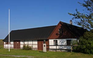 Dag Hammarskjold's Backåkra: just west of here along the lane we
turned off again to find the Backåkra farmstead bought by Dag Hammarskjöld as a
summer retreat. Set amid rolling heath-land close to the Hagestad Nature Reserve,
the farmhouse and surrounding meadowland was willed by Hammarskjöld to the
Swedish Touring Association (STF) of which he was vice-president, as a meeting
place for cultural activities. After his tragic death in 1961, the farm was set
up by STF as a museum to Hammarskjöld's life and work and many of the works of
art collected by him were gathered there. To STF's embarrassment however this
not-for-profits organisation found itself strapped for cash, and was forced to
close the Backåkra. Dag Hammarskjold's Backåkra: just west of here along the lane we
turned off again to find the Backåkra farmstead bought by Dag Hammarskjöld as a
summer retreat. Set amid rolling heath-land close to the Hagestad Nature Reserve,
the farmhouse and surrounding meadowland was willed by Hammarskjöld to the
Swedish Touring Association (STF) of which he was vice-president, as a meeting
place for cultural activities. After his tragic death in 1961, the farm was set
up by STF as a museum to Hammarskjöld's life and work and many of the works of
art collected by him were gathered there. To STF's embarrassment however this
not-for-profits organisation found itself strapped for cash, and was forced to
close the Backåkra.
Born in 1905 to a wealthy family (his father was
Swedish PM from 1914~17), Hammarskjöld was educated at Uppsala and Cambridge and
followed a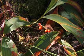 political career. In 1953 he was elected to the post of UN Secretary
General, the 2nd holder of the post since the UN's foundation in 1946, and
re-elected for a second term in 1958. His approach to settling world problems
was characterised by determined but 'quiet diplomacy', and during the 1956 Suez Crisis, he
instituted UN peace-keeping forces. While on a mission to former Belgian Congo
in 1961, attempting to re-integrate the breakaway mineral-rich province of
Katanga to the Congo's elected Lumumba government, the plane in which he was
travelling mysteriously crashed killing all on board. The cause of the crash has
never been resolved but neither has foul play been ruled out.
A 2013 BBC News report detailed pressure for the UN to re-open its enquiries into
Hammarskjöld's death, alleging that mining interests who stood to loose if
Katanga was re-integrated into Congo were involved and that the plane had been
shot down; it was also alleged that US and British security agencies had
previously withheld knowledge of radio messages from the plane's pilot saying
they were under attack. political career. In 1953 he was elected to the post of UN Secretary
General, the 2nd holder of the post since the UN's foundation in 1946, and
re-elected for a second term in 1958. His approach to settling world problems
was characterised by determined but 'quiet diplomacy', and during the 1956 Suez Crisis, he
instituted UN peace-keeping forces. While on a mission to former Belgian Congo
in 1961, attempting to re-integrate the breakaway mineral-rich province of
Katanga to the Congo's elected Lumumba government, the plane in which he was
travelling mysteriously crashed killing all on board. The cause of the crash has
never been resolved but neither has foul play been ruled out.
A 2013 BBC News report detailed pressure for the UN to re-open its enquiries into
Hammarskjöld's death, alleging that mining interests who stood to loose if
Katanga was re-integrated into Congo were involved and that the plane had been
shot down; it was also alleged that US and British security agencies had
previously withheld knowledge of radio messages from the plane's pilot saying
they were under attack.
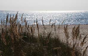 We walked up to the down-land farmhouse where an
information panel said that a new foundation had been formed by the Swedish
Academy, the STF and Hammarskjöld family, to take over ownership of the Backåkra;
renovation work was to begin in autumn 2016 with the aim of re-opening the
museum and conference centre in mid-2017. In the meantime, this peaceful
farmstead left by the post-war diplomat in the care of the STF remains closed,
with a bust of the UN Secretary General standing beside the
still-locked and deserted farmhouse much in need of upkeep (see above left). But as far as is
known, We walked up to the down-land farmhouse where an
information panel said that a new foundation had been formed by the Swedish
Academy, the STF and Hammarskjöld family, to take over ownership of the Backåkra;
renovation work was to begin in autumn 2016 with the aim of re-opening the
museum and conference centre in mid-2017. In the meantime, this peaceful
farmstead left by the post-war diplomat in the care of the STF remains closed,
with a bust of the UN Secretary General standing beside the
still-locked and deserted farmhouse much in need of upkeep (see above left). But as far as is
known,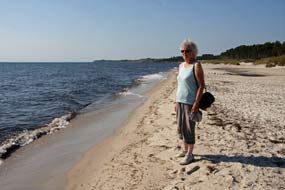 nothing further has happened to the calls for re-investigation into the
shady dealings behind Hammarskjöld's tragic death. nothing further has happened to the calls for re-investigation into the
shady dealings behind Hammarskjöld's tragic death.
Hagestad Nature Reserve: a lane leads
from the Hammarskjöld farmstead through the down-land to the Hagestad Nature
Reserve, an area of pine, beech and oak woodlands standing behind beautiful
white sand beaches along the southern Skåne coast, where during the 19th century
1000s of trees were planted to bind the sandy soil. Coastal sand continues to be
eroded by wind and current, blown eastwards reducing land area here and piling
up on Sandhammaren beach further round where the coast swings northwards. We
again followed the path leading through the woodland, where Lily of the Valley
covered the ground, their leaves now brown and their autumn orange berries
catching the sunlight (see above right); in the early summer this would be a haven of sweetly
scented flowers. Reaching the dunes backing the
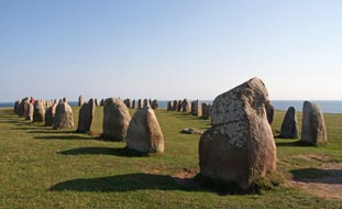 shore-line, where tall marram
grasses were outlined against the sea-scape backdrop by soft afternoon sunlight
(see above left),
we crossed the fine sandy beach to stand by the Baltic waterline (see right). shore-line, where tall marram
grasses were outlined against the sea-scape backdrop by soft afternoon sunlight
(see above left),
we crossed the fine sandy beach to stand by the Baltic waterline (see right).
Iron Age stone ship-setting monument of
Ales Stenar: a short distance further west, we reached the village of
Kåseberga, where alongside the visitor parking area and football ground, a ställplats
was laid out operated by the local football club; this looked promising for
tonight. A path led past the village cottages uphill to the cliff-top
sandy meadowland, to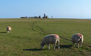 the Iron Age stone ship-setting
monument of Ales Stenar. Ahead the outline of megaliths was silhouetted
against the sky, as gaunt as ever, overlooking the sea on the flat hill-top: 59
standing stones arranged in a 67m long ship-setting, with larger bow and stern
stones, make up the megalithic monument which has been dated to the late Iron
Age between 600~1,000 AD (see above left) (Photo
41 - Ales Stenar). Sheep grazed the breezy cliff-top turf (see right) and, indicative of
people's thoughtless behaviour nowadays and absence of any respect for others'
property, the farmer had been forced to put up a notice demanding that visitors
control their kids and dogs and not allow them to disturb the sheep: 'Sheep are
not toys', it poignantly said! the Iron Age stone ship-setting
monument of Ales Stenar. Ahead the outline of megaliths was silhouetted
against the sky, as gaunt as ever, overlooking the sea on the flat hill-top: 59
standing stones arranged in a 67m long ship-setting, with larger bow and stern
stones, make up the megalithic monument which has been dated to the late Iron
Age between 600~1,000 AD (see above left) (Photo
41 - Ales Stenar). Sheep grazed the breezy cliff-top turf (see right) and, indicative of
people's thoughtless behaviour nowadays and absence of any respect for others'
property, the farmer had been forced to put up a notice demanding that visitors
control their kids and dogs and not allow them to disturb the sheep: 'Sheep are
not toys', it poignantly said!
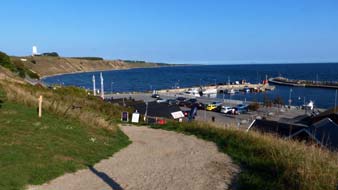 The stones, each weighing over a ton, are not
native to these parts and must have been transported here. Leaving aside bizarre
theories about the alignment of stones forming an astronomical calendar, no one
really knows the monument's purpose or significance. Evidence of earlier Bronze
Age burials beneath the stones suggests it had long been a sacred place of
ritual, assembly and memorial, and looking around the mysterious cliff-top and
rolling coastal hills, you could understand why. Clearly it was a powerful
chieftain who had caused it to be built at The stones, each weighing over a ton, are not
native to these parts and must have been transported here. Leaving aside bizarre
theories about the alignment of stones forming an astronomical calendar, no one
really knows the monument's purpose or significance. Evidence of earlier Bronze
Age burials beneath the stones suggests it had long been a sacred place of
ritual, assembly and memorial, and looking around the mysterious cliff-top and
rolling coastal hills, you could understand why. Clearly it was a powerful
chieftain who had caused it to be built at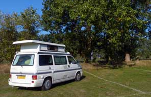 such a noteworthy spot, and standing
there on the cliff-top in the soft, hazy sunlight, looking across the
ship-setting with sheep grazing peacefully around the meadow, it was enough to
acknowledge the timelessness and the beauty of the setting against the backdrop
of
the Baltic. Back downhill to Kåseberga's little fishing harbour (see left), we bought
another supper of smoked fish from Ahl's Rökeri, and walked back through the
village to the parking area. such a noteworthy spot, and standing
there on the cliff-top in the soft, hazy sunlight, looking across the
ship-setting with sheep grazing peacefully around the meadow, it was enough to
acknowledge the timelessness and the beauty of the setting against the backdrop
of
the Baltic. Back downhill to Kåseberga's little fishing harbour (see left), we bought
another supper of smoked fish from Ahl's Rökeri, and walked back through the
village to the parking area.
Kåseberga ställplats Camping:
the ställplats operated by Kåseberga football club looked ideal for tonight's camp and we
moved George over to the camping area alongside the football field. As we
settled in, Ronny the football club manager who also looked after the ställplats,
called round for the 100kr/night rent; a hospitable and jovial gent, he showed
us the facilities in the club changing rooms. After a peaceful night's camp, the sun was just dawning on a
misty autumn morning when our alarm went off; it was going to be another hot
day. The football club changing room
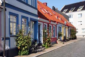 facilities were straightforward but
functional, and Larry the linesman was out this morning re-marking the pitch's
white lines for the new season, and chatted away in good English when we went
over for showers. All in all, although basic, Kåseberga ställplats was a
welcoming place and had served us well. facilities were straightforward but
functional, and Larry the linesman was out this morning re-marking the pitch's
white lines for the new season, and chatted away in good English when we went
over for showers. All in all, although basic, Kåseberga ställplats was a
welcoming place and had served us well.
Wallander country at Ystad:
on a bright, sunny morning, we continued west through the flat, agricultural
countryside beside the attractive
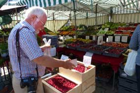 sheep-grazed coastal downs to join Route 9
into Ystad and parked opposite the railway station and port (click here for detailed map of route). Ystad began life as
a Baltic herring fishing port-village in the early 12th century, and the herring
trade remained a major local industry for centuries. In the mid-13th century the
town's Maria kyrkan was built and in 1267 Danish Grey Friars founded the
monastery. In the 14th century such was Ystad's wealth that the port joined the
Hanseatic League. The monastery was closed by the 1532 Reformation, and in 1569
Ystad was attacked by Swedes during the years of warfare over Skåne, but the
port survived and continued to flourish. As the herring industry declined, the
export trade of cattle to North Germany increased in importance. By the time
Skåne became Swedish in 1658 Ystad had reached a population of 2,000 and a
regular post-boat service to Stralsund began. The trading port increased in size
and wealthy merchants built imposing houses in the town. With the arrival of the
railway, Ystad became a popular seaside resort and the port continued to bring
prosperity to the town. There are still major ferry links to Świnoujście in
Northern Poland, sheep-grazed coastal downs to join Route 9
into Ystad and parked opposite the railway station and port (click here for detailed map of route). Ystad began life as
a Baltic herring fishing port-village in the early 12th century, and the herring
trade remained a major local industry for centuries. In the mid-13th century the
town's Maria kyrkan was built and in 1267 Danish Grey Friars founded the
monastery. In the 14th century such was Ystad's wealth that the port joined the
Hanseatic League. The monastery was closed by the 1532 Reformation, and in 1569
Ystad was attacked by Swedes during the years of warfare over Skåne, but the
port survived and continued to flourish. As the herring industry declined, the
export trade of cattle to North Germany increased in importance. By the time
Skåne became Swedish in 1658 Ystad had reached a population of 2,000 and a
regular post-boat service to Stralsund began. The trading port increased in size
and wealthy merchants built imposing houses in the town. With the arrival of the
railway, Ystad became a popular seaside resort and the port continued to bring
prosperity to the town. There are still major ferry links to Świnoujście in
Northern Poland,
 but Ystad is better known to
the English at least as the setting
for Henning Mankell's Wallander detective novels. but Ystad is better known to
the English at least as the setting
for Henning Mankell's Wallander detective novels.
Before today's brief re-visit to Ystad, first stop
was the TIC to use their wi-fi to confirm details of the Falsterbo bird-watching
sites at the Nabben sand-spit; it was one of those TICs not well versed in providing
information to visitors, but only in selling tickets for their expensive guided Wallander tours!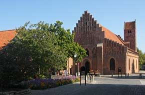 We were not impressed, and walked through the attractive back
streets (see above left) around to Stor Torget to browse the market stalls and buy vegetables and
lingonberries for our final suppers in Sweden (see above right) (Photo
42 - Ystad market stalls). Around at the truly beautiful
medieval Church of St Mary we again admired its rich decorative features
and walls covered with ornate 17th century commemorative sepulchral tablets set
up by wealthy families. Along Norrgatan we admired the beautifully restored 16th
century Änglahuset with its carved, decorated beam-ends of half-timbering, and
along a side street, the attractively restored red brick former Klostret
(monastery) now doubles as parish church and museum (see right). We were not impressed, and walked through the attractive back
streets (see above left) around to Stor Torget to browse the market stalls and buy vegetables and
lingonberries for our final suppers in Sweden (see above right) (Photo
42 - Ystad market stalls). Around at the truly beautiful
medieval Church of St Mary we again admired its rich decorative features
and walls covered with ornate 17th century commemorative sepulchral tablets set
up by wealthy families. Along Norrgatan we admired the beautifully restored 16th
century Änglahuset with its carved, decorated beam-ends of half-timbering, and
along a side street, the attractively restored red brick former Klostret
(monastery) now doubles as parish church and museum (see right).
Smygehuk, Sweden's southernmost point: leaving
Ystad, we followed Route 9 westwards along the coast, initially through farming
countryside but increasingly past bathing beaches and a series of dreary holiday
home settlements, to reach Smygehamn and Smygehuk. This otherwise unnoteworthy
marina
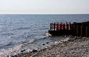 enjoys the distinction of being Sweden's southernmost point which, on a
sunny September day, even midweek, draws bus loads of tourists to what is a
largely featureless part Skåne, flocking here for over-expensive lunches at the
fish rökeri (smoke-house). We pulled in by the little harbour for a token visit;
the sign-board announced: Smygehuk, Sveriges sydligaste udde - 55° 20' 13" N,
13° 21' 34" O, with distances London 991km, Stockholm 510km,
Copenhagen 61km
and Treriksröset 1572km, although had we taken a straw-poll of Swedes snapping
away here before piling back into their tour-bus, doubtless not one would have
known enjoys the distinction of being Sweden's southernmost point which, on a
sunny September day, even midweek, draws bus loads of tourists to what is a
largely featureless part Skåne, flocking here for over-expensive lunches at the
fish rökeri (smoke-house). We pulled in by the little harbour for a token visit;
the sign-board announced: Smygehuk, Sveriges sydligaste udde - 55° 20' 13" N,
13° 21' 34" O, with distances London 991km, Stockholm 510km,
Copenhagen 61km
and Treriksröset 1572km, although had we taken a straw-poll of Swedes snapping
away here before piling back into their tour-bus, doubtless not one would have
known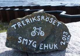 where the Three Countries Stone was or its significance!
(see
log of our 2015 visit to Treriksröset, Sweden's northernmost point).
On our last visit in 2013 to Smygehuk, a far more
admirable and personal point of note was the stone set on the sea-wall inscribed
Lisa 2013 - Treriksröset to Smygehuk, and an outline of
her bicycle on which the unknown Lisa had ridden the 1,572km from the
northernmost to southernmost points of Sweden (see right). Lisa the cyclist's
memorial record was now no longer there, and unlike on our first visit in
2013, when a lively gale blew from the wine-dark sea driving breakers onto the
shingle-shore, today there was not even a light breeze and the blue sea was
placid calm (see above left). Smygehuk was just another unnoteworthy tourists attraction stop-off
on a largely unattractive coastline; we moved on. where the Three Countries Stone was or its significance!
(see
log of our 2015 visit to Treriksröset, Sweden's northernmost point).
On our last visit in 2013 to Smygehuk, a far more
admirable and personal point of note was the stone set on the sea-wall inscribed
Lisa 2013 - Treriksröset to Smygehuk, and an outline of
her bicycle on which the unknown Lisa had ridden the 1,572km from the
northernmost to southernmost points of Sweden (see right). Lisa the cyclist's
memorial record was now no longer there, and unlike on our first visit in
2013, when a lively gale blew from the wine-dark sea driving breakers onto the
shingle-shore, today there was not even a light breeze and the blue sea was
placid calm (see above left). Smygehuk was just another unnoteworthy tourists attraction stop-off
on a largely unattractive coastline; we moved on.
Trelleborg's restored Viking fortress:
the final stretch of Route 9 along to Trelleborg was even more tediously
unattractive; even the industrial warehouses on the approach to the port-town
seemed more interesting than the flat farmland and holiday-homes along the coast.
Trelleborg (pronounced Trelleboye) had for centuries been a prosperous
Baltic herring fishing port, attracting merchants from Germany. Commercial
rivalry with Malmö however resulted in the city's merchant status being revoked
in 1619 by the Danish King. It became Swedish again in 1658 along with the rest
of Skåne, but it was only in 1867 that Trelleborg regained its merchant city
status. With the coming of the railways in the late 19th century, both port and
industry expanded, so that today Trelleborg is the 2nd largest sea port in
Sweden after Göteborg,
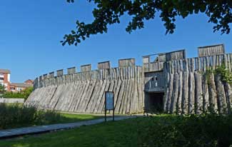 with 10 million tons of freight passing through the port
each year. It is also Sweden's principal ferry passenger link with Northern
Europe with ferry links to Rostock, Travemünde, Lübeck and Sassnitz for both
cars and freight lorries which began in 1909. It was in April 1917 that Lenin
arrived at Trelleborg on the ferry from Sassnitz on his way back from exile to
lead the Revolution in Russia. with 10 million tons of freight passing through the port
each year. It is also Sweden's principal ferry passenger link with Northern
Europe with ferry links to Rostock, Travemünde, Lübeck and Sassnitz for both
cars and freight lorries which began in 1909. It was in April 1917 that Lenin
arrived at Trelleborg on the ferry from Sassnitz on his way back from exile to
lead the Revolution in Russia.
Today we should make only two brief stop-offs at Trelleborg, the first for a cultural re-visit to an aspect of Trelleborg's
Viking past, the second more functional to complete our take-home shopping at
the enormous ICA Maxi by the port. Past the railway freight terminus and ferry
port, we turned off into an area of residential back-streets just west of the
city centre to the restored remains of the once circular Viking borg-fortress
built originally around 980 AD by Harold Bluetooth. It was That Harold
Bluetooth who united the Danish Viking Kingdom and converted it to Christianity
as his record inscribed on his memorial runestone at Jelling in Jutland had told
us (see
log of our 2007 visit to the Jelling Stone). This was a time of
consolidating the home kingdom rather than grand overseas expeditions of raids
plundering treasures. It was also a time of defending the newly united Danish
kingdom from neighbours both in the North and Germany, hence the need for
ring-fortresses. The borg at Trelleborg shows all the characteristics of other
ring-forts constructed by Harold Bluetooth in Sjæland and Jutland: built astride
significant trade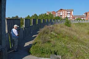 and communications land and marine routes, not for military
occupation but for defending the consolidated kingdom, levying taxes and tolls
and for guarding accumulated wealth. Each of the ring-forts covered a large area
with gates at the cardinal quarters and enclosing significant numbers of long
houses. We had visited 3 of Harold's identically arranged ring-fort at Trelleborg in Sjæland, and at Fyrkat and Aggersborg in North Jutland. Little of
these had survived except the circuit of earthworks which had originally formed
the core of timber-palisade fortification walls. Here in Skåne Trelleborg in
1988, a quarter-segment of earthworks core had been discovered and excavated
1,000 years after its construction. The rest were now buried under later
medieval streets and buildings and a city street, Bryggaregatan, ran through the
middle along the same direction as the Viking road. By the time of the 13th
century, when Trelleborg gained its city status, the Viking fortress had given
its name to the place (borg meaning fortress, and threlae
meaning the timber poles which formed the outer palisade-cladding of the
earthwork walls), but the fortress had been buried and forgotten for over 200 years. The surviving
quarter-segment of circular earthworks was reconstructed with their timber
palisade cladding together with one of the 4 gatehouses, giving a vivid impression of what
the original Trelleborg fortress would have looked like: Harold Bluetooth's
Trelleborg had risen from the ashes. and communications land and marine routes, not for military
occupation but for defending the consolidated kingdom, levying taxes and tolls
and for guarding accumulated wealth. Each of the ring-forts covered a large area
with gates at the cardinal quarters and enclosing significant numbers of long
houses. We had visited 3 of Harold's identically arranged ring-fort at Trelleborg in Sjæland, and at Fyrkat and Aggersborg in North Jutland. Little of
these had survived except the circuit of earthworks which had originally formed
the core of timber-palisade fortification walls. Here in Skåne Trelleborg in
1988, a quarter-segment of earthworks core had been discovered and excavated
1,000 years after its construction. The rest were now buried under later
medieval streets and buildings and a city street, Bryggaregatan, ran through the
middle along the same direction as the Viking road. By the time of the 13th
century, when Trelleborg gained its city status, the Viking fortress had given
its name to the place (borg meaning fortress, and threlae
meaning the timber poles which formed the outer palisade-cladding of the
earthwork walls), but the fortress had been buried and forgotten for over 200 years. The surviving
quarter-segment of circular earthworks was reconstructed with their timber
palisade cladding together with one of the 4 gatehouses, giving a vivid impression of what
the original Trelleborg fortress would have looked like: Harold Bluetooth's
Trelleborg had risen from the ashes.
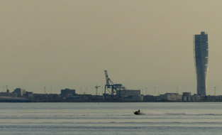 The small museum displaying the remains excavated
from the site was again closed, but we walked across the parkland to the
reconstructed quarter-segment of the timber-clad earthwork walls of the
reconstructed fortress (see above left) (Photo
43 - Trelleborg's restored Viking fortress). Set in the midst of modern city apartment blocks and
tower cranes, there was the realistic The small museum displaying the remains excavated
from the site was again closed, but we walked across the parkland to the
reconstructed quarter-segment of the timber-clad earthwork walls of the
reconstructed fortress (see above left) (Photo
43 - Trelleborg's restored Viking fortress). Set in the midst of modern city apartment blocks and
tower cranes, there was the realistic 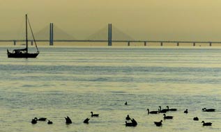 timber-clad palisade and gatehouse of
Harold Bluetooth's Trelleborg; it was an imposing sight. Through the fortified
gateway surrounding the now empty segment of space once occupied by longhouses,
the inner face of the palisade was reinforced by the original massive earthwork
embankment. It was the remains of the earthworks, after the timber palisade had
long rotted away, that we had seen at the Danish ring-fortresses. We followed
the walkway around the top of the quarter-section of palisade wall (see above
right), while quite
incongruously traffic passed along the modern city street over on the far side . timber-clad palisade and gatehouse of
Harold Bluetooth's Trelleborg; it was an imposing sight. Through the fortified
gateway surrounding the now empty segment of space once occupied by longhouses,
the inner face of the palisade was reinforced by the original massive earthwork
embankment. It was the remains of the earthworks, after the timber palisade had
long rotted away, that we had seen at the Danish ring-fortresses. We followed
the walkway around the top of the quarter-section of palisade wall (see above
right), while quite
incongruously traffic passed along the modern city street over on the far side .
Sunset over the Öresund at Habo-Ljung Camping
near Lomma: we now turned our attention to more mundane matters and
headed down to the docks and the huge ICA Maxi for final provisions and
take-home shopping. The sun was now hotter than ever and the hypermarket's air
conditioning brought welcome relief from the heat. We were still uncertain about
a final campsite, but a
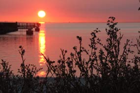 glance at the map showed it was no more than a half
hour's drive from Trelleborg around the E20/E6 motorway past Malmö to Lomma and
Habo-Ljung Camping where we had started the trip 4 months ago. Inevitably traffic
around Malmö was aggressively furious, but we turned off at Junction 20 close to
Lund for Lomma and the Öresund-side campsite. A number of camping-cars already glance at the map showed it was no more than a half
hour's drive from Trelleborg around the E20/E6 motorway past Malmö to Lomma and
Habo-Ljung Camping where we had started the trip 4 months ago. Inevitably traffic
around Malmö was aggressively furious, but we turned off at Junction 20 close to
Lund for Lomma and the Öresund-side campsite. A number of camping-cars already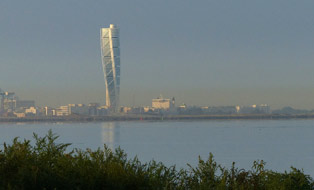 occupied the shore-side camping area, as well as locals beaching it on a sunny
afternoon. We found an empty spot in the shade of trees, where we had camped
back in mid-June at the start of the trip, and settled in looking across the
Öresund. From the shore-side, Malmö's twisted 190m high skyscraper building
Turning Torso stood out partly silhouetted against the evening sky among
dockyard cranes on the city horizon (see above left), along with the even more distant Öresund
Bridge (see above right). The sky remained clear and the sun gradually declined over the sound,
and for the first time in the number of occasions we had camped here, we watched
a perfect sunset. The sun's golden-red orb declined towards the horizon on the
Danish side, with its trail of reflected light sparkling across the waters of
the Öresund, making the perfect photo against a foreground of silhouetted
shore-side grasses (Photo
44 - Öresund Sunset).
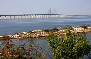 The Öresund Bridge view-point: a hazy sun
lit the distant skyline of Malmö (see right) on our
final day in Sweden this year, to be spent down at the Falsterbo sand-spit
hoping to see migrating birds of prey. First stop however was the Öresund Bridge
shore-side view-point at the end of the aptly named Utsiktsvägen (View-point
Way), just off Last Exit in Sweden (as the signs warn) on E20 heading
towards The Öresund Bridge view-point: a hazy sun
lit the distant skyline of Malmö (see right) on our
final day in Sweden this year, to be spent down at the Falsterbo sand-spit
hoping to see migrating birds of prey. First stop however was the Öresund Bridge
shore-side view-point at the end of the aptly named Utsiktsvägen (View-point
Way), just off Last Exit in Sweden (as the signs warn) on E20 heading
towards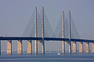 the Bridge, for morning photos looking across at the glorious panoramic
spectacle of the Öresund Bridge's sweep across the straits. Having taken the
exit, we were guided by our sat-nav, not via what the map suggested was an
obvious route through the outskirts of Malmö, but rather through the city suburb
of Bunkerflostrand, a singularly apt name given the massed rows of bunker-like
yuppie apartments which make up the place with yet more bunkers under
construction for the Volvo-driving chinless wonders who live in this
god-forsaken, soulless place; what it must be like to live there, and why anyone
would choose to do so, beggars belief! The route entailed 17 sequential roundabouts, each
with its gut-wrenching farthinders (as the Swedes charmingly call
speed-humps), before we finally emerged to pass under the E20 and turn off along
Utsiktsvägen to the Öresund view-point. On such a clear sunny morning, with the
sun behind us, these were perfect lighting conditions for photographing this
magnificent bridge (Photo
45 - Öresund Bridge) (see left and right). the Bridge, for morning photos looking across at the glorious panoramic
spectacle of the Öresund Bridge's sweep across the straits. Having taken the
exit, we were guided by our sat-nav, not via what the map suggested was an
obvious route through the outskirts of Malmö, but rather through the city suburb
of Bunkerflostrand, a singularly apt name given the massed rows of bunker-like
yuppie apartments which make up the place with yet more bunkers under
construction for the Volvo-driving chinless wonders who live in this
god-forsaken, soulless place; what it must be like to live there, and why anyone
would choose to do so, beggars belief! The route entailed 17 sequential roundabouts, each
with its gut-wrenching farthinders (as the Swedes charmingly call
speed-humps), before we finally emerged to pass under the E20 and turn off along
Utsiktsvägen to the Öresund view-point. On such a clear sunny morning, with the
sun behind us, these were perfect lighting conditions for photographing this
magnificent bridge (Photo
45 - Öresund Bridge) (see left and right).
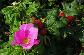 Bird-watching
on the Nabben sand-spit on Falsterbo peninsula: our plan was to spend
our final day bird watching down at the Nabben sand-spit at the tip of the
Falsterbo peninsula. The Falsterbo headland is formed mainly of sand built up
around ridges of moraine, with the sand-spits constantly changing shape and size
as the sand is moved around by wind and sea currents (see right). For Bird-watching
on the Nabben sand-spit on Falsterbo peninsula: our plan was to spend
our final day bird watching down at the Nabben sand-spit at the tip of the
Falsterbo peninsula. The Falsterbo headland is formed mainly of sand built up
around ridges of moraine, with the sand-spits constantly changing shape and size
as the sand is moved around by wind and sea currents (see right). For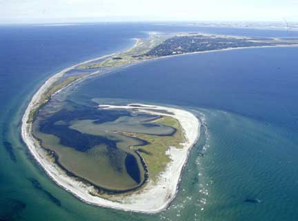 centuries
it was barren treeless heath-land with sand dunes, grazed meadows and marshes;
today this open landscape is mixed with woodland, residential areas and gardens.
It is estimated that a remarkable 500 million birds migrate from Scandinavia
every autumn following the west and south coasts of Sweden before crossing the
Baltic, the first hazardous obstacle on their long journey south. Nabben, the SW
tip of Falsterbo is therefore the last land for birds to roost and feed before
attempting the Baltic crossing. The shallow shores of the peninsula provide
ideal feeding grounds as the migrating birds prepare for their journey south,
and in late summer and autumn 100s of thousands of birds cross the peninsula daily;
the most spectacular are the migrating raptors sometimes seen soaring around in
flocks over the heath-land. centuries
it was barren treeless heath-land with sand dunes, grazed meadows and marshes;
today this open landscape is mixed with woodland, residential areas and gardens.
It is estimated that a remarkable 500 million birds migrate from Scandinavia
every autumn following the west and south coasts of Sweden before crossing the
Baltic, the first hazardous obstacle on their long journey south. Nabben, the SW
tip of Falsterbo is therefore the last land for birds to roost and feed before
attempting the Baltic crossing. The shallow shores of the peninsula provide
ideal feeding grounds as the migrating birds prepare for their journey south,
and in late summer and autumn 100s of thousands of birds cross the peninsula daily;
the most spectacular are the migrating raptors sometimes seen soaring around in
flocks over the heath-land.
We now set the sat-nav for the Nabben sand-spit
on Falsterbo peninsula, and returned down the E22 motorway, turning off around
Höllviken Strand over the canal which cuts through the peninsula. Falsterbo's
narrow rustic lanes led eventually to the parking area by the Falsterbo golf
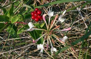 club's car park reserved for all the Mercedes and Volvos of the exclusively
self-important golf club members whose egos are inversely proportional in size
to the little white balls they hack around, with manners to match. A few
twitchers ambled past lugging their mighty tripodular apparatus with camera lens
the size of buckets; we set out with our modest binoculars and cameras, risking
life and limb from flying golf balls across the golf course track to the old
Falsterbo lighthouse which now houses the bird station. The juxtaposition of
twitchers and golfers at Falsterbo had all the potential for amusing encounters.
On our last visit in 2013, we had worn full waterproofs against pouring rain;
today the weather was less promising for bird-watching with clear sky and hot,
hazy sun. No self-respecting birds would consider migratory crossing of the
Baltic in heat such as this. club's car park reserved for all the Mercedes and Volvos of the exclusively
self-important golf club members whose egos are inversely proportional in size
to the little white balls they hack around, with manners to match. A few
twitchers ambled past lugging their mighty tripodular apparatus with camera lens
the size of buckets; we set out with our modest binoculars and cameras, risking
life and limb from flying golf balls across the golf course track to the old
Falsterbo lighthouse which now houses the bird station. The juxtaposition of
twitchers and golfers at Falsterbo had all the potential for amusing encounters.
On our last visit in 2013, we had worn full waterproofs against pouring rain;
today the weather was less promising for bird-watching with clear sky and hot,
hazy sun. No self-respecting birds would consider migratory crossing of the
Baltic in heat such as this.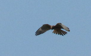
Having survived the crossing of the golf course,
in the face of those impatiently waiting to hit their little white balls in our
direction, we walked slowly
alongside the outer lagoon peering through
binoculars into the far reed beds, but apart from a lone bird of prey emerging
briefly from the reeds, birds were there none. Instead we spent time
photographing the beautifully scented wild roses and honeysuckle (see above
left). At the far end
overlooking the outer lagoons, we met and
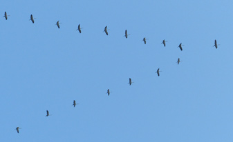 chatted with a pleasant couple from
inland Skåne; they made no great pretensions but we learned much from their
birding knowledge which helped to identify more bird-life than we might have
unassisted: greenshank waders pecked busily out in the shallows along with
clumsily plodging geese, a line of cormorants perched out along a sand-bar
bordering onto the open sea (the lady told us the Swedish name skarv,
with a characteristic rolling of the r), a kestrel (tornfalk
- tower falcon - in Swedish) soared around searching for prey (see above right). But the prize of
the day was the vector formation of migrating cranes flying gracefully overhead
(Photo
46 - Migrating cranes) (see left). As they passed overhead we could hear
their mewing sound, and through
binoculars could see their long trailing legs, as they circled around and changed their minds deciding it was too late in the
day to begin their crossing of the Baltic today. They flew back inland to
overnight before beginning their migratory flight across to mainland Europe
tomorrow. The weather continued fine this afternoon with a hazy sun, and a lone
buzzard chatted with a pleasant couple from
inland Skåne; they made no great pretensions but we learned much from their
birding knowledge which helped to identify more bird-life than we might have
unassisted: greenshank waders pecked busily out in the shallows along with
clumsily plodging geese, a line of cormorants perched out along a sand-bar
bordering onto the open sea (the lady told us the Swedish name skarv,
with a characteristic rolling of the r), a kestrel (tornfalk
- tower falcon - in Swedish) soared around searching for prey (see above right). But the prize of
the day was the vector formation of migrating cranes flying gracefully overhead
(Photo
46 - Migrating cranes) (see left). As they passed overhead we could hear
their mewing sound, and through
binoculars could see their long trailing legs, as they circled around and changed their minds deciding it was too late in the
day to begin their crossing of the Baltic today. They flew back inland to
overnight before beginning their migratory flight across to mainland Europe
tomorrow. The weather continued fine this afternoon with a hazy sun, and a lone
buzzard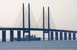 soared around over the reed beds as we ambled back towards the
lighthouse after a couple of hours out along the sand-spit. We had seen more
bird-life than expected. soared around over the reed beds as we ambled back towards the
lighthouse after a couple of hours out along the sand-spit. We had seen more
bird-life than expected.
A final night at Habo-Ljung Camping:
we returned up the length of the peninsula to re-join the E22, with time this
afternoon to return to the Öresund view-point for further photos of the
Bridge against the light of the afternoon sun. Reaching the Utsikten, the
parking area was now full of smart Volvos, their smart occupants gathered at the
restaurant for some Volvo promotional event. We parked at the end of a line of
Volvo limousines whose Turkish chauffeurs lounged around smoking (not a pretty
sight!), while we took further photos, just as a large cargo ship passed beneath
the central span of the Bridge under the pylons (see right) (Photo
47 - Cargo ship passing under central span of Öresund Bridge). Earlier out at the Nabben
sand-spit, we had seen the Baltic horizon lined with distant tankers and
top-heavy container ships, and it occurred to us that, unless such huge vessels
passed through the Kiel Canal, the only maritime route into or out of the entire
Baltic was
via
the Öresund and under the Bridge. No wonder the Danes had for
centuries made a national fortune by levying the Öresund toll on maritime
traffic passing through the sound.
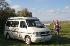 Re-joining the E20 for the drive around the Malmö
motorway network, congested with European freight lorries merging with local
commuter traffic, we were glad to turn off finally to Lomma, and out to the
coast at Habo-Ljung Camping. The shore-side camping area was virtually empty
tonight and we had the pick of spaces, pitching in sunlight looking out across
the Öresund straits for our final night's camp in Sweden (see left). The sun declined Re-joining the E20 for the drive around the Malmö
motorway network, congested with European freight lorries merging with local
commuter traffic, we were glad to turn off finally to Lomma, and out to the
coast at Habo-Ljung Camping. The shore-side camping area was virtually empty
tonight and we had the pick of spaces, pitching in sunlight looking out across
the Öresund straits for our final night's camp in Sweden (see left). The sun declined
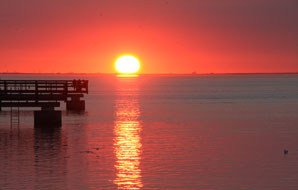 even
earlier, hazier than last evening, setting with a crimson glow across on the
Danish side (see below right). An almost full moon rose above the Öresund for our final evening in
Sweden, and we cooked a celebratory supper of elk meat (bought at the Karesuando
Meat Hall and kept frozen) with lingonberries; meat from the northernmost
village of Sweden and cooked near the southernmost town. After our 4 month stay
this summer, tomorrow we should
cross the Bridge saying farewell to Sweden for another year (see below left) (Photo
48 - Crossing Öresund Bridge), to begin our long journey home, through southern Denmark and
across the Rødby~Puttgarden ferry, to camp tomorrow night at Lübeck in Germany. even
earlier, hazier than last evening, setting with a crimson glow across on the
Danish side (see below right). An almost full moon rose above the Öresund for our final evening in
Sweden, and we cooked a celebratory supper of elk meat (bought at the Karesuando
Meat Hall and kept frozen) with lingonberries; meat from the northernmost
village of Sweden and cooked near the southernmost town. After our 4 month stay
this summer, tomorrow we should
cross the Bridge saying farewell to Sweden for another year (see below left) (Photo
48 - Crossing Öresund Bridge), to begin our long journey home, through southern Denmark and
across the Rødby~Puttgarden ferry, to camp tomorrow night at Lübeck in Germany.
Our observations on Sweden
after living there for 4 months this year and 5
months in 2013: there is no doubt that Sweden, particularly the north,
is one of our favourite European countries, still with an enviable society and
standard of living. But our observations show that things have changed
drastically compared even with 2013. And the reason is obvious: Sweden, a
naturally humanitarian and welcoming society with progressive social policies,
has accepted more immigrant asylum seekers per head of population than any other country in the developed world. But a visit to any town or city throughout the country
shows that the country has singularly failed to manage this extraordinary level
of immigration and to integrate the newcomers into their society. Restrictive employment
regulations have kept immigrants unemployed and accommodated
in ghetto-like suburbs, albeit at state expense; the cost of accommodating and
maintaining enforced allocations of immigrant asylum seekers now represents an overwhelming
financial burden
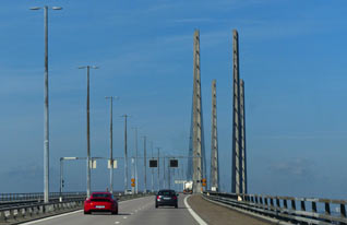 for local authorities. The evident maladroit mismanagement of the problem
and loss of control by the Social Democratic and Green Parties coalition
government led by
Prime Minister Stefan Löfven, has led to a public political backlash, a gift for
the extreme right wing Sweden Democrats, a party once derided as cranks and
thugs. As a Telegraph report of January 2017 said (Sweden
is a perfect example of how not to handle the Great Migration): "If the
finest political minds in Sweden had set out to incubate a far-Right backlash in
the world’s most tolerant country, they could not have done better than what has
happened over the last few years. First, run an open-door immigration policy
making your country the top destination in the middle of a global migration
crisis. Next denounce as neo-fascist anyone who raises objections. All of
this has handed entire sections of the electorate on a plate to the Sweden
Democrats ... In Sweden, immigrants are twice as likely to be unemployed as
natives, one of the worst ratios in the developed world. Accepting immigration
at such a level, while being unable to integrate it, is the recipe not just for
a political crisis but a national identity crisis". In the 2014 general election
the Sweden Democrats more than doubled their seat holding in the
Riksdag (Parliament) from
20 to 49 seats, then in early 2016, the Swedish government bowed to for local authorities. The evident maladroit mismanagement of the problem
and loss of control by the Social Democratic and Green Parties coalition
government led by
Prime Minister Stefan Löfven, has led to a public political backlash, a gift for
the extreme right wing Sweden Democrats, a party once derided as cranks and
thugs. As a Telegraph report of January 2017 said (Sweden
is a perfect example of how not to handle the Great Migration): "If the
finest political minds in Sweden had set out to incubate a far-Right backlash in
the world’s most tolerant country, they could not have done better than what has
happened over the last few years. First, run an open-door immigration policy
making your country the top destination in the middle of a global migration
crisis. Next denounce as neo-fascist anyone who raises objections. All of
this has handed entire sections of the electorate on a plate to the Sweden
Democrats ... In Sweden, immigrants are twice as likely to be unemployed as
natives, one of the worst ratios in the developed world. Accepting immigration
at such a level, while being unable to integrate it, is the recipe not just for
a political crisis but a national identity crisis". In the 2014 general election
the Sweden Democrats more than doubled their seat holding in the
Riksdag (Parliament) from
20 to 49 seats, then in early 2016, the Swedish government bowed to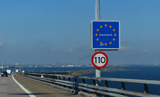 public
pressure and re-introduced border controls in a belated attempt to stem the rising
pressures of immigrants and asylum seekers entering Sweden, with resulting long
delays even for the daily numbers of Danish commuters crossing the Öresund
bridge. In the absence of any effective longer term management of past open door
immigration policies, all this feels like a vain attempt at bolting the stable
door. The impact of the authorities' failure to manage uncontrolled immigration
and consequent social divisiveness is plain to see. Claims about levels of
deportation of failed asylum seekers are treated with derision since those
denied entry simply disappear into an expanding underworld, continuing to live
illegally in Sweden and exploiting the system. A September 2016 article in the
Spectator
How Sweden became an example of how not to handle immigration highlighted
the social consequences of such mismanagement of the levels of asylum seekers. public
pressure and re-introduced border controls in a belated attempt to stem the rising
pressures of immigrants and asylum seekers entering Sweden, with resulting long
delays even for the daily numbers of Danish commuters crossing the Öresund
bridge. In the absence of any effective longer term management of past open door
immigration policies, all this feels like a vain attempt at bolting the stable
door. The impact of the authorities' failure to manage uncontrolled immigration
and consequent social divisiveness is plain to see. Claims about levels of
deportation of failed asylum seekers are treated with derision since those
denied entry simply disappear into an expanding underworld, continuing to live
illegally in Sweden and exploiting the system. A September 2016 article in the
Spectator
How Sweden became an example of how not to handle immigration highlighted
the social consequences of such mismanagement of the levels of asylum seekers.
The impact on Swedish society of unrestricted immigration and
government failure adequately to manage the situation has been
reaffirmed by our own daily observations throughout the length and breadth of
Sweden during the 4 months of our stay, and by our many conversations with Swedes
on the issue during our time there. We were told that work permit regulations impose punitive
restrictions preventing
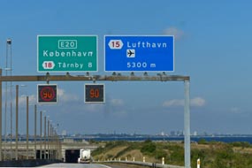 immigrants from obtaining employment, meaning that vast
numbers are needing to be maintained and accommodated at state expense. The
government compulsorily requires local authorities across the entire country to
accommodate dispersed allocations of immigrants proportional to local population,
imposing unaffordable financial burden on local authorities. We ourselves
witnessed the impact of this enforced dispersal of asylum seekers, all requiring
accommodation, throughout the country in every village, town and city visited:
immigrant asylum seekers were accommodated in barracks, huts, hotels, campsites, everywhere
and anywhere, in a desperate attempt to contain the problem, resulting in some
tragically ludicrous situations. For example, at Kiruna in the far north, 1,000 immigrants were
allocated by the government and were
accommodated during summer time in vacant ski hotels in the remote mountains at Riksgränsen
on the Norwegian border; when this was required for the winter ski trade, the
immigrants were moved down to hotels on the Bothnian coast.
At Porjus village in Lapland, a community of 400 residents, the Stockholm
government had assigned 100 immigrants to live here in a former barracks hut. The result of restrictive opportunity for employment, non-integration into
Swedish society, and enforced distribution throughout the country in varying
standards of state funded accommodation, meant that wherever we went, every town
and village seemed to be populated by groups of hopeless immigrants aimlessly
milling around. Along many country roads outside of villages, lines of
immigrants wandered purposelessly along the roadside. And we were there in
summer time; today in the north, temperatures will be -10ºC. immigrants from obtaining employment, meaning that vast
numbers are needing to be maintained and accommodated at state expense. The
government compulsorily requires local authorities across the entire country to
accommodate dispersed allocations of immigrants proportional to local population,
imposing unaffordable financial burden on local authorities. We ourselves
witnessed the impact of this enforced dispersal of asylum seekers, all requiring
accommodation, throughout the country in every village, town and city visited:
immigrant asylum seekers were accommodated in barracks, huts, hotels, campsites, everywhere
and anywhere, in a desperate attempt to contain the problem, resulting in some
tragically ludicrous situations. For example, at Kiruna in the far north, 1,000 immigrants were
allocated by the government and were
accommodated during summer time in vacant ski hotels in the remote mountains at Riksgränsen
on the Norwegian border; when this was required for the winter ski trade, the
immigrants were moved down to hotels on the Bothnian coast.
At Porjus village in Lapland, a community of 400 residents, the Stockholm
government had assigned 100 immigrants to live here in a former barracks hut. The result of restrictive opportunity for employment, non-integration into
Swedish society, and enforced distribution throughout the country in varying
standards of state funded accommodation, meant that wherever we went, every town
and village seemed to be populated by groups of hopeless immigrants aimlessly
milling around. Along many country roads outside of villages, lines of
immigrants wandered purposelessly along the roadside. And we were there in
summer time; today in the north, temperatures will be -10ºC.
These observations are the result of our constant
experience throughout our 4 month in Sweden, and are in no way an exaggeration.
We love Sweden, but all that we saw with our own eyes throughout the country,
the result of failed government policies adequately to manage Sweden's natural
hospitality towards asylum seekers, and the sorry impact on both the immigrants
themselves and on Swedish society which we so admire, has left us feeling greatly
distressed.
We shall conclude this series of travelogues with an updated Review of Swedish Campsites,
reflecting our experiences during our 4 months stay in Sweden during 2016.
Next edition
to be published shortly
|
Sheila and Paul |
Published: 8 February 2016 |
|
 CAMPING IN SWEDEN 2016 - Småland Kingdom of Glass (Glasriket), Baltic island of Öland,
Kalmar, Southern coastline of Skåne, Kristianstad, Kivik, Ystad, Trelleborg,
Falsterbo sand-spit, Öresund Bridge to Denmark for
journey home:
 The Småland Glasriket (Kingdom of Glass) and
Målerås Glass Works:
clear skies and warm autumn sunshine for the morning we drove back along the
Oknö peninsula, past the holiday homes and marinas into Mönsterås, to rejoin the
E22 highway. 12 kms south at Ålem we turned off onto a quiet rural lane through
the Småland pine forests (
 She introduced herself as Marianne Degener who
had herself trained at Målerås in the 1980s; she now had her own studio and
taught glass-making skills to students at the Målerås workshops. It was totally
fascinating watching her take a red hot gobbet of molten glass from the furnace,
slowly work it into shape, then skilfully chop off the finished product into the annealing oven for slow overnight cooling. She readily answered our
questions and demonstrated the technique, explaining the stages of glass-working
(see left and above) (
 town lake (see left), the municipal campsite was set in open public
parkland, with local people walking through and children playing down by the
lake, and immediately by a busy main road with the constant noise of passing
traffic. With some misgivings, we settled in but there was scarcely a flat spot
to camp, and as darkness fell the numbers of people still loitering in the open
parkland gave concerns about security. Joelskogens was certainly not a comfortable place
to camp.
 scant regard for its native peasant
farmers who were barred from chopping wood, hunting animals or selling their
produce on the open market. Danish attacks added to the Ölanders' miseries, and
a series of disastrous harvests in mid-19th century led to a quarter of the
population emigrating to seek a new life in America. Wooden windmills dating
from the 18th century still cover Öland, and as we drove northwards from the
bridge towards the island's main town of Borgholm, we immediately began
to pass classically characteristic features of Öland: conserved post-windmills, dry
limestone walls, and blue chicory flowers at the roadside.
 the Vasa dynasty. In the mid-17th century Tessin the Elder further
enlarged the royal palace, but by the 18th century the disused castle fell into
ruins, finally being destroyed by fire in 1806. Today the roofless ruins still
stand proudly atop the cliffs near to one of the Swedish royal family's summer
residences, and we walked across the limestone scrubland meadows, where standing
under the stark towers and redoubts showed the castle's fearsome scale (
 archaeological finds at the site date the grave-mound to around 1,000 BC. We took our photos of the burial-mound,
and of the Dewberries growing among brambles, then continued north passing an exposed
section of Öland's classic limestone escarpment.
  as times became more
unsettled, with attacks from across the Baltic, the church's tower was fortified
as a defensive refuge. Although the church was extended in later years, this
sturdy west end tower remains, evidence of these violent times (
 on farms,
whereas the larger Dutch mills were operated as toll mills by a miller, with
payment for grinding farmers' corn either in cash or a share of the grain. The
Sandvik mill was built originally in Småland in 1856; it was sold in 1885 and
transported piecemeal and reassembled here at Sandvik on a 2-storey sandstone
base, and remained in use as a working mill until 1950. It was later converted
to a café, serving traditional Öland peasant meals such as Lufsa and Kroppkakor,
potato dumplings filled with chopped pork and onion. Having photographed the
mill (see above left) (
 Knisa Mosse
Nature Reserve: back
at the main Route 136, a single-track lane led out to the Knisa Mosse Nature
Reserve. These coastal wetlands were spared the 19th century drainage ditching
when as much land as possible on Öland was cultivated to feed a growing
population (see left). The area was used for cutting reeds as roofing material and hay and
for grazing cattle, and conserved as a nature reserve in the mid 20th century
for its birdlife and flora. From the parking area, we followed a faint track through scrubland pastures rather hesitantly past a small herd of large-horned
highland cattle across to an oak copse to the bird observation tower overlooking
the marshes. Low blackthorn bushes full of sloes grew alongside
 the path and, crossing
a board-walk we found a patch of
Grass of Parnassus flowers in the moist land (see right); we had seen this
beautiful flower from way up in the Arctic right down to here in the very
south of Scandinavia. The tower overlooked the Knisa Mosse wetlands where ducks
gathered on the waters, gulls flew around and swallows soared overhead dipping
to feed in the shallows
 father worked the farm. The 5
younger children eventually emigrated, and Alma the eldest daughter maintained
the farm until she died in 1959; the farm became a campsite in 1980. As in 2013,
we were again welcomed by the elderly lady owner who chatted away in a
semi-intelligible mix of Swedish and German, showing us the straightforward
facilities and suggesting spots for us to camp. The price was still 200kr/night,
good value for such an exceptional location. We selected a pitch sheltered from
the brisk Öland wind by large juniper bushes, looking out to the magnificent
Baltic shoreline (
 overcast for
our day in camp here at Wikegårds. Since our 2013 stay, wi-fi had now been
installed at the farmhouse and the forecast showed improving weather for our
week on Öland. We enjoyed a gloriously peaceful and restful day, and during the
afternoon, the cloud cover broke with a clear warming sun streaming in from
Wikegårds' renowned Big Baltic Sky above the farm's post-mill
(
 As attacks from Baltic pirate increased during the
later 12th century, the original 11th century wooden church at Källa was
destroyed by fire, and a new stone church, dedicated to St Olav, was built in
the form of a 2 storey defensive fortress, the church's tower serving as a refuge
in times of attack (see above right). The church was further enlarged in the 14th century and the
tower demolished. A new church was built at Källa in the 19th century as the
village expanded closer to the main road, and most of the old church's fitments
were moved there. The huge barn-like old church with its sturdy stone walls was
conserved as a national heritage, and in 2013 we were able to see its
magnificent interior architecture. Today in September, it was all locked but we
took our photos from the outside from the corner of the graveyard which was
filled with flat-slabbed tombs from the 1600~1700s. Just along from the church,
we reached Källa Hamn at the lane's end; today the little harbour was peaceful
with just a few boats moored by the fishing sheds (see left) (
 Neptuni Åkrar beach: we continued north
past the windmills at Högby, and after shopping for provisions at the ICA Nära
at Löttorp village, we turned off beyond Böda around the densely pine-forested
coast road to reach Tokenäs Camping. Just opposite the campsite, a shore-side
post-windmill stood atop a hillock overlooking the Kalmar Sound. The campsite
was virtually empty and we should return there later after our day around the
northern tip of the island. Beyond the little port-resort of Byxelkrok from
where summer ferries cross to Oskarhamn on the mainland, we stopped by the
stony, rubble-field of Neptuni Åkrar, a barren beach of wave-pounded
rubble-banks
 above the flat slabs of bed-rock limestone along the waterline. The
flat upper surface of the slabs was scored with linear Orthoceratite fossils, a
marine cephalopod with external tubular shell. Labelled 'Neptune's Fields' by
Linné after his 1741 visit, the 200m wide glacially deposited rubble embankments
have been tiered up by tidal action over aeons, and now presents a barren
appearance stretching for several miles along Öland's NW coastline. Among the
sparse vegetation that somehow manages to take root on the rubble, the
distinctive blue-purple-pink spiky flowers of Viper's Bugloss stand out (see
above right) (
 in 2013, a stiff wind was
driving a pounding surf onto the beach; today there was not a breath of breeze,
and the sun glinted across the still sea with the distant islet of Blå Jungfrau
standing out on the horizon (see left).
 of the 2 peninsulas enclosing Grankullaviken lagoon, ending at the Trollskogen Nature Reserve. Here we set off
to walk the 4.5kms way-marked Trollskogen circuit trail around the forested
Trollskogen peninsula. The path crossed the width of the peninsula, passing a
now fallen ancient oak tree, and running alongside the remains of a stone wall
which once enclosed a medieval royal hunting lodge. The path emerged on the
eastern shore-line which was normally exposed to the full force of gales blowing
across the Baltic. Today however, with virtually no wind, the sky was cloudless
with scarcely a ripple of surf on the shingle beach. It was a picture-postcard
of a view looking along the forest-fringed beach with the still sea reflecting
the blue sky and lit by bright sun
(
 tip
looking out across the still waters of Grankullaviken lagoon towards the
distant Långe Erik lighthouse on the tip of the western side (see right). The lagoon was almost
enclosed on the seaward side by a chain of islets. The return path wound past
stone defensive works from the 14~16th century wars between Sweden and Denmark,
and Iron Age burial mounds. On the peninsula's more sheltered western side, the
lagoon was fringed with meadows where cattle grazed. The path crossed the
meadows before re-entering the forest, where spotted woodpeckers frolicked high
in the pines, to complete the circuit of the forest nature trail.
 golden light. An elderly gent from one of
the static caravans called round to collect our rent; he chatted away jovially
in Swedish too quickly for us to follow, but when he wrote down '65 års', we got
the gist: 'ah rabatt!' we responded - discount for seniors - and paid the
reduced figure of 170kr, very reasonable for such a peaceful setting. As the
golden sun declined and set along the seaward horizon, we dashed over to
photograph the windmill silhouetted against the sunset across
the Kalmar Sound (
 Byrums Raukar sea stacks: the
overnight cloud cleared to give another clear, sunny day but a fresh northerly
breeze kept temperatures cooler, raising white horses out in the Kalmar Sound.
We packed, re-filled George's fresh water, and set off through Byxelkrok to
pause again at Neptuni Åkrar beach where the brisk wind was today driving a
lively swell off the Sound; the contrast of white waves against the wine-dark
sea this morning made for more interesting photography than yesterday's
flat, glassy calm (see above right). We turned off onto the minor lane around to the northern tip,
and as we drove through the coastal woodland, sea eagles soared overhead and a
kestrel landed on a roadside tree. At the parking area near to Långe Erik
lighthouse, a large flock of cormorants was perched out on the rocks in the
 shallows of Grankullaviken lagoon. We walked over to photograph the lighthouse
against the backdrop of breakers driven in by the wind, but cloud had now
gathered giving the scene a grey, dismal air (see left).
 with today's Öland limestone layers being 40m in depth, this means that it took 40 million
years for the Öland limestone bed-rock to form. Differing content of clay
minerals in the limestone caused variations in its hardness and therefore
resistance to erosion. At Byrums, softer limestone has been eroded by wind and
wave action, leaving behind the stacks of harder, more resistant limestone. We
parked at the end of road shore-side and walked along to the first of the Byrums
stacks. The cloud cover of earlier was just beginning to break, and the sky
clearing to give bright western sun, perfect lighting conditions for
photographing the line of sea-stacks against the dark sea and white waves
breaking against the foot of the limestone cliffs, continuing
 their erosive
action (see above right) (
 Swedish with us
catching just the occasional word. Tonight, apart from his caravan as the only
other occupant, we had the campsite to ourselves, and the sun set across the
Sound once more silhouetting the windmill against a crimson sky (see above right).
 restock
at Borgholm, we were ready to begin our exploration of Southern Öland (
 Ismantorp Iron Age ring-fortress: turning inland at Långlöt, and
passing the post-mills by the Himmelsberga skansen, we took a side-lane ending
at the parking area for Ismantorp Early Iron Age ring-fortress. The oldest of
the 20 known ring-forts on Öland and built around 200 AD, the circular limestone
block-built exterior wall, remarkably conserved at 3~4m in height, encloses an
open inner space with the stone foundation-remains of 95 dwellings (see left). Excavations
at the site have revealed no archaeological remains, and the fortress was likely
not to have been permanently occupied. It is thought to have been the fortified
headquarters for a clan chieftain and his garrison who controlled the
surrounding area, and a secure refuge for his peasant
 farmers in times of
danger. Nothing is known for certain about the ring-fort's history or its
occupants, but it was abandoned around 650 AD. But the scale and solidity of the
fortress' construction to have lasted so well is an indication of the power of
the chieftain who controlled Ismantorp.
 they had to take refuge in
the fortress, and the nature of the external threats they faced. Standing here in
the fortress' inner area among the ruins of dwellings, in the silence of Ismantorp's lost world, was another of the trip's memorable highlights.
 inland to find the Gråborg Iron Age~Medieval
ring-fortress. The approach pathway passed by a classic Öland farmstead with
long-barn enclosing its farmhouse courtyard. Gråborg is an even bigger ring-fort
built in the 6th century AD at a time when Ismantorp was in decline. It was
later adapted with strengthened walls as a military fortification and trade
centre in medieval times, and was even occupied as defence against Danish attacks
as late as the 17th century. Nothing of the Iron Age fortified settlement or
later medieval military works survives today other than the 7m high ring-walls
(see above left)
and a vaulted medieval gateway (see right); the vast open space enclosed by the circular walls
is now meadowland mown for hay. Nearby stand the remains of the medieval chapel
of St Knut and tax records show both the fortress and chapel were owned by Vadstena Abbey
(
 Southern Öland's Stora Alvaret limestone
plateau: at Brunneby we turned off inland to cross the semi-barren
limestone plateau of Stora Alvaret, the vast limestone plateau which
covers the bulk of Southern Öland; at 260km2 it is the largest such
limestone expanse in Europe. Southern Öland's topography showed the nature of
the island's agriculture, with the coastal strip having the most fertile, deeper
soil, cultivated as arable land and meadows, and the inland Alvar plain
with its thin soil mantle and sparse vegetation grazed by cattle and sheep. The
medieval layout of farmsteads along the line of the coastal strip, and frequency
of Iron Age grave-fields and medieval churches, show these lands to have had
continuity of human occupation for almost 2,000 years. And the number of farm
vehicles passing along the coast road, and affluence of modern farmsteads,
showed that agriculture still flourished.
 Resmo medieval church and the 10th century
Karlevi Runestone:
at the far end of the road across the Alvar, we reached Resmo village and
paused to photograph the 11th century church, said to be Öland's oldest
surviving church still in regular use (see left). It began as a private foundation
 in the
11th century, endowed by a local wealthy landowner who stood to gain from his
investment in the church from fees paid by parishioners for baptisms, weddings
and funerals. Again the tower was strengthened as a defensive refuge, but the
Danish invasions of 1677 wrought havoc with the decorations, treasures and
archives of both Resmo and Vickleby churches plundered or destroyed. We turned
down the steep slope of Öland's western coastal escarpment to revisit the
Karlevi runestone set amid fields down by the Kalmar Sound. Dated to the late
10th century, the time of transition from the pagan Æsir religion to
Christianity, the runestone is unique in containing within its runic inscription
both the prose dedication to a Viking chieftain and the oldest known stanza of
Skaldic verse, and on the reverse side a later non-runic inscription with
Christian reference. The stone marks the grave of the Danish chieftain Sibbi
Fuldarsson, killed in the 985 AD battle of Fýrisvellir, and was raised in dedicatory memory by his retinue. The prose
dedication records the commemoration to Sibbi, and the honorific verse which
follows mentions a female Valkyrie deity Thrud and reference to one of the names
of Odin, perhaps an acknowledgement that Sibbi still clung to the old pagan
beliefs. The 1.4m high, rounded top stone was not Öland limestone, but harder
granite rock transported from elsewhere. The main inscription was deeply
engraved in beautiful runic characters in vertical lines covering the front face
and
 side (see right), while on the reverse face were Christian characters in Roman script,
interpreted as In Nomin[e]...Ie[su], raising the question whether this
was contemporary
with the runic inscription almost as a 'fail-safe' addendum at
time of religious transition or a later Christian defamatory graffito on a pagan
monument. Either way, our feeling was that the Karlevi monument, along with the
Rök runestone, was the most intriguing of those we had seen, a very special
monument marking the final resting place of a Viking warrior-chieftain (
 runestone by the road side at Seby (see left); the runic inscription
enclosed within scrolls translates as Ingjald, Näf and Sven erected this
stone as a memorial to their father Rodmar. The face of the limestone showed
traces of exposed Orthoceratite fossils between the lines of runes. We were
weary after a long day of exploration, and looking forward to camping again by
the fishing harbour of Gräsgårds
Hamn where we had enjoyed a peaceful stay in
2103. To our relief, the straightforward little campsite at the end of the lane
by the tiny port was not only still open but empty. The small camping area
enclosed by a ring of dilapidated huts was unchanged, as if frozen in a
time-warp, with its basic facilities and power supplies covered by a plastic
fish crate. The instructions to leave the nightly charge of 110kr (unchanged
since 2013) in an envelope at the reception hut was still there, and with the
sun declining and the dusky evening growing cool, we gladly settled in with
George's nose into the crisp breeze blowing in from the Baltic and the open
slider facing out to the fishing harbour. The sun set leaving a deep salmon glow
along the western horizon, and the evening grew dark with a thin sliver of new
moon rising over the Baltic. What a thoroughly fulsome day this had been, and
how good it was to be camping again at this wonderfully peaceful setting on the
Baltic coastline here at Gräsgårds Fiskehamn.
 Seby
prehistoric grave-fields:
before heading down to Ottenby and the Södre Udde (Southernmost Point) of Öland,
we diverted briefly north to the Iron Age grave-fields at Seby and Segestad. The
line of Öland's south-eastern coastal road is marked by a narrow, low-lying
ridge, originally a raised beach formed as land levels rose following the last
Ice Age. The fertile soil along this ridge has been farmed and grazed for over
2,000 years of occupation, with farms and villages developing along the line of
the ridge from the early Iron Age, through Viking and medieval times, up to the
present day. Evidence for this continuity of human occupation can be
 traced not
only from the farmsteads and villages along the line of the road; the ridge was
also the only place with soil deep enough for human burials, and at Seby and
Segestad, some 285 stone grave monuments have been found dating from the early
Iron Age (200 AD) to the Viking period (1,000 AD), when with conversion to
Christianity and building of churches, burials transferred to churchyards. Just
outside Segestad, some of the most prominent standing stone monoliths stood
along the line of the ridge, and opposite to the east of the road, the coastal
strip of farmland stretched away to the Baltic shore grazed by modern cattle.
Taken together, ancient standing stones marking burials and modern farming symbolised this long
continuity of human occupation.
 lighthouse at Öland's southernmost tip. we parked by
the bird observation station and sat to eat our sandwich lunch, entertained by
the silly antics of tourists milling around. Armed with cameras, tripod and
binoculars, we walked over past the sturdy lighthouse tower out to the shore-side
bird-watching area (
 perched on rocks or
flying around (
 binoculars and photographing them at extreme telephoto range
(
 area in a large garden behind a cottage; this looked
ideal for this evening, particularly as it was uncontaminated by camping-cars.
 We continued along the main road to Gettlinge; the
sky was now disappointingly overcast with a gloomy light for photographing the
impressive grave-fields. As on the Baltic coastline, there had been a continuum
of human occupation along this western coastal ridge since the Bronze Age,
through the Iron Age, Viking and Medieval times, right down to the
present, with farms, villages, burial grounds, churches and graveyards spread
along the narrow coastal strip and animals grazed on the Alvar plain
inland. The low ridge, produced originally by wave action on the residue of a
raised beach formed during the post-glacial land uplift, created a deeper layer
of fertile moraine soil along the line of the ridge than the thinner surface
layer inland across the Alvar. This deeper soil layer, running north~south between the coastal strip and western fringe of the Stora Alvaret
limestone plateau, provided the only hospitable place for dwellings, for
farming, and for burial of the dead. Both villages and grave-fields therefore
spread along the length of the ridge from over 2,000 years of human occupation.
As the land-uplift has continued over aeons, the line of the ancient ridge now
stands high above the modern shore-line which is now at the foot of a steeply
sloping escarpment. What remarkable topography Southern Öland displays. One
of the island's largest prehistoric burial grounds extends for some 2 kms along
this ridge at Gettlinge, covering the period from 1,000 BC to 1,000 AD, with
Bronze Age burial mounds, Iron Age standing stones, and stone ship-settings from
the Viking period. Just south of the modern village, we reached the most
prominent grave fields
 with the close cropped turf emphasising the standing
stones. At the northern end, the stone outline of the Gettlinge ship-setting
survived with the entrance to the grave field marked by 2 prominent monoliths,
making a perfect picture even in today's poor light against the backdrop of a
19th century post-windmill on the brow of the ridge and a distant modern wind
farm (see above right) (
 despite being subjected to 11 sieges as the 2 states rivalled for
power. When Gustav Vasa secured Sweden's independence in 1523, he strengthened
Kalmar Castle's fortifications further to protect the new kingdom, while his
degenerate sons Erik and Johann converted the Slott into a luxuriously appointed
Renaissance palace. The interior remains intact today as one of Scandinavia's
finest palaces of the period. The old town of Kalmar close to the castle was
destroyed by fire in the 1640s, and was moved to the nearby island of
Kvarnholmen and rebuilt with Baroque precision by Tessin the Elder in 1660 as a
model grid-plan with the domkyrka (cathedral) at its centre. Being vulnerable to
Danish attack during the Scanian Wars of the 1670s, the town's island was
surrounded by fortification walls. The modern city has expanded inland but
overall Kalmar remains small with a population of around 60,000. And here we
stood gazing across the lake to the magnificent castle, which still stands
guarding the straits looking like a fairy-tale fortress-palace in the
afternoon's hazy light (see above right) (
 We walked across to the marina, staring with
contemptuous horror at the massed camping-cars parked in sordid rows in the
town's ställplats; to think we had even considered trying to camp there!
We ambled around the Tullhamn (customs port), its distant view of the Öland
bridge scarcely visible in today's haze, and passing the moored rescue boats, we
crossed to the magnificently restored red-brick former warehouse which now
serves as the County Museum (see above left). We had thought to pay a re-visit to the Museum's
excellent exhibition of artefacts recovered from the wreck of the 17th century
Swedish warship Kronan which had been sunk in a naval action with the
Danes off Öland in 1676. But the expensive entry price of 80kr with no seniors' reductions
was enough to change our minds (
 looking more like a bauble-decked 17th century palace
than a cathedral (see right); Tessin had modelled his design for the new city's cathedral on
Baroque churches he had seen in Rome. On the SE corner of the square, the more
modest Rådhus, also designed by Tessin, paled into insignificance in comparison
with the Domkyrka though in its way no less splendid. Inside, the cathedral was
indeed a palace of Baroque extravaganza with an enormous and unsightly (no other
word is apt!) altar piece backed by a painting showing the Deposition
graphically detailing the dead Christ being hauled by ropes down from the cross
by men on ladders. Equally obscene was the over-ornate, decorated tiered
wedding-cake of a
 pulpit topped by a triple-decker confection of gnome-like sleeping soldiers
guarding a gilded figure of Christ. In contrast with all the Baroque exuberance,
the walls of the vast, high nave were painted in refrained plain cream but
covered with huge and ornate funerary memorial plaques of aristocratic families. Enough was enough,
and we left to buy a punnet of ripe Lingonberries from a market stall out in Stor Torget, before wandering along Storgatan past modern shops and coffee bars,
back to the railway station. Before leaving Kalmar, we walked through the town
park round to the Castle and across the moat's reconstructed drawbridge where
Gustav Vasa's bold coat of arms in limestone relief decorated the panel over the
gateway. The view from the high outer ramparts gave a full
 impression of the
scale of Vasa's mighty fortifications, and a line of cannons pointing out across
the misty Sound stood in readiness to repel renewed Danish attacks.
 we turned
off down to the coast at Bergkvarva and along the Dalskärs peninsula lane which
divided the guest-harbour and open sea from the reed-lined lagoons around which the campsite is
set and which gives its characteristic environment (see left). The owner again welcomed us
and showed us around to the lagoon-side pitch among the reeds where we had
camped in 2013
(
 Overnight mist hung around over the lagoons and
only began to lift at 10-00am as the sun broke through to give a lovely soft
sunlight. Gradually however the mist re-settled and remained for the rest of the
day. Teal quacked around the lagoon (see left), the
heron made one brief appearance and Greater Spotted Woodpeckers drummed away high
in the campsite trees. Facilities at Dalskärs were modern and clean, the owner
was welcoming, the price was very reasonable at 215kr/night, and we were able to
complete this trip's final load of laundry; it was just a pity about the
increasing trend of profitable static caravans, reducing travelling pitches, and
attracting an alien breed of holiday-makers, regrettably a universal phenomenon.
But at the tail end of the season, we enjoyed a restfully productive day in camp
by the lagoon at Dalskärs.
 Christian
IV's 1614 founding of Kristianstad: Kristianstad was founded in 1614 by
King Christian IV of Denmark. The youthful Gustav II Adolfus had assumed the
Swedish throne in 1610 and one of his first acts was to conclude peace with
Denmark in 1613 recognising Denmark's control of the Skåne region of SW Sweden.
To reinforce Danish control of Skåne, Christian IV built the fortress-town of
Kristianstad at a site protected by the marshlands of the Helge å river. The
town within its fortress walls was laid out in model Renaissance form with
elegantly proportioned squares, a broad grid of streets, and fine
 buildings, the
grandest of which was the glorious Renaissance church of Trefaldighets (Holy
Trinity) kyrkan (see right). But Danish rule lasted only for 44 years: Gustav II Adolfus
harried Skåne, and his successor Karl X forced the defeated Danes to accept the
terms of the 1658 Treaty of Roskilde which finally conceded Skåne back to
Sweden. Many of Christian IV's grandly ambitious buildings in Kristianstad were
left unfinished when the Swedes took over the fortress-town, including Holy
Trinity Church whose elegant spire never reached its intended place but finished
up decorating Copenhagen Stock Exchange instead! Christian IV's emblem, C4,
ironically however still emblazons the town's coat of arms (see left). The town
remained small during the subsequent centuries, but 19th century demolition of
the confining fortress walls enabled the growing industrial town to extend
beyond into what was formerly the wetlands. Grand
 Parisian-style boulevards were
created in the late 19th century, and although the town centre still retains
many of its original Renaissance buildings, these have been sullied by sordidly
dull concrete blocks of 1960~70s infills.
 outlet of the river is at Åhus, but in 1775 an
artificial channel was cut to drain the lower marshes. The shallow river is
usually just 1m above sea level but in high Spring tides can rise to over 2m,
and gales from the SE can blow salty water and sea fish up into the river. The
afternoon sun was now hot as we walked across the wooden footbridge spanning the
river from the Visitor Centre over to the town centre. Today the central square
of Stora Torg was peaceful, after the disruptive renovations to mark Kristianstad's
400th anniversary which had coincided with our first visit 3 years ago. Today we
photographed the elegant Rådhus (town hall) (see above left) on the western side of the square
and the 1840 Empire Style Kronhusut, formerly HQ of the Wende Artillery Regiment
which dominated the northern side (see right) (
 were rather low key, as were those telling the story of the
town's part in the early history of Sweden's film industry. A wander around the
rather less distinguished back streets of modern Kristianstad's grid-plan centre
brought us through Lilla Torget across the Western Boulevard to the English
style gardens of Tivoli Park and the town's 1910 Art Nouveau theatre (see left).
 grid-plan layout to ensure its chancel faced east. The church's 7 lofty, decorated gable ends
were modelled on those at Frederiksborg Castle at Hillerød in Zealand, Denmark. The church's vaulted
ceiling was supported by 12 slender granite pillars, with light streaming in
through 26 plain glass windows which give the renaissance style church a bright air. The
most striking feature however was the 61 high carved wooden pew-ends, each one
different, some having heraldic motifs. The west end was dominated by the
magnificent 1630 gilded Renaissance organ. Around the church, both inside and out,
tombstones were set against the walls, with one macabre stone bearing the Grim
Reaper and hour-class symbolising human mortality. The north and south walls
were decorated with wealthy families' epitaphia memorials. One from 1661
commemorating the Lavesen family was particularly moving, set up by the wife in
memory of her husband who had died at the age of 42; they had been married for
15 years and had 11 children; the monument's central painting showed the whole
family with all 11 children,
 5 of whom were crowned with garlands symbolising
their deaths in infancy (see right) (
 accommodate large numbers
of refugees in a static caravan immigrant encampment, taking up most the space
previously available for visiting campers. The place now has a general air of
neglect, the facilities are now grubby and uncared for, the wi-fi no longer works, the supposed warden operates a shady fruit
machine business from the site,
the parkland is open to all and sundry with dodgy-looking characters and unknown cars coming and going at all
hours. There are major security concerns. And no one seems to care. It is such a
pity to have to report, but
You now camp at Charlottsborg at your own risk.
 The small port of Åhus: after a tense
and uncertain night, we were glad to leave Charlottsborg, and pick up our
journey southward on
Route 118 through the flat agricultural lands of the lower Helge å river down to
the little port-village of Åhus (
 Åhus became a popular
seaside bathing resort in the 20th century and the Absolut Vodka distillery
began production here and is still a local prominent landmark now owned by the
Pernod conglomerate. We parked and walked along Köpmannagatan to the Torget
where the NW corner of the square was dominated by the red brick gabled tower of
the lovely Maria kyrka (St Mary's Church); parts of the church date from the 12th century, extended over
subsequent centuries (
 kyrka retains magnificent treasures. Its most prominent
decorations were the 16~17th century beautifully carved and decorated wooden
pulpit and altar retable (see above right). A side-chapel contained a 15th century Triptych
with carving of the Three Maries, the Virgin, Mary Cleophas and Mary Salome (see
above left).
Probably made in Lübeck, the triptych also included carvings of St Barbara with
her tower, and St Andrew with his cross. Having managed to escape Baroque and
19th century ornamentation, St Mary's at Åhus was one of Southern Sweden's
finest churches. We ambled along the Helge å waterfront where a variety of boats
were moored, past the Absolut Vodka distillery with its distinctive red brick
clock tower (see left) (reportedly ½ million bottles of the evil stuff are produced here
daily), towards the grain silos which dominate the industrial port, and returned
to the parking area to continue our journey.
 dug into the
stone-covered mound and discovered a cist-tomb lined with 10 stone slabs. Hoping
for treasure, they continued digging but found nothing and were arrested for
tomb-robbing. Quarrying continued but then it was discovered that the cist-tomb
slabs were covered with engraved petroglyphs. The site was excavated during the
1930s and 2 tombs were discovered but little in the way of remains, the tombs
having been looted over the centuries. The tombs' stone tumulus was restored and
a new artificial burial chamber created with an access tunnel cut into the side
of the mound for modern-day visitors to see the surviving engraved upright slabs
which had lined the original grave. We had visited the burial mound in 2013 and
wanted to make a re-visit today. To our dismay however, we discovered that we
had missed the café ticket office opening time by half an hour; it had closed at
4-00pm and was not open tomorrow Monday. We photographed the tumulus exterior,
and were just about to leave when the café owners
 returned, and were persuaded to open the tomb for us to visit; it turned out that the lady
was the resident site archaeologist. She took us over to the winding access
dromos cut into the mound leading to a stone-lintelled doorway into the
inner chamber, where the cist-tomb lining of upright slabs were set up to give an
impression of the original grave. We were able to spend an absorbing time, not
only seeing the burial chamber petroglyphs but also hearing further
interpretation, and making comparisons with other Bronze Age sites we had
visited elsewhere in Sweden and with Paul's undergraduate studies of Bronze Age
Mycenaean art
(
 Archaeological finds had enabled the tomb to be
dated to around 1,400 BC. The grave had received 6 bodies of young adolescents,
probably priests, over a period of 600 years before finally being sealed. 6 sets
of skeletal remains along with some bronze grave-goods had been found, but most
had been plundered in antiquity. The petroglyphs had been partially coloured in
with red paint to make them more visible. The most evident engravings showed
figures playing lurs and drums, a funeral procession of cloak-wearing figures,
2 mysterious Ω symbols (see above left), sun emblems and a pair of axe symbols, so closely resembling the
Minoan double axes from Bronze age Knossos in Crete (see above right) (bronze was traded from
Southern Europe in the form of axe-shaped ingots). But the most significant
engraving showed a 2-horse chariot with 4-spoked wheels and a charioteer holding
the reins, exactly as from contemporary Mycenaean vase paintings
(
 Our thanks go to the site archaeologist for the time she spent with us.
 gently sloping hillside looking out over the Österlen coastal downs. Ängdala was
a wonderfully peaceful site after last night's uncertain camp, and we were
looking forward to a day in camp here tomorrow and hopefully the opportunity
to see Red Kites soaring over the down-land as in 2013. We celebrated a long and
fruitful day by cooking a creamy beef and lingonberry supper, one of the most
delicious of the trip.
 The Österlen coast of southern Skåne to Sandhammaren beach: setting off the
following morning, we paused in Kivik to buy another smoked fish supper from
Buhres Rökeri down at the little fishing harbour, and a bag of local apples,
together with cider from the Kivik Musteri apple-juice producer; all around Kivik
apple orchards fill every field and cottage garden, the trees at this time of
year laden with red, rosy apples.
Following the Baltic coastline on Route 9 and passing more apple and plum
orchards,
we drove along to Simrishamn, from where ferries sail to the Danish Baltic
island of Bornholm (
 Dag Hammarskjold's Backåkra: just west of here along the lane we
turned off again to find the Backåkra farmstead bought by Dag Hammarskjöld as a
summer retreat. Set amid rolling heath-land close to the Hagestad Nature Reserve,
the farmhouse and surrounding meadowland was willed by Hammarskjöld to the
Swedish Touring Association (STF) of which he was vice-president, as a meeting
place for cultural activities. After his tragic death in 1961, the farm was set
up by STF as a museum to Hammarskjöld's life and work and many of the works of
art collected by him were gathered there. To STF's embarrassment however this
not-for-profits organisation found itself strapped for cash, and was forced to
close the Backåkra.
  political career. In 1953 he was elected to the post of UN Secretary
General, the 2nd holder of the post since the UN's foundation in 1946, and
re-elected for a second term in 1958. His approach to settling world problems
was characterised by determined but 'quiet diplomacy', and during the 1956 Suez Crisis, he
instituted UN peace-keeping forces. While on a mission to former Belgian Congo
in 1961, attempting to re-integrate the breakaway mineral-rich province of
Katanga to the Congo's elected Lumumba government, the plane in which he was
travelling mysteriously crashed killing all on board. The cause of the crash has
never been resolved but neither has foul play been ruled out.
 We walked up to the down-land farmhouse where an
information panel said that a new foundation had been formed by the Swedish
Academy, the STF and Hammarskjöld family, to take over ownership of the Backåkra;
renovation work was to begin in autumn 2016 with the aim of re-opening the
museum and conference centre in mid-2017. In the meantime, this peaceful
farmstead left by the post-war diplomat in the care of the STF remains closed,
with a bust of the UN Secretary General standing beside the
still-locked and deserted farmhouse much in need of upkeep (see above left). But as far as is
known,
 nothing further has happened to the calls for re-investigation into the
shady dealings behind Hammarskjöld's tragic death.
 shore-line, where tall marram
grasses were outlined against the sea-scape backdrop by soft afternoon sunlight
(see above left),
we crossed the fine sandy beach to stand by the Baltic waterline (see right).
 the Iron Age stone ship-setting
monument of Ales Stenar. Ahead the outline of megaliths was silhouetted
against the sky, as gaunt as ever, overlooking the sea on the flat hill-top: 59
standing stones arranged in a 67m long ship-setting, with larger bow and stern
stones, make up the megalithic monument which has been dated to the late Iron
Age between 600~1,000 AD (see above left) (
 The stones, each weighing over a ton, are not
native to these parts and must have been transported here. Leaving aside bizarre
theories about the alignment of stones forming an astronomical calendar, no one
really knows the monument's purpose or significance. Evidence of earlier Bronze
Age burials beneath the stones suggests it had long been a sacred place of
ritual, assembly and memorial, and looking around the mysterious cliff-top and
rolling coastal hills, you could understand why. Clearly it was a powerful
chieftain who had caused it to be built at
 such a noteworthy spot, and standing
there on the cliff-top in the soft, hazy sunlight, looking across the
ship-setting with sheep grazing peacefully around the meadow, it was enough to
acknowledge the timelessness and the beauty of the setting against the backdrop
of
the Baltic. Back downhill to Kåseberga's little fishing harbour (see left), we bought
another supper of smoked fish from Ahl's Rökeri, and walked back through the
village to the parking area.
 facilities were straightforward but
functional, and Larry the linesman was out this morning re-marking the pitch's
white lines for the new season, and chatted away in good English when we went
over for showers. All in all, although basic, Kåseberga ställplats was a
welcoming place and had served us well.
 sheep-grazed coastal downs to join Route 9
into Ystad and parked opposite the railway station and port (
 but Ystad is better known to
the English at least as the setting
for Henning Mankell's Wallander detective novels.
 We were not impressed, and walked through the attractive back
streets (see above left) around to Stor Torget to browse the market stalls and buy vegetables and
lingonberries for our final suppers in Sweden (see above right) (
 enjoys the distinction of being Sweden's southernmost point which, on a
sunny September day, even midweek, draws bus loads of tourists to what is a
largely featureless part Skåne, flocking here for over-expensive lunches at the
fish rökeri (smoke-house). We pulled in by the little harbour for a token visit;
the sign-board announced: Smygehuk, Sveriges sydligaste udde - 55° 20' 13" N,
13° 21' 34" O, with distances London 991km, Stockholm 510km,
Copenhagen 61km
and Treriksröset 1572km, although had we taken a straw-poll of Swedes snapping
away here before piling back into their tour-bus, doubtless not one would have
known
 where the Three Countries Stone was or its significance!
(
 with 10 million tons of freight passing through the port
each year. It is also Sweden's principal ferry passenger link with Northern
Europe with ferry links to Rostock, Travemünde, Lübeck and Sassnitz for both
cars and freight lorries which began in 1909. It was in April 1917 that Lenin
arrived at Trelleborg on the ferry from Sassnitz on his way back from exile to
lead the Revolution in Russia.
 and communications land and marine routes, not for military
occupation but for defending the consolidated kingdom, levying taxes and tolls
and for guarding accumulated wealth. Each of the ring-forts covered a large area
with gates at the cardinal quarters and enclosing significant numbers of long
houses. We had visited 3 of Harold's identically arranged ring-fort at Trelleborg in Sjæland, and at Fyrkat and Aggersborg in North Jutland. Little of
these had survived except the circuit of earthworks which had originally formed
the core of timber-palisade fortification walls. Here in Skåne Trelleborg in
1988, a quarter-segment of earthworks core had been discovered and excavated
1,000 years after its construction. The rest were now buried under later
medieval streets and buildings and a city street, Bryggaregatan, ran through the
middle along the same direction as the Viking road. By the time of the 13th
century, when Trelleborg gained its city status, the Viking fortress had given
its name to the place (borg meaning fortress, and threlae
meaning the timber poles which formed the outer palisade-cladding of the
earthwork walls), but the fortress had been buried and forgotten for over 200 years. The surviving
quarter-segment of circular earthworks was reconstructed with their timber
palisade cladding together with one of the 4 gatehouses, giving a vivid impression of what
the original Trelleborg fortress would have looked like: Harold Bluetooth's
Trelleborg had risen from the ashes.
 The small museum displaying the remains excavated
from the site was again closed, but we walked across the parkland to the
reconstructed quarter-segment of the timber-clad earthwork walls of the
reconstructed fortress (see above left) (
 timber-clad palisade and gatehouse of
Harold Bluetooth's Trelleborg; it was an imposing sight. Through the fortified
gateway surrounding the now empty segment of space once occupied by longhouses,
the inner face of the palisade was reinforced by the original massive earthwork
embankment. It was the remains of the earthworks, after the timber palisade had
long rotted away, that we had seen at the Danish ring-fortresses. We followed
the walkway around the top of the quarter-section of palisade wall (see above
right), while quite
incongruously traffic passed along the modern city street over on the far side .
 glance at the map showed it was no more than a half
hour's drive from Trelleborg around the E20/E6 motorway past Malmö to Lomma and
Habo-Ljung Camping where we had started the trip 4 months ago. Inevitably traffic
around Malmö was aggressively furious, but we turned off at Junction 20 close to
Lund for Lomma and the Öresund-side campsite. A number of camping-cars already
 occupied the shore-side camping area, as well as locals beaching it on a sunny
afternoon. We found an empty spot in the shade of trees, where we had camped
back in mid-June at the start of the trip, and settled in looking across the
Öresund. From the shore-side, Malmö's twisted 190m high skyscraper building
Turning Torso stood out partly silhouetted against the evening sky among
dockyard cranes on the city horizon (see above left), along with the even more distant Öresund
Bridge (see above right). The sky remained clear and the sun gradually declined over the sound,
and for the first time in the number of occasions we had camped here, we watched
a perfect sunset. The sun's golden-red orb declined towards the horizon on the
Danish side, with its trail of reflected light sparkling across the waters of
the Öresund, making the perfect photo against a foreground of silhouetted
shore-side grasses (
 The Öresund Bridge view-point: a hazy sun
lit the distant skyline of Malmö (see right) on our
final day in Sweden this year, to be spent down at the Falsterbo sand-spit
hoping to see migrating birds of prey. First stop however was the Öresund Bridge
shore-side view-point at the end of the aptly named Utsiktsvägen (View-point
Way), just off Last Exit in Sweden (as the signs warn) on E20 heading
towards
 the Bridge, for morning photos looking across at the glorious panoramic
spectacle of the Öresund Bridge's sweep across the straits. Having taken the
exit, we were guided by our sat-nav, not via what the map suggested was an
obvious route through the outskirts of Malmö, but rather through the city suburb
of Bunkerflostrand, a singularly apt name given the massed rows of bunker-like
yuppie apartments which make up the place with yet more bunkers under
construction for the Volvo-driving chinless wonders who live in this
god-forsaken, soulless place; what it must be like to live there, and why anyone
would choose to do so, beggars belief! The route entailed 17 sequential roundabouts, each
with its gut-wrenching farthinders (as the Swedes charmingly call
speed-humps), before we finally emerged to pass under the E20 and turn off along
Utsiktsvägen to the Öresund view-point. On such a clear sunny morning, with the
sun behind us, these were perfect lighting conditions for photographing this
magnificent bridge (
 Bird-watching
on the Nabben sand-spit on Falsterbo peninsula: our plan was to spend
our final day bird watching down at the Nabben sand-spit at the tip of the
Falsterbo peninsula. The Falsterbo headland is formed mainly of sand built up
around ridges of moraine, with the sand-spits constantly changing shape and size
as the sand is moved around by wind and sea currents (see right). For
 centuries
it was barren treeless heath-land with sand dunes, grazed meadows and marshes;
today this open landscape is mixed with woodland, residential areas and gardens.
It is estimated that a remarkable 500 million birds migrate from Scandinavia
every autumn following the west and south coasts of Sweden before crossing the
Baltic, the first hazardous obstacle on their long journey south. Nabben, the SW
tip of Falsterbo is therefore the last land for birds to roost and feed before
attempting the Baltic crossing. The shallow shores of the peninsula provide
ideal feeding grounds as the migrating birds prepare for their journey south,
and in late summer and autumn 100s of thousands of birds cross the peninsula daily;
the most spectacular are the migrating raptors sometimes seen soaring around in
flocks over the heath-land.
 club's car park reserved for all the Mercedes and Volvos of the exclusively
self-important golf club members whose egos are inversely proportional in size
to the little white balls they hack around, with manners to match. A few
twitchers ambled past lugging their mighty tripodular apparatus with camera lens
the size of buckets; we set out with our modest binoculars and cameras, risking
life and limb from flying golf balls across the golf course track to the old
Falsterbo lighthouse which now houses the bird station. The juxtaposition of
twitchers and golfers at Falsterbo had all the potential for amusing encounters.
On our last visit in 2013, we had worn full waterproofs against pouring rain;
today the weather was less promising for bird-watching with clear sky and hot,
hazy sun. No self-respecting birds would consider migratory crossing of the
Baltic in heat such as this.
 chatted with a pleasant couple from
inland Skåne; they made no great pretensions but we learned much from their
birding knowledge which helped to identify more bird-life than we might have
unassisted: greenshank waders pecked busily out in the shallows along with
clumsily plodging geese, a line of cormorants perched out along a sand-bar
bordering onto the open sea (the lady told us the Swedish name skarv,
with a characteristic rolling of the r), a kestrel (tornfalk
- tower falcon - in Swedish) soared around searching for prey (see above right). But the prize of
the day was the vector formation of migrating cranes flying gracefully overhead
(
 soared around over the reed beds as we ambled back towards the
lighthouse after a couple of hours out along the sand-spit. We had seen more
bird-life than expected.
 Re-joining the E20 for the drive around the Malmö
motorway network, congested with European freight lorries merging with local
commuter traffic, we were glad to turn off finally to Lomma, and out to the
coast at Habo-Ljung Camping. The shore-side camping area was virtually empty
tonight and we had the pick of spaces, pitching in sunlight looking out across
the Öresund straits for our final night's camp in Sweden (see left). The sun declined
 even
earlier, hazier than last evening, setting with a crimson glow across on the
Danish side (see below right). An almost full moon rose above the Öresund for our final evening in
Sweden, and we cooked a celebratory supper of elk meat (bought at the Karesuando
Meat Hall and kept frozen) with lingonberries; meat from the northernmost
village of Sweden and cooked near the southernmost town. After our 4 month stay
this summer, tomorrow we should
cross the Bridge saying farewell to Sweden for another year (see below left) (
 for local authorities. The evident maladroit mismanagement of the problem
and loss of control by the Social Democratic and Green Parties coalition
government led by
Prime Minister Stefan Löfven, has led to a public political backlash, a gift for
the extreme right wing Sweden Democrats, a party once derided as cranks and
thugs. As a Telegraph report of January 2017 said (
 public
pressure and re-introduced border controls in a belated attempt to stem the rising
pressures of immigrants and asylum seekers entering Sweden, with resulting long
delays even for the daily numbers of Danish commuters crossing the Öresund
bridge. In the absence of any effective longer term management of past open door
immigration policies, all this feels like a vain attempt at bolting the stable
door. The impact of the authorities' failure to manage uncontrolled immigration
and consequent social divisiveness is plain to see. Claims about levels of
deportation of failed asylum seekers are treated with derision since those
denied entry simply disappear into an expanding underworld, continuing to live
illegally in Sweden and exploiting the system. A September 2016 article in the
Spectator
  immigrants from obtaining employment, meaning that vast
numbers are needing to be maintained and accommodated at state expense. The
government compulsorily requires local authorities across the entire country to
accommodate dispersed allocations of immigrants proportional to local population,
imposing unaffordable financial burden on local authorities. We ourselves
witnessed the impact of this enforced dispersal of asylum seekers, all requiring
accommodation, throughout the country in every village, town and city visited:
immigrant asylum seekers were accommodated in barracks, huts, hotels, campsites, everywhere
and anywhere, in a desperate attempt to contain the problem, resulting in some
tragically ludicrous situations. For example, at Kiruna in the far north, 1,000 immigrants were
allocated by the government and were
accommodated during summer time in vacant ski hotels in the remote mountains at Riksgränsen
on the Norwegian border; when this was required for the winter ski trade, the
immigrants were moved down to hotels on the Bothnian coast.
At Porjus village in Lapland, a community of 400 residents, the Stockholm
government had assigned 100 immigrants to live here in a former barracks hut. The result of restrictive opportunity for employment, non-integration into
Swedish society, and enforced distribution throughout the country in varying
standards of state funded accommodation, meant that wherever we went, every town
and village seemed to be populated by groups of hopeless immigrants aimlessly
milling around. Along many country roads outside of villages, lines of
immigrants wandered purposelessly along the roadside. And we were there in
summer time; today in the north, temperatures will be -10ºC.