|
 CAMPING
IN ICELAND 2017 - Breiðamerkursandur, Skaftafell National Park, Fjallsárlón
and Jökulsárlón glacial lagoons,
SE coast from Höfn to Djúpivogur, East Fjords at Breiðdalvík, Stöðvarfjörður, Fáskrúðsfjörður,
Eskifjörður, Reyðarfjörður, Kárahnjúkar Dam, return to Egilsstaðir and Seyðisfjörður for Smyril
Line ferry to Denmark: CAMPING
IN ICELAND 2017 - Breiðamerkursandur, Skaftafell National Park, Fjallsárlón
and Jökulsárlón glacial lagoons,
SE coast from Höfn to Djúpivogur, East Fjords at Breiðdalvík, Stöðvarfjörður, Fáskrúðsfjörður,
Eskifjörður, Reyðarfjörður, Kárahnjúkar Dam, return to Egilsstaðir and Seyðisfjörður for Smyril
Line ferry to Denmark:
 Eastwards
from Kirkjubæjarklaustur:
before leaving Kirkjubæjarklaustur, we said farewell to the German couple who
had been our neighbours in camp here, and whom we had seen up at Lakagígur
craters yesterday. They had bravely driven the F206 mountain road in their
little 4WD Lada, and we should see them again later in September since by
coincidence they also were booked on the same return Smyril Line ferry from
Seyđisfjörđur as ourselves. Having shopped for provisions at the little stores
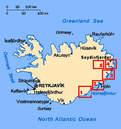
in Kirkjubæjarklaustur village, we set off eastwards on the Ring Road (click
on Map 1 right for details of route) Eastwards
from Kirkjubæjarklaustur:
before leaving Kirkjubæjarklaustur, we said farewell to the German couple who
had been our neighbours in camp here, and whom we had seen up at Lakagígur
craters yesterday. They had bravely driven the F206 mountain road in their
little 4WD Lada, and we should see them again later in September since by
coincidence they also were booked on the same return Smyril Line ferry from
Seyđisfjörđur as ourselves. Having shopped for provisions at the little stores
in Kirkjubæjarklaustur village, we set off eastwards on the Ring Road (click
on Map 1 right for details of route)
|
Click on 5 highlighted areas of
map
for details of SE Iceland |
 |
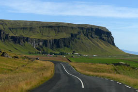
Brunasandur and Brunahraun lava field: it was a beautiful morning,
with clear blue sky and bright sunlight picking out all the details
 on the
escarpment-line
of former coastal cliffs which extended along the length of the
road across the coastal plain lowlands (see above left); here the Lower Skaftá River spread out
across Brunasandur sand/gravel flood-plain through the many-channelled Landbrotsvotn estuary towards the southern coast. Farms and their lowland
pastures lined the foot of the rocky escarpment that marked the downfall from
the inland mountains. The escarpment's dark brown stratified Palagonite tuff
rock was weathered into arrays of fantastically shaped towers and outcrops, and
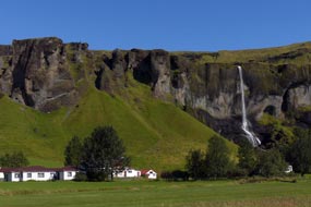
we paused close to where the Foss á Siða waterfalls tumbled over the brink of
the escarpment precipice to flow on past the farm at its foot (see left) (Photo 1 - Former coastal cliff-line). We began the
crossing of the Brunahraun lava field, now covered with Woolly Hair
Moss (Racomitrium lanuginosum), and set against the backdrop of the distant Vatnajökull ice-cap
and the nearer cliff-end of Kálfafell (see below right) (Photo 2 - Brunahraun lava field). The Brunahraun lava field was created by
the second series of eruptions when the NE Lakagígur fissure crater-row on the
escarpment-line
of former coastal cliffs which extended along the length of the
road across the coastal plain lowlands (see above left); here the Lower Skaftá River spread out
across Brunasandur sand/gravel flood-plain through the many-channelled Landbrotsvotn estuary towards the southern coast. Farms and their lowland
pastures lined the foot of the rocky escarpment that marked the downfall from
the inland mountains. The escarpment's dark brown stratified Palagonite tuff
rock was weathered into arrays of fantastically shaped towers and outcrops, and
we paused close to where the Foss á Siða waterfalls tumbled over the brink of
the escarpment precipice to flow on past the farm at its foot (see left) (Photo 1 - Former coastal cliff-line). We began the
crossing of the Brunahraun lava field, now covered with Woolly Hair
Moss (Racomitrium lanuginosum), and set against the backdrop of the distant Vatnajökull ice-cap
and the nearer cliff-end of Kálfafell (see below right) (Photo 2 - Brunahraun lava field). The Brunahraun lava field was created by
the second series of eruptions when the NE Lakagígur fissure crater-row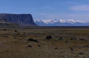 opened
up in late-July 1783, pouring out vast quantities of molten lava which flooded
down the upper gorge-valley of the Hverfisfljót river, into the lowlands
destroying and burying farms and spreading out into the Brunasandur sand/gravel
flood-plain. The eruption lasted until February 1784, producing what is believed
to be one of the most voluminous flows of lava in historical times, pouring out
an estimated 14 cubic kilometres of basalt lava which covered an area of almost
600 square kilometres of territory. opened
up in late-July 1783, pouring out vast quantities of molten lava which flooded
down the upper gorge-valley of the Hverfisfljót river, into the lowlands
destroying and burying farms and spreading out into the Brunasandur sand/gravel
flood-plain. The eruption lasted until February 1784, producing what is believed
to be one of the most voluminous flows of lava in historical times, pouring out
an estimated 14 cubic kilometres of basalt lava which covered an area of almost
600 square kilometres of territory.
 Nupsstaður 1650 turf huts and chapel:
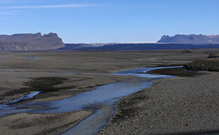
the Ring Road now approached the majestic mountainous massif of
Kálfafellsheiði with its sculpted Palagonite rock towers and pillars, at the
foot of which stood the Nupsstaður Farm. This includes several preserved
turf-roofed farm buildings dating from 1650 and typical of farms of that period,
and a turf chapel, one of the few remaining such turf churches. Although
preserved by the National Museum of Iceland, the chapel at Nupsstaður is on
private property and access even to the farm driveway was regrettably barred by a distinctly
unwelcoming locked gate. The huts and church were set back far from the Ring Road and we could only peer from a distance. Nupsstaður 1650 turf huts and chapel:
the Ring Road now approached the majestic mountainous massif of
Kálfafellsheiði with its sculpted Palagonite rock towers and pillars, at the
foot of which stood the Nupsstaður Farm. This includes several preserved
turf-roofed farm buildings dating from 1650 and typical of farms of that period,
and a turf chapel, one of the few remaining such turf churches. Although
preserved by the National Museum of Iceland, the chapel at Nupsstaður is on
private property and access even to the farm driveway was regrettably barred by a distinctly
unwelcoming locked gate. The huts and church were set back far from the Ring Road and we could only peer from a distance.
The vast wastes of Skeiðarársandur sand/gravel glacial outwash flood-plain:
Route 1 now began the crossing of the mighty Skeiðarársandur sand/gravel glacial
outwash flood-plain. The Icelandic word sandur, meaning a glacial debris
outwash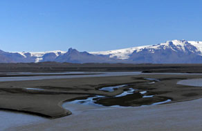 plain, is now used universally to describe this topographical
phenomenon. Skeiðarársandur is the world's largest sandur, a vast waste
of grey-black sands stretching 60kms west to east from Nupsstaður to Öræfi, and 40kms
from its source ice-cap to the coast, covering an area of 1,300 square kms. It
was created from all the silt, sand and gravel scraped up by the mighty
Skeiðarárjökull glacier, the largest of Vatnajökull ice-cap's glacial tongues.
This glacial and volcanic sediment and debris is then transported down to the
coastal plain both by the plain, is now used universally to describe this topographical
phenomenon. Skeiðarársandur is the world's largest sandur, a vast waste
of grey-black sands stretching 60kms west to east from Nupsstaður to Öræfi, and 40kms
from its source ice-cap to the coast, covering an area of 1,300 square kms. It
was created from all the silt, sand and gravel scraped up by the mighty
Skeiðarárjökull glacier, the largest of Vatnajökull ice-cap's glacial tongues.
This glacial and volcanic sediment and debris is then transported down to the
coastal plain both by the
 Skeiðará River and a myriad of other glacial rivers,
and by glacial flash-floods (jökulhlaup) fed by the Grimsvötn and
Öræfajökull volcanic systems, and dumped across the huge desert-like flood-plain
now devoid of any vegetation (see above left). From the time of Iceland's Settlement, there were
farms in the region which over time have been swallowed up by the sandur.
The great eruption of 1362 under Öræfajökull caused jökulhlaup
flash-floods which laid waste the entire region. Skeiðarársandur was an
impassable obstacle to travellers across the region until 1974, when the final
section of the Ring Road was completed with a series of bridges constructed to
span the complex network of turbulent, ever-shifting glacial rivers flowing out
from under Skeiðarárjökull. Skeiðará River and a myriad of other glacial rivers,
and by glacial flash-floods (jökulhlaup) fed by the Grimsvötn and
Öræfajökull volcanic systems, and dumped across the huge desert-like flood-plain
now devoid of any vegetation (see above left). From the time of Iceland's Settlement, there were
farms in the region which over time have been swallowed up by the sandur.
The great eruption of 1362 under Öræfajökull caused jökulhlaup
flash-floods which laid waste the entire region. Skeiðarársandur was an
impassable obstacle to travellers across the region until 1974, when the final
section of the Ring Road was completed with a series of bridges constructed to
span the complex network of turbulent, ever-shifting glacial rivers flowing out
from under Skeiðarárjökull.
Our crossing of Skeiðarársandur:
the morning was bright and sunny as we began our crossing of Skeiðarársandur (click
here for map of route),
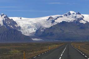
with perfect views across the awesome sand/gravel wastes to the distant Vatnajökull
ice-cap (see above right) (Photo 3 - Skeiðarársandur glacial outwash flood-plain). The scale and wilderness of the surrounding sandur
was fearsome enough, but the aggressively speeding tourist traffic made
 this an
even more stressfully hazardous driving experience; despite our observing the
90kph speed
limit, tourist cars constantly hurtled past. Given the overwhelming
volume of tourist traffic, and the cost of maintaining this precious yet
vulnerable route across the sandur's ever-shifting terrain, the this an
even more stressfully hazardous driving experience; despite our observing the
90kph speed
limit, tourist cars constantly hurtled past. Given the overwhelming
volume of tourist traffic, and the cost of maintaining this precious yet
vulnerable route across the sandur's ever-shifting terrain, the
 Icelandic Government would do well to position frequent speed cameras across this 60kms
stretch of the Ring Road. The revenue raised from speeding fines levied on
tourists or their hire car companies would constitute a viable form of tourist
taxation to contribute to the road's constant need for maintenance. The need for
maximum concentration on both the road and the speeding traffic meant that Paul
could have little appreciation of the fearsomely impressive surroundings of the
flat sand/gravel wasteland, marbled by so many melt-water channels, the distant
40kms wide glacial tongue of Skeiðarárjökull, and the eastern skyline dominated
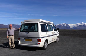
by the Vatnajökull ice-cap. Three quarters of the way across, we were able to
pull off into a lay-by for full appreciation to the wonderful vista of the
distant ice-cap against the foreground of the sandur's desolate
wasteland (see above left) (Photo 4 - Vatnajökull backdrop). Icelandic Government would do well to position frequent speed cameras across this 60kms
stretch of the Ring Road. The revenue raised from speeding fines levied on
tourists or their hire car companies would constitute a viable form of tourist
taxation to contribute to the road's constant need for maintenance. The need for
maximum concentration on both the road and the speeding traffic meant that Paul
could have little appreciation of the fearsomely impressive surroundings of the
flat sand/gravel wasteland, marbled by so many melt-water channels, the distant
40kms wide glacial tongue of Skeiðarárjökull, and the eastern skyline dominated
by the Vatnajökull ice-cap. Three quarters of the way across, we were able to
pull off into a lay-by for full appreciation to the wonderful vista of the
distant ice-cap against the foreground of the sandur's desolate
wasteland (see above left) (Photo 4 - Vatnajökull backdrop).
Almost across on the eastern side with the Vatnajökull
vista looming ever larger (see above right), road signs
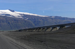
indicated speed limits where the Ring Road was being re-routed onto a temporary
unsurfaced stretch of road by-passing a new bridge construction on a lengthy embankment (see above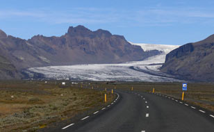 left) replacing earlier bridges washed away by the disastrous 1996 jökulhlaup
flash-flood. At the far side, we
reached a parking area by the site of the original Skeiðarárbru Bridge that had
once carried the Ring Road across the main channel of the Skeiðarár glacial
river. The impressive structure
 of the almost 1,000m long Skeiðarárbru Bridge had been a major engineering feat when
constructed in 1974~75, to complete the Ring Road's crossing of Skeiðarársandur.
Before that time, the unstable terrain of Skeiðarársandur was such an obstacle
to road construction that the Ring Road remained incomplete in this region.
Prior to 1974, this had meant that anyone from Höfn wishing to travel west by
road to Reykjavík had in fact to drive eastward anticlockwise all the way around the
Ring Road via Akureyri to reach the capital. But despite its scale, the bridge
was all to no avail: 20 years after its construction, in October 1996 Grimsvötn
erupted again under the Vatnajökull ice-cap. Geothermal heat from lava and ash
contained beneath the glacier melted a monumental mass of water which lifted the
ice-cap 10m before finally, after a month of anxious waiting, the inevitable
happened: the pressure of sub-glacial water outburst along a 300m wall of ice on
5 November 1996, sending 3 billion litres of water spewing across the sandur
in a 5m high tsunami, sweeping away a 7kms stretch of the Ring Road, despite the
long gravel dykes built to channel flood waters away from the highway. The Skeiðarárbru
Bridge was washed away like match sticks in less than an hour. At its height,
the jökulhlaup was surging down at of the almost 1,000m long Skeiðarárbru Bridge had been a major engineering feat when
constructed in 1974~75, to complete the Ring Road's crossing of Skeiðarársandur.
Before that time, the unstable terrain of Skeiðarársandur was such an obstacle
to road construction that the Ring Road remained incomplete in this region.
Prior to 1974, this had meant that anyone from Höfn wishing to travel west by
road to Reykjavík had in fact to drive eastward anticlockwise all the way around the
Ring Road via Akureyri to reach the capital. But despite its scale, the bridge
was all to no avail: 20 years after its construction, in October 1996 Grimsvötn
erupted again under the Vatnajökull ice-cap. Geothermal heat from lava and ash
contained beneath the glacier melted a monumental mass of water which lifted the
ice-cap 10m before finally, after a month of anxious waiting, the inevitable
happened: the pressure of sub-glacial water outburst along a 300m wall of ice on
5 November 1996, sending 3 billion litres of water spewing across the sandur
in a 5m high tsunami, sweeping away a 7kms stretch of the Ring Road, despite the
long gravel dykes built to channel flood waters away from the highway. The Skeiðarárbru
Bridge was washed away like match sticks in less than an hour. At its height,
the jökulhlaup was surging down at
 50,000m3 per second, carrying with it enormous
chunks of glacial ice and boulders ripped from Skeiðarárjökull out across the
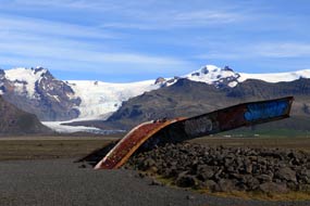
flooded sandur down to the ocean. The twisted girders of the bridge, all
that remained after the destruction, stand today as testament to the fury of the 1996 jökulhlaup
flash-flood, which demonstrated how 50,000m3 per second, carrying with it enormous
chunks of glacial ice and boulders ripped from Skeiðarárjökull out across the
flooded sandur down to the ocean. The twisted girders of the bridge, all
that remained after the destruction, stand today as testament to the fury of the 1996 jökulhlaup
flash-flood, which demonstrated how 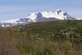 vulnerable this stretch of the Ring Road was
(see above left)
(Photo 5 - Destroyed bridge memorial). vulnerable this stretch of the Ring Road was
(see above left)
(Photo 5 - Destroyed bridge memorial).
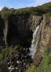
Hundafoss and Svartifoss waterfalls on Skaftafell:
we continued around the Ring Road, with the magnificent vista of Skaftafellsjökull looming ahead, the glacier snaking around between the crested
ridges of Skarðdartindur and Hafrafell down from the high snowfields of Vatnajökull
ice-cap (see above right). Turning off to Skaftafell National Park Visitor
Centre, we confirmed routes for our planned circular
walk this afternoon up to Svartifoss waterfalls and Skaftafell. We had imagined from the map this to be, if not a difficult climb, at least
to involve challenging route-finding in wild country. In fact, as the lad at the Visitor
Centre had advised, you simply 'follow the rubber mat road', meaning the
broad trackway rubber-reinforced for anti-erosion protection, and the hordes of tourists!
Kitting up at the parking area, we set off. The route began from the
National Park Centre, sloping uphill onto
the Skaftafellsheiði moorland and passing the Hundafoss waterfalls which dropped into
a tree-lined gorge (see right) (Photo
6 - Hundafoss waterfalls). The fellside path gained height
passing bushes of Angelica, to reveal increasing views eastwards across to the
snowfields of Öræfajökull which graced the jagged peaks of 2110m high Hvannadalsnúkur (Photo
7 - Öræfajökull topping 2110m high Hvannadalsnúkur) (see above left). Further height gain brought
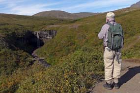
a distant view of Svartifoss dropping into its basalt column-lined cove (see below
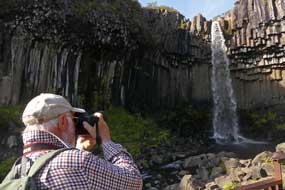
left). Scrambling down into the hollow enabled us to examine at close quarters
the magnificent vista of
 Svartifoss waterfalls dropping from the fellside above
into the cove, surrounded by the most elegant basalt columnar array
(Photo
8 - Svartifoss and its basalt columns) (see below right). Basalt columns are formed as contraction
forces build up in rapidly cooling basaltic lava Svartifoss waterfalls dropping from the fellside above
into the cove, surrounded by the most elegant basalt columnar array
(Photo
8 - Svartifoss and its basalt columns) (see below right). Basalt columns are formed as contraction
forces build up in rapidly cooling basaltic lava
 flow; shrinkage contraction causes the new igneous rock to develop fracture networks resulting in formation of the
6-sided columns. The columns always form at right angles to the cooling surface
where heat loss is greatest (see diagram below right); this means that vertical
columns are created when a basaltic lava intrusion flows into horizontal cracks in the
bed-rock (sills), and horizontal columns when the lava intrusion flows into vertical cracks
(dykes). Where the cooling surface is irregular, the columns radiate in many
directions. Hexagonal columns are the most common since fracture patterns with
120º corners are the most efficient for stress resistance as in dried up muddy
ponds, or freeze-thaw patterns in the ground. Hence 6-sided patterns are seen
widely in nature as the most efficient close-packing use of space (eg honeycombs).
Whatever the technical geological explanation of basalt column formation, there
was no denying the beauty in their visual aesthetics and the elegance of the
columns' symmetry, seen to best effect here at Svartifoss.
 Skaftafell:
leaving the tourists to their silly antics around the falls, we crossed the
stream descending from Svartifoss to begin the climb up onto the open heath-land
of Skaftafellsheiði. As we crossed the foot-bridge, a little Icelandic Wren
hopped around on Skaftafell:
leaving the tourists to their silly antics around the falls, we crossed the
stream descending from Svartifoss to begin the climb up onto the open heath-land
of Skaftafellsheiði. As we crossed the foot-bridge, a little Icelandic Wren
hopped around on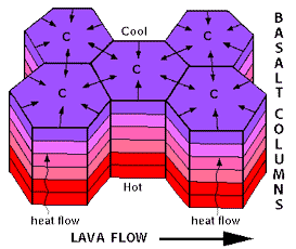 the boulders beneath our feet. Emerging
onto the open moorland
brought us out onto
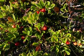
a peaceful fell-side carpeted with low birch and willow scrub and a ground cover of
Crowberry and Bearberry with its ripening red berries (see left) (Photo
9 - Bearberry). Our photographic attention was divided between the
ground cover berries and the magnificent panorama N towards the Vatnajökull
ice-cap, and NW over to the distant jagged, crested peak and ridges of Hvannadalsnúkur,
Iceland's highest mountain at 2110m, and the nearer shapely ridge of Hafrafell
which now divides Skaftafellsjökull from its neighbouring outlet glacier of
Svinafellsjökull (see below left) (Photo
10 - Hvannadalsnúkur and Hafrafell).
Further height gain up the open heath-land
slope brought us to the high point of Sjónarsker; from here a sweeping
panorama opened up westwards to where the broad front of Skeiðarárjökull outlet
glacier crept down towards the vast open outwash flood-plain of Skeiðarársandur
which stretched away towards the coast on the misty southern horizon. Even
further
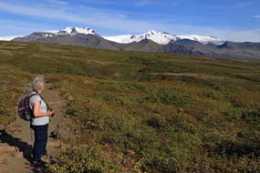 westwards,
we could just make out the moss-covered Brunahraun lava field catching the
afternoon sun. Beginning the descent, we followed way-marked tracks, still with
much height to loose. The path descended through high birch scrub alongside the Bæjargil stream dropping down the deep, rocky gorge below Hundafoss. At the foot
of this, a path crossed the beck on a wooden footbridge, leading back through the Skaftafell campsite to the Visitor Centre. westwards,
we could just make out the moss-covered Brunahraun lava field catching the
afternoon sun. Beginning the descent, we followed way-marked tracks, still with
much height to loose. The path descended through high birch scrub alongside the Bæjargil stream dropping down the deep, rocky gorge below Hundafoss. At the foot
of this, a path crossed the beck on a wooden footbridge, leading back through the Skaftafell campsite to the Visitor Centre.
 Svinafellsjökull glacier snout and lagoon: back out to the Ring
Road, we crossed the glacial River Skaftafellsá which pours down from the Skaftafellsjökull
outlet glacier, and turned off onto a rough and pot-holed gravel track-way which
led across the grey terminal moraine (click
here for map of route). The roadway rounded
moraine hillocks to end at a small parking area beneath the prow-end tip of the
Hafrafell ridge, and from here a path led over
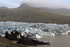
the rocks to overlook Skaftafellsjökull's glacial lagoon. Misty cloud now
hovered around the surrounding mountains, giving the enclosed snout of the
glacier a gloomy and eerily silent atmosphere (see right). The grey, sediment-rich icy water
was backed by the blue-grey glacial snout, with the occasional splash as chunks
of ice fell from the glacier's end walls into the lagoon. We edged a way
uncertainly upwards over the rocky side-shelf, to gain a clearer view onto the
sediment-stained lower ice-field which was fractured by crevasses, the more open
ice-cliffs glowing a vivid Svinafellsjökull glacier snout and lagoon: back out to the Ring
Road, we crossed the glacial River Skaftafellsá which pours down from the Skaftafellsjökull
outlet glacier, and turned off onto a rough and pot-holed gravel track-way which
led across the grey terminal moraine (click
here for map of route). The roadway rounded
moraine hillocks to end at a small parking area beneath the prow-end tip of the
Hafrafell ridge, and from here a path led over
the rocks to overlook Skaftafellsjökull's glacial lagoon. Misty cloud now
hovered around the surrounding mountains, giving the enclosed snout of the
glacier a gloomy and eerily silent atmosphere (see right). The grey, sediment-rich icy water
was backed by the blue-grey glacial snout, with the occasional splash as chunks
of ice fell from the glacier's end walls into the lagoon. We edged a way
uncertainly upwards over the rocky side-shelf, to gain a clearer view onto the
sediment-stained lower ice-field which was fractured by crevasses, the more open
ice-cliffs glowing a vivid
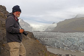 aquamarine blue. The only sound to disturb the eerie
silence was the cracking and groaning of the ice, and the occasional splash as
chunks of ice broke off into the lagoon. In the murky northern distance,
the upper end of the outlet glacier's lower ice-field, enclosed by the craggy
side of Hafrafell, rose seemingly vertical onto the main ice-cap of Vatnajökull (Photo
11 - Svinafellsjökull outlet-glacier) (see left and below right). This was a truly fearful,
heart-stopping vista to savour in undisturbed silence. Edging our way back over
the rock-shelf above the sheer drop into the lagoon's icy-cold, grey waters, we
passed a lone young aquamarine blue. The only sound to disturb the eerie
silence was the cracking and groaning of the ice, and the occasional splash as
chunks of ice broke off into the lagoon. In the murky northern distance,
the upper end of the outlet glacier's lower ice-field, enclosed by the craggy
side of Hafrafell, rose seemingly vertical onto the main ice-cap of Vatnajökull (Photo
11 - Svinafellsjökull outlet-glacier) (see left and below right). This was a truly fearful,
heart-stopping vista to savour in undisturbed silence. Edging our way back over
the rock-shelf above the sheer drop into the lagoon's icy-cold, grey waters, we
passed a lone young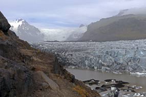 German visitor who, with quaintly charming, old fashioned
courtesy offered Sheila an assisting hand, and took our photo against
this astonishing glacial backdrop (Photo
12 - Svinafellsjökull glacier snout) (see below left).
Skaftafell National Park campsite:
we bumped our way back to the Ring Road and drove eastwards in now murky light
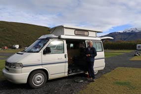
to investigate what appeared to be the preferred campsite option at Svinafell Farm. Just off the main road under the brooding shadow of Hvannadalsnúkur
and Öræfajökull way above hidden in the misty cloud, there had been a farmstead
here at Svinafell going right back to Njál's Saga times. where settlers had
attempted to eke out a living.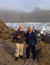 The little campsite was well laid out with straightforward facilities, but
unfortunately no power supplies. Although more attractive and better value than
the National Park campsite at Skaftafell, to face days in camp in this chill,
wet weather here at Svinafell without power was not an option. We therefore with
regret returned around to Skaftafell, reaching the reception at 7-00pm. As with
the equivalent Jökulsárgljúfur National
Park campsite at Asbyrgi in the north, the National Park Authority exploited its
almost monopolistic position to charge off-the-planet prices for camping here
at Skaftafell: 1,600kr/person (no seniors' discount), 900kr for power, plus
500kr for showers, making a potential total of 5,100kr (£40). The lad at
reception responded to our protestations in typical Jobsworth manner with I
just work here, I don't make the rules. We had our own means however of
dealing with such a monopolistic rip-off!
 Fearing we should be hemmed in by camping-cars,
we found a pitch in the corner of a formally laid out enclosure, with clear views
over towards the two outlet glaciers of Skaftafellsjökull and Svinafellsjökull
(see right); the intervening ridge-line of Hafrafell
was topped by the serrated peaks of Hvannadalsnúkur
and beyond, the upper ice-fields of Öræfajökull. With the trip's timescale ticking
towards its conclusion and Iceland's autumnal weather now closing in, we lit the
final barbecue for supper, and settled in on a very dark evening. Fearing we should be hemmed in by camping-cars,
we found a pitch in the corner of a formally laid out enclosure, with clear views
over towards the two outlet glaciers of Skaftafellsjökull and Svinafellsjökull
(see right); the intervening ridge-line of Hafrafell
was topped by the serrated peaks of Hvannadalsnúkur
and beyond, the upper ice-fields of Öræfajökull. With the trip's timescale ticking
towards its conclusion and Iceland's autumnal weather now closing in, we lit the
final barbecue for supper, and settled in on a very dark evening.
A wet day in camp at Skaftafell:
today was the first of several forecast wet days, to be spent in camp here at
Skaftafell, catching up after an intensive period of travel. If only the
National Park had provided facilities at its Skaftafell campsite of a
commensurate standard with its grossly inflated prices, but of course it didn't!
Given the size of the campsite, facilities were basic and unduly limited: just 2
WCs, with a queue of wet and bedraggled campers queuing outside in the rain to
use them, 2 showers largely unused given the
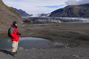 excessive additional cost, and one
wash-up sink with lukewarm water. There were absolutely no cooking facilities or
covered area for shelter for the large number of tent campers. Given this, and
the extortionate prices charged by the fat-cat National Park bureaucrats from
Reykjavík who run the campsite, Skaftafell
was an absolute disgrace deserving the negative rating we gave it. But of course
as with any monopoly, the consumer has no choice but to pay up, or like us play
them at their own game! excessive additional cost, and one
wash-up sink with lukewarm water. There were absolutely no cooking facilities or
covered area for shelter for the large number of tent campers. Given this, and
the extortionate prices charged by the fat-cat National Park bureaucrats from
Reykjavík who run the campsite, Skaftafell
was an absolute disgrace deserving the negative rating we gave it. But of course
as with any monopoly, the consumer has no choice but to pay up, or like us play
them at their own game!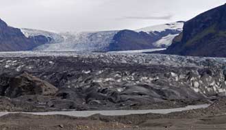
Skaftafellsjökull terminal moraine and glacial snout:
with a fine day forecast before the next lot of rain rolled in tomorrow, we
planned today to walk out across the glacial outwash plain and terminal moraine
fields to the lagoon and snout of the larger Skaftafellsjökull. The tongues of Vatnajökull's
two southern outlet glaciers, Skaftafellsjökull and Svinafellsjökull, once
merged along this valley below the leading prow-edge of Hafrafell's ridge as is
shown on a Danish 1904 geological survey map
(Click here for 1904 map of merged glaciers). But since that
time, the two glaciers have retreated substantially during the 20th century,
gradually exposing the land along the lower valley. Contrast the 1904 map with
the equivalent 2017 map which shows the scale of the two now separated glaciers'
retreat (Click here for 2017 map of glaciers' retreat).
This 2017 map shows both the route of our earlier visit to the terminal snout of Svinafellsjökull
along the rough track, and
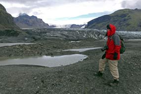 today's walk from the National Park Visitor Centre
(Skaftafellsstofa) along Skaftafellsjökull's now exposed outwash plain to its
glacial snout and terminal lagoon. Vegetation has gradually
colonised the outwash plain and moraine left behind by the retreating ice with a
succession of plant species. At the 1904 level of the retreating ice at the open
outer end of the valley, the vegetation was now lush with birch and willow scrub
and Crowberry ground-cover and Bearberry with its bright red berries. today's walk from the National Park Visitor Centre
(Skaftafellsstofa) along Skaftafellsjökull's now exposed outwash plain to its
glacial snout and terminal lagoon. Vegetation has gradually
colonised the outwash plain and moraine left behind by the retreating ice with a
succession of plant species. At the 1904 level of the retreating ice at the open
outer end of the valley, the vegetation was now lush with birch and willow scrub
and Crowberry ground-cover and Bearberry with its bright red berries.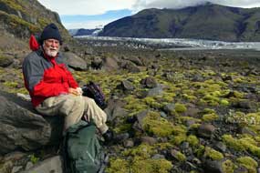 As we
moved up the valley however, the vegetation became progressively less diverse
and more stunted, with finally the most recently exposed moraine close to the
terminal lagoon being bare grey gravel deposit. As we
moved up the valley however, the vegetation became progressively less diverse
and more stunted, with finally the most recently exposed moraine close to the
terminal lagoon being bare grey gravel deposit.
We walked along the moraine valley at a
leisurely pace enjoying the wealth of flora, and at the inner end rose up onto
the bare ridge of moraine gravel. There before us was the most recent vast area
of bare, grey gravel and sand, exposed from the glacier's terminal from 1980
onwards, the flatness of this 'new land' indicating that in the last 35 years,
the ice had melted and Skaftafellsjökull retreated at a faster rate than
previously. Earlier in the comparative shelter of the moraine valley, it had
felt quite warm; but now on this higher, more exposed vantage point, the cold
air blowing down from the higher ice-field suddenly hit us. We quickly donned
jackets, muffs and hats in the now very chill breeze. But the view! Utterly
awe-inspiring, looking across the broad glacial lagoon where small, recently
detached icebergs from the
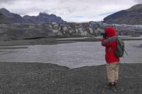 glacier's leading edge floated in the sediment-laden,
grey waters (see above left and right) (Photo
13 - Skaftafellsjökull glacial snout). And rising up from the lagoon, the nearest corner of the glacial
ice snout was filthy grey with sediment. Further up, the crevasse-scarred,
cleaner ice gleamed a bright aquamarine blue, while higher still, the upper
reached of Skaftafellsjökull rose steeply in the distance towards the
ice-field of Vatnajökull. We stood admiring this glacier's leading edge floated in the sediment-laden,
grey waters (see above left and right) (Photo
13 - Skaftafellsjökull glacial snout). And rising up from the lagoon, the nearest corner of the glacial
ice snout was filthy grey with sediment. Further up, the crevasse-scarred,
cleaner ice gleamed a bright aquamarine blue, while higher still, the upper
reached of Skaftafellsjökull rose steeply in the distance towards the
ice-field of Vatnajökull. We stood admiring this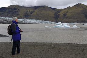 fairy-tale ice-scape and
speculated on the causes of the snout end being so filthy: sediment scoured out
from the bed-rock over aeons by the glacier's downward movement, ash fallout
from nearby volcanic eruptions, or wind-blown fine particulate material from the
moraine field all being concentrated at the glacier's melting leading-edge.
Alongside the high mounds and moraine ridge where we stood, two large
kettle-holes showed where huge blocks of ice, broken off from the glacier's
snout at an earlier stage and left behind by the retreating glacier, became
buried in the till (glacier-borne sediment) or fluvio-glacial deposits (sediment
carried by glacial rivers); the ice blocks eventually melted to leave large
depressions in the outwash plain which filled with water, forming lakes (see above
left). fairy-tale ice-scape and
speculated on the causes of the snout end being so filthy: sediment scoured out
from the bed-rock over aeons by the glacier's downward movement, ash fallout
from nearby volcanic eruptions, or wind-blown fine particulate material from the
moraine field all being concentrated at the glacier's melting leading-edge.
Alongside the high mounds and moraine ridge where we stood, two large
kettle-holes showed where huge blocks of ice, broken off from the glacier's
snout at an earlier stage and left behind by the retreating glacier, became
buried in the till (glacier-borne sediment) or fluvio-glacial deposits (sediment
carried by glacial rivers); the ice blocks eventually melted to leave large
depressions in the outwash plain which filled with water, forming lakes (see above
left).
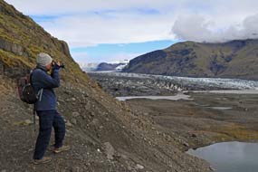 Around the
top of the moraine ridge, an area of
moss-covered boulders provided another unique spot for eating our lunch
sandwiches, as we sat looking up across the glacier's tongue dropping down from
the Vatnajökull snow fields (Photo
14 - Lunch on lateral moraine) (see above right). From here we descended onto the flat
wash-out moraine field across to the edge of the terminal lagoon. Melt-water
surged at a terrifying rate from under the leading edge of the ice (see above
left), and further
round sunlight picked out the floating icebergs giving them an aquamarine tinge Around the
top of the moraine ridge, an area of
moss-covered boulders provided another unique spot for eating our lunch
sandwiches, as we sat looking up across the glacier's tongue dropping down from
the Vatnajökull snow fields (Photo
14 - Lunch on lateral moraine) (see above right). From here we descended onto the flat
wash-out moraine field across to the edge of the terminal lagoon. Melt-water
surged at a terrifying rate from under the leading edge of the ice (see above
left), and further
round sunlight picked out the floating icebergs giving them an aquamarine tinge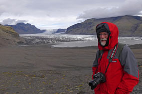 (see above right) (Photo
15 - Glacial icebergs).
Back up onto the high moraine ridge, we followed this around to a point which
gave a fuller view across the ice-filled corner of the lagoon up onto the full
sweep of the glacier's upper ice-field
(Photo
16 - Skaftafellsjökull's full sweep) (see left and right). From here, escaping all the noise of the
tourists now flocking along the valley in increasing numbers, we followed an
alternative route back across the moraine-field; the further we moved away from Skaftafellsjökull's
current leading-edge, the more lush the vegetation and flora became (see below left), and warmer the air noticeably
felt.
Another wet day at Skaftafell Camping:
back at the Skaftafell Visitor Centre, we had hoped to see the video
showing the devastation caused by the 1996 jökulhlaup
flash-flood. But, a sign of the times, this was no longer available, replaced by
a tourist-oriented, dumbed-down superficial film on the
 National Park;
disappointed we returned to the campsite. Today had been a thoroughly educative
day out at the glacier's edge, enabling good opportunity for glacial
photography. As dusk approached and gloomy darkness fell, misty cloud gathered
and drizzly rain began as a prelude to tomorrow's forecast louring rain; and the
tourist hire cars and camping-cars swarmed in with much slamming of car doors
until late into the evening. The following day was only fit for National Park;
disappointed we returned to the campsite. Today had been a thoroughly educative
day out at the glacier's edge, enabling good opportunity for glacial
photography. As dusk approached and gloomy darkness fell, misty cloud gathered
and drizzly rain began as a prelude to tomorrow's forecast louring rain; and the
tourist hire cars and camping-cars swarmed in with much slamming of car doors
until late into the evening. The following day was only fit for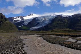 another day in
camp, and the rain continued well into the morning; we still had much catching
up to do and put the wet day to good use. The rain eased early afternoon and sky
cleared a little, enabling us at least to get washing up done without a soaking,
but early evening the clouds gathered again over the surrounding mountains, and
rain began again driven by the south-easterly gale. The pouring rain continued
all evening on a very dark and wretchedly wet night. another day in
camp, and the rain continued well into the morning; we still had much catching
up to do and put the wet day to good use. The rain eased early afternoon and sky
cleared a little, enabling us at least to get washing up done without a soaking,
but early evening the clouds gathered again over the surrounding mountains, and
rain began again driven by the south-easterly gale. The pouring rain continued
all evening on a very dark and wretchedly wet night.
The Öræfi wasteland and turf-roofed church at Hof:
it rained solidly all night, but by the time we woke the following morning the sky
was beginning to clear, and as we sat eating breakfast, the sun broke through
bringing a restorative warmth. It was for the moment a beautiful morning after
all the rain. Leaving Skaftafell (click
here for map of route), Route 1 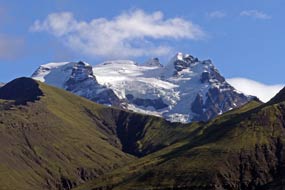 Ring Rind crossed the main,
fast-flowing and sediment-laden Skaftafellsá glacial river pouring out from Skaftafellsjökull and Svinafellsjökull (see right)
(Photo
17 - Skaftafellsá glacial river).
We headed south under the slopes of the mighty peak of Hvannadalsnúkur and across the partly vegetated wasteland of Öræfi
(see left)
(Photo
18 - Hvannadalsnúkur, Iceland's highest peak). The peak's ridges, protruding
from the equally formidable Öræfajökull (Photo
19 - Öræfajökull glacier) (see below right), form the NW edge of an immense 5kms
wide caldera, the biggest Ring Rind crossed the main,
fast-flowing and sediment-laden Skaftafellsá glacial river pouring out from Skaftafellsjökull and Svinafellsjökull (see right)
(Photo
17 - Skaftafellsá glacial river).
We headed south under the slopes of the mighty peak of Hvannadalsnúkur and across the partly vegetated wasteland of Öræfi
(see left)
(Photo
18 - Hvannadalsnúkur, Iceland's highest peak). The peak's ridges, protruding
from the equally formidable Öræfajökull (Photo
19 - Öræfajökull glacier) (see below right), form the NW edge of an immense 5kms
wide caldera, the biggest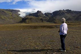 active volcano in Europe after Etna. The
glacier-covered Öræfajökull volcano erupted explosively in 1362 ejecting huge
amounts of tephra, and obliterated the entire region with floods and tephra-fall
and causing its total abandonment; the name Öræfi in Icelandic has come to
mean Desolation. This had always been an isolated region, cut off by the
impassable sandur to east and west, by the mountainous interior and
ice-caps to the north, and by a harbourless wild coastline to the south.
Before rounding the southern tip of the Öræfi
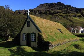
headland, the road reached the tiny farming hamlet of Hof which nestles into the
protective mountainous cliffs; on a sunny morning with the clear sky a deep
blue, the farmstead looked a tiny green oasis in this
 inhospitable
wasteland, surrounded by its pastureland. We turned off Route 1 to the
settlement to visit the little turf-roofed Hof church. Built on the foundations
of an earlier 14th century church, the current church at Hof dates from 1884.
The turf-covered roof slopes down to the thick stone side walls, and the 2
gable-ends are built of timber. The church and graveyard stood in a grove of birch
and rowan and were backed by the Öræfajökull mountains, lit by the lovely morning sunshine
(Photo
20 - Turf-roofed Hof church) (see left). Having taken our photos, we
returned to the Ring Road to continue our journey. inhospitable
wasteland, surrounded by its pastureland. We turned off Route 1 to the
settlement to visit the little turf-roofed Hof church. Built on the foundations
of an earlier 14th century church, the current church at Hof dates from 1884.
The turf-covered roof slopes down to the thick stone side walls, and the 2
gable-ends are built of timber. The church and graveyard stood in a grove of birch
and rowan and were backed by the Öræfajökull mountains, lit by the lovely morning sunshine
(Photo
20 - Turf-roofed Hof church) (see left). Having taken our photos, we
returned to the Ring Road to continue our journey.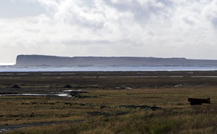
Eastern Skeiðarársandur, Ingólfshöfði and Kviárjökull:
Rounding the southern tip of Öræfi, and looking out across the easternmost
wastes of Skeiðarársandur, the skyline was dominated by the massive headland of Ingólfshöfði,
the cape terminating the sandbar which extends along the outer width of the
Leirur outwash-plain (see right). The headland is named after Iceland's legendary first
settler, Ingólfur Arnasson, who is said to have made his original landfall here
in 874 AD before sailing on to found his farm at what became Reykjavík. The
isolated headland is now a nature reserve for nesting sea birds, mainly Puffins
and Great Skuas, and the local
 farm operates tractor tours across the
treacherous sandur and marshes. We paused at the turning from the Ring
Road to gaze across the Skeiðarársandur outwash-plain at the silhouetted
headland. Continuing on Route 1 (click
here for map of route), rounding the sweep of dramatic glacier-topped
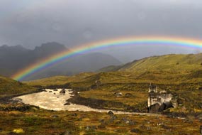
mountains, with the weather now heavily overcast, we reached the turning for Kviárjökull,
just before the bridge across the Kvíá river pouring down from the glacier. 300m along a bumpy dirt road, we paused at
a parking area alongside the glacial river to eat our lunch sandwiches and to
wait for a squally shower to pass. The sky had darkened and a rainbow spanned
the misty fell-side and savage farm operates tractor tours across the
treacherous sandur and marshes. We paused at the turning from the Ring
Road to gaze across the Skeiðarársandur outwash-plain at the silhouetted
headland. Continuing on Route 1 (click
here for map of route), rounding the sweep of dramatic glacier-topped
mountains, with the weather now heavily overcast, we reached the turning for Kviárjökull,
just before the bridge across the Kvíá river pouring down from the glacier. 300m along a bumpy dirt road, we paused at
a parking area alongside the glacial river to eat our lunch sandwiches and to
wait for a squally shower to pass. The sky had darkened and a rainbow spanned
the misty fell-side and savage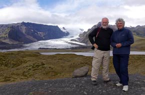 mountainous backdrop
(see left) (Photo
21 - Rainbow over Kvíá glacial river). When the storm passed, we walked
up over the hillocks of the lower valley for the magnificent vista of Kviárjökull,
one of Öræfajökull's principal outlet glaciers,
snaking its way elegantly down between the enclosing peaks, (see right) (Photo
22 - Kviárjökull, outlet glacier of Öræfajökull). mountainous backdrop
(see left) (Photo
21 - Rainbow over Kvíá glacial river). When the storm passed, we walked
up over the hillocks of the lower valley for the magnificent vista of Kviárjökull,
one of Öræfajökull's principal outlet glaciers,
snaking its way elegantly down between the enclosing peaks, (see right) (Photo
22 - Kviárjökull, outlet glacier of Öræfajökull).
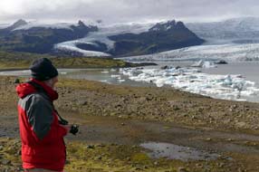
Fjallsjökull glacier and Fjallsárlón glacial
lagoon:
a short distance along this desolate coastline, a turning led to the glacial
lagoons of Fjallsárlón and Breiðárlón (click
here for map of route). The first of these lagoons lies at the
foot of Fjallsjökull glacier and the smaller adjacent Hrútárjökull both of which
glaciers, along with Kviárjökull, are outlet glaciers of Öræfajökull. The
neighbouring
 and broader fronted Breiðamerkurjökull drains down into Breiðárlón
and Jökulsárlón lagoons. Both parent glaciers Öræfajökull and Breiðamerkurjökull,
along with many other glaciers, themselves form outlet-glaciers of the grandfather of
them all, the mighty Vatnajökull ice-cap; Iceland's largest glacier, Vatnajökull covers an area of over 8,000 square kms (8% of the
country), 1,000m deep at its thickest point, and also Europe's greatest ice mass. and broader fronted Breiðamerkurjökull drains down into Breiðárlón
and Jökulsárlón lagoons. Both parent glaciers Öræfajökull and Breiðamerkurjökull,
along with many other glaciers, themselves form outlet-glaciers of the grandfather of
them all, the mighty Vatnajökull ice-cap; Iceland's largest glacier, Vatnajökull covers an area of over 8,000 square kms (8% of the
country), 1,000m deep at its thickest point, and also Europe's greatest ice mass.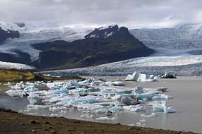
A rough trackway forked right to Breiðárlón,
but we took the left fork to a parking area below Fjallsárlón. Climbing up onto
the terminal moraine gravelly hillock, the magnificent vista opened up of the
twin glaciers of Fjallsjökull and Hrútárjökull (Photo
23 - Hrútárjökull and Fjallsjökull) (see left); these both snaked down the hillside
opposite between enclosing ridges, from the distant higher snowfields of Öræfajökull, down to the
fractured and crevasse-ridden leading-edge of the grey-streaked and aquamarine-blue
ice tongue above the huge glacial lagoon (see right) (Photo
24 - Fjallsárlón glacial lagoon). The lagoon itself was filled with
ice-bergs of every size and shape, which had calved from the glacier ice's
leading edge (Photo
25 - Icebergs floating on Fjallsárlón) (see below
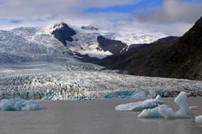 left), and now floated in graceful silence
around the lagoon (Photo
26- Floating glacial icebergs). We clambered down the steep, gravelly slope to
the water's edge to gaze out across the glacial lagoon and the floating armada
of icebergs (see below right) (Photo
27- Fjallsjökull and distant Öræfajökull), many melted into fantastic
shapes (see below left); one resembled a swan with curving neck, another a
narrow stemmed mushroom. Every so often, the silence was broken by
a distant rumble and crash just like thunder, as further huge chunks of ice broke
from the markedly turquoise-blue leading-edge left), and now floated in graceful silence
around the lagoon (Photo
26- Floating glacial icebergs). We clambered down the steep, gravelly slope to
the water's edge to gaze out across the glacial lagoon and the floating armada
of icebergs (see below right) (Photo
27- Fjallsjökull and distant Öræfajökull), many melted into fantastic
shapes (see below left); one resembled a swan with curving neck, another a
narrow stemmed mushroom. Every so often, the silence was broken by
a distant rumble and crash just like thunder, as further huge chunks of ice broke
from the markedly turquoise-blue leading-edge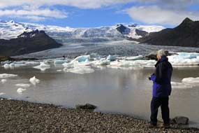 of the glacier's ice (Photo
28 - Fragmented glacier leading-edge), sending mini-tsunamis flooding across the sediment-grey water. A chilling cold wind blew across the
lagoon from
the glacier as we stood to take our photos (Photo
29 - Chill glacial wind). Chunks of the crystal clear ice floated
onto the shore-line, and picking up these pieces of glacial ice (Photo
30 - Glacial ice), it was intriguing to wonder just how old they were or
from which part of the glacier they had broken. Considering the number of
tourist cars at the parking area, we were fortunate to enjoy a remarkably
peaceful and undisturbed hour by the shore-side, looking out across the lagoon (Photo
31- Fjallsjökull glacial slopes) to the floating icebergs, and the
glacial slopes and snow fields beyond. of the glacier's ice (Photo
28 - Fragmented glacier leading-edge), sending mini-tsunamis flooding across the sediment-grey water. A chilling cold wind blew across the
lagoon from
the glacier as we stood to take our photos (Photo
29 - Chill glacial wind). Chunks of the crystal clear ice floated
onto the shore-line, and picking up these pieces of glacial ice (Photo
30 - Glacial ice), it was intriguing to wonder just how old they were or
from which part of the glacier they had broken. Considering the number of
tourist cars at the parking area, we were fortunate to enjoy a remarkably
peaceful and undisturbed hour by the shore-side, looking out across the lagoon (Photo
31- Fjallsjökull glacial slopes) to the floating icebergs, and the
glacial slopes and snow fields beyond.
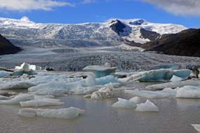 Jökulsárlón glacial lagoon and
Jökulsá River:
10kms east along the Ring Road brought us to the bridge over the Jökulsá River
which drained down seaward from the Jökulsárlón glacial lagoon (click
here for map of route). The parking area
on the far side was over-spilling with tourist cars and tour-buses; we therefore
turned off into the less crowded parking area on the western side of the bridge.
Again we followed a pathway around the gravelly moraine slopes overlooking the Jökulsárlón Jökulsárlón glacial lagoon and
Jökulsá River:
10kms east along the Ring Road brought us to the bridge over the Jökulsá River
which drained down seaward from the Jökulsárlón glacial lagoon (click
here for map of route). The parking area
on the far side was over-spilling with tourist cars and tour-buses; we therefore
turned off into the less crowded parking area on the western side of the bridge.
Again we followed a pathway around the gravelly moraine slopes overlooking the Jökulsárlón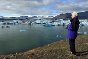 glacial lagoon
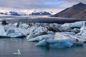
(see below right) (Photo 32 - Jökulsárlón glacial lagoon). Until the 1940s, all these glaciers were merged into
one with its leading edge stretching right down to the coast where icebergs
calved directly into the North Atlantic Ocean. As the glaciers receded, they formed
their own individual identities over the last 70 years, each with their own glacial
lagoon where the ice had gouged out depressions in the terminal moraine below
the glacial tongue; these filled with sediment-laden melt-water and giant
chunks of ice breaking from the glaciers' ends. The Jökulsá River, just 50m long,
now drains down from Jökulsárlón to the sea, and smaller ice-boulders swirled
around in the surging current (Photo
33 - Swirling ice-boulders), performing a merry-go-round dance where the
down-flow of glacial melt-water met the opposing incoming tidal wash from the
sea just 50m away. Across the Jökulsárlón lagoon, icebergs and
ice-boulders of every size and shape, some massive, others just small glacial lagoon
(see below right) (Photo 32 - Jökulsárlón glacial lagoon). Until the 1940s, all these glaciers were merged into
one with its leading edge stretching right down to the coast where icebergs
calved directly into the North Atlantic Ocean. As the glaciers receded, they formed
their own individual identities over the last 70 years, each with their own glacial
lagoon where the ice had gouged out depressions in the terminal moraine below
the glacial tongue; these filled with sediment-laden melt-water and giant
chunks of ice breaking from the glaciers' ends. The Jökulsá River, just 50m long,
now drains down from Jökulsárlón to the sea, and smaller ice-boulders swirled
around in the surging current (Photo
33 - Swirling ice-boulders), performing a merry-go-round dance where the
down-flow of glacial melt-water met the opposing incoming tidal wash from the
sea just 50m away. Across the Jökulsárlón lagoon, icebergs and
ice-boulders of every size and shape, some massive, others just small
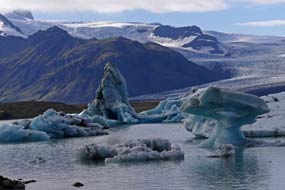 chunks,
floated around the lagoon water; some were stationary, others glided silently
around. Some smaller pieces were sparklingly crystal clear, other larger pieces
were streaked with volcanic ash fallout (Photo
34 - Volcanic ash-streaked icebergs), while others were vivid
aquamarine-blue. This blue colour of the ice indicated a smooth surface with few
trapped air bubbles, due either to having been subjected to severe pressure or
having partially melted under water. Again many of the icebergs were
melting into chunks,
floated around the lagoon water; some were stationary, others glided silently
around. Some smaller pieces were sparklingly crystal clear, other larger pieces
were streaked with volcanic ash fallout (Photo
34 - Volcanic ash-streaked icebergs), while others were vivid
aquamarine-blue. This blue colour of the ice indicated a smooth surface with few
trapped air bubbles, due either to having been subjected to severe pressure or
having partially melted under water. Again many of the icebergs were
melting into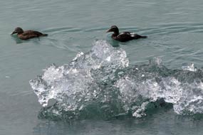 weird shapes (Photo
35 - Weirdly shaped glacial icebergs) (see left), and as the current
picked up individual bergs, they moved rapidly towards the river's exit channel;
most however remained
stationary in majestic silence (see below left). Seals could be seen swimming around the lagoon
among the floating chunks of ice, their snouts just protruding from the water,
and Eider ducks bobbed around closer to the shore-line (see right). All of this was
happening against the backdrop of the great sweep of the Breiðamerkurjökull
glacier which loomed down from the higher ice-fields (Photo
36 - Breiðamerkurjökull glacier).
We spent another hour walking along the moraine slopes above the lagoon taking our photos. Remarkably,
despite the hordes of tourists who flock here in swarms, we managed to find
peace and seclusion in this western area of the Jökulsárlón lagoon to enjoy this
magnificent spectacle without disturbance or intrusion.
 Ice 'diamonds' on Jökulsá River black sand beach:
back across the moraine fields, we crossed the Ring Road to walk the short stretch across the black sands down to the Ocean
shore-line by the Jökulsá River's outflow into the sea. Here the air was filled
with the booming roar of the mighty Atlantic surf which crashed onto the fine
black sand beach. But even more of a remarkable spectacle was the array Ice 'diamonds' on Jökulsá River black sand beach:
back across the moraine fields, we crossed the Ring Road to walk the short stretch across the black sands down to the Ocean
shore-line by the Jökulsá River's outflow into the sea. Here the air was filled
with the booming roar of the mighty Atlantic surf which crashed onto the fine
black sand beach. But even more of a remarkable spectacle was the array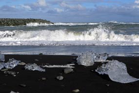 of
glacial ice chunks which had floated down the river from the Jökulsárlón lagoon
into the surf and now lay littered along the shore-line of black sand. Sparkling
in the hazy sunlight like huge diamonds laid out on a black velvet cushion,
these beach-stranded ice 'diamonds' made a noteworthy series of photographs
(Photo
37 - Jökulsárlón ice 'diamonds') (see right). of
glacial ice chunks which had floated down the river from the Jökulsárlón lagoon
into the surf and now lay littered along the shore-line of black sand. Sparkling
in the hazy sunlight like huge diamonds laid out on a black velvet cushion,
these beach-stranded ice 'diamonds' made a noteworthy series of photographs
(Photo
37 - Jökulsárlón ice 'diamonds') (see right).
Höfn Camping:
crossing the Jökulsá bridge, we began the 80kms final section of today's long
drive around the southern coastline towards Höfn (click
here for map of route). Route 1 initially crossed an area of vegetation-covered sandur before reaching farmland,
running between coast, where lines of breakers crashed onto the shore with a
constant distant roaring, and inland a backdrop of spectacular mountains capped by the ice-fields of Vatnajökull. The road now crossed the flat coastal
farmlands of Mýrar, backed by a hinterland graced with a mighty triple array of
glaciers, Skálafellsjökull,
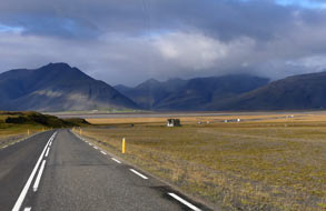 Heinabergsjökull, and Fláajökull, with their
intervening nunataks (an Inuit word meaning exposed, jaggedly crested and ice-free rocky ridges
projecting above a glacier) of Hafrafell and Heinabergsfjöll. The Ring Road now turned northwards away from the
coast (see left and below right), to sweep more than 30kms around the bay of Hornafjörður. Finally down
Hornafjörður's eastern shore, Heinabergsjökull, and Fláajökull, with their
intervening nunataks (an Inuit word meaning exposed, jaggedly crested and ice-free rocky ridges
projecting above a glacier) of Hafrafell and Heinabergsfjöll. The Ring Road now turned northwards away from the
coast (see left and below right), to sweep more than 30kms around the bay of Hornafjörður. Finally down
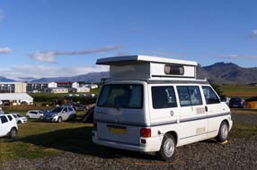
Hornafjörður's eastern shore,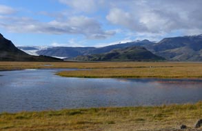 we turned off onto Route 99 into the port-town of Höfn. Höfn
Camping was a large site along Hafnarbraut, tiered up the hillside, with what
seemed pleasant turfed areas for tent campers on the lower levels. We
found an area with power supplies on one of the higher gravelled tiers, and with
some difficulty managed to level George with his chocks. The view from this
higher position, looking across the town outskirts in the now bright late
afternoon sunshine, was simply stunning (see below left) (Photo
38 - Höfn Camping mountain vista), with a northward 180º skyline of
mountain peaks and ridges, graced with intervening glaciers and all topped by Vatnajökull's
snowfields. But the price of facing out across this spectacular outlook was that
a chill northerly wind now blew directly into the open slider. we turned off onto Route 99 into the port-town of Höfn. Höfn
Camping was a large site along Hafnarbraut, tiered up the hillside, with what
seemed pleasant turfed areas for tent campers on the lower levels. We
found an area with power supplies on one of the higher gravelled tiers, and with
some difficulty managed to level George with his chocks. The view from this
higher position, looking across the town outskirts in the now bright late
afternoon sunshine, was simply stunning (see below left) (Photo
38 - Höfn Camping mountain vista), with a northward 180º skyline of
mountain peaks and ridges, graced with intervening glaciers and all topped by Vatnajökull's
snowfields. But the price of facing out across this spectacular outlook was that
a chill northerly wind now blew directly into the open slider.
Having pitched, we walked down to book
in. As at all the campsites along Iceland's southern coast cashing in on a
seemingly insatiable tourist demand,
prices
 were greed-driven and unduly expensive: adults 1,650kr,
power 750kr, and 2 minute showers 50kr, making a total of 4,150kr; we managed to
negotiate a seniors' discount of 3,450kr. But despite the high charges,
facilities were basic, totally inadequate given the
size of the campsite, and with disgraceful showers. As dusk and darkness fell mid-evening, huge numbers of
hire-campers, camping-cars and hire-cars flooded in, with traffic
driving around in search were greed-driven and unduly expensive: adults 1,650kr,
power 750kr, and 2 minute showers 50kr, making a total of 4,150kr; we managed to
negotiate a seniors' discount of 3,450kr. But despite the high charges,
facilities were basic, totally inadequate given the
size of the campsite, and with disgraceful showers. As dusk and darkness fell mid-evening, huge numbers of
hire-campers, camping-cars and hire-cars flooded in, with traffic
driving around in search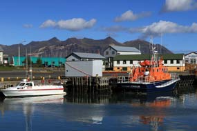 of a space and constant slamming of car doors until
gone 11-00pm, along with the noise of traffic along the main road; if you stay
at Höfn Camping, even in September, don't expect to get any sleep! It was one of
the most overcrowded and noisy campsites we had stayed at, and with its unduly
expensive prices and sub-standard facilities, only the magnificent setting saved Höfn
Camping from being given the lowest negative rating. of a space and constant slamming of car doors until
gone 11-00pm, along with the noise of traffic along the main road; if you stay
at Höfn Camping, even in September, don't expect to get any sleep! It was one of
the most overcrowded and noisy campsites we had stayed at, and with its unduly
expensive prices and sub-standard facilities, only the magnificent setting saved Höfn
Camping from being given the lowest negative rating.
Visit to Höfn harbour:
we were woken early, not by our alarm, but yet again by the noise of slamming
car doors and loud shouting from un-neighbourly nearby tent campers. Fortunately
the campsite emptied quite quickly, leaving us to enjoy a peaceful morning; the
sun shone brightly in a clear blue sky, but with the keen, northerly wind still
blowing. Perched at the tip of a narrow neck of land extending out into the
stormy Atlantic, Höfn is now the main town and only port along this part of the
south coast; today we should take a walk around the harbour and the Ósland
marshes and peninsula out towards the coast. The town only began to develop in
the late 19th~early 20th centuries as a trading centre for the farms
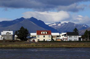 scattered
along the south coast; its name Höfn meaning Harbour is derived from being sited
at this coastline's only natural harbour and deep water anchorage,
though the harbour needs regular dredging to prevent silting up.
Expansion followed with the 1950s fishing boom and the establishment of a fish
processing and freezing factory, still the town's major employer. These days lobster has scattered
along the south coast; its name Höfn meaning Harbour is derived from being sited
at this coastline's only natural harbour and deep water anchorage,
though the harbour needs regular dredging to prevent silting up.
Expansion followed with the 1950s fishing boom and the establishment of a fish
processing and freezing factory, still the town's major employer. These days lobster has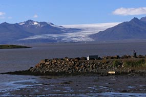 become the main luxury catch at Höfn, selling at unimaginably high prices in
local restaurants. Tourism has also increasingly become a mainstay of the local
economy.
We drove down the main street, Hafnarbraut, to its
end at the large harbour where a few boats, including the local lifeboat, were
moored (see above right) (Photo
39 - Höfn harbour). Nearby in a prime position by the harbour front, Gamlabúð
(meaning Old
Shop), an attractively refurbished 1864 wooden warehouse, which had once been the original
trading centre's shop, now serves as Höfn's Visitor Centre and Exhibition on Vatnajökull
National Park. The Exhibition was not only free entry but, to our delight, was
also showing the 1996 documentary film on the Grimsvötn sub-glacial eruption and
disastrous jökulhlaup which had washed away a section of the Ring Road,
destroying the main bridge at Skeiðarársandur. The film included wonderful
aerial footage, filmed at great
 hazard to aircraft and pilot, of the Grimsvötn
eruption, the build-up of sub-glacial melt-water, and eventual burst-out of the
flood. It also included incredible footage of the jökulhlaup's destructive
tsunami across the Skeiðarársandur outwash-plain, smashing its way through the
Ring Road and toppling the bridge like matchwood, with house-sized chunks of ice hazard to aircraft and pilot, of the Grimsvötn
eruption, the build-up of sub-glacial melt-water, and eventual burst-out of the
flood. It also included incredible footage of the jökulhlaup's destructive
tsunami across the Skeiðarársandur outwash-plain, smashing its way through the
Ring Road and toppling the bridge like matchwood, with house-sized chunks of ice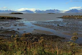 weighing 100s of tons borne along by the flood. We expressed our thanks to the
attendant for having this valuable archive film available here, when it was no
longer shown at the tourist-oriented Skaftafell Visitor Centre. She even taught
us how to pronounce the Icelandic word jökulhlaup, something like
Yer-kul-hleup. But even with our earnest practising, the Icelandic au
diphthong is a sound we simply do not have in English, sounding more like the
French eu in feuille.
Coastal walk around Ósland marshes: having eaten our lunch
sandwiches by the harbour side, we set off to walk the footpath around the
marshes of the Ósland peninsula down at the coast. In the clear light of a sunny
day, the landward panorama northward across the Hornafjörður lagoon was
absolutely stunning (see above left), with an array of four glaciers, left to
right Skálafellsjökull, Heinabergsjökull, Fláajökull
and Hoffellsjökull, gracing the
 mountainous skyline,
and Fláajökull's full length
sweeping down to the coast (see above right) (Photo
40 - Hornafjörður vista of Fláajökull). To the eastward beyond the
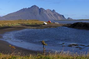
harbour, across the width of Skarðsfjörður, the jagged ridges of Vestrahorn
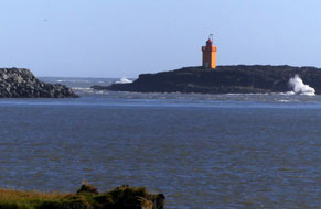
descended to the coast (see above left) where Stokksnes lighthouse was just visible. We followed the footpath alongside a small bay off Hornafjörður
with the mountainous and glacier-strewn panorama becoming even more dramatic mountainous skyline,
and Fláajökull's full length
sweeping down to the coast (see above right) (Photo
40 - Hornafjörður vista of Fláajökull). To the eastward beyond the
harbour, across the width of Skarðsfjörður, the jagged ridges of Vestrahorn
descended to the coast (see above left) where Stokksnes lighthouse was just visible. We followed the footpath alongside a small bay off Hornafjörður
with the mountainous and glacier-strewn panorama becoming even more dramatic
 (see above right) (Photo
41 - Glacier-strewn panorama). Out onto the tip of the grassy peninsula with its central marshy pond,
all
the Arctic Terns which nest here in the tufty grass in early summer had long
since departed for their long migration to the Antarctic; you would need a hard
hat to walk out here earlier in the year to protect your head from aerial attack
by the Terns defending their nests and young. But at this late stage of the
summer, there was little bird-life to be seen other than a few Eiders as we
followed the path around the outer side of the peninsula. What we could hear
however was the thunderous roar, even at this distance, of the Atlantic surf
crashing against the unseen outer face of the sand-bar which encloses the far
side of the lagoon (see left). Every now and again, monstrous columns of seawater spray
would rear up above the sand-bar as gigantic unseen waves pounded the outer
coastline, filling the air with their roar. The return path led us around the
marshy pond and over a hillock back to the shore-side (see above right) (Photo
41 - Glacier-strewn panorama). Out onto the tip of the grassy peninsula with its central marshy pond,
all
the Arctic Terns which nest here in the tufty grass in early summer had long
since departed for their long migration to the Antarctic; you would need a hard
hat to walk out here earlier in the year to protect your head from aerial attack
by the Terns defending their nests and young. But at this late stage of the
summer, there was little bird-life to be seen other than a few Eiders as we
followed the path around the outer side of the peninsula. What we could hear
however was the thunderous roar, even at this distance, of the Atlantic surf
crashing against the unseen outer face of the sand-bar which encloses the far
side of the lagoon (see left). Every now and again, monstrous columns of seawater spray
would rear up above the sand-bar as gigantic unseen waves pounded the outer
coastline, filling the air with their roar. The return path led us around the
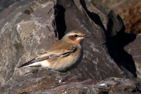
marshy pond and over a hillock back to the shore-side  path to the harbour, where
a perky little Northern Wheatear hopped from rock to rock, inviting us to take her
photograph (Photo
42 - Northern Wheatear) (see right). path to the harbour, where
a perky little Northern Wheatear hopped from rock to rock, inviting us to take her
photograph (Photo
42 - Northern Wheatear) (see right).
Back at the harbour-side, we drove along to the
Netto supermarket to stock up with provisions for the next 4 days, before
returning to Höfn Camping for a second night. We earlier had identified a corner
position, tucked away on an upper side-tier, and having re-filled our fresh
water for the final time in Iceland, we pitched George there. The campsite at
4-30pm was still peacefully empty, and with the sun still shining, we sat with
the slider open gazing landward to the wonderful array of mountains and glaciers
along the Vatnajökull skyline. As early evening drew on however, the campsite began to
fill again and as darkness fell, even earlier now, the late arrivals flooded in
with all the inevitable cacophony of slamming car doors which went on until well
after 11-00pm when we had long turned in. But at least we had enjoyed a flaring
sunset above the northward skyline of mountains (see left) (Photo
43 - Flaring sunset). in Iceland, we pitched George there. The campsite at
4-30pm was still peacefully empty, and with the sun still shining, we sat with
the slider open gazing landward to the wonderful array of mountains and glaciers
along the Vatnajökull skyline. As early evening drew on however, the campsite began to
fill again and as darkness fell, even earlier now, the late arrivals flooded in
with all the inevitable cacophony of slamming car doors which went on until well
after 11-00pm when we had long turned in. But at least we had enjoyed a flaring
sunset above the northward skyline of mountains (see left) (Photo
43 - Flaring sunset).
Eastwards around Skarðsfjörður to Vestrahorn and
Stokksnes Head:
leaving Höfn, we re-joined the Ring Road eastward around the shore of
sand-bar-enclosed Skarðsfjörður. Ahead loomed the jagged ridge-line of
Vestrahorn, the westerly of the pair of mountainous 'horns' projecting into the
 Atlantic and enclosing the 30kms wide Lónsvík Bay (click
here for map of route). The massively peaked
ridge-line of Vestrahorn appeared to present a formidably impassable obstacle to
further eastward travel, and the scree-covered mountainous flanks of Fjarðarfjall extended almost 900m from the craggy ridge-line vertically down to
road level (see above right). Before 2005, the only passage eastward for the
Ring Road to negotiate this mountainous barrier of Fjarðarfjall was via the
steep and Atlantic and enclosing the 30kms wide Lónsvík Bay (click
here for map of route). The massively peaked
ridge-line of Vestrahorn appeared to present a formidably impassable obstacle to
further eastward travel, and the scree-covered mountainous flanks of Fjarðarfjall extended almost 900m from the craggy ridge-line vertically down to
road level (see above right). Before 2005, the only passage eastward for the
Ring Road to negotiate this mountainous barrier of Fjarðarfjall was via the
steep and narrow Almannaskarð Pass between Hornafjörður and Lón. During winter,
the pass was often closed by snow, blocking traffic to and from East Iceland.
Work on construction of a new tunnel cutting under the former pass was begun in
early 2004, and the 1.312km long Almannaskarðsgöng Tunnel opened in 2005. As we
approached the tunnel's western portal, the old gravel road up to the former
pass was visible rising steeply up the mountainside; it looked a truly
formidable route. narrow Almannaskarð Pass between Hornafjörður and Lón. During winter,
the pass was often closed by snow, blocking traffic to and from East Iceland.
Work on construction of a new tunnel cutting under the former pass was begun in
early 2004, and the 1.312km long Almannaskarðsgöng Tunnel opened in 2005. As we
approached the tunnel's western portal, the old gravel road up to the former
pass was visible rising steeply up the mountainside; it looked a truly
formidable route.
Just before the tunnel, we turned off onto a
gravel track which ran for some 5kms around the western foot of Vestrahorn out
to the coastal headland of Stokksnes. The public road ended at the Viking Café, operated
by the owner of the farm who makes a small charge for entry onto the private lane
leading across the black sands of the lagoon out to a parking area by what was
once a NATO radar station. From the marram grass covered dunes, the view
eastward at
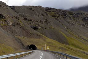 Stokksnes Head was simply staggeringly beautiful: the Atlantic white surf crashed onto
the sweep of the black volcanic sand bay, backed by the fearsomely majestic,
scree-draped, craggy ridge of Vestrahorn, all lit by soft morning sunlight (see
above left) (Photo
44 - Stokksnes Head). The combination of black sand beach, pounding
Atlantic surf, and jagged Stokksnes Head was simply staggeringly beautiful: the Atlantic white surf crashed onto
the sweep of the black volcanic sand bay, backed by the fearsomely majestic,
scree-draped, craggy ridge of Vestrahorn, all lit by soft morning sunlight (see
above left) (Photo
44 - Stokksnes Head). The combination of black sand beach, pounding
Atlantic surf, and jagged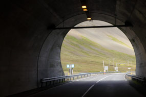 peaks presented a classic South Iceland coastline
scene. Returning around the gravel track from Stokksnes Head to the Ring Road also gave
beautifully lit vistas of these formidable mountains rearing up to their jagged
crests (see above right). peaks presented a classic South Iceland coastline
scene. Returning around the gravel track from Stokksnes Head to the Ring Road also gave
beautifully lit vistas of these formidable mountains rearing up to their jagged
crests (see above right).
Through Almannaskarðsgöng Tunnel, around Lónsvík Bay to Eystrahorn and Hvalsnes:
re-joining the Ring Road, we approached the western portal of Almannaskarðsgöng
Tunnel, a tiny opening dwarfed by the massive, craggy mountain face into which
the road now plunged (see left) (click
here for map of route); the passage through this mighty mountain was so
straightforward compared with the former hazardous route over the steep and
narrow pass, to emerge into the upper Lón valley (see right). The two mountainous capes of Vestrahorn
and Eystrahorn enfold the 30kms wide estuary whose mouth is enclosed by
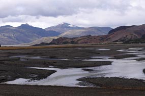 a sand-bar causing the bay to silt up into lagoons. The main glacial
river of Jökulsá í Lóni flows from the inland savage mountains down into Lónsvík
Bay, its broad sandur gravel-bed criss-crossed by multiple channels (see
left). a sand-bar causing the bay to silt up into lagoons. The main glacial
river of Jökulsá í Lóni flows from the inland savage mountains down into Lónsvík
Bay, its broad sandur gravel-bed criss-crossed by multiple channels (see
left).
The road travelled deep inland, rounding the head
of the bay to cross the Jökulsá í Lóni at Stafafell farm,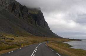 and continue through
the flatter and more fertile farming district of Lón. Passing inner the bay of Lónsfjörður, we approached the mountains on the far side of the delta where the
formidable, scree-skirted, jagged-topped cliffs of Eystrahorn loomed ahead. The
now narrow Ring Road rounded the tip of the mountainous cape near to Hvalsnes
lighthouse and continued ahead on a restricted shelf cut across the unstable,
steeply sloping and scree-covered face of Eystrahorn and Krossanesfjall (see
right). Safety fencing on the seaward side gave a limited feeling of security with the sheer
drop down to the rocky coast, but on the landward side, a low wall seemed little
protection from rockfalls from the precipitous, scree-covered slope looming
overhead. It seemed fearful and unstable terrain over which to maintain this
road. In addition to the hazardous nature of the terrain, we were harassed by
homicidally speeding tourist cars attempting to force a way past on the narrow,
winding road. and continue through
the flatter and more fertile farming district of Lón. Passing inner the bay of Lónsfjörður, we approached the mountains on the far side of the delta where the
formidable, scree-skirted, jagged-topped cliffs of Eystrahorn loomed ahead. The
now narrow Ring Road rounded the tip of the mountainous cape near to Hvalsnes
lighthouse and continued ahead on a restricted shelf cut across the unstable,
steeply sloping and scree-covered face of Eystrahorn and Krossanesfjall (see
right). Safety fencing on the seaward side gave a limited feeling of security with the sheer
drop down to the rocky coast, but on the landward side, a low wall seemed little
protection from rockfalls from the precipitous, scree-covered slope looming
overhead. It seemed fearful and unstable terrain over which to maintain this
road. In addition to the hazardous nature of the terrain, we were harassed by
homicidally speeding tourist cars attempting to force a way past on the narrow,
winding road.
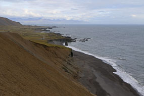 Cautiously we rounded this unstable section of rockfall-prone
road, with little opportunity to glance around even briefly at this fearful
coastline and the sea-stacks of Stapinn (see left). Cautiously we rounded this unstable section of rockfall-prone
road, with little opportunity to glance around even briefly at this fearful
coastline and the sea-stacks of Stapinn (see left).
Þvottá
farmstead, Áltafjörður, Hamarsfjörður,
approaching Djúpivogur:
at the far end of this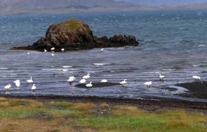 fearful mountain shelf, the Ring Road passed Þvottá farmstead
(click
here for map of route).
It was here that in the late 10th century the militant missionary
zealot Þangbrandur, sent by Norwegian King Ólafur Tryggvason to convert the Icelanders
from paganism to Christianity, first landed. Þangbrandur is said to have spent
his first winter in Iceland at Áltafjörður, making his first conversion at Þvottá
farmstead (the name means Washing River from this baptism), before setting off to battle against fierce opposition to his
Christianising zealous bigotry from pagan stalwarts. The road rounded into Áltafjörður bay where Whooper Swans nest, and as we passed the inner bay of
Krossvík, a flock of Whoopers was gathered on the shore. Around Áltafjörður,
we crossed the two glacial rivers Hofsá and Geithellaá and along the far side of
the bay, we rounded the cape into Hamarsfjörður. Crossing the next glacial river
Hamarsá, which flowed down the steep-sided inner valley, the road returned along
the far side of the bay to approach Djúpivogur which was set at the tip of the
promontory just round into Berufjörður. fearful mountain shelf, the Ring Road passed Þvottá farmstead
(click
here for map of route).
It was here that in the late 10th century the militant missionary
zealot Þangbrandur, sent by Norwegian King Ólafur Tryggvason to convert the Icelanders
from paganism to Christianity, first landed. Þangbrandur is said to have spent
his first winter in Iceland at Áltafjörður, making his first conversion at Þvottá
farmstead (the name means Washing River from this baptism), before setting off to battle against fierce opposition to his
Christianising zealous bigotry from pagan stalwarts. The road rounded into Áltafjörður bay where Whooper Swans nest, and as we passed the inner bay of
Krossvík, a flock of Whoopers was gathered on the shore. Around Áltafjörður,
we crossed the two glacial rivers Hofsá and Geithellaá and along the far side of
the bay, we rounded the cape into Hamarsfjörður. Crossing the next glacial river
Hamarsá, which flowed down the steep-sided inner valley, the road returned along
the far side of the bay to approach Djúpivogur which was set at the tip of the
promontory just round into Berufjörður.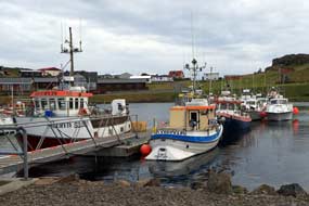
Djúpivogur
Camping: turning off into Djúpivogur village, first impressions from
the neat rows of houses were of a thriving community. We found the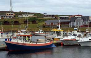 village shop,
and just opposite the fishing harbour
(Photo
45 - Djúpivogur fishing harbour) (see left and right), drove up to the campsite;
this had a
flat and grassy camping area overlooking the harbour and sheltered on both sides from
the chill wind by rocky bluffs. We pitched George just by the huts, plugged into
power, and walked down to explore the village and harbour. Djúpivogur (meaning
Deep Bay) with its 350 residents, is the southernmost of the East Fjords
settlements, and the oldest port having been founded by German Hanseatic
merchant-traders in 1589. The Danish developed the fishing in the 18th century,
and fishing and fish-processing still provide the principal employment, along of
course these days with tourism. The small off-shore island of Papey is thought
to have been briefly occupied by hermit Irish monks (called Papar meaning
Father, giving the island its name) in the 8th century before the arrival
and settlement of the Norse Vikings. village shop,
and just opposite the fishing harbour
(Photo
45 - Djúpivogur fishing harbour) (see left and right), drove up to the campsite;
this had a
flat and grassy camping area overlooking the harbour and sheltered on both sides from
the chill wind by rocky bluffs. We pitched George just by the huts, plugged into
power, and walked down to explore the village and harbour. Djúpivogur (meaning
Deep Bay) with its 350 residents, is the southernmost of the East Fjords
settlements, and the oldest port having been founded by German Hanseatic
merchant-traders in 1589. The Danish developed the fishing in the 18th century,
and fishing and fish-processing still provide the principal employment, along of
course these days with tourism. The small off-shore island of Papey is thought
to have been briefly occupied by hermit Irish monks (called Papar meaning
Father, giving the island its name) in the 8th century before the arrival
and settlement of the Norse Vikings.
 We walked down to the harbour and watched as a
couple of boats drew in. The small fishing boat Glaður unloaded her catch
at the quay (see left) for crating and transportation over to the fish-processing plant (see right), as we had seen at other Icelandic fishing ports in the north and the West Fjords
(Photo
46 - Unloading today's catch). The elderly skipper busied himself filleting
haddock and laying them out on deck, along with a row of dead Guillemots
(see below left), before taking the boat around We walked down to the harbour and watched as a
couple of boats drew in. The small fishing boat Glaður unloaded her catch
at the quay (see left) for crating and transportation over to the fish-processing plant (see right), as we had seen at other Icelandic fishing ports in the north and the West Fjords
(Photo
46 - Unloading today's catch). The elderly skipper busied himself filleting
haddock and laying them out on deck, along with a row of dead Guillemots
(see below left), before taking the boat around to dock with other smaller boats at the moorings. We followed him round, and
hesitantly approached to ask if we could buy some fish for our supper. The
skipper fetched a plastic bag and handed us a large haddock fillet, refusing to
accept any payment (see below right) (Photo
47 - Haddock fillets from Glaður). Humbled by such kindness, we talked with
him to learn more about hand-line fishing; he described in good English that,
with hand-line fishing, the lines were not baited (as in long-line fishing), and
that the fish are simply attracted by the fish-shaped weighted sinkers attached
to hooked lures. Asked also about the Guillemots, he explained that a few were
shot for eating during autumn to control numbers, and in fact tasted very good;
we took his word for that! Thanking him for his generosity, we walked back up
into the village. Up by the village school and health centre, we found the
handicraft workshop of Jón Friðrik Sigurðsson, a little Aladdin's Cave of
polished stones, carved wood and tourist
 ephemera; we had been told about this
eccentrically interesting character by the German couple we had camped near at Kirkjubæjarklaustur.
Originally from the northern port of Siglufjörður, he had worked on the fishing boats and settled here at Djúpivogur
in 1973; he had shown no surprise at our knowing his home town. ephemera; we had been told about this
eccentrically interesting character by the German couple we had camped near at Kirkjubæjarklaustur.
Originally from the northern port of Siglufjörður, he had worked on the fishing boats and settled here at Djúpivogur
in 1973; he had shown no surprise at our knowing his home town.
Back round at the campsite, we booked in:
facilities were brand new with a well-equipped kitchen, but
 again the price was
unduly expensive at 4,650kr (seniors' discount 3,850kr) We quickly settled in
with a chill northerly wind blowing, and brewed tea. Dusk and darkness fell even
earlier now so that by 8-30pm it was fully dark, as we cooked supper of the
deliciously tasting local haddock fillets, freshly caught this afternoon and
given to us by the skipper of Glaður. Inevitably again our late
evening was disturbed by car door slamming late arriving tourists; oh for a
peaceful campsite free from the scourge of wretched tourists! again the price was
unduly expensive at 4,650kr (seniors' discount 3,850kr) We quickly settled in
with a chill northerly wind blowing, and brewed tea. Dusk and darkness fell even
earlier now so that by 8-30pm it was fully dark, as we cooked supper of the
deliciously tasting local haddock fillets, freshly caught this afternoon and
given to us by the skipper of Glaður. Inevitably again our late
evening was disturbed by car door slamming late arriving tourists; oh for a
peaceful campsite free from the scourge of wretched tourists!
A quick repair of George's puncture at Djúpivogur:
on a heavily overcast morning with chill northerly wind, we were just preparing
to depart from Djúpivogur Camping when we discovered that George's rear off-side tyre was flat.
After all the rough, stony gravel roads he had driven during the last 4 months,
his tyre had let him down at this stage. But if it had to happen,
 at least we
were not driving and at some remote, isolated spot miles from anywhere. We were
safely at a camp site with a tyre repair workshop in the village just down by
the harbour. The garage was a one-man operation, and the rather reticent owner
was clearly busy with other vehicles. We explained our problem and he promised
to come up to the campsite in 45 minutes; we could not ask fairer than that.
Within the hour the garage owner drove up, jacked up George and removed the
wheel, offering to leave George up on the jack and take the flat tyre back to
the workshop for repair. Within 15 minutes he returned with the puncture
repaired, and replaced at least we
were not driving and at some remote, isolated spot miles from anywhere. We were
safely at a camp site with a tyre repair workshop in the village just down by
the harbour. The garage was a one-man operation, and the rather reticent owner
was clearly busy with other vehicles. We explained our problem and he promised
to come up to the campsite in 45 minutes; we could not ask fairer than that.
Within the hour the garage owner drove up, jacked up George and removed the
wheel, offering to leave George up on the jack and take the flat tyre back to
the workshop for repair. Within 15 minutes he returned with the puncture
repaired, and replaced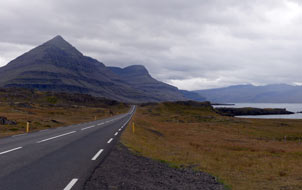 the wheel (see left). All in all, with the gift of
haddock for supper and prompt tyre repair service, Djúpivogur had served us well. the wheel (see left). All in all, with the gift of
haddock for supper and prompt tyre repair service, Djúpivogur had served us well.
Around Berufjörður, Breiðdalsvík and
Stöðvarfjörður: with low cloud
touching the surrounding peaks, we left
Djúpivogur and re-joined the Ring Road eastwards around into the long arm of Berufjörður
(click
here for map of route).
Despite the gloomy light, the shapely 1,069m high pyramidical peak of Búlandstindur stood out clearly, with its distinctive rhyolite stratifications streaked across the face of the mountain
(see right). Following the winding shoreline, the
road headed into the inner depths of Berufjörður, and around the head of the narrow valley,
reached the Ring Road's only remaining 10kms stretch
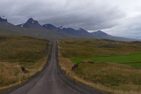 of unsurfaced road. At the apex of the valley head, Route 939 branched off along the Berufjurðará side-valley, a short-cut route linking with the on-going Route 1 to Egilsstaðir but climbing over a steep,
winding and narrow 700m high pass, and of course unsurfaced. Most of the tourist
traffic followed this route; we continued ahead around the far side of Berufjörður,
picking up tarmac again. The weather was now gloomier than ever with rain
beginning, making the terrain appear so forbiddingly uninviting (see left). It made you realise that the first
Viking settlers must have been desperate to find new lands to come ashore here
and attempt to establish their settlement farms in such a bleak landscape. The
road passed along the broad of unsurfaced road. At the apex of the valley head, Route 939 branched off along the Berufjurðará side-valley, a short-cut route linking with the on-going Route 1 to Egilsstaðir but climbing over a steep,
winding and narrow 700m high pass, and of course unsurfaced. Most of the tourist
traffic followed this route; we continued ahead around the far side of Berufjörður,
picking up tarmac again. The weather was now gloomier than ever with rain
beginning, making the terrain appear so forbiddingly uninviting (see left). It made you realise that the first
Viking settlers must have been desperate to find new lands to come ashore here
and attempt to establish their settlement farms in such a bleak landscape. The
road passed along the broad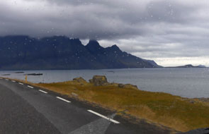 southern coastal strip, with gloomy mountains
looming overhead and water courses tumbling down the dark face of Núpstindur.
Rounding into Breiðdalsvík Bay, the road crossed the shallows of the bay mouth
on a made up natural sand-bar causeway; ahead the darkened spiny ridge of
Lambafell looked gloomier than ever, a formidable obstacle to the ongoing road
(see right). Across the far side of the bay, the designated Route 1 branched off inland along Breiðdalur; we continued ahead on Route 96, turning off into the small
settlement and fishing port of Breiðdalsvík. On such a gloomy morning, the
village looked a sad backwater of a place, but then in such weather even the
most attractive of places would! We rejoined Route 96 to continue our journey. southern coastal strip, with gloomy mountains
looming overhead and water courses tumbling down the dark face of Núpstindur.
Rounding into Breiðdalsvík Bay, the road crossed the shallows of the bay mouth
on a made up natural sand-bar causeway; ahead the darkened spiny ridge of
Lambafell looked gloomier than ever, a formidable obstacle to the ongoing road
(see right). Across the far side of the bay, the designated Route 1 branched off inland along Breiðdalur; we continued ahead on Route 96, turning off into the small
settlement and fishing port of Breiðdalsvík. On such a gloomy morning, the
village looked a sad backwater of a place, but then in such weather even the
most attractive of places would! We rejoined Route 96 to continue our journey.
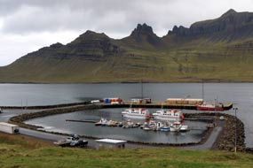 The road passed around the tip of the cape,
clinging to the unstable, steep mountain slope and fenced on the seaward side
where the scree-covered, rockfall-prone mountain-side plunged sheer down to the
sea below. The gloomy weather made the surroundings seem even more forbidding
than ever. The cape extended seaward onto flatter ground, ending at the Kambanes
lighthouse. Thankful to be clear of the unstable slope, we turned along the
southern shore of Stöðvarfjörður. Rounding the head of the narrow fjord, we
returned along the northern shore-line into the fishing village of
Stöðvarfjörður,
which The road passed around the tip of the cape,
clinging to the unstable, steep mountain slope and fenced on the seaward side
where the scree-covered, rockfall-prone mountain-side plunged sheer down to the
sea below. The gloomy weather made the surroundings seem even more forbidding
than ever. The cape extended seaward onto flatter ground, ending at the Kambanes
lighthouse. Thankful to be clear of the unstable slope, we turned along the
southern shore of Stöðvarfjörður. Rounding the head of the narrow fjord, we
returned along the northern shore-line into the fishing village of
Stöðvarfjörður,
which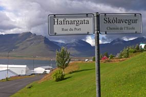 extended along the road. Perhaps because the weather seemed a little less
gloomy here, this felt to be a brighter, more cheery village, with its small
fishing harbour by the fjord-side set against the impressive mountainous
backdrop of the narrow fjord (Photo
48 - Stöðvarfjörður fishing harbour) (see left). We paused to inspect the little campsite at the far
end of the village; although a Camping Card site, facilities were very basic
with no showers, so we continued, rounding the headland along the southern
coast. Although there was no pounding surf here, the grey Atlantic looked so
forbidding. In the distance, just off the mouth of Fáskrúðsfjörður, the sheer
cliffs of the towering rocky islet of Skrúður rose from the sea, home only to
Gannets and Puffins. extended along the road. Perhaps because the weather seemed a little less
gloomy here, this felt to be a brighter, more cheery village, with its small
fishing harbour by the fjord-side set against the impressive mountainous
backdrop of the narrow fjord (Photo
48 - Stöðvarfjörður fishing harbour) (see left). We paused to inspect the little campsite at the far
end of the village; although a Camping Card site, facilities were very basic
with no showers, so we continued, rounding the headland along the southern
coast. Although there was no pounding surf here, the grey Atlantic looked so
forbidding. In the distance, just off the mouth of Fáskrúðsfjörður, the sheer
cliffs of the towering rocky islet of Skrúður rose from the sea, home only to
Gannets and Puffins.
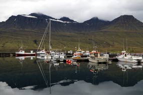 Fáskrúðsfjörður and its campsite:
passing the squat Hafarnes lighthouse, the road rounded into the long, narrow Fáskrúðsfjörður,
shelving along its southern shore-line
(click
here for map of route). Around the head of the fjord, where the
on-going Route 96 branched off along Daladalur towards the tunnel
through to Reyðarfjörður, we turned down the far shore-line into Fáskrúðsfjörður village. In the late 19th~early 20th
centuries, Fáskrúðsfjörður port was a busy seasonal base for fishing fleets Fáskrúðsfjörður and its campsite:
passing the squat Hafarnes lighthouse, the road rounded into the long, narrow Fáskrúðsfjörður,
shelving along its southern shore-line
(click
here for map of route). Around the head of the fjord, where the
on-going Route 96 branched off along Daladalur towards the tunnel
through to Reyðarfjörður, we turned down the far shore-line into Fáskrúðsfjörður village. In the late 19th~early 20th
centuries, Fáskrúðsfjörður port was a busy seasonal base for fishing fleets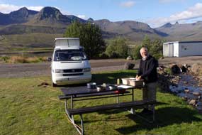 from
Northern France. The French built a trading-base, hospital, and even a cemetery
where 49 French and Belgian seafarers are buried, and the town once had up to 5,000 French residents. All of this has long
gone, but the heritage is commemorated by the modern village with bilingual Icelandic~French street signs
(see above right), and a 4 day Franskirdagar (French Days) Festival in July; houses in Fáskrúðsfjörður
sport the twin flags of Iceland and France, and the village is twinned with
Gravelines on the French Channel coast near to Dunkerque. from
Northern France. The French built a trading-base, hospital, and even a cemetery
where 49 French and Belgian seafarers are buried, and the town once had up to 5,000 French residents. All of this has long
gone, but the heritage is commemorated by the modern village with bilingual Icelandic~French street signs
(see above right), and a 4 day Franskirdagar (French Days) Festival in July; houses in Fáskrúðsfjörður
sport the twin flags of Iceland and France, and the village is twinned with
Gravelines on the French Channel coast near to Dunkerque.
We found the straightforward campsite near the end
of the village, a rather muddy, grassy area with trees for shelter, and a stream
trickling through down to a shallow fjord-lake (see below left); facilities seemed basic with hot
showers in a woebegone hut.
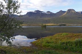 Along in the village, we gave George his final fill
of Icelandic diesel, shopped at the rather sparse village shop, and took a couple of photos down at the harbour.
Here the mountains on the opposite
fjord-side, still with residual snow cornices, created perfect reflections in the water (Photo
49 - Fáskrúðsfjörður fishing harbour) (see above left). But there were few fishing boats left now
compared with the days when this was a lively port, and the village had Along in the village, we gave George his final fill
of Icelandic diesel, shopped at the rather sparse village shop, and took a couple of photos down at the harbour.
Here the mountains on the opposite
fjord-side, still with residual snow cornices, created perfect reflections in the water (Photo
49 - Fáskrúðsfjörður fishing harbour) (see above left). But there were few fishing boats left now
compared with the days when this was a lively port, and the village had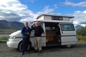 a rather sorry, passé air. Back along at the campsite, we found the only flattish spot
alongside the stream and settled in. We had hoped for a more peaceful evening,
being off the main Ring Road circuit, but early evening as dusk fell the
inevitable tourist car door slammers piled in, fortunately choosing to camp on
the far side of the brook. Darkness fell quickly by 8-00pm now. A local lady
with her little children called round for payment, and we were able to use the
26th slot on our Camping Card. Even the power supplies at Fáskrúðsfjörður
Camping had a French connection with continental sockets and highly dubious
polarity. a rather sorry, passé air. Back along at the campsite, we found the only flattish spot
alongside the stream and settled in. We had hoped for a more peaceful evening,
being off the main Ring Road circuit, but early evening as dusk fell the
inevitable tourist car door slammers piled in, fortunately choosing to camp on
the far side of the brook. Darkness fell quickly by 8-00pm now. A local lady
with her little children called round for payment, and we were able to use the
26th slot on our Camping Card. Even the power supplies at Fáskrúðsfjörður
Camping had a French connection with continental sockets and highly dubious
polarity.
The following pleasantly sunny morning, we washed
up at our picnic table, drawing hot water from the facilities (see above right) (Photo
50 - Fáskrúðsfjörður Camping). But the best feature of Fáskrúðsfjörður
Camping was yet to come. It felt as if we had
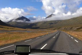 not managed to get satisfactory showers
if at all for some 2 weeks, given the series of unduly
expensive or inadequate campsites along the entire length of the SE Iceland
coast. Despite
the apparently semi-derelict shower hut here at Fáskrúðsfjörður, the showers not
only delivered unlimited supplies of refreshingly hot water, and were included
in the very
reasonable price, but also the cubicles inside were clean, heated and equipped
with bench and plenty of hooks. All that you could ask for, and not
available at any of the other SE Iceland not managed to get satisfactory showers
if at all for some 2 weeks, given the series of unduly
expensive or inadequate campsites along the entire length of the SE Iceland
coast. Despite
the apparently semi-derelict shower hut here at Fáskrúðsfjörður, the showers not
only delivered unlimited supplies of refreshingly hot water, and were included
in the very
reasonable price, but also the cubicles inside were clean, heated and equipped
with bench and plenty of hooks. All that you could ask for, and not
available at any of the other SE Iceland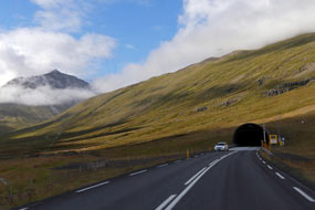 campsites. This not only rescued Fáskrúðsfjörður
Camping's reputation but secured it a +4 rating! We also still needed a 2017 camp photograph
of us both alongside
George as a comparison with the photo in front of our tent taken on our
1972 expedition to Iceland. We therefore positioned George against the backdrop
of fjord-side mountains in order to take a time-delay photo to include both
of us (see above right) (Photo
51 - Camping in Iceland 2017).
Through the Fáskrúðsfjarðgöng Tunnel to Reyðarfjörður:
we finally left Fáskrúðsfjörður after our unexpectedly pleasing stay, and turned
off on Route 96 along Daladalur with the peaks surrounding this long glacial
valley lit by a bright morning sun (see above left) (click
here for map of route). The valley head enclosed by its wall of
encircling mountains seemed to present an impassable barrier, but the road
suddenly curved into the projecting concrete
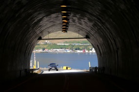 portal of Fáskrúðsfjarðgöng Tunnel
(see right).
The 5.85kms long tunnel, opened in 2005, cuts a straight course directly through
the mountainous ridge which separates Fáskrúðsfjörður from Reyðarfjörður,
greatly easing land communications in the East Fjords by avoiding the long and
hazardous coastal route. The tunnel emerged into bright sunlight directly above
the fjord with the port of Reyðarfjörður spread along the far shore (see left). portal of Fáskrúðsfjarðgöng Tunnel
(see right).
The 5.85kms long tunnel, opened in 2005, cuts a straight course directly through
the mountainous ridge which separates Fáskrúðsfjörður from Reyðarfjörður,
greatly easing land communications in the East Fjords by avoiding the long and
hazardous coastal route. The tunnel emerged into bright sunlight directly above
the fjord with the port of Reyðarfjörður spread along the far shore (see left).
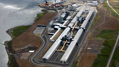 Reyðarfjörður and the Alcoa Fjarðaál aluminium smelting plant:
rounding the head of the fjord, where the on-going Route 92 continued along Fagrídalur towards Egilsstađir,
we turned off into Reyðarfjörður. We had no great hopes of the campsite here,
believing it to be in an unattractive setting in the town outskirts. In fact
however on investigating, it seemed a very pleasant site surrounded by trees
alongside
a small ornamental lake, with reasonable facilities and accepted the
Camping Card. It was certainly a contender for our rest day tomorrow if the
campsite at Eskifjörður proved unsuitable. We drove into Reyðarfjörður, and found the Icelandic WW2 Museum based in Nissen
Huts above the town. Unfortunately closed at the end of August, the Museum documents Reyðarfjörður and the Alcoa Fjarðaál aluminium smelting plant:
rounding the head of the fjord, where the on-going Route 92 continued along Fagrídalur towards Egilsstađir,
we turned off into Reyðarfjörður. We had no great hopes of the campsite here,
believing it to be in an unattractive setting in the town outskirts. In fact
however on investigating, it seemed a very pleasant site surrounded by trees
alongside
a small ornamental lake, with reasonable facilities and accepted the
Camping Card. It was certainly a contender for our rest day tomorrow if the
campsite at Eskifjörður proved unsuitable. We drove into Reyðarfjörður, and found the Icelandic WW2 Museum based in Nissen
Huts above the town. Unfortunately closed at the end of August, the Museum documents
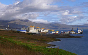 the British and American occupation of Iceland from May 1940 until
1945, and the impact this had on local people. Reyðarfjörður became another huge
Allied land-forces and naval base along with Hvalfjörður in West Iceland visited
by us earlier. During WW2 some 4,000 British, Canadian and US troops were based
around Reyðarfjörður, overwhelming the local Icelandic population of 300. Reyðarfjörður
had
begun life in the early 20th century as a trading post and fishing port, but had
fallen on hard times as the fishing industry declined. the British and American occupation of Iceland from May 1940 until
1945, and the impact this had on local people. Reyðarfjörður became another huge
Allied land-forces and naval base along with Hvalfjörður in West Iceland visited
by us earlier. During WW2 some 4,000 British, Canadian and US troops were based
around Reyðarfjörður, overwhelming the local Icelandic population of 300. Reyðarfjörður
had
begun life in the early 20th century as a trading post and fishing port, but had
fallen on hard times as the fishing industry declined.
 Today however Reyðarfjörður with a population of
1,100 has a prosperous air as the largest settlement in East Fjords, following
construction and opening of the controversial Fjarðaál aluminium smelting plant
in 2008 operated by the American company Alcoa. The quiet fjord-side former
fishing village was selected by Alcoa as the site for the Fjarðaál aluminium
smelting plant because of ready access along the deep-water fjord for the huge
ships importing raw bauxite ore from Chile and all round the world. The enormous
smelter one kilometre in length was constructed by the fjord-side at Reyðarfjörður between 2004~2007 by the Bechtel contracting
firm using 1000s of mainly Polish workers (see above right for aerial photo of
the controversial fjord-side smelting plant). At one Today however Reyðarfjörður with a population of
1,100 has a prosperous air as the largest settlement in East Fjords, following
construction and opening of the controversial Fjarðaál aluminium smelting plant
in 2008 operated by the American company Alcoa. The quiet fjord-side former
fishing village was selected by Alcoa as the site for the Fjarðaál aluminium
smelting plant because of ready access along the deep-water fjord for the huge
ships importing raw bauxite ore from Chile and all round the world. The enormous
smelter one kilometre in length was constructed by the fjord-side at Reyðarfjörður between 2004~2007 by the Bechtel contracting
firm using 1000s of mainly Polish workers (see above right for aerial photo of
the controversial fjord-side smelting plant). At one
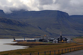 point Reyðarfjörður had the highest concentration of foreign residents of
any community in Iceland. The plant still employs a mainly Polish workforce of
450; in the Reyðarfjörður supermarket, we had spoken with a Lithuanian who had worked at the Fjarðaál
plant for 11 years and seemed resigned to life here
with his family. Despite objections from conservationists about the plant's impact on the local environment, the smelter
reached full capacity in 2008 and now produces 940 tons of aluminium a day.
Alcoa moved their aluminium smelting from the USA to take advantage of Iceland's
low-cost availability of geothermal and hydro-generated electricity. Aluminium
electrolytic smelting requires enormous quantities of electricity, and the Fjarðaál
plant was the principal reason for the even more controversial point Reyðarfjörður had the highest concentration of foreign residents of
any community in Iceland. The plant still employs a mainly Polish workforce of
450; in the Reyðarfjörður supermarket, we had spoken with a Lithuanian who had worked at the Fjarðaál
plant for 11 years and seemed resigned to life here
with his family. Despite objections from conservationists about the plant's impact on the local environment, the smelter
reached full capacity in 2008 and now produces 940 tons of aluminium a day.
Alcoa moved their aluminium smelting from the USA to take advantage of Iceland's
low-cost availability of geothermal and hydro-generated electricity. Aluminium
electrolytic smelting requires enormous quantities of electricity, and the Fjarðaál
plant was the principal reason for the even more controversial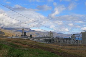 construction of
the Kárahnjúkar Dam and flooding of vast areas of wilderness land at Vatnajökull by its reservoir, to drive the hydro-electric power station in the Fljötsdalur
valley (see below for details of the Kárahnjúkar Dam). HV power lines connect the HEP station over the fells to power
the Reyðarfjörður aluminium smelter. Although the aluminium smelter employs
little local labour, its presence has clearly brought an affluence to Reyðarfjörður
which, along with Eskifjörður and Neskaupstaður, is now part of the Fjarðabyggð
municipality. construction of
the Kárahnjúkar Dam and flooding of vast areas of wilderness land at Vatnajökull by its reservoir, to drive the hydro-electric power station in the Fljötsdalur
valley (see below for details of the Kárahnjúkar Dam). HV power lines connect the HEP station over the fells to power
the Reyðarfjörður aluminium smelter. Although the aluminium smelter employs
little local labour, its presence has clearly brought an affluence to Reyðarfjörður
which, along with Eskifjörður and Neskaupstaður, is now part of the Fjarðabyggð
municipality.
We shopped at the Kronan supermarket in the town's shopping centre, then continued along
the fjord, following the tell-tale trail of power lines to find the Fjarðaál aluminium smelting plant
(click
here for map of route). Some 4kms along, we reached
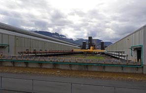 the
enormous fjord-side complex, and hesitantly edged down
towards the docks where the bauxite ore is shipped in (see above left). The lane ended at
security gates with little to be seen here (see above right). Continuing along Route 92, the
one km
long smelting factory came into view (see above left), with the power lines from the
hydro-electrical generating plant over in the neighbouring valley of Fljótsdalur
all leading into it (see above right). At the far end, we took another side road leading down to
the factory, and from here we could see only half the length of the one
kilometre long plant. But at least we were able to get some impression of the scale of
this gigantic factory's full length (see left) (Photo
52 - Fjarðaál aluminium smelting plant). It was unlikely we should
get any closer look or be able to visit the smelter, the
enormous fjord-side complex, and hesitantly edged down
towards the docks where the bauxite ore is shipped in (see above left). The lane ended at
security gates with little to be seen here (see above right). Continuing along Route 92, the
one km
long smelting factory came into view (see above left), with the power lines from the
hydro-electrical generating plant over in the neighbouring valley of Fljótsdalur
all leading into it (see above right). At the far end, we took another side road leading down to
the factory, and from here we could see only half the length of the one
kilometre long plant. But at least we were able to get some impression of the scale of
this gigantic factory's full length (see left) (Photo
52 - Fjarðaál aluminium smelting plant). It was unlikely we should
get any closer look or be able to visit the smelter,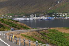 but at least we had been able to see the controversial plant. but at least we had been able to see the controversial plant.
The fjord-side port of Eskifjörður:
the far side of the bleak and otherwise deserted fjord was lined with vast
basalt-tiered mountains, and we paused at the prominent look-out point of
Hólmanes looking along the length of Reyðarfjörður, the longest of the East
Fjords. Standing here, it was evident why Reyðarfjörður was chosen as an Allied
naval-base in WW2 given the security of the deep fjord; it was tragic that 50
years later, the peaceful terrain was now sullied by such an intrusively
incongruous blot on the fjord-scape as a kilometre-long aluminium smelter.
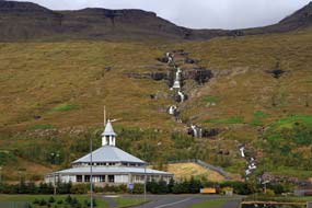 Rounding
the point of Hólmanes, the road sloped down the flank of the inner side-fjord of Eskifjörður
(see right). Just before crossing the head of the fjord into the town of Eskifjörður, a new road continued ahead curving towards the concrete portal of a new tunnel under
construction, cutting through the mountains to replace the present ongoing Route
92 which winds over a hazardous mountain pass ending at the large township of Neskaupstaður
over on Norðfjörður. The new 7.5 kms Norðfjarðargöng Tunnel was due to open in
November 2017 so we had just missed the opportunity to reach Neskaupstaður. Rounding
the point of Hólmanes, the road sloped down the flank of the inner side-fjord of Eskifjörður
(see right). Just before crossing the head of the fjord into the town of Eskifjörður, a new road continued ahead curving towards the concrete portal of a new tunnel under
construction, cutting through the mountains to replace the present ongoing Route
92 which winds over a hazardous mountain pass ending at the large township of Neskaupstaður
over on Norðfjörður. The new 7.5 kms Norðfjarðargöng Tunnel was due to open in
November 2017 so we had just missed the opportunity to reach Neskaupstaður.
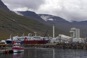 We rounded the fjord head into Eskifjörður where
the local football team was playing a home match in the small stadium. Ahead,
the town's modern church was dwarfed by a magnificent series of waterfalls cascading
down the tiered basalt cliffs (see left) (Photo
53 - Eskifjörður church). The church unfortunately was locked so we were
unable to see the east window behind the altar which looks out directly onto
this natural masterpiece. Eskifjörður is one of the only East Fjord ports still
managing to maintain a large, industrial scale fishing fleet of ocean-going
trawlers, and the large
fish-processing factory dominated the waterfront along the fjord (Photo
54 - Eskifjörður fishing harbour) (see right). It is also the
only town in the East Fjords with a geothermal borehole which provides hot water
to heat homes and the swimming pool. We drove along Strandgata, with the
enclosing mountain-sides We rounded the fjord head into Eskifjörður where
the local football team was playing a home match in the small stadium. Ahead,
the town's modern church was dwarfed by a magnificent series of waterfalls cascading
down the tiered basalt cliffs (see left) (Photo
53 - Eskifjörður church). The church unfortunately was locked so we were
unable to see the east window behind the altar which looks out directly onto
this natural masterpiece. Eskifjörður is one of the only East Fjord ports still
managing to maintain a large, industrial scale fishing fleet of ocean-going
trawlers, and the large
fish-processing factory dominated the waterfront along the fjord (Photo
54 - Eskifjörður fishing harbour) (see right). It is also the
only town in the East Fjords with a geothermal borehole which provides hot water
to heat homes and the swimming pool. We drove along Strandgata, with the
enclosing mountain-sides
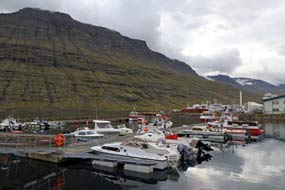 towering above the narrow fjord, and pulled off into
the docks to photograph the fishing boats and fish-processing factory (see left); a boat moored at the quay was registered at Fuglafjørður in the
Faroes where we had camped 5 months ago (see below right). The town still had a purposeful air as
we drove through, and the views of basalt-tiered mountains towering around the
fjord were magnificent. But the municipal campsite at Eskifjörður, which
we had favoured for our rest day towering above the narrow fjord, and pulled off into
the docks to photograph the fishing boats and fish-processing factory (see left); a boat moored at the quay was registered at Fuglafjørður in the
Faroes where we had camped 5 months ago (see below right). The town still had a purposeful air as
we drove through, and the views of basalt-tiered mountains towering around the
fjord were magnificent. But the municipal campsite at Eskifjörður, which
we had favoured for our rest day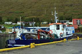 tomorrow, was tiny and right by the busy main
road; Reyðarfjörður was much better. tomorrow, was tiny and right by the busy main
road; Reyðarfjörður was much better.
A final day in camp at Reyðarfjörður Camping:
we returned around Route 92 past the aluminium smelting plant, back to Reyðarfjörður
and settled into a corner of its campsite in the shelter of mature birch trees
(see below left) (Photo
55 - Reyðarfjörður Camping). We truly hoped that, being just off the main road to Egilsstaðir,
the little campsite would remain quiet tonight. The evening grew dusky and by
8-00pm it was fully dark as we cooked supper of the last of our Djúpivogur
haddock fillets. A pleasant local lady called round to collect payment, and we
used the 27th slot on our Camping Card. The campsite remained delightfully
peaceful, the first evening for months without any disturbance by tourists and
slamming of car doors, but it was a dark, chill and miserably wet evening,
typically Reyðarfjörður weather.
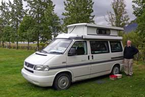 It was still wet and chill when we woke the
following morning for our final camp day in Iceland, which we should spend
winding down and preparing kit and food lists in readiness for the ferry
from Seyðisfjörður on Wednesday evening. During the morning, a snipe with adult
plumage was seen sheltering under the hedge close to our camp. It made no
attempt to fly away even when a car passed by, and its only response to our
presence was to tuck its It was still wet and chill when we woke the
following morning for our final camp day in Iceland, which we should spend
winding down and preparing kit and food lists in readiness for the ferry
from Seyðisfjörður on Wednesday evening. During the morning, a snipe with adult
plumage was seen sheltering under the hedge close to our camp. It made no
attempt to fly away even when a car passed by, and its only response to our
presence was to tuck its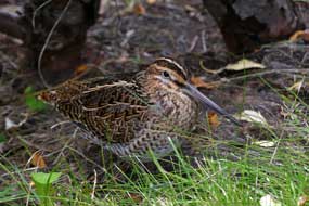 head under its wing, suggesting it was injured.
We could only leave the poor bird in peace (Photo
56 - Snipe sheltering under hedge) (see right), and later it had disappeared. We both enjoyed refreshingly relaxing
showers in the newly renovated facilities hut; it was such a welcome change to
have piping hot, unlimited showers included in the basic charge. Although
overcast and dull, the weather was stable all day, but late afternoon Fagrídalur
valley to the north filled with threateningly murky rain cloud, and a stormy,
very chill northerly wind blew up. We were pitched sideways on to this, blowing
into the door, but thankfully our screen of birches gave good protection. The
lady called round again after supper for payment, and we used the final, 28th
slot on our Camping Card; it had in fact by careful planning served us well. But
experience showed that, with the seniors' discounts available at most campsites,
the Camping Card is only worth buying if like us you are camping for several months
in Iceland with opportunity to use all its 28 slots. Reyðarfjörður Camping had
also served us well and, along with Djúpivogur,
was certainly the best of the East Fjords region's campsites. Tonight we head under its wing, suggesting it was injured.
We could only leave the poor bird in peace (Photo
56 - Snipe sheltering under hedge) (see right), and later it had disappeared. We both enjoyed refreshingly relaxing
showers in the newly renovated facilities hut; it was such a welcome change to
have piping hot, unlimited showers included in the basic charge. Although
overcast and dull, the weather was stable all day, but late afternoon Fagrídalur
valley to the north filled with threateningly murky rain cloud, and a stormy,
very chill northerly wind blew up. We were pitched sideways on to this, blowing
into the door, but thankfully our screen of birches gave good protection. The
lady called round again after supper for payment, and we used the final, 28th
slot on our Camping Card; it had in fact by careful planning served us well. But
experience showed that, with the seniors' discounts available at most campsites,
the Camping Card is only worth buying if like us you are camping for several months
in Iceland with opportunity to use all its 28 slots. Reyðarfjörður Camping had
also served us well and, along with Djúpivogur,
was certainly the best of the East Fjords region's campsites. Tonight we
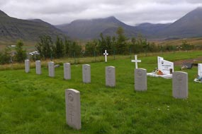 battened down for a cold, stormy and very dark night. battened down for a cold, stormy and very dark night.
Over the Fagrídalur Pass to Egilsstaðir: on a heavily overcast morning,
with low rain cloud spreading a mournful gloom over the surrounding hills,
before leaving Reyðarfjörður we drove up to the town cemetery to
pay our respects at the graves of 8 British soldiers who died tragically from
exposure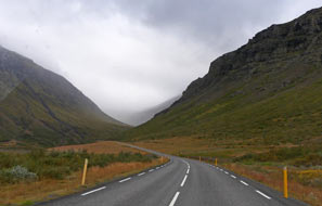 in January 1942, when they became lost on a winter training exercise in the
mountains between Reyðarfjörður and Eskifjörður. The men were buried in a
Commonwealth War Graves Commission plot at the cemetery along with a Canadian
soldier who was killed the year before in a shooting accident (see left). in January 1942, when they became lost on a winter training exercise in the
mountains between Reyðarfjörður and Eskifjörður. The men were buried in a
Commonwealth War Graves Commission plot at the cemetery along with a Canadian
soldier who was killed the year before in a shooting accident (see left).
With the rain cloud gloomier than ever, we set off northwards for the 32kms drive over Fagrídalur Pass to Egilsstaðir,
following Route 92 as it turned into the long valley approach (see right)
(click
here for map of route). Here the HV power lines feeding
the aluminium smelter led off over the fells towards the Fljötsdalur underground
HEP generating station close to tonight's campsite at Fljötsdalsgrund Farm. The
road up Fagrídalur gained height steadily for some 20kms up into these empty,
bleak fells; once clear of the valley floor, there was not a farm or any other
building in sight, save
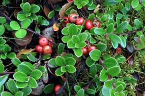 for one derelict refuge shelter towards the watershed. This was a
good road leading directly in almost a straight line up the 20kms length of the
valley. Just over the long watershed, the unsurfaced Route 953 fell away down
into Eyvindardalur towards Mjóifjörður, while the main Route 92 dropped down in
less than 10kms to the outskirts of Egilsstaðir, which we had left 5 long months ago at the start of
our circuit of Iceland. Down into the town of Egilsstaðir, we shopped for our
final nights' food at Netto, and for our final bottles of Kaldi beers at the
Vinbuðin. for one derelict refuge shelter towards the watershed. This was a
good road leading directly in almost a straight line up the 20kms length of the
valley. Just over the long watershed, the unsurfaced Route 953 fell away down
into Eyvindardalur towards Mjóifjörður, while the main Route 92 dropped down in
less than 10kms to the outskirts of Egilsstaðir, which we had left 5 long months ago at the start of
our circuit of Iceland. Down into the town of Egilsstaðir, we shopped for our
final nights' food at Netto, and for our final bottles of Kaldi beers at the
Vinbuðin.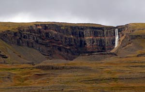
Fljötsdalur underground hydro-generating station: 10kms south from Egilsstaðir,
we turned off onto Route 31 along the length of Largarfljöt lake, pausing
part-way along by the Hallormsstaður forest trail which we had walked back in
May on our arrival in Iceland. Back then in Spring, the ground-cover Bearberry
was in full flower; now in Autumn, the plants were covered with ripening red
berries (see left). What was even more noticeable in the Hallormsstaður woodland
was how autumnally golden all the birches were turning, and how the forest floor
was already carpeted with fallen birch leaves. Continuing along the length of Largarfljöt
(see below left),
we turned across the far end of the lake, just as a patch of sunlight caught the
full face of the Hengifoss cliffs and waterfall, highlighting the red iron-rich ash and
scoria striped strata (see right) (see
Log of our May-time visit to Hengifoss).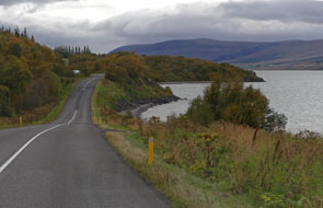
Beyond the turning onto Route 910 up to the Kárahnjúkar
Dam, we continued along past Fljötsdalsgrund Camping to the road's end at the Fljötsdalur
hydro-generating station. HV power lines emerged from the building frontage, transmitting
electricity for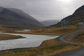 almost 50kms over the fells to the Fjarðaál aluminium smelting
plant near to Reyðarfjörður (see right). The actual generating plant is deep underground
below Valþjófsstaður mountain, at the foot of the 600m deep intake tunnel system
which delivers high pressure water 72kms from the Kárahnjúkar dams complex in
the highlands to drive the station's 6 sets of turbine~generators (Click here for map of Kárahnjúkar system).
There was little to see on the surface, but just below, alongside the Jökulsá í
Fljótsdal river's natural course, the tailrace tunnel emerged, carrying the
outflow water from the underground generating plant into an artificially cut
canal carrying the waste water to merge into the Jökulsá í Fljótsdal's natural
channel (see below left). One of the environmentalist objections to the entire Kárahnjúkar
project was this diversion of increased levels of silt-laden glacial water,
which would naturally have flowed into the neighbouring Jökulsá í Bru valley. It
now out-flowed at a greater rate into the once silt-free and gently flowing Jökulsá í
Fljótsdal river,
as a result contaminating Largarfljót
lake almost 50kms over the fells to the Fjarðaál aluminium smelting
plant near to Reyðarfjörður (see right). The actual generating plant is deep underground
below Valþjófsstaður mountain, at the foot of the 600m deep intake tunnel system
which delivers high pressure water 72kms from the Kárahnjúkar dams complex in
the highlands to drive the station's 6 sets of turbine~generators (Click here for map of Kárahnjúkar system).
There was little to see on the surface, but just below, alongside the Jökulsá í
Fljótsdal river's natural course, the tailrace tunnel emerged, carrying the
outflow water from the underground generating plant into an artificially cut
canal carrying the waste water to merge into the Jökulsá í Fljótsdal's natural
channel (see below left). One of the environmentalist objections to the entire Kárahnjúkar
project was this diversion of increased levels of silt-laden glacial water,
which would naturally have flowed into the neighbouring Jökulsá í Bru valley. It
now out-flowed at a greater rate into the once silt-free and gently flowing Jökulsá í
Fljótsdal river,
as a result contaminating Largarfljót
lake
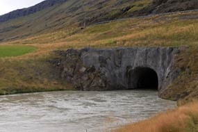 with greater concentration of glacial silt; this causes the formerly clear
lake waters to become more opaque, adversely affecting the lake's natural
vegetation and fish. We drove down to the tailrace end, where the
fast-flowing out-flow water was visibly very murky and silt-laden (see right). with greater concentration of glacial silt; this causes the formerly clear
lake waters to become more opaque, adversely affecting the lake's natural
vegetation and fish. We drove down to the tailrace end, where the
fast-flowing out-flow water was visibly very murky and silt-laden (see right).
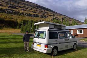 Return to Fljötsdalsgrund Camping: back along the valley to Fljötsdalsgrund
Camping, we pitched George on the grassy strip alongside the driveway opposite
the facilities hut, and phoned Helga the farm owner to say that, as promised back
in May on our first stay at the start of our Icelandic venture, we had returned.
We settled in and Sheila did a final batch of laundry to last out the remainder
of the trip. This was hung out on a line strung between the birches, but with
little chance of drying now as a misty drizzle began. At 6-00pm, Helga came
round to greet us again and collect her payment. We cooked our penultimate
supper in Iceland as the evening grew very cold and dark, with a brisk NE wind
blowing up the valley; how different from our May-time stay when we eat out for
meals at the picnic table in warm Spring sunshine! Tomorrow, our last full day
in Iceland, we planned to spend up in the Snæfell Mountains, to see for
ourselves the scale of devastation brought about by construction of the
Kárahnjúkar Dam and flooding of the Hálslón reservoir. Return to Fljötsdalsgrund Camping: back along the valley to Fljötsdalsgrund
Camping, we pitched George on the grassy strip alongside the driveway opposite
the facilities hut, and phoned Helga the farm owner to say that, as promised back
in May on our first stay at the start of our Icelandic venture, we had returned.
We settled in and Sheila did a final batch of laundry to last out the remainder
of the trip. This was hung out on a line strung between the birches, but with
little chance of drying now as a misty drizzle began. At 6-00pm, Helga came
round to greet us again and collect her payment. We cooked our penultimate
supper in Iceland as the evening grew very cold and dark, with a brisk NE wind
blowing up the valley; how different from our May-time stay when we eat out for
meals at the picnic table in warm Spring sunshine! Tomorrow, our last full day
in Iceland, we planned to spend up in the Snæfell Mountains, to see for
ourselves the scale of devastation brought about by construction of the
Kárahnjúkar Dam and flooding of the Hálslón reservoir.
Kárahnjúkar Dam in the highlands of East Iceland:
the Kárahnjúkar Dams project, named after Kárahnjúkar mountain, involved damming both the Jökulsá í Bru and Jökulsá í Fljótsdal
to create a complex of 3 reservoirs, with 5 concrete-faced rock-fill embankment
dams. The largest of the reservoirs is
the 57 km2 Hálslón artificial lake, which stretches all the way south
from the Kárahnjúkar to the foot of Brúarjökull, a 1600km2
glacial-tongue extending northward from the Vatnajökull ice-cap.
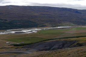 High pressure water
from the enormous reservoir is then
channelled to the Fljötsdalur generating plant via a 73kms complex of
underground head-race conduits, finally dropping down a 420m high vertical
penstock-tunnel to provide a 600m head of water to drive the turbine~generators.
All out-flow water is now discharged into the once gently flowing Jökulsá í Fljótsdal river at a
vastly increased flow rate of 144m3 per second (Click here for map of Kárahnjúkar system). High pressure water
from the enormous reservoir is then
channelled to the Fljötsdalur generating plant via a 73kms complex of
underground head-race conduits, finally dropping down a 420m high vertical
penstock-tunnel to provide a 600m head of water to drive the turbine~generators.
All out-flow water is now discharged into the once gently flowing Jökulsá í Fljótsdal river at a
vastly increased flow rate of 144m3 per second (Click here for map of Kárahnjúkar system).
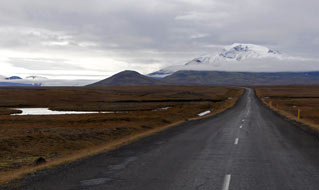
The Kárahnjúkar Dam is the centrepiece of the 5
dams, damming the main course of the Jökulsá í Bru at Fremri Kárahnjúkar at
the head of the Hafrahvammar Canyon. This mighty canyon had been carved out over
aeons by the natural flow of glacial melt-waters from Brúarjökull, forming the Jökulsá í Bru
river. Two smaller auxiliary saddle-dams complete
the river's damming at Kárahnjúkar to form the Hálslón reservoir, the Desjará Dam to the east, and the Sauðárdalur Dam to the west. At 193m
high and 730m wide, Kárahnjúkar is Europe's largest dam, and among the largest of this type of dam in the world. In comparison,
the Desjará is 60m tall and 1,000m wide and the Sauðárdalur 25m tall
and 1,100m wide. Most years, the Hálslón reservoir now fills with glacial melt-water
from Vatnajökull in late summer. When this happens, overspill water is diverted
at Kárahnjúkar Dam along a spill-way channel to the edge of the Hafrahvammar
Canyon, dropping to form the 100m high Hverfandi artificially created waterfall,
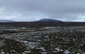 then to flow through the Hafrahvammar Canyon and on along the natural
course of the Jökulsá í Bru river. For most of the year however, while water
levels in the reservoir are lower, the over-spill channel and Hverfandi falls
are dry, and the now dammed Upper Jökulsá í Bru is merely a trickle, leaving the Hafrahvammar
Canyon almost empty of river torrents which had once surged down the valley from
the glaciers. Construction of the entire complex lasted
from 2003~2007, at the same time as the Reyðarfjörður smelting plant which the
dams power; all became operational in 2008. then to flow through the Hafrahvammar Canyon and on along the natural
course of the Jökulsá í Bru river. For most of the year however, while water
levels in the reservoir are lower, the over-spill channel and Hverfandi falls
are dry, and the now dammed Upper Jökulsá í Bru is merely a trickle, leaving the Hafrahvammar
Canyon almost empty of river torrents which had once surged down the valley from
the glaciers. Construction of the entire complex lasted
from 2003~2007, at the same time as the Reyðarfjörður smelting plant which the
dams power; all became operational in 2008.
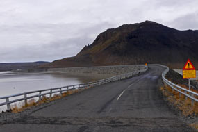 Background to and consequences of the Kárahnjúkar Dam
project: Iceland's domestic and industrial demand for
electricity was already more than adequately supplied by the county's existing
complex of hydro-generating plants along the Upper Þjórsárdalur valley and the
geothermal generating capacity around Krafla in the north and Hengill in the SW,
all of which we had visited during or Icelandic travels. The only reason for
building this enormous dams complex up in the Kárahnjúkar wilderness, flooding
so much wild, unspoilt land north of Vatnajökull by creation of the vast Hálslón
reservoir to provide head-waters to drive the Fljötsdalur HEP
generating plant, was solely to supply power for Alcoa's Fjarðaál aluminium
smelter at Reyðarfjörður. Iceland neither needed nor directly benefits from the environmental disaster of the Kárahnjúkar dams; the only beneficiaries
are the overseas financial investment and industrial interests, profiting from
the country's cheap hydro-energy resources, at Iceland's environmental expense. Background to and consequences of the Kárahnjúkar Dam
project: Iceland's domestic and industrial demand for
electricity was already more than adequately supplied by the county's existing
complex of hydro-generating plants along the Upper Þjórsárdalur valley and the
geothermal generating capacity around Krafla in the north and Hengill in the SW,
all of which we had visited during or Icelandic travels. The only reason for
building this enormous dams complex up in the Kárahnjúkar wilderness, flooding
so much wild, unspoilt land north of Vatnajökull by creation of the vast Hálslón
reservoir to provide head-waters to drive the Fljötsdalur HEP
generating plant, was solely to supply power for Alcoa's Fjarðaál aluminium
smelter at Reyðarfjörður. Iceland neither needed nor directly benefits from the environmental disaster of the Kárahnjúkar dams; the only beneficiaries
are the overseas financial investment and industrial interests, profiting from
the country's cheap hydro-energy resources, at Iceland's environmental expense.
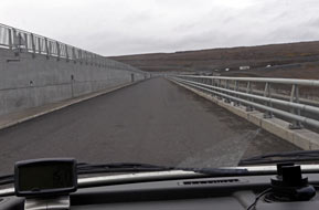 As a result of the Kárahnjúkar project, unique
geological formations and landscapes along Hafrahvammar Canyon have been
irredeemably lost, and downstream ecosystems have suffered impacts yet to be
fully understood. The local fish population in Lagarfljót lake has been killed
by excess silt, and East Iceland’s wild reindeer population has been deprived of
a vast wilderness area of grazing and breeding grounds as a result of inundation
by Hálslón reservoir. The then Icelandic government envisaged the combined Kárahnjúkar development As a result of the Kárahnjúkar project, unique
geological formations and landscapes along Hafrahvammar Canyon have been
irredeemably lost, and downstream ecosystems have suffered impacts yet to be
fully understood. The local fish population in Lagarfljót lake has been killed
by excess silt, and East Iceland’s wild reindeer population has been deprived of
a vast wilderness area of grazing and breeding grounds as a result of inundation
by Hálslón reservoir. The then Icelandic government envisaged the combined Kárahnjúkar development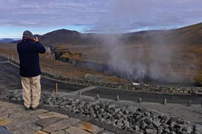 project and Reyðarfjörður aluminium smelter would boost the regional economy in the East of
the country. To support this goal, the Environment Minister overrode the
environmental impact assessment that vetoed the hydro-energy project because of
its destructive environmental impact. Yet despite claims that the development
would bring increased local employment opportunities to East Iceland, the entire
workforce both for the Kárahnjúkar construction and at the Alcoa Fjarðaál
smelting plant was supplied by low cost immigrant labour, mainly Polish and East
European. The contract between Landsvirkjun and Alcoa turned out to be unfavourable for the state-run energy
company. The energy prices paid by Alcoa are extremely low and
tied to the volatile global market prices for aluminium. This
makes revenue for Landsvirkjun very low and unpredictable. In
addition, Alcoa has contrived to avoid paying any taxes in Iceland:
revenues from Alcoa's Icelandic operation are used to pay interest on
the paper debt owed to its parent company based in Luxembourg;
the local smelting company has therefore appeared not to have
generated any project and Reyðarfjörður aluminium smelter would boost the regional economy in the East of
the country. To support this goal, the Environment Minister overrode the
environmental impact assessment that vetoed the hydro-energy project because of
its destructive environmental impact. Yet despite claims that the development
would bring increased local employment opportunities to East Iceland, the entire
workforce both for the Kárahnjúkar construction and at the Alcoa Fjarðaál
smelting plant was supplied by low cost immigrant labour, mainly Polish and East
European. The contract between Landsvirkjun and Alcoa turned out to be unfavourable for the state-run energy
company. The energy prices paid by Alcoa are extremely low and
tied to the volatile global market prices for aluminium. This
makes revenue for Landsvirkjun very low and unpredictable. In
addition, Alcoa has contrived to avoid paying any taxes in Iceland:
revenues from Alcoa's Icelandic operation are used to pay interest on
the paper debt owed to its parent company based in Luxembourg;
the local smelting company has therefore appeared not to have
generated any
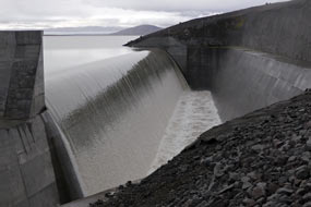 taxable profits. Since Alcoa Iceland has declared no operating
profits from the Reyðarfjörður aluminium smelter, the Icelandic government
has not yet benefited from any taxation revenue. This is
particularly scandalous, as Alcoa's 2012 annual report had praised the
Reyðarfjörður smelter for its record profits, describing it as a profit
leader due to
low local
energy prices. Yet no such profits have been recorded in the company's books in
Iceland. taxable profits. Since Alcoa Iceland has declared no operating
profits from the Reyðarfjörður aluminium smelter, the Icelandic government
has not yet benefited from any taxation revenue. This is
particularly scandalous, as Alcoa's 2012 annual report had praised the
Reyðarfjörður smelter for its record profits, describing it as a profit
leader due to
low local
energy prices. Yet no such profits have been recorded in the company's books in
Iceland.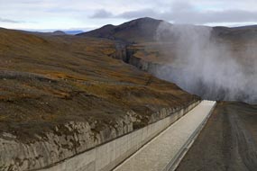
For more on the Kárahnjúkar Dam controversy, see 2003 Guardian
article
Power Driven on the
environmental and political issues raised by Kárahnjúkar. See also see
Kárahnjúkar Dam controversy
for background to the controversial construction.
Our visit to the Kárahnjúkar Dam: a
steep climb via a sequence of 8 hair-pin bends brought the asphalted Route 910
up out of the valley (see above left) (click
here for map of route) onto Fljótsdalsheiði plateau-top fell-land for the 60kms
drive out across this stony, barren wilderness to the complex of 3 Kárahnjúkar
dams. As we made progress across the immense and lonely
plateau-land of stony wilderness, ahead loomed the impressive outline of 1,833
high Snæfell, its snow-covered dome partly hidden by cloud on a dull morning
(see above right); on the distant horizon, the Vatnajökull ice-cap was just
visible.
Route 910 was a well-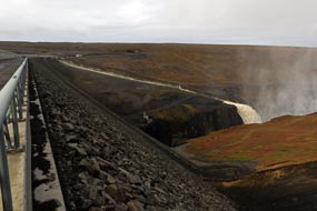 surfaced, wide asphalt road, built to give access to the
dams. The road swung westwards, advancing over ever bleaker landscape, and as we
passed over higher moorland, a fresh sprinkling of snow coated the barren fells
(see above left).
After over an hour's drive across 60kms of Fljótsdalsheiði's desolately empty, high moorland plateau, with the dominating
presence of snow-capped Snæfell looming over the highlands, we finally came into
sight of the distant Hálslón reservoir, and reached the first of the surfaced, wide asphalt road, built to give access to the
dams. The road swung westwards, advancing over ever bleaker landscape, and as we
passed over higher moorland, a fresh sprinkling of snow coated the barren fells
(see above left).
After over an hour's drive across 60kms of Fljótsdalsheiði's desolately empty, high moorland plateau, with the dominating
presence of snow-capped Snæfell looming over the highlands, we finally came into
sight of the distant Hálslón reservoir, and reached the first of the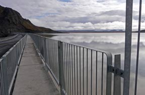 complex of
three dams. We had arrived
at the point where the road crossed the top of the 1km wide Desjará
Dam. Hesitantly we turned onto the road-way across top of the dam's wall (see
above right). To the
south, the grey and murky Hálslón reservoir stretched away into the remote
distance. Below the outer face of the dam's rock-fill 60m high wall, a virtually
dry valley extended northwards which was once filled with a side-tributary of
the Jökulsá í Bru. Ahead of us to the west, the craggy face and
bulky ridge of Kárahnjúkar mountain loomed, bridging the gap between the Desjará
and Kárahnjúkar Dams. Across on the far side, the road rounded the mountain's
base to turn 90º onto the start of the crossing of Kárahnjúkar Dam. Beyond the
mountain, the land fell away abruptly into the deep Dimmugljúfur Gorge below the
unbelievably tall outer face of the dam's rock-fill wall. The head of the gorge
was filled with vast, billowing clouds of spray from Hverfandi waterfalls, still
largely out of sight, where the dam's overspill flowed down an artificial
spill-way to drop 100m into the Hafrahvammar Canyon carved out by the complex of
three dams. We had arrived
at the point where the road crossed the top of the 1km wide Desjará
Dam. Hesitantly we turned onto the road-way across top of the dam's wall (see
above right). To the
south, the grey and murky Hálslón reservoir stretched away into the remote
distance. Below the outer face of the dam's rock-fill 60m high wall, a virtually
dry valley extended northwards which was once filled with a side-tributary of
the Jökulsá í Bru. Ahead of us to the west, the craggy face and
bulky ridge of Kárahnjúkar mountain loomed, bridging the gap between the Desjará
and Kárahnjúkar Dams. Across on the far side, the road rounded the mountain's
base to turn 90º onto the start of the crossing of Kárahnjúkar Dam. Beyond the
mountain, the land fell away abruptly into the deep Dimmugljúfur Gorge below the
unbelievably tall outer face of the dam's rock-fill wall. The head of the gorge
was filled with vast, billowing clouds of spray from Hverfandi waterfalls, still
largely out of sight, where the dam's overspill flowed down an artificial
spill-way to drop 100m into the Hafrahvammar Canyon carved out by the
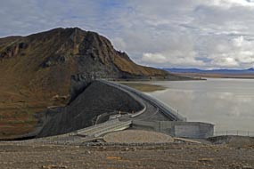 ongoing Jökulsá í Bru
river. ongoing Jökulsá í Bru
river.
Still totally overawed by such monumental
surroundings, we began our crossing of the 2-lane road-way over the curving top
of the dam, below the high concrete inner wall on our left (see above left), to reach a parking area on
the far side. From here there was a clearer view of the Hafrahvammar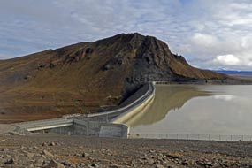 Canyon's
deep gash winding across the fell-side below the spray of the overspill falls (Photo
57 - Hafrahvammar Canyon) (see above right).
On this far side, the road crossed a bridge over the dam's spill-way where overspill
water from the now full reservoir dropped in a long, even cascade down into the
artificial spill-way channel
(see above left) (Photo
58 - Hálslón reservoir overspill ). Evil-looking, turbulent, foaming grey waters
surged down the chute with mesmerising force for some 750m towards Hverfandi falls, then
to plunge into the head of the Dimmugljúfur Gorge (Photo
59 - Kárahnjúkar spill-way) (see above right). Leaving George here, we
walked back across the 700m wide dam, and from the wall above the high rock-fill
outer face, the Hverfandi falls came increasingly into view, topped by billowing
clouds of spray as the waters dropped from the chute's end over into the narrow head of the canyon (Photo
60 - Hverfandi falls) (see above left). Canyon's
deep gash winding across the fell-side below the spray of the overspill falls (Photo
57 - Hafrahvammar Canyon) (see above right).
On this far side, the road crossed a bridge over the dam's spill-way where overspill
water from the now full reservoir dropped in a long, even cascade down into the
artificial spill-way channel
(see above left) (Photo
58 - Hálslón reservoir overspill ). Evil-looking, turbulent, foaming grey waters
surged down the chute with mesmerising force for some 750m towards Hverfandi falls, then
to plunge into the head of the Dimmugljúfur Gorge (Photo
59 - Kárahnjúkar spill-way) (see above right). Leaving George here, we
walked back across the 700m wide dam, and from the wall above the high rock-fill
outer face, the Hverfandi falls came increasingly into view, topped by billowing
clouds of spray as the waters dropped from the chute's end over into the narrow head of the canyon (Photo
60 - Hverfandi falls) (see above left).
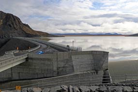 While the engineering feat of the dam's monumental construction was indisputably
extraordinary, the natural vista and unimaginable power of the falling water, and
the canyon's titanic gash were even more awe-inspiring. Across on far side of the
dam, below the craggy slopes of Kárahnjúkar mountain, we climbed up onto the
walkway across the top of the dam's water-side concrete lining wall, and began
the nerve-wracking walk to re-cross the width of the dam, While the engineering feat of the dam's monumental construction was indisputably
extraordinary, the natural vista and unimaginable power of the falling water, and
the canyon's titanic gash were even more awe-inspiring. Across on far side of the
dam, below the craggy slopes of Kárahnjúkar mountain, we climbed up onto the
walkway across the top of the dam's water-side concrete lining wall, and began
the nerve-wracking walk to re-cross the width of the dam,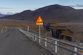 with just a handrail
separating us from the immense reservoir's grey waters immediately below our
feet (see above right). Back at the far end, a viewpoint above the spill-way
gave a full view of the rock-fill retaining wall's height and width (see above
left) (Photo
61 - Rock-fill retaining wall) spanning the Dimmugljúfur Gorge
against the backdrop of Kárahnjúkar mountain (Photo
62 - Kárahnjúkar Dam) (see above right), and the scale of the Hálslón reservoir
stretching away southwards into unseen distances to the foot of Vatnajökull ice-cap
(see left) (Photo
63 - Hálslón reservoir). We drove back down from the upper area of the
dam (see right), and as the weather began to improve, a rainbow
materialised in the misty spray above the Hverfandi falls (Photo
64 - Kárahnjúkar rainbow). with just a handrail
separating us from the immense reservoir's grey waters immediately below our
feet (see above right). Back at the far end, a viewpoint above the spill-way
gave a full view of the rock-fill retaining wall's height and width (see above
left) (Photo
61 - Rock-fill retaining wall) spanning the Dimmugljúfur Gorge
against the backdrop of Kárahnjúkar mountain (Photo
62 - Kárahnjúkar Dam) (see above right), and the scale of the Hálslón reservoir
stretching away southwards into unseen distances to the foot of Vatnajökull ice-cap
(see left) (Photo
63 - Hálslón reservoir). We drove back down from the upper area of the
dam (see right), and as the weather began to improve, a rainbow
materialised in the misty spray above the Hverfandi falls (Photo
64 - Kárahnjúkar rainbow).
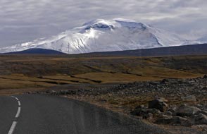 Given that Iceland had no intrinsic need for the
dam project, nor gains any direct benefit from its operation, the sheer scale of
remote, once unspoilt wilderness terrain now swallowed up by this immense body
of water showed at first hand the obscene folly and intemperate greed that had
given rise to the Kárahnjúkar project. The scale and daring of the
Kárahnjúkar engineering was undeniably impressive, and the
potential of the surroundings gave us Given that Iceland had no intrinsic need for the
dam project, nor gains any direct benefit from its operation, the sheer scale of
remote, once unspoilt wilderness terrain now swallowed up by this immense body
of water showed at first hand the obscene folly and intemperate greed that had
given rise to the Kárahnjúkar project. The scale and daring of the
Kárahnjúkar engineering was undeniably impressive, and the
potential of the surroundings gave us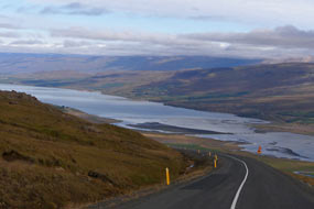 endless photographic potential. There is
however
no denying that the case against the dam seemed
self-evidently proven by the environmental impact which we now could see with
our own eyes. endless photographic potential. There is
however
no denying that the case against the dam seemed
self-evidently proven by the environmental impact which we now could see with
our own eyes.
Return to Fljötsdalsgrund Camping for our final night in Iceland:
re-crossing the 2 dams, we began the long, 60kms drive back across the once
unsullied highland wilderness. As we drove back, the weather brightened and cloud
lifted to give a clear and fulsome view of snow-covered Snæfell's mountainous
scale (see left) (Photo
65 - Snow-covered Snæfell), looking so grandiose against the now partially blue sky. Back across Fljótsdalsheiði's
moorland, we finally dropped steeply down the series of 8 hairpins alongside the
Bássastaðir Gorge, looking along the length of Largarfljöt lake down in
Fljótsdalur valley (see right), to return to camp at Fljötsdalsgrund Farm for
our final night in Iceland.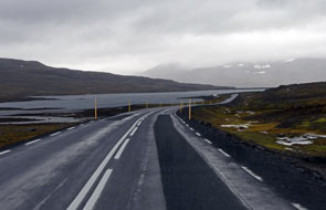
Return to Egilsstaðir and Seyðisfjörður:
George was packed for the final time in Iceland, and with farewells to
Fljötsdalsgrund after our second stay, at the start and end of this trip, we
departed to return along the Fljótsdalur valley (click
here for map of route). The weather was grey and
bitterly cold, and despite the forecast for gentle breeze, a gusty wind was
blowing. As we drove back past Hallormsstaður, the birches were autumnally golden
and the crisp wind blowing across
the lake raised serious waves. The waters of Largarfljót were visibly opaque
grey from the volumes of glacial sediment now being deposited in the once clear
lake. It took just over an hour to reach Egilsstaðir where we shopped for our
ferry food, and gave George his promised hose-brushing at the filling station to
remove all the accumulated dirt road mud from the last week. Leaving Egilsstaðir
for the last time, we turned up the Seyðisfjörður road to tackle the series of 5
hairpins over the mountain pass. The weather was now utterly grim, with a very
chill wind blowing mountain rain and low misty cloud obscuring the mountains.
There were even traces of residual snow still clinging to north-facing hollows
on the gloomy mountain sides. Across the desolate plateau, which today looked
gloomier than ever in this foul weather, we began the final descent towards Seyðisfjörður.
After a was grey and
bitterly cold, and despite the forecast for gentle breeze, a gusty wind was
blowing. As we drove back past Hallormsstaður, the birches were autumnally golden
and the crisp wind blowing across
the lake raised serious waves. The waters of Largarfljót were visibly opaque
grey from the volumes of glacial sediment now being deposited in the once clear
lake. It took just over an hour to reach Egilsstaðir where we shopped for our
ferry food, and gave George his promised hose-brushing at the filling station to
remove all the accumulated dirt road mud from the last week. Leaving Egilsstaðir
for the last time, we turned up the Seyðisfjörður road to tackle the series of 5
hairpins over the mountain pass. The weather was now utterly grim, with a very
chill wind blowing mountain rain and low misty cloud obscuring the mountains.
There were even traces of residual snow still clinging to north-facing hollows
on the gloomy mountain sides. Across the desolate plateau, which today looked
gloomier than ever in this foul weather, we began the final descent towards Seyðisfjörður.
After a
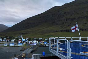 pause for late lunch sandwiches almost at the foot of the pass in this
chill, driving, wet drizzle, we reached the outskirts of Seyðisfjörður and
turned along to the port. To our relief, we could see the ferry M/S Norröna
docked at the port in the misty distance. pause for late lunch sandwiches almost at the foot of the pass in this
chill, driving, wet drizzle, we reached the outskirts of Seyðisfjörður and
turned along to the port. To our relief, we could see the ferry M/S Norröna
docked at the port in the misty distance.
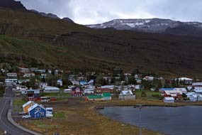 Departing Iceland on the ferry for Hirtshals in Denmark: it was now only 2-00pm and check-in for the ferry would not even begin for a couple of hours.
With wind-driven, soaking rain now pouring, making it impossible to check though
our ferry kit and food outdoors as planned, we drove around to the Smyril Line
terminal building, taking everything into the waiting area to check through and
re-load. The room was filled with other ferry passengers doing likewise. At
4-30pm we drove back around to the ferry dock, and after a brief queuing, we
were able to check-in and move through to the ferry waiting lanes (see above
right). Here we waited along with other small campers. At 5-30pm the first
vehicles moved forward to board, but it was another hour before George's line
was able to drive on board. With the weather so cold and wet, and with fewer
vehicles to load than on the outward crossing, at least passengers were allowed
to board with their vehicles. Initially the car deck seemed quite empty, but the
crewmen were parking vehicles into the far end of the hold without turning. What
chaos there would be when disembarking at Hirtshals remained to be seen! George
was parked in line, we unloaded our kit and food, and we went aloft to find our
cabin. Departing Iceland on the ferry for Hirtshals in Denmark: it was now only 2-00pm and check-in for the ferry would not even begin for a couple of hours.
With wind-driven, soaking rain now pouring, making it impossible to check though
our ferry kit and food outdoors as planned, we drove around to the Smyril Line
terminal building, taking everything into the waiting area to check through and
re-load. The room was filled with other ferry passengers doing likewise. At
4-30pm we drove back around to the ferry dock, and after a brief queuing, we
were able to check-in and move through to the ferry waiting lanes (see above
right). Here we waited along with other small campers. At 5-30pm the first
vehicles moved forward to board, but it was another hour before George's line
was able to drive on board. With the weather so cold and wet, and with fewer
vehicles to load than on the outward crossing, at least passengers were allowed
to board with their vehicles. Initially the car deck seemed quite empty, but the
crewmen were parking vehicles into the far end of the hold without turning. What
chaos there would be when disembarking at Hirtshals remained to be seen! George
was parked in line, we unloaded our kit and food, and we went aloft to find our
cabin.
 Having stowed our kit, we went up to the stern
of the outer deck while there was still residual light for final photos looking
down across the tiny village-port of Seyðisfjörður (see above left)
(Photo
66 - Seyðisfjörður ferry port). The sky had cleared a little, but it was
evident that the rain of earlier had fallen as the first sprinkling of the snows
of autumn on the high mountains surrounding the narrow fjord (see above right) (Photo
67 - First snows of autumn). With the harsher weather of approaching winter
beginning, it was definitely time to be leaving Having stowed our kit, we went up to the stern
of the outer deck while there was still residual light for final photos looking
down across the tiny village-port of Seyðisfjörður (see above left)
(Photo
66 - Seyðisfjörður ferry port). The sky had cleared a little, but it was
evident that the rain of earlier had fallen as the first sprinkling of the snows
of autumn on the high mountains surrounding the narrow fjord (see above right) (Photo
67 - First snows of autumn). With the harsher weather of approaching winter
beginning, it was definitely time to be leaving Iceland. The light was now
fading fast, and we went down below to the warmth of the ferry lounge, and at
8-00pm Norröna's engines increased their revs. The ferry drew away from
the dock and the lights of Seyðisfjörður faded quickly into the distance, as we
watched Norröna's wake from the bow windows. After our 5 month and very eventful stay in this country, it was
Farewell Iceland!
(Photo
68 - Farewell Iceland) (see left and right). Iceland. The light was now
fading fast, and we went down below to the warmth of the ferry lounge, and at
8-00pm Norröna's engines increased their revs. The ferry drew away from
the dock and the lights of Seyðisfjörður faded quickly into the distance, as we
watched Norröna's wake from the bow windows. After our 5 month and very eventful stay in this country, it was
Farewell Iceland!
(Photo
68 - Farewell Iceland) (see left and right).
Iceland overwhelmed by mass tourism: we
have bitter-sweet memories of our long and satisfyingly arduous summer in
Iceland, a place of 2 extremes: at the highest level, the spectacular volcanic
terrain, and unprecedented bird-life and wild flora, was some of the most
majestic ever experienced; at the lowest extreme however, this small and starkly
beautiful country is now so utterly and severely ravaged by the mass tourism
industry. Iceland's native population of 360,000 is increased by over 2 million
tourists each year! The overall result is that, with the deepest regret, we are
compelled to urge that serious and responsible travellers should avoid Iceland
completely, and allow the island space and time to recover from this assault by
mass tourism before the damage becomes irretrievable.
Final edition
with a review of all the campsites used in Faroes and Iceland
to be published quite soon
|
Sheila and Paul |
Published: 22 January 2020 |
|

 CAMPING
IN ICELAND 2017 - Breiðamerkursandur, Skaftafell National Park, Fjallsárlón
and Jökulsárlón glacial lagoons,
SE coast from Höfn to Djúpivogur, East Fjords at Breiðdalvík, Stöðvarfjörður, Fáskrúðsfjörður,
Eskifjörður, Reyðarfjörður, Kárahnjúkar Dam, return to Egilsstaðir and Seyðisfjörður for Smyril
Line ferry to Denmark:
 Eastwards
from Kirkjubæjarklaustur:
before leaving Kirkjubæjarklaustur, we said farewell to the German couple who
had been our neighbours in camp here, and whom we had seen up at Lakagígur
craters yesterday. They had bravely driven the F206 mountain road in their
little 4WD Lada, and we should see them again later in September since by
coincidence they also were booked on the same return Smyril Line ferry from
Seyđisfjörđur as ourselves. Having shopped for provisions at the little stores
in Kirkjubæjarklaustur village, we set off eastwards on the Ring Road (click
on Map 1 right for details of route)
 on the
escarpment-line
of former coastal cliffs which extended along the length of the
road across the coastal plain lowlands (see above left); here the Lower Skaftá River spread out
across Brunasandur sand/gravel flood-plain through the many-channelled Landbrotsvotn estuary towards the southern coast. Farms and their lowland
pastures lined the foot of the rocky escarpment that marked the downfall from
the inland mountains. The escarpment's dark brown stratified Palagonite tuff
rock was weathered into arrays of fantastically shaped towers and outcrops, and
we paused close to where the Foss á Siða waterfalls tumbled over the brink of
the escarpment precipice to flow on past the farm at its foot (see left) (
 opened
up in late-July 1783, pouring out vast quantities of molten lava which flooded
down the upper gorge-valley of the Hverfisfljót river, into the lowlands
destroying and burying farms and spreading out into the Brunasandur sand/gravel
flood-plain. The eruption lasted until February 1784, producing what is believed
to be one of the most voluminous flows of lava in historical times, pouring out
an estimated 14 cubic kilometres of basalt lava which covered an area of almost
600 square kilometres of territory.
 Nupsstaður 1650 turf huts and chapel:
the Ring Road now approached the majestic mountainous massif of
Kálfafellsheiði with its sculpted Palagonite rock towers and pillars, at the
foot of which stood the Nupsstaður Farm. This includes several preserved
turf-roofed farm buildings dating from 1650 and typical of farms of that period,
and a turf chapel, one of the few remaining such turf churches. Although
preserved by the National Museum of Iceland, the chapel at Nupsstaður is on
private property and access even to the farm driveway was regrettably barred by a distinctly
unwelcoming locked gate. The huts and church were set back far from the Ring Road and we could only peer from a distance.
 plain, is now used universally to describe this topographical
phenomenon. Skeiðarársandur is the world's largest sandur, a vast waste
of grey-black sands stretching 60kms west to east from Nupsstaður to Öræfi, and 40kms
from its source ice-cap to the coast, covering an area of 1,300 square kms. It
was created from all the silt, sand and gravel scraped up by the mighty
Skeiðarárjökull glacier, the largest of Vatnajökull ice-cap's glacial tongues.
This glacial and volcanic sediment and debris is then transported down to the
coastal plain both by the
 Skeiðará River and a myriad of other glacial rivers,
and by glacial flash-floods (jökulhlaup) fed by the Grimsvötn and
Öræfajökull volcanic systems, and dumped across the huge desert-like flood-plain
now devoid of any vegetation (see above left). From the time of Iceland's Settlement, there were
farms in the region which over time have been swallowed up by the sandur.
The great eruption of 1362 under Öræfajökull caused jökulhlaup
flash-floods which laid waste the entire region. Skeiðarársandur was an
impassable obstacle to travellers across the region until 1974, when the final
section of the Ring Road was completed with a series of bridges constructed to
span the complex network of turbulent, ever-shifting glacial rivers flowing out
from under Skeiðarárjökull.
 this an
even more stressfully hazardous driving experience; despite our observing the
90kph speed
limit, tourist cars constantly hurtled past. Given the overwhelming
volume of tourist traffic, and the cost of maintaining this precious yet
vulnerable route across the sandur's ever-shifting terrain, the
 Icelandic Government would do well to position frequent speed cameras across this 60kms
stretch of the Ring Road. The revenue raised from speeding fines levied on
tourists or their hire car companies would constitute a viable form of tourist
taxation to contribute to the road's constant need for maintenance. The need for
maximum concentration on both the road and the speeding traffic meant that Paul
could have little appreciation of the fearsomely impressive surroundings of the
flat sand/gravel wasteland, marbled by so many melt-water channels, the distant
40kms wide glacial tongue of Skeiðarárjökull, and the eastern skyline dominated
by the Vatnajökull ice-cap. Three quarters of the way across, we were able to
pull off into a lay-by for full appreciation to the wonderful vista of the
distant ice-cap against the foreground of the sandur's desolate
wasteland (see above left) (
 left) replacing earlier bridges washed away by the disastrous 1996 jökulhlaup
flash-flood. At the far side, we
reached a parking area by the site of the original Skeiðarárbru Bridge that had
once carried the Ring Road across the main channel of the Skeiðarár glacial
river. The impressive structure
 of the almost 1,000m long Skeiðarárbru Bridge had been a major engineering feat when
constructed in 1974~75, to complete the Ring Road's crossing of Skeiðarársandur.
Before that time, the unstable terrain of Skeiðarársandur was such an obstacle
to road construction that the Ring Road remained incomplete in this region.
Prior to 1974, this had meant that anyone from Höfn wishing to travel west by
road to Reykjavík had in fact to drive eastward anticlockwise all the way around the
Ring Road via Akureyri to reach the capital. But despite its scale, the bridge
was all to no avail: 20 years after its construction, in October 1996 Grimsvötn
erupted again under the Vatnajökull ice-cap. Geothermal heat from lava and ash
contained beneath the glacier melted a monumental mass of water which lifted the
ice-cap 10m before finally, after a month of anxious waiting, the inevitable
happened: the pressure of sub-glacial water outburst along a 300m wall of ice on
5 November 1996, sending 3 billion litres of water spewing across the sandur
in a 5m high tsunami, sweeping away a 7kms stretch of the Ring Road, despite the
long gravel dykes built to channel flood waters away from the highway. The Skeiðarárbru
Bridge was washed away like match sticks in less than an hour. At its height,
the jökulhlaup was surging down at
 50,000m3 per second, carrying with it enormous
chunks of glacial ice and boulders ripped from Skeiðarárjökull out across the
flooded sandur down to the ocean. The twisted girders of the bridge, all
that remained after the destruction, stand today as testament to the fury of the 1996 jökulhlaup
flash-flood, which demonstrated how
  vulnerable this stretch of the Ring Road was
(see above left)
(
 Svartifoss waterfalls dropping from the fellside above
into the cove, surrounded by the most elegant basalt columnar array
(
 flow; shrinkage contraction causes the new igneous rock to develop fracture networks resulting in formation of the
6-sided columns. The columns always form at right angles to the cooling surface
where heat loss is greatest (see diagram below right); this means that vertical
columns are created when a basaltic lava intrusion flows into horizontal cracks in the
bed-rock (sills), and horizontal columns when the lava intrusion flows into vertical cracks
(dykes). Where the cooling surface is irregular, the columns radiate in many
directions. Hexagonal columns are the most common since fracture patterns with
120º corners are the most efficient for stress resistance as in dried up muddy
ponds, or freeze-thaw patterns in the ground. Hence 6-sided patterns are seen
widely in nature as the most efficient close-packing use of space (eg honeycombs).
Whatever the technical geological explanation of basalt column formation, there
was no denying the beauty in their visual aesthetics and the elegance of the
columns' symmetry, seen to best effect here at Svartifoss.
 Skaftafell:
leaving the tourists to their silly antics around the falls, we crossed the
stream descending from Svartifoss to begin the climb up onto the open heath-land
of Skaftafellsheiði. As we crossed the foot-bridge, a little Icelandic Wren
hopped around on
 the boulders beneath our feet. Emerging
onto the open moorland
brought us out onto
a peaceful fell-side carpeted with low birch and willow scrub and a ground cover of
Crowberry and Bearberry with its ripening red berries (see left) (
 westwards,
we could just make out the moss-covered Brunahraun lava field catching the
afternoon sun. Beginning the descent, we followed way-marked tracks, still with
much height to loose. The path descended through high birch scrub alongside the Bæjargil stream dropping down the deep, rocky gorge below Hundafoss. At the foot
of this, a path crossed the beck on a wooden footbridge, leading back through the Skaftafell campsite to the Visitor Centre.
  Svinafellsjökull glacier snout and lagoon: back out to the Ring
Road, we crossed the glacial River Skaftafellsá which pours down from the Skaftafellsjökull
outlet glacier, and turned off onto a rough and pot-holed gravel track-way which
led across the grey terminal moraine (
 aquamarine blue. The only sound to disturb the eerie
silence was the cracking and groaning of the ice, and the occasional splash as
chunks of ice broke off into the lagoon. In the murky northern distance,
the upper end of the outlet glacier's lower ice-field, enclosed by the craggy
side of Hafrafell, rose seemingly vertical onto the main ice-cap of Vatnajökull (
 German visitor who, with quaintly charming, old fashioned
courtesy offered Sheila an assisting hand, and took our photo against
this astonishing glacial backdrop (
 The little campsite was well laid out with straightforward facilities, but
unfortunately no power supplies. Although more attractive and better value than
the National Park campsite at Skaftafell, to face days in camp in this chill,
wet weather here at Svinafell without power was not an option. We therefore with
regret returned around to Skaftafell, reaching the reception at 7-00pm. As with
the equivalent Jökulsárgljúfur National
Park campsite at Asbyrgi in the north, the National Park Authority exploited its
almost monopolistic position to charge off-the-planet prices for camping here
at Skaftafell: 1,600kr/person (no seniors' discount), 900kr for power, plus
500kr for showers, making a potential total of 5,100kr (£40). The lad at
reception responded to our protestations in typical Jobsworth manner with I
just work here, I don't make the rules. We had our own means however of
dealing with such a monopolistic rip-off!
 Fearing we should be hemmed in by camping-cars,
we found a pitch in the corner of a formally laid out enclosure, with clear views
over towards the two outlet glaciers of Skaftafellsjökull and Svinafellsjökull
(see right); the intervening ridge-line of Hafrafell
was topped by the serrated peaks of Hvannadalsnúkur
and beyond, the upper ice-fields of Öræfajökull. With the trip's timescale ticking
towards its conclusion and Iceland's autumnal weather now closing in, we lit the
final barbecue for supper, and settled in on a very dark evening.
 excessive additional cost, and one
wash-up sink with lukewarm water. There were absolutely no cooking facilities or
covered area for shelter for the large number of tent campers. Given this, and
the extortionate prices charged by the fat-cat National Park bureaucrats from
Reykjavík who run the campsite, Skaftafell
was an absolute disgrace deserving the negative rating we gave it. But of course
as with any monopoly, the consumer has no choice but to pay up, or like us play
them at their own game!
 today's walk from the National Park Visitor Centre
(Skaftafellsstofa) along Skaftafellsjökull's now exposed outwash plain to its
glacial snout and terminal lagoon. Vegetation has gradually
colonised the outwash plain and moraine left behind by the retreating ice with a
succession of plant species. At the 1904 level of the retreating ice at the open
outer end of the valley, the vegetation was now lush with birch and willow scrub
and Crowberry ground-cover and Bearberry with its bright red berries.
 As we
moved up the valley however, the vegetation became progressively less diverse
and more stunted, with finally the most recently exposed moraine close to the
terminal lagoon being bare grey gravel deposit.
 glacier's leading edge floated in the sediment-laden,
grey waters (see above left and right) (
 fairy-tale ice-scape and
speculated on the causes of the snout end being so filthy: sediment scoured out
from the bed-rock over aeons by the glacier's downward movement, ash fallout
from nearby volcanic eruptions, or wind-blown fine particulate material from the
moraine field all being concentrated at the glacier's melting leading-edge.
Alongside the high mounds and moraine ridge where we stood, two large
kettle-holes showed where huge blocks of ice, broken off from the glacier's
snout at an earlier stage and left behind by the retreating glacier, became
buried in the till (glacier-borne sediment) or fluvio-glacial deposits (sediment
carried by glacial rivers); the ice blocks eventually melted to leave large
depressions in the outwash plain which filled with water, forming lakes (see above
left).
 Around the
top of the moraine ridge, an area of
moss-covered boulders provided another unique spot for eating our lunch
sandwiches, as we sat looking up across the glacier's tongue dropping down from
the Vatnajökull snow fields (
 (see above right) (
 National Park;
disappointed we returned to the campsite. Today had been a thoroughly educative
day out at the glacier's edge, enabling good opportunity for glacial
photography. As dusk approached and gloomy darkness fell, misty cloud gathered
and drizzly rain began as a prelude to tomorrow's forecast louring rain; and the
tourist hire cars and camping-cars swarmed in with much slamming of car doors
until late into the evening. The following day was only fit for
 another day in
camp, and the rain continued well into the morning; we still had much catching
up to do and put the wet day to good use. The rain eased early afternoon and sky
cleared a little, enabling us at least to get washing up done without a soaking,
but early evening the clouds gathered again over the surrounding mountains, and
rain began again driven by the south-easterly gale. The pouring rain continued
all evening on a very dark and wretchedly wet night.
 Ring Rind crossed the main,
fast-flowing and sediment-laden Skaftafellsá glacial river pouring out from Skaftafellsjökull and Svinafellsjökull (see right)
(
 active volcano in Europe after Etna. The
glacier-covered Öræfajökull volcano erupted explosively in 1362 ejecting huge
amounts of tephra, and obliterated the entire region with floods and tephra-fall
and causing its total abandonment; the name Öræfi in Icelandic has come to
mean Desolation. This had always been an isolated region, cut off by the
impassable sandur to east and west, by the mountainous interior and
ice-caps to the north, and by a harbourless wild coastline to the south.
 inhospitable
wasteland, surrounded by its pastureland. We turned off Route 1 to the
settlement to visit the little turf-roofed Hof church. Built on the foundations
of an earlier 14th century church, the current church at Hof dates from 1884.
The turf-covered roof slopes down to the thick stone side walls, and the 2
gable-ends are built of timber. The church and graveyard stood in a grove of birch
and rowan and were backed by the Öræfajökull mountains, lit by the lovely morning sunshine
(
 farm operates tractor tours across the
treacherous sandur and marshes. We paused at the turning from the Ring
Road to gaze across the Skeiðarársandur outwash-plain at the silhouetted
headland. Continuing on Route 1 (
 mountainous backdrop
(see left) (
 and broader fronted Breiðamerkurjökull drains down into Breiðárlón
and Jökulsárlón lagoons. Both parent glaciers Öræfajökull and Breiðamerkurjökull,
along with many other glaciers, themselves form outlet-glaciers of the grandfather of
them all, the mighty Vatnajökull ice-cap; Iceland's largest glacier, Vatnajökull covers an area of over 8,000 square kms (8% of the
country), 1,000m deep at its thickest point, and also Europe's greatest ice mass.
 left), and now floated in graceful silence
around the lagoon (
 of the glacier's ice (
 Jökulsárlón glacial lagoon and
Jökulsá River:
10kms east along the Ring Road brought us to the bridge over the Jökulsá River
which drained down seaward from the Jökulsárlón glacial lagoon (
 glacial lagoon
(see below right) (
 chunks,
floated around the lagoon water; some were stationary, others glided silently
around. Some smaller pieces were sparklingly crystal clear, other larger pieces
were streaked with volcanic ash fallout (
 weird shapes (
 Ice 'diamonds' on Jökulsá River black sand beach:
back across the moraine fields, we crossed the Ring Road to walk the short stretch across the black sands down to the Ocean
shore-line by the Jökulsá River's outflow into the sea. Here the air was filled
with the booming roar of the mighty Atlantic surf which crashed onto the fine
black sand beach. But even more of a remarkable spectacle was the array
 of
glacial ice chunks which had floated down the river from the Jökulsárlón lagoon
into the surf and now lay littered along the shore-line of black sand. Sparkling
in the hazy sunlight like huge diamonds laid out on a black velvet cushion,
these beach-stranded ice 'diamonds' made a noteworthy series of photographs
(
 Heinabergsjökull, and Fláajökull, with their
intervening nunataks (an Inuit word meaning exposed, jaggedly crested and ice-free rocky ridges
projecting above a glacier) of Hafrafell and Heinabergsfjöll. The Ring Road now turned northwards away from the
coast (see left and below right), to sweep more than 30kms around the bay of Hornafjörður. Finally down
Hornafjörður's eastern shore,
 we turned off onto Route 99 into the port-town of Höfn. Höfn
Camping was a large site along Hafnarbraut, tiered up the hillside, with what
seemed pleasant turfed areas for tent campers on the lower levels. We
found an area with power supplies on one of the higher gravelled tiers, and with
some difficulty managed to level George with his chocks. The view from this
higher position, looking across the town outskirts in the now bright late
afternoon sunshine, was simply stunning (see below left) (
 were greed-driven and unduly expensive: adults 1,650kr,
power 750kr, and 2 minute showers 50kr, making a total of 4,150kr; we managed to
negotiate a seniors' discount of 3,450kr. But despite the high charges,
facilities were basic, totally inadequate given the
size of the campsite, and with disgraceful showers. As dusk and darkness fell mid-evening, huge numbers of
hire-campers, camping-cars and hire-cars flooded in, with traffic
driving around in search
 of a space and constant slamming of car doors until
gone 11-00pm, along with the noise of traffic along the main road; if you stay
at Höfn Camping, even in September, don't expect to get any sleep! It was one of
the most overcrowded and noisy campsites we had stayed at, and with its unduly
expensive prices and sub-standard facilities, only the magnificent setting saved Höfn
Camping from being given the lowest negative rating.
 scattered
along the south coast; its name Höfn meaning Harbour is derived from being sited
at this coastline's only natural harbour and deep water anchorage,
though the harbour needs regular dredging to prevent silting up.
Expansion followed with the 1950s fishing boom and the establishment of a fish
processing and freezing factory, still the town's major employer. These days lobster has
 become the main luxury catch at Höfn, selling at unimaginably high prices in
local restaurants. Tourism has also increasingly become a mainstay of the local
economy.
 hazard to aircraft and pilot, of the Grimsvötn
eruption, the build-up of sub-glacial melt-water, and eventual burst-out of the
flood. It also included incredible footage of the jökulhlaup's destructive
tsunami across the Skeiðarársandur outwash-plain, smashing its way through the
Ring Road and toppling the bridge like matchwood, with house-sized chunks of ice
 weighing 100s of tons borne along by the flood. We expressed our thanks to the
attendant for having this valuable archive film available here, when it was no
longer shown at the tourist-oriented Skaftafell Visitor Centre. She even taught
us how to pronounce the Icelandic word jökulhlaup, something like
Yer-kul-hleup. But even with our earnest practising, the Icelandic au
diphthong is a sound we simply do not have in English, sounding more like the
French eu in feuille.
 mountainous skyline,
and Fláajökull's full length
sweeping down to the coast (see above right) (
 (see above right) (
 path to the harbour, where
a perky little Northern Wheatear hopped from rock to rock, inviting us to take her
photograph (
 in Iceland, we pitched George there. The campsite at
4-30pm was still peacefully empty, and with the sun still shining, we sat with
the slider open gazing landward to the wonderful array of mountains and glaciers
along the Vatnajökull skyline. As early evening drew on however, the campsite began to
fill again and as darkness fell, even earlier now, the late arrivals flooded in
with all the inevitable cacophony of slamming car doors which went on until well
after 11-00pm when we had long turned in. But at least we had enjoyed a flaring
sunset above the northward skyline of mountains (see left) (
 Atlantic and enclosing the 30kms wide Lónsvík Bay (
 narrow Almannaskarð Pass between Hornafjörður and Lón. During winter,
the pass was often closed by snow, blocking traffic to and from East Iceland.
Work on construction of a new tunnel cutting under the former pass was begun in
early 2004, and the 1.312km long Almannaskarðsgöng Tunnel opened in 2005. As we
approached the tunnel's western portal, the old gravel road up to the former
pass was visible rising steeply up the mountainside; it looked a truly
formidable route.
 Stokksnes Head was simply staggeringly beautiful: the Atlantic white surf crashed onto
the sweep of the black volcanic sand bay, backed by the fearsomely majestic,
scree-draped, craggy ridge of Vestrahorn, all lit by soft morning sunlight (see
above left) (
 peaks presented a classic South Iceland coastline
scene. Returning around the gravel track from Stokksnes Head to the Ring Road also gave
beautifully lit vistas of these formidable mountains rearing up to their jagged
crests (see above right).
 a sand-bar causing the bay to silt up into lagoons. The main glacial
river of Jökulsá í Lóni flows from the inland savage mountains down into Lónsvík
Bay, its broad sandur gravel-bed criss-crossed by multiple channels (see
left).
 and continue through
the flatter and more fertile farming district of Lón. Passing inner the bay of Lónsfjörður, we approached the mountains on the far side of the delta where the
formidable, scree-skirted, jagged-topped cliffs of Eystrahorn loomed ahead. The
now narrow Ring Road rounded the tip of the mountainous cape near to Hvalsnes
lighthouse and continued ahead on a restricted shelf cut across the unstable,
steeply sloping and scree-covered face of Eystrahorn and Krossanesfjall (see
right). Safety fencing on the seaward side gave a limited feeling of security with the sheer
drop down to the rocky coast, but on the landward side, a low wall seemed little
protection from rockfalls from the precipitous, scree-covered slope looming
overhead. It seemed fearful and unstable terrain over which to maintain this
road. In addition to the hazardous nature of the terrain, we were harassed by
homicidally speeding tourist cars attempting to force a way past on the narrow,
winding road.
 Cautiously we rounded this unstable section of rockfall-prone
road, with little opportunity to glance around even briefly at this fearful
coastline and the sea-stacks of Stapinn (see left).
 fearful mountain shelf, the Ring Road passed Þvottá farmstead
(
 village shop,
and just opposite the fishing harbour
(
 We walked down to the harbour and watched as a
couple of boats drew in. The small fishing boat Glaður unloaded her catch
at the quay (see left) for crating and transportation over to the fish-processing plant (see right), as we had seen at other Icelandic fishing ports in the north and the West Fjords
(
 to dock with other smaller boats at the moorings. We followed him round, and
hesitantly approached to ask if we could buy some fish for our supper. The
skipper fetched a plastic bag and handed us a large haddock fillet, refusing to
accept any payment (see below right) (
 ephemera; we had been told about this
eccentrically interesting character by the German couple we had camped near at Kirkjubæjarklaustur.
Originally from the northern port of Siglufjörður, he had worked on the fishing boats and settled here at Djúpivogur
in 1973; he had shown no surprise at our knowing his home town.
 again the price was
unduly expensive at 4,650kr (seniors' discount 3,850kr) We quickly settled in
with a chill northerly wind blowing, and brewed tea. Dusk and darkness fell even
earlier now so that by 8-30pm it was fully dark, as we cooked supper of the
deliciously tasting local haddock fillets, freshly caught this afternoon and
given to us by the skipper of Glaður. Inevitably again our late
evening was disturbed by car door slamming late arriving tourists; oh for a
peaceful campsite free from the scourge of wretched tourists!
 at least we
were not driving and at some remote, isolated spot miles from anywhere. We were
safely at a camp site with a tyre repair workshop in the village just down by
the harbour. The garage was a one-man operation, and the rather reticent owner
was clearly busy with other vehicles. We explained our problem and he promised
to come up to the campsite in 45 minutes; we could not ask fairer than that.
Within the hour the garage owner drove up, jacked up George and removed the
wheel, offering to leave George up on the jack and take the flat tyre back to
the workshop for repair. Within 15 minutes he returned with the puncture
repaired, and replaced
 the wheel (see left). All in all, with the gift of
haddock for supper and prompt tyre repair service, Djúpivogur had served us well.
 of unsurfaced road. At the apex of the valley head, Route 939 branched off along the Berufjurðará side-valley, a short-cut route linking with the on-going Route 1 to Egilsstaðir but climbing over a steep,
winding and narrow 700m high pass, and of course unsurfaced. Most of the tourist
traffic followed this route; we continued ahead around the far side of Berufjörður,
picking up tarmac again. The weather was now gloomier than ever with rain
beginning, making the terrain appear so forbiddingly uninviting (see left). It made you realise that the first
Viking settlers must have been desperate to find new lands to come ashore here
and attempt to establish their settlement farms in such a bleak landscape. The
road passed along the broad
 southern coastal strip, with gloomy mountains
looming overhead and water courses tumbling down the dark face of Núpstindur.
Rounding into Breiðdalsvík Bay, the road crossed the shallows of the bay mouth
on a made up natural sand-bar causeway; ahead the darkened spiny ridge of
Lambafell looked gloomier than ever, a formidable obstacle to the ongoing road
(see right). Across the far side of the bay, the designated Route 1 branched off inland along Breiðdalur; we continued ahead on Route 96, turning off into the small
settlement and fishing port of Breiðdalsvík. On such a gloomy morning, the
village looked a sad backwater of a place, but then in such weather even the
most attractive of places would! We rejoined Route 96 to continue our journey.
 The road passed around the tip of the cape,
clinging to the unstable, steep mountain slope and fenced on the seaward side
where the scree-covered, rockfall-prone mountain-side plunged sheer down to the
sea below. The gloomy weather made the surroundings seem even more forbidding
than ever. The cape extended seaward onto flatter ground, ending at the Kambanes
lighthouse. Thankful to be clear of the unstable slope, we turned along the
southern shore of Stöðvarfjörður. Rounding the head of the narrow fjord, we
returned along the northern shore-line into the fishing village of
Stöðvarfjörður,
which
 extended along the road. Perhaps because the weather seemed a little less
gloomy here, this felt to be a brighter, more cheery village, with its small
fishing harbour by the fjord-side set against the impressive mountainous
backdrop of the narrow fjord (
 Fáskrúðsfjörður and its campsite:
passing the squat Hafarnes lighthouse, the road rounded into the long, narrow Fáskrúðsfjörður,
shelving along its southern shore-line
(
 from
Northern France. The French built a trading-base, hospital, and even a cemetery
where 49 French and Belgian seafarers are buried, and the town once had up to 5,000 French residents. All of this has long
gone, but the heritage is commemorated by the modern village with bilingual Icelandic~French street signs
(see above right), and a 4 day Franskirdagar (French Days) Festival in July; houses in Fáskrúðsfjörður
sport the twin flags of Iceland and France, and the village is twinned with
Gravelines on the French Channel coast near to Dunkerque.
 Along in the village, we gave George his final fill
of Icelandic diesel, shopped at the rather sparse village shop, and took a couple of photos down at the harbour.
Here the mountains on the opposite
fjord-side, still with residual snow cornices, created perfect reflections in the water (
 a rather sorry, passé air. Back along at the campsite, we found the only flattish spot
alongside the stream and settled in. We had hoped for a more peaceful evening,
being off the main Ring Road circuit, but early evening as dusk fell the
inevitable tourist car door slammers piled in, fortunately choosing to camp on
the far side of the brook. Darkness fell quickly by 8-00pm now. A local lady
with her little children called round for payment, and we were able to use the
26th slot on our Camping Card. Even the power supplies at Fáskrúðsfjörður
Camping had a French connection with continental sockets and highly dubious
polarity.
 not managed to get satisfactory showers
if at all for some 2 weeks, given the series of unduly
expensive or inadequate campsites along the entire length of the SE Iceland
coast. Despite
the apparently semi-derelict shower hut here at Fáskrúðsfjörður, the showers not
only delivered unlimited supplies of refreshingly hot water, and were included
in the very
reasonable price, but also the cubicles inside were clean, heated and equipped
with bench and plenty of hooks. All that you could ask for, and not
available at any of the other SE Iceland
 campsites. This not only rescued Fáskrúðsfjörður
Camping's reputation but secured it a +4 rating! We also still needed a 2017 camp photograph
of us both alongside
George as a comparison with the photo in front of our tent taken on our
1972 expedition to Iceland. We therefore positioned George against the backdrop
of fjord-side mountains in order to take a time-delay photo to include both
of us (see above right) (
 portal of Fáskrúðsfjarðgöng Tunnel
(see right).
The 5.85kms long tunnel, opened in 2005, cuts a straight course directly through
the mountainous ridge which separates Fáskrúðsfjörður from Reyðarfjörður,
greatly easing land communications in the East Fjords by avoiding the long and
hazardous coastal route. The tunnel emerged into bright sunlight directly above
the fjord with the port of Reyðarfjörður spread along the far shore (see left).
 Reyðarfjörður and the Alcoa Fjarðaál aluminium smelting plant:
rounding the head of the fjord, where the on-going Route 92 continued along Fagrídalur towards Egilsstađir,
we turned off into Reyðarfjörður. We had no great hopes of the campsite here,
believing it to be in an unattractive setting in the town outskirts. In fact
however on investigating, it seemed a very pleasant site surrounded by trees
alongside
a small ornamental lake, with reasonable facilities and accepted the
Camping Card. It was certainly a contender for our rest day tomorrow if the
campsite at Eskifjörður proved unsuitable. We drove into Reyðarfjörður, and found the Icelandic WW2 Museum based in Nissen
Huts above the town. Unfortunately closed at the end of August, the Museum documents
 the British and American occupation of Iceland from May 1940 until
1945, and the impact this had on local people. Reyðarfjörður became another huge
Allied land-forces and naval base along with Hvalfjörður in West Iceland visited
by us earlier. During WW2 some 4,000 British, Canadian and US troops were based
around Reyðarfjörður, overwhelming the local Icelandic population of 300. Reyðarfjörður
had
begun life in the early 20th century as a trading post and fishing port, but had
fallen on hard times as the fishing industry declined.
  Today however Reyðarfjörður with a population of
1,100 has a prosperous air as the largest settlement in East Fjords, following
construction and opening of the controversial Fjarðaál aluminium smelting plant
in 2008 operated by the American company Alcoa. The quiet fjord-side former
fishing village was selected by Alcoa as the site for the Fjarðaál aluminium
smelting plant because of ready access along the deep-water fjord for the huge
ships importing raw bauxite ore from Chile and all round the world. The enormous
smelter one kilometre in length was constructed by the fjord-side at Reyðarfjörður between 2004~2007 by the Bechtel contracting
firm using 1000s of mainly Polish workers (see above right for aerial photo of
the controversial fjord-side smelting plant). At one
 point Reyðarfjörður had the highest concentration of foreign residents of
any community in Iceland. The plant still employs a mainly Polish workforce of
450; in the Reyðarfjörður supermarket, we had spoken with a Lithuanian who had worked at the Fjarðaál
plant for 11 years and seemed resigned to life here
with his family. Despite objections from conservationists about the plant's impact on the local environment, the smelter
reached full capacity in 2008 and now produces 940 tons of aluminium a day.
Alcoa moved their aluminium smelting from the USA to take advantage of Iceland's
low-cost availability of geothermal and hydro-generated electricity. Aluminium
electrolytic smelting requires enormous quantities of electricity, and the Fjarðaál
plant was the principal reason for the even more controversial
 construction of
the Kárahnjúkar Dam and flooding of vast areas of wilderness land at Vatnajökull by its reservoir, to drive the hydro-electric power station in the Fljötsdalur
valley (see below for details of the Kárahnjúkar Dam). HV power lines connect the HEP station over the fells to power
the Reyðarfjörður aluminium smelter. Although the aluminium smelter employs
little local labour, its presence has clearly brought an affluence to Reyðarfjörður
which, along with Eskifjörður and Neskaupstaður, is now part of the Fjarðabyggð
municipality.
 the
enormous fjord-side complex, and hesitantly edged down
towards the docks where the bauxite ore is shipped in (see above left). The lane ended at
security gates with little to be seen here (see above right). Continuing along Route 92, the
one km
long smelting factory came into view (see above left), with the power lines from the
hydro-electrical generating plant over in the neighbouring valley of Fljótsdalur
all leading into it (see above right). At the far end, we took another side road leading down to
the factory, and from here we could see only half the length of the one
kilometre long plant. But at least we were able to get some impression of the scale of
this gigantic factory's full length (see left) (
the
enormous fjord-side complex, and hesitantly edged down
towards the docks where the bauxite ore is shipped in (see above left). The lane ended at
security gates with little to be seen here (see above right). Continuing along Route 92, the
one km
long smelting factory came into view (see above left), with the power lines from the
hydro-electrical generating plant over in the neighbouring valley of Fljótsdalur
all leading into it (see above right). At the far end, we took another side road leading down to
the factory, and from here we could see only half the length of the one
kilometre long plant. But at least we were able to get some impression of the scale of
this gigantic factory's full length (see left) ( but at least we had been able to see the controversial plant.
 Rounding
the point of Hólmanes, the road sloped down the flank of the inner side-fjord of Eskifjörður
(see right). Just before crossing the head of the fjord into the town of Eskifjörður, a new road continued ahead curving towards the concrete portal of a new tunnel under
construction, cutting through the mountains to replace the present ongoing Route
92 which winds over a hazardous mountain pass ending at the large township of Neskaupstaður
over on Norðfjörður. The new 7.5 kms Norðfjarðargöng Tunnel was due to open in
November 2017 so we had just missed the opportunity to reach Neskaupstaður.
 We rounded the fjord head into Eskifjörður where
the local football team was playing a home match in the small stadium. Ahead,
the town's modern church was dwarfed by a magnificent series of waterfalls cascading
down the tiered basalt cliffs (see left) (
 towering above the narrow fjord, and pulled off into
the docks to photograph the fishing boats and fish-processing factory (see left); a boat moored at the quay was registered at Fuglafjørður in the
Faroes where we had camped 5 months ago (see below right). The town still had a purposeful air as
we drove through, and the views of basalt-tiered mountains towering around the
fjord were magnificent. But the municipal campsite at Eskifjörður, which
we had favoured for our rest day
 tomorrow, was tiny and right by the busy main
road; Reyðarfjörður was much better.
 It was still wet and chill when we woke the
following morning for our final camp day in Iceland, which we should spend
winding down and preparing kit and food lists in readiness for the ferry
from Seyðisfjörður on Wednesday evening. During the morning, a snipe with adult
plumage was seen sheltering under the hedge close to our camp. It made no
attempt to fly away even when a car passed by, and its only response to our
presence was to tuck its
 head under its wing, suggesting it was injured.
We could only leave the poor bird in peace (
 battened down for a cold, stormy and very dark night.
 in January 1942, when they became lost on a winter training exercise in the
mountains between Reyðarfjörður and Eskifjörður. The men were buried in a
Commonwealth War Graves Commission plot at the cemetery along with a Canadian
soldier who was killed the year before in a shooting accident (see left).
  for one derelict refuge shelter towards the watershed. This was a
good road leading directly in almost a straight line up the 20kms length of the
valley. Just over the long watershed, the unsurfaced Route 953 fell away down
into Eyvindardalur towards Mjóifjörður, while the main Route 92 dropped down in
less than 10kms to the outskirts of Egilsstaðir, which we had left 5 long months ago at the start of
our circuit of Iceland. Down into the town of Egilsstaðir, we shopped for our
final nights' food at Netto, and for our final bottles of Kaldi beers at the
Vinbuðin.

 almost 50kms over the fells to the Fjarðaál aluminium smelting
plant near to Reyðarfjörður (see right). The actual generating plant is deep underground
below Valþjófsstaður mountain, at the foot of the 600m deep intake tunnel system
which delivers high pressure water 72kms from the Kárahnjúkar dams complex in
the highlands to drive the station's 6 sets of turbine~generators (
 with greater concentration of glacial silt; this causes the formerly clear
lake waters to become more opaque, adversely affecting the lake's natural
vegetation and fish. We drove down to the tailrace end, where the
fast-flowing out-flow water was visibly very murky and silt-laden (see right).
 Return to Fljötsdalsgrund Camping: back along the valley to Fljötsdalsgrund
Camping, we pitched George on the grassy strip alongside the driveway opposite
the facilities hut, and phoned Helga the farm owner to say that, as promised back
in May on our first stay at the start of our Icelandic venture, we had returned.
We settled in and Sheila did a final batch of laundry to last out the remainder
of the trip. This was hung out on a line strung between the birches, but with
little chance of drying now as a misty drizzle began. At 6-00pm, Helga came
round to greet us again and collect her payment. We cooked our penultimate
supper in Iceland as the evening grew very cold and dark, with a brisk NE wind
blowing up the valley; how different from our May-time stay when we eat out for
meals at the picnic table in warm Spring sunshine! Tomorrow, our last full day
in Iceland, we planned to spend up in the Snæfell Mountains, to see for
ourselves the scale of devastation brought about by construction of the
Kárahnjúkar Dam and flooding of the Hálslón reservoir.
 High pressure water
from the enormous reservoir is then
channelled to the Fljötsdalur generating plant via a 73kms complex of
underground head-race conduits, finally dropping down a 420m high vertical
penstock-tunnel to provide a 600m head of water to drive the turbine~generators.
All out-flow water is now discharged into the once gently flowing Jökulsá í Fljótsdal river at a
vastly increased flow rate of 144m3 per second (
 then to flow through the Hafrahvammar Canyon and on along the natural
course of the Jökulsá í Bru river. For most of the year however, while water
levels in the reservoir are lower, the over-spill channel and Hverfandi falls
are dry, and the now dammed Upper Jökulsá í Bru is merely a trickle, leaving the Hafrahvammar
Canyon almost empty of river torrents which had once surged down the valley from
the glaciers. Construction of the entire complex lasted
from 2003~2007, at the same time as the Reyðarfjörður smelting plant which the
dams power; all became operational in 2008.
 Background to and consequences of the Kárahnjúkar Dam
project: Iceland's domestic and industrial demand for
electricity was already more than adequately supplied by the county's existing
complex of hydro-generating plants along the Upper Þjórsárdalur valley and the
geothermal generating capacity around Krafla in the north and Hengill in the SW,
all of which we had visited during or Icelandic travels. The only reason for
building this enormous dams complex up in the Kárahnjúkar wilderness, flooding
so much wild, unspoilt land north of Vatnajökull by creation of the vast Hálslón
reservoir to provide head-waters to drive the Fljötsdalur HEP
generating plant, was solely to supply power for Alcoa's Fjarðaál aluminium
smelter at Reyðarfjörður. Iceland neither needed nor directly benefits from the environmental disaster of the Kárahnjúkar dams; the only beneficiaries
are the overseas financial investment and industrial interests, profiting from
the country's cheap hydro-energy resources, at Iceland's environmental expense.
 As a result of the Kárahnjúkar project, unique
geological formations and landscapes along Hafrahvammar Canyon have been
irredeemably lost, and downstream ecosystems have suffered impacts yet to be
fully understood. The local fish population in Lagarfljót lake has been killed
by excess silt, and East Iceland’s wild reindeer population has been deprived of
a vast wilderness area of grazing and breeding grounds as a result of inundation
by Hálslón reservoir. The then Icelandic government envisaged the combined Kárahnjúkar development
 project and Reyðarfjörður aluminium smelter would boost the regional economy in the East of
the country. To support this goal, the Environment Minister overrode the
environmental impact assessment that vetoed the hydro-energy project because of
its destructive environmental impact. Yet despite claims that the development
would bring increased local employment opportunities to East Iceland, the entire
workforce both for the Kárahnjúkar construction and at the Alcoa Fjarðaál
smelting plant was supplied by low cost immigrant labour, mainly Polish and East
European. The contract between Landsvirkjun and Alcoa turned out to be unfavourable for the state-run energy
company. The energy prices paid by Alcoa are extremely low and
tied to the volatile global market prices for aluminium. This
makes revenue for Landsvirkjun very low and unpredictable. In
addition, Alcoa has contrived to avoid paying any taxes in Iceland:
revenues from Alcoa's Icelandic operation are used to pay interest on
the paper debt owed to its parent company based in Luxembourg;
the local smelting company has therefore appeared not to have
generated any
 taxable profits. Since Alcoa Iceland has declared no operating
profits from the Reyðarfjörður aluminium smelter, the Icelandic government
has not yet benefited from any taxation revenue. This is
particularly scandalous, as Alcoa's 2012 annual report had praised the
Reyðarfjörður smelter for its record profits, describing it as a profit
leader due to

 surfaced, wide asphalt road, built to give access to the
dams. The road swung westwards, advancing over ever bleaker landscape, and as we
passed over higher moorland, a fresh sprinkling of snow coated the barren fells
(see above left).
After over an hour's drive across 60kms of Fljótsdalsheiði's desolately empty, high moorland plateau, with the dominating
presence of snow-capped Snæfell looming over the highlands, we finally came into
sight of the distant Hálslón reservoir, and reached the first of the
 complex of
three dams. We had arrived
at the point where the road crossed the top of the 1km wide Desjará
Dam. Hesitantly we turned onto the road-way across top of the dam's wall (see
above right). To the
south, the grey and murky Hálslón reservoir stretched away into the remote
distance. Below the outer face of the dam's rock-fill 60m high wall, a virtually
dry valley extended northwards which was once filled with a side-tributary of
the Jökulsá í Bru. Ahead of us to the west, the craggy face and
bulky ridge of Kárahnjúkar mountain loomed, bridging the gap between the Desjará
and Kárahnjúkar Dams. Across on the far side, the road rounded the mountain's
base to turn 90º onto the start of the crossing of Kárahnjúkar Dam. Beyond the
mountain, the land fell away abruptly into the deep Dimmugljúfur Gorge below the
unbelievably tall outer face of the dam's rock-fill wall. The head of the gorge
was filled with vast, billowing clouds of spray from Hverfandi waterfalls, still
largely out of sight, where the dam's overspill flowed down an artificial
spill-way to drop 100m into the Hafrahvammar Canyon carved out by the
 ongoing Jökulsá í Bru
river.
 Canyon's
deep gash winding across the fell-side below the spray of the overspill falls (
 While the engineering feat of the dam's monumental construction was indisputably
extraordinary, the natural vista and unimaginable power of the falling water, and
the canyon's titanic gash were even more awe-inspiring. Across on far side of the
dam, below the craggy slopes of Kárahnjúkar mountain, we climbed up onto the
walkway across the top of the dam's water-side concrete lining wall, and began
the nerve-wracking walk to re-cross the width of the dam,
 with just a handrail
separating us from the immense reservoir's grey waters immediately below our
feet (see above right). Back at the far end, a viewpoint above the spill-way
gave a full view of the rock-fill retaining wall's height and width (see above
left) (
 Given that Iceland had no intrinsic need for the
dam project, nor gains any direct benefit from its operation, the sheer scale of
remote, once unspoilt wilderness terrain now swallowed up by this immense body
of water showed at first hand the obscene folly and intemperate greed that had
given rise to the Kárahnjúkar project. The scale and daring of the
Kárahnjúkar engineering was undeniably impressive, and the
potential of the surroundings gave us
 endless photographic potential. There is
however
no denying that the case against the dam seemed
self-evidently proven by the environmental impact which we now could see with
our own eyes.
 was grey and
bitterly cold, and despite the forecast for gentle breeze, a gusty wind was
blowing. As we drove back past Hallormsstaður, the birches were autumnally golden
and the crisp wind blowing across
the lake raised serious waves. The waters of Largarfljót were visibly opaque
grey from the volumes of glacial sediment now being deposited in the once clear
lake. It took just over an hour to reach Egilsstaðir where we shopped for our
ferry food, and gave George his promised hose-brushing at the filling station to
remove all the accumulated dirt road mud from the last week. Leaving Egilsstaðir
for the last time, we turned up the Seyðisfjörður road to tackle the series of 5
hairpins over the mountain pass. The weather was now utterly grim, with a very
chill wind blowing mountain rain and low misty cloud obscuring the mountains.
There were even traces of residual snow still clinging to north-facing hollows
on the gloomy mountain sides. Across the desolate plateau, which today looked
gloomier than ever in this foul weather, we began the final descent towards Seyðisfjörður.
After a
 pause for late lunch sandwiches almost at the foot of the pass in this
chill, driving, wet drizzle, we reached the outskirts of Seyðisfjörður and
turned along to the port. To our relief, we could see the ferry M/S Norröna
docked at the port in the misty distance.
 Departing Iceland on the ferry for Hirtshals in Denmark: it was now only 2-00pm and check-in for the ferry would not even begin for a couple of hours.
With wind-driven, soaking rain now pouring, making it impossible to check though
our ferry kit and food outdoors as planned, we drove around to the Smyril Line
terminal building, taking everything into the waiting area to check through and
re-load. The room was filled with other ferry passengers doing likewise. At
4-30pm we drove back around to the ferry dock, and after a brief queuing, we
were able to check-in and move through to the ferry waiting lanes (see above
right). Here we waited along with other small campers. At 5-30pm the first
vehicles moved forward to board, but it was another hour before George's line
was able to drive on board. With the weather so cold and wet, and with fewer
vehicles to load than on the outward crossing, at least passengers were allowed
to board with their vehicles. Initially the car deck seemed quite empty, but the
crewmen were parking vehicles into the far end of the hold without turning. What
chaos there would be when disembarking at Hirtshals remained to be seen! George
was parked in line, we unloaded our kit and food, and we went aloft to find our
cabin.
 Having stowed our kit, we went up to the stern
of the outer deck while there was still residual light for final photos looking
down across the tiny village-port of Seyðisfjörður (see above left)
(
 Iceland. The light was now
fading fast, and we went down below to the warmth of the ferry lounge, and at
8-00pm Norröna's engines increased their revs. The ferry drew away from
the dock and the lights of Seyðisfjörður faded quickly into the distance, as we
watched Norröna's wake from the bow windows. After our 5 month and very eventful stay in this country, it was
Farewell Iceland!
(