|
 CAMPING
IN NORWAY 2014: Kystriksveien Coastal Route (Route 17) - Saltstraumen,
Engabreen glacier, and south to Namsos, Steinkjer and Trondheim: CAMPING
IN NORWAY 2014: Kystriksveien Coastal Route (Route 17) - Saltstraumen,
Engabreen glacier, and south to Namsos, Steinkjer and Trondheim:
 Route 80 from Fauske led westwards along the
shore of Skjerstadsfjord and just before Bodø, we turned off onto Route 17, the
Kystriksveien (Coastal Road). This road was to be our route southwards over the next
week, weaving its tortuous way along the fretted western coastline of Norway,
running parallel with the inland E6 highway, and taking us as far as Steinkjer where we should re-join E6. It's a challenging 630km route but with
many excellent scenic rewards along its much-indented course. It's also however expensive
involving 6 ferries connecting across fjord inlets; one of the ferries has the
novelty of crossing
the Polar Circle. Many of the coastal villages along the length of the route
would once only have been accessible by boat before the creation of Route 17,
and survived by coastal fishing and subsistence farming. Having used the
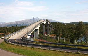
E6 route on our northward journey for speed's sake to give us as much time as
possible within the Arctic for experiencing the Midnight Sun, Route 17 Kystriksveien
seemed a worthwhile route to take heading back south. Route 80 from Fauske led westwards along the
shore of Skjerstadsfjord and just before Bodø, we turned off onto Route 17, the
Kystriksveien (Coastal Road). This road was to be our route southwards over the next
week, weaving its tortuous way along the fretted western coastline of Norway,
running parallel with the inland E6 highway, and taking us as far as Steinkjer where we should re-join E6. It's a challenging 630km route but with
many excellent scenic rewards along its much-indented course. It's also however expensive
involving 6 ferries connecting across fjord inlets; one of the ferries has the
novelty of crossing
the Polar Circle. Many of the coastal villages along the length of the route
would once only have been accessible by boat before the creation of Route 17,
and survived by coastal fishing and subsistence farming. Having used the
E6 route on our northward journey for speed's sake to give us as much time as
possible within the Arctic for experiencing the Midnight Sun, Route 17 Kystriksveien
seemed a worthwhile route to take heading back south.
|
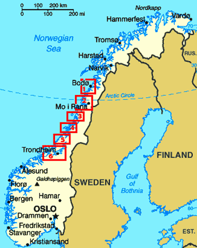
Click on 6 highlighted areas of map for
details of
Kystriksveien Coastal Route |
 |
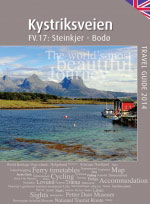
The Kystriksveien tourist web site together with the
Kystriksveien Travel Guide booklet (see above
left), available free of charge in all Tourist Information Centres along the
route, are both essential reading and mini-encyclopaedias of invaluable
information about travelling the Route 17 Coastal Route. We have also given
below a schedule of timetables for the 6 ferry-crossings that form part of the
route, together with winter 2014~15 prices (vehicle/driver plus 1 senior passenger/honnør) and crossing times
(the Norwegian term overfart has a certain resonance!);
prices and frequency are increased during the summer period.
See also the
Map of the Kystriksveien ferries.
Saltstraumen tidal
race: Saltstraumen village sits
above the 3km long, 150m wide narrows which connect the outer sea-fjord of
Saltfjord with the inner enclosed Skjerstadfjord. Every 6 hours as the tide
turns, up to 400 million cubic metres of seawater surges its way upstream
through the narrow straits at speeds of 40kph/25mph. As this
in-flowing mass of racing water of what is said to be the world's strongest tidal
current meets the natural down-flow of water from Skjerstadfjord just opposite
the headland under the Saltstraumen bridge, turbulent mælstroms with whirlpool
vortices of up to 10m in diameter and 5m deep are produced, especially when the
tidal current is at its strongest at times of the new and full moons. There
can be a 1m height difference between the sea level and the inner fjord, and
each time the tide turns, there is a brief time window while the current is
almost calm when boats can pass safely
through the sound. Tide tables for the
Saltstraumen tidal race
are readily available locally giving the times of incoming and outgoing
tides when the current is strongest creating the mælstroms. See
Detailed map of Saltstraumen tidal race
 Elvegård Camping: Route 17, the
Kystriksveien (Coastal Road), at its northern end crosses the
Saltstraumen channel on an elegantly high-arching bridge, and just beyond Elvegård Camping: Route 17, the
Kystriksveien (Coastal Road), at its northern end crosses the
Saltstraumen channel on an elegantly high-arching bridge, and just beyond
 we
turned off to Elvegård Camping on the island of Straumøya. We settled into this
small, welcoming and excellent value farm-campsite on a terraced pitch overlooking the Saltstraumen channel;
with a forecast of fine weather, our plan was to
spend tomorrow watching the Saltstraumen tidal race from the vantage point of
the bridge which arches over the straits giving a perfect view down onto the mælstroms.
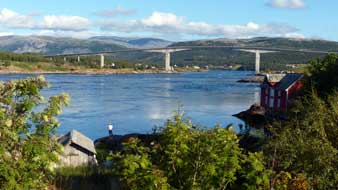
Late on the first afternoon at Elvegård Camping, we followed a fishermen's path
down towards the fjord, which led to flat rocky outcrops directly
overlooking the Saltstraumen channel at its western end; from here there were glorious views
along the length of the narrows towards the bridge and its mountainous backdrop,
with the evening outgoing tidal race still running, all lit by the late
afternoon sun (Photo 1 - Saltstraumen Bridge from west)
(see left).
On a wonderfully peaceful evening, after a cordon-bleu supper of elk and
lingonberry stew, we sat looking out across the fjord; as we now approached the
southern limit of the Polar Circle, the sun truly set tonight just after
11-00pm, and did not rise again until 3-45am. we
turned off to Elvegård Camping on the island of Straumøya. We settled into this
small, welcoming and excellent value farm-campsite on a terraced pitch overlooking the Saltstraumen channel;
with a forecast of fine weather, our plan was to
spend tomorrow watching the Saltstraumen tidal race from the vantage point of
the bridge which arches over the straits giving a perfect view down onto the mælstroms.
Late on the first afternoon at Elvegård Camping, we followed a fishermen's path
down towards the fjord, which led to flat rocky outcrops directly
overlooking the Saltstraumen channel at its western end; from here there were glorious views
along the length of the narrows towards the bridge and its mountainous backdrop,
with the evening outgoing tidal race still running, all lit by the late
afternoon sun (Photo 1 - Saltstraumen Bridge from west)
(see left).
On a wonderfully peaceful evening, after a cordon-bleu supper of elk and
lingonberry stew, we sat looking out across the fjord; as we now approached the
southern limit of the Polar Circle, the sun truly set tonight just after
11-00pm, and did not rise again until 3-45am.
 A
sunny
day to watch the spectacular Saltstraumen tidal race: on a pleasantly sunny Sunday
morning, we breakfasted outside looking across the narrows, with the bells of
Saltstraumen church ringing in the distance. With its wonderful location,
hospitable welcome, good facilities including A
sunny
day to watch the spectacular Saltstraumen tidal race: on a pleasantly sunny Sunday
morning, we breakfasted outside looking across the narrows, with the bells of
Saltstraumen church ringing in the distance. With its wonderful location,
hospitable welcome, good facilities including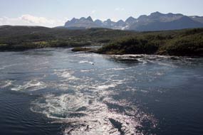 wi-fi, and super value
all-inclusive price of 230 NOK, Elvegård Camping was one of the very best. The
tide-tables showed that today's mid-day in-flowing Saltstraumen tide would be at
its highest at 12-30pm. By good chance, our visit coincided with the time of the new moon when
the incoming tidal level is at its highest, creating the most spectacular levels
of turbulence as the vast quantities of tidal in-flow surging up through the
narrow 150m wide channel meet the fjord's natural down-flow below the bridge
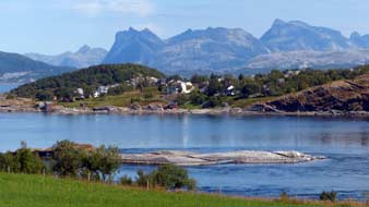
opposite Saltstraumen village. On such a fine morning, it was a pleasant 10
minute stroll along the lane, looking out across Elvegård's hay meadows to the
blue waters of the channel against the backdrop of jagged peaks (see right). Reaching Route
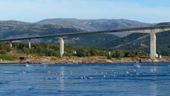
17, we crossed towards the footpath over the high-arching Saltstraumen bridge (see
left) (Photo 2 - Saltstraumen Bridge).
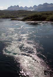
Climbing up onto the bridge's slope to peer down into the narrower southern
channel, the in-flowing tidal race surged through at a terrifying pace, the
resulting line of turbulence lit by the sunshine in all shades of iridescent
grey, aquamarine, blue, silver and white flecks, with eddying whirlpools forming
and coalescing at unpredictable speed
(Photo 3 - Saltstraumen mælstroms).
This violent mass of surging, inflowing tidal water spread out across the width
of the channel as it met the fjord's natural outflow, with the sun glistening on
the turbulence in an array of sparkling, opalescent silver and white. All of
this was set out before us as we looked down from our wi-fi, and super value
all-inclusive price of 230 NOK, Elvegård Camping was one of the very best. The
tide-tables showed that today's mid-day in-flowing Saltstraumen tide would be at
its highest at 12-30pm. By good chance, our visit coincided with the time of the new moon when
the incoming tidal level is at its highest, creating the most spectacular levels
of turbulence as the vast quantities of tidal in-flow surging up through the
narrow 150m wide channel meet the fjord's natural down-flow below the bridge
opposite Saltstraumen village. On such a fine morning, it was a pleasant 10
minute stroll along the lane, looking out across Elvegård's hay meadows to the
blue waters of the channel against the backdrop of jagged peaks (see right). Reaching Route
17, we crossed towards the footpath over the high-arching Saltstraumen bridge (see
left) (Photo 2 - Saltstraumen Bridge).
Climbing up onto the bridge's slope to peer down into the narrower southern
channel, the in-flowing tidal race surged through at a terrifying pace, the
resulting line of turbulence lit by the sunshine in all shades of iridescent
grey, aquamarine, blue, silver and white flecks, with eddying whirlpools forming
and coalescing at unpredictable speed
(Photo 3 - Saltstraumen mælstroms).
This violent mass of surging, inflowing tidal water spread out across the width
of the channel as it met the fjord's natural outflow, with the sun glistening on
the turbulence in an array of sparkling, opalescent silver and white. All of
this was set out before us as we looked down from our
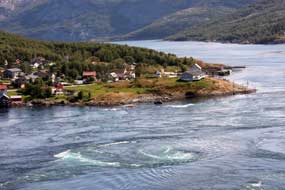 high vantage point on the
bridge (Photo 4 - Saltstraumen turbulence),
against the backdrop of hazy peaks and blue sky. With today's clear sky,
w high vantage point on the
bridge (Photo 4 - Saltstraumen turbulence),
against the backdrop of hazy peaks and blue sky. With today's clear sky,
w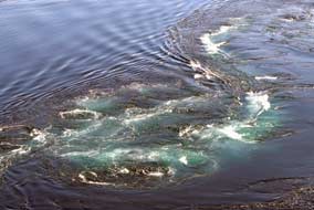 e could fully appreciate the splendour of the eastern skyline's jagged array of
peaks which formed a backdrop to the equally spectacular display of mælstroms
below us, every detail picked out by the bright sunlight
(Photo 5 - Saltstraumen's backdrop of jagged peaks). On an overcast day
with no sunlight glinting on the surging waters, most of the detail would be
lost in a monochrome of grey and white. e could fully appreciate the splendour of the eastern skyline's jagged array of
peaks which formed a backdrop to the equally spectacular display of mælstroms
below us, every detail picked out by the bright sunlight
(Photo 5 - Saltstraumen's backdrop of jagged peaks). On an overcast day
with no sunlight glinting on the surging waters, most of the detail would be
lost in a monochrome of grey and white.
We took a series of photographs along the
narrow side-channel before moving up to the bridge's apex to look down on the length
of the wider channel where the incoming waters flowed around the projecting
headland on which the scattered village of Saltstraumen was built (Photo
6 - Saltstraumen headland). Here the
fast-flowing tidal-current moved under the bridge with less evident turbulence,
forming 2 trails of in-coming water to each side of the channel with apparently
more placid water between along the centre of the straits
(Photo
7 - In-flowing tidal currents). But when this
in-flowing mass of water hit the natural down-flow at the bend just opposite the Saltstraumen headland, a wall of water welled up
(Photo
8 - Meeting of in-flowing and out-flowing currents), spreading violently into
eddying swirls and huge mælstroms sucking down the waters into their maw
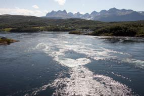 (see
right) (Photo
9 - Saltstraumen mælstrom), which dissipated as quickly as they had
formed. This terrifyingly mesmerizing
spectacle spreading out across the channel held our attention as we tried to
record it on photograph (see
right) (Photo
9 - Saltstraumen mælstrom), which dissipated as quickly as they had
formed. This terrifyingly mesmerizing
spectacle spreading out across the channel held our attention as we tried to
record it on photograph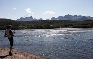 (Photo
10 - Saltstraumen turbulence), the angle of the sun backlighting the turbulence and
picking out the details of the trails of iridescent water (Photo
11 - Backlit turbulence). We continued down
the bridge's northern slope, looking across the village, the width of turbulent
river, and mountainous backdrop (Photo
12 - Saltstraumen mountainous backdrop), to turn off onto a footpath past Saltstraumen church
and down the lane into the village. Here at a café on the headland directly
overlooking the most turbulent area of mælstroms was where local fishermen
gathered to cast their lines into the speeding waters
(Photo
13 - Saltstraumen fishing). From this lower vantage
point looking across the wider channel, the eddying turbulence where the
in-surging and out-flowing waters coincided was less evident. But the rapid
speed of the in-flowing tidal race was so much more vivid, racing past with
terrifying pace. Even the experienced fishermen standing on the rocks at the
waters' edge wore life-jackets. We stood watching all that was happening before
us, our eyes torn between the exhilarating inflow of surging tidal current and
the fishermen. Some more experienced ones pulled twitching fish from their
hooks, while other younger ones cast their lines forlornly into the current
catching nothing.
(Photo
10 - Saltstraumen turbulence), the angle of the sun backlighting the turbulence and
picking out the details of the trails of iridescent water (Photo
11 - Backlit turbulence). We continued down
the bridge's northern slope, looking across the village, the width of turbulent
river, and mountainous backdrop (Photo
12 - Saltstraumen mountainous backdrop), to turn off onto a footpath past Saltstraumen church
and down the lane into the village. Here at a café on the headland directly
overlooking the most turbulent area of mælstroms was where local fishermen
gathered to cast their lines into the speeding waters
(Photo
13 - Saltstraumen fishing). From this lower vantage
point looking across the wider channel, the eddying turbulence where the
in-surging and out-flowing waters coincided was less evident. But the rapid
speed of the in-flowing tidal race was so much more vivid, racing past with
terrifying pace. Even the experienced fishermen standing on the rocks at the
waters' edge wore life-jackets. We stood watching all that was happening before
us, our eyes torn between the exhilarating inflow of surging tidal current and
the fishermen. Some more experienced ones pulled twitching fish from their
hooks, while other younger ones cast their lines forlornly into the current
catching nothing.
  After such a thrillingly spectacular morning,
it was a long plod back up through Saltstraumen village
(Photo
14 - Saltstraumen village), over the bridge and
along the lane to Elvegård Camping for a late lunch. Later in the afternoon we
returned to the rocky outcrops at the western end of the channel below the
campsite as the early evening tidal out-flow built up, watching gulls aimlessly swirling around and gathering in flocks to drift downstream in the
fast-flowing current (Photo
15 - Saltstraumen out-flowing current). They
showed no evident signs of feeding, but presumably were scooping up small fish
or plankton. We sat out late on a warm and peaceful evening with vivid cloud
glow, and dew forming on the table. But a late influx of inconsiderately rowdy
folk in monster camping-cars brought an end to the evening peace. We had enjoyed
a pleasantly peaceful weekend with civilised neighbours who like us valued their natural
surroundings and respected other people’s
environment; the contrast in behaviours however caused us to reflect on the
increasingly frequent occasions on campsites when we are compelled to remind
boorish folk to show consideration to others and
reduce the noise of overloud TVs or insensitive rowdiness: O tempora, o
mores. After such a thrillingly spectacular morning,
it was a long plod back up through Saltstraumen village
(Photo
14 - Saltstraumen village), over the bridge and
along the lane to Elvegård Camping for a late lunch. Later in the afternoon we
returned to the rocky outcrops at the western end of the channel below the
campsite as the early evening tidal out-flow built up, watching gulls aimlessly swirling around and gathering in flocks to drift downstream in the
fast-flowing current (Photo
15 - Saltstraumen out-flowing current). They
showed no evident signs of feeding, but presumably were scooping up small fish
or plankton. We sat out late on a warm and peaceful evening with vivid cloud
glow, and dew forming on the table. But a late influx of inconsiderately rowdy
folk in monster camping-cars brought an end to the evening peace. We had enjoyed
a pleasantly peaceful weekend with civilised neighbours who like us valued their natural
surroundings and respected other people’s
environment; the contrast in behaviours however caused us to reflect on the
increasingly frequent occasions on campsites when we are compelled to remind
boorish folk to show consideration to others and
reduce the noise of overloud TVs or insensitive rowdiness: O tempora, o
mores.
First section of the mountainous Coastal
Route: today we should begin the first section of the
Kystriksveien as far as Furøy Camping. After stocking up with provisions
at the busy little Co-Op stores by the Saltstraumen Bridge, we set off on Route
17 crossing the narrow channel to the south of Straumøya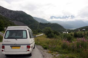 Island with the weather
now overcast and cloud gathering on the distant mountains. The road descended to a further fjord and, crossing a
headland through a short tunnel, emerged on the descent to the shore of Nordfjord.
A spectacular mountainous panorama opened up ahead with a high
glacier-filled corrie surrounded by a coronet of the 1,332m high pinnacles of Memaurtinden,
its lower rocky skirts scoured smooth by glacial ice (Photo
16 - Memaurtinden's coronet of pinnacles) (see right). Unfortunately
hazy cloud now obscured this magnificent vista. Along the fjord shore, the
surrounding mountains with their notable ice-scoured faces now fully shrouded in
cloud, the road crossed a narrow fjord inlet and passed Island with the weather
now overcast and cloud gathering on the distant mountains. The road descended to a further fjord and, crossing a
headland through a short tunnel, emerged on the descent to the shore of Nordfjord.
A spectacular mountainous panorama opened up ahead with a high
glacier-filled corrie surrounded by a coronet of the 1,332m high pinnacles of Memaurtinden,
its lower rocky skirts scoured smooth by glacial ice (Photo
16 - Memaurtinden's coronet of pinnacles) (see right). Unfortunately
hazy cloud now obscured this magnificent vista. Along the fjord shore, the
surrounding mountains with their notable ice-scoured faces now fully shrouded in
cloud, the road crossed a narrow fjord inlet and passed
 through
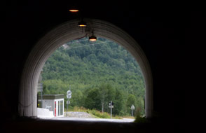
a couple of short tunnels penetrating the next high headland. Around a further
section of coast the 3.2 km Storvikskaret Tunnel passed through the neck of a mountainous peninsula (see left), the road descending around a large
bay. The far end was enclosed by a distinctively lumpy hill where the road swung
inland along a broad, flat farming valley leading to the attractive village of
Reipå. A short distance further and we reached Ørnes, a small port on the
Hurtigrute route. Sheltered from the open sea by a protective archipelago of
islands, this was a warm, sunny place even when the surrounding high mountains
were swathed in gloomy cloud. The road now passed along the length of the
increasingly gloomy Glomfjord, enclosed by fearsomely high mountains now
entirely cloud-covered, and at the inner end penetrated this massive mountainous
barrier through a succession of tunnels and with little gap entered the dismal
mouth of the 7.6 km long Svartis Tunnel which cuts directly through the high through
a couple of short tunnels penetrating the next high headland. Around a further
section of coast the 3.2 km Storvikskaret Tunnel passed through the neck of a mountainous peninsula (see left), the road descending around a large
bay. The far end was enclosed by a distinctively lumpy hill where the road swung
inland along a broad, flat farming valley leading to the attractive village of
Reipå. A short distance further and we reached Ørnes, a small port on the
Hurtigrute route. Sheltered from the open sea by a protective archipelago of
islands, this was a warm, sunny place even when the surrounding high mountains
were swathed in gloomy cloud. The road now passed along the length of the
increasingly gloomy Glomfjord, enclosed by fearsomely high mountains now
entirely cloud-covered, and at the inner end penetrated this massive mountainous
barrier through a succession of tunnels and with little gap entered the dismal
mouth of the 7.6 km long Svartis Tunnel which cuts directly through the high
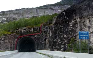 glacier-covered
mountains (see below right). The tunnel was poorly lit and felt scarily narrow as we passed a lot
of traffic and 2 heavy trucks with little room to spare. We emerged into the
steep-sided valley filled by Nordfjord. Part of the massive Svartisen Glacier
drains into this narrow fjord, its glacial sediment giving the fjord waters a
beautiful turquoise-aquamarine iridescence even on a gloomily overcast day like
today. glacier-covered
mountains (see below right). The tunnel was poorly lit and felt scarily narrow as we passed a lot
of traffic and 2 heavy trucks with little room to spare. We emerged into the
steep-sided valley filled by Nordfjord. Part of the massive Svartisen Glacier
drains into this narrow fjord, its glacial sediment giving the fjord waters a
beautiful turquoise-aquamarine iridescence even on a gloomily overcast day like
today.
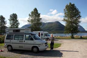 Furøy Camping: the road shelved above the
fjord to reach the Holandsfjord Information Centre where we pulled in for
details of the boats across the fjord to the foot of the Engabreen Glacier. This
projection of Svartisen Glacier, whose icy tongue drops steeply down to
Holandsfjord, was just visible in the gloomy distance on the far side of the fjord.
Armed with information on ferry times and route of the walk up to the foot of
the glacier in readiness for tomorrow's visit to Engabreen, we continued around
to the peninsula's end at Furøy Camping. The campsite was welcoming and
had pleasant fjord-side location and spectacular mountainous outlook, but
with its monopolistic position on the Coastal Route immediately by the Furøy~Ågskardet
ferry, it was expensive at 260 NOK/night. It was also a noisy site with all the
comings and goings, and the air was pervaded by an earthy smell from a nearby
artificial fertiliser plant. But we settled in looking out to the little ferry
which chugged across the fjord to and from Ågskardet (Photo
17 - Furøy Camping) (see below right). The campsite wi-fi enabled
us to catch up with emails and consult the weather forecast: with the evening's
covering of murky cloud, tomorrow's sunny forecast seemed hard to believe, but
beyond tomorrow the pessimistic outlook was for solid cloud and rain. Furøy Camping: the road shelved above the
fjord to reach the Holandsfjord Information Centre where we pulled in for
details of the boats across the fjord to the foot of the Engabreen Glacier. This
projection of Svartisen Glacier, whose icy tongue drops steeply down to
Holandsfjord, was just visible in the gloomy distance on the far side of the fjord.
Armed with information on ferry times and route of the walk up to the foot of
the glacier in readiness for tomorrow's visit to Engabreen, we continued around
to the peninsula's end at Furøy Camping. The campsite was welcoming and
had pleasant fjord-side location and spectacular mountainous outlook, but
with its monopolistic position on the Coastal Route immediately by the Furøy~Ågskardet
ferry, it was expensive at 260 NOK/night. It was also a noisy site with all the
comings and goings, and the air was pervaded by an earthy smell from a nearby
artificial fertiliser plant. But we settled in looking out to the little ferry
which chugged across the fjord to and from Ågskardet (Photo
17 - Furøy Camping) (see below right). The campsite wi-fi enabled
us to catch up with emails and consult the weather forecast: with the evening's
covering of murky cloud, tomorrow's sunny forecast seemed hard to believe, but
beyond tomorrow the pessimistic outlook was for solid cloud and rain.
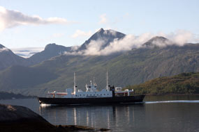 Engabreen Glacier:
exactly as forecast, St Olaf's Day (29 July) was a beautiful morning with sun
glinting across the fjord lighting the shapely conical Engabreen Glacier:
exactly as forecast, St Olaf's Day (29 July) was a beautiful morning with sun
glinting across the fjord lighting the shapely conical
 peak of Blokktinden (Photo
18 - Holandsfjord and Blokktinden).
Reserving our pitch, we set off early from Furøy Camping in good time to
catch the 11-15 boat across Holandsfjord for our planned walk up to the foot of
the Engabreen glacial tongue. Whereas yesterday afternoon the surrounding
mountains had been buried in gloomy low cloud and the glacier tongue almost
totally obscured in murk, this morning as we waited at the boat landing-stage
the sky was clear, and the entire fjordland panorama of glorious mountains was
well lit by bright sun; the crowning glory was the Svartisen Glacier capping the
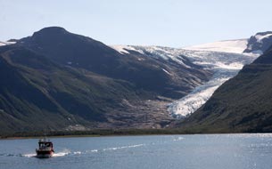
skyline, with the Engabreen extension tongue dropping down towards Holandsfjord
occupying centre stage. The small boat was full to capacity but we secured seats
with a clear view of the glacier as the ferry chugged across for its 15 minutes
crossing of the fjord (Photo
19 - Engabreen glacial tongue). Across at the opposite landing-stage, we set off on the
3km long gravel track around the fjord shore-line and through birch groves to
reach a café set on a hillock looking down the length of the turquoise-blue
glacial lake of Engabrevatnet with Engabreen itself rising spectacularly at the
far end of the lake. This hillock gave perfect views of the glacier-filled
corrie at the head of the lake with the tongue of Engabreen descending steeply
from the main body of the high Svartisen Glacier surrounded by bare, ice-scoured
rocky slopes peak of Blokktinden (Photo
18 - Holandsfjord and Blokktinden).
Reserving our pitch, we set off early from Furøy Camping in good time to
catch the 11-15 boat across Holandsfjord for our planned walk up to the foot of
the Engabreen glacial tongue. Whereas yesterday afternoon the surrounding
mountains had been buried in gloomy low cloud and the glacier tongue almost
totally obscured in murk, this morning as we waited at the boat landing-stage
the sky was clear, and the entire fjordland panorama of glorious mountains was
well lit by bright sun; the crowning glory was the Svartisen Glacier capping the
skyline, with the Engabreen extension tongue dropping down towards Holandsfjord
occupying centre stage. The small boat was full to capacity but we secured seats
with a clear view of the glacier as the ferry chugged across for its 15 minutes
crossing of the fjord (Photo
19 - Engabreen glacial tongue). Across at the opposite landing-stage, we set off on the
3km long gravel track around the fjord shore-line and through birch groves to
reach a café set on a hillock looking down the length of the turquoise-blue
glacial lake of Engabrevatnet with Engabreen itself rising spectacularly at the
far end of the lake. This hillock gave perfect views of the glacier-filled
corrie at the head of the lake with the tongue of Engabreen descending steeply
from the main body of the high Svartisen Glacier surrounded by bare, ice-scoured
rocky slopes
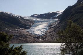 (Photo
20 - Glacier-filled corrie). We continued ahead on the gravel track
passing around the Engabrevatnet lake which glowed a turquoise-aquamarine colour
from glacial sediment (Photo
20 - Glacier-filled corrie). We continued ahead on the gravel track
passing around the Engabrevatnet lake which glowed a turquoise-aquamarine colour
from glacial sediment
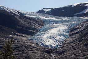 washed down from Engabreen and reflecting the clear blue
sky. The lower slopes of the high mountains enclosing the lake were covered with
birch and alder trees with a ground-covering of juniper bushes loaded with
ripening berries
(Photo
21 - Ripening Juniper berries). washed down from Engabreen and reflecting the clear blue
sky. The lower slopes of the high mountains enclosing the lake were covered with
birch and alder trees with a ground-covering of juniper bushes loaded with
ripening berries
(Photo
21 - Ripening Juniper berries).
At the lake's far end, a path with safety-chain
continued ahead across the basin of ice-scoured rock which
enclosed the foot of the glacial tongue; through binoculars we could see the
pinnacles, buttresses and crevasses of ice along the edge of Engabreen (Photo
22 - Glacial ice). One of
Europe's lowest glaciers and a side tongue of Svartisen, Engabreen descends from
1,200m down almost to fjord level into the lake of glacial melt-water at the
glacier's foot. Such is Engabreen's steepness that this huge mass of ice can
move as much as 2 metres in 24 hours. In the sunlight, the ice formations along
the glacier's edge glowed with deep shades of turquoise-blue contrasting with
the stark white of the glacial tongue's steep, smooth ice-field. The gradient of the rock scoured smooth
by glacial ice now steepened severely as we hauled ourselves upwards with the
aid of the safety-chain (Photo
23 - Ice-smoothed rocky approach). We assumed this route would lead out
from the top rim of the ice-smoothed rock to the edge of the glacier's
ice-towers, and made slow progress up the steep line of the safety-chain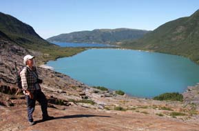 (Photo
24 - Glacial ice formations). Fortunately, although scoured smooth,
the rock surface gave good boot-grip despite its steepness. This ice-smoothed
rock basin enclosing the sides and foot of the lower glacial tongue was a
remarkable phenomenon: whereas the higher slopes were green with
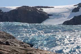 vegetation, the
ice-smoothed rock of the immediate enclosing basin was entirely bare and devoid
of any soil to give root to vegetation. In geological time-scale, it must have
been quite recently that the ice had covered these rocks. We hand-over-handed
ourselves up the steep rock slope, expecting the route to lead to a point on the
glacier's edge where we could look across directly at the ice formations (see
left), but at
the top of the steepest section, the route turned away leftwards: the deep chasm
of a rocky ravine now barred our direct access to the glacier's rim. The
safety-chain ended with no evident means of forward progress across the gulf; to attempt further
progress with
no idea of route would have been foolhardy. Frustratingly we halted there, taking
photos from our vegetation, the
ice-smoothed rock of the immediate enclosing basin was entirely bare and devoid
of any soil to give root to vegetation. In geological time-scale, it must have
been quite recently that the ice had covered these rocks. We hand-over-handed
ourselves up the steep rock slope, expecting the route to lead to a point on the
glacier's edge where we could look across directly at the ice formations (see
left), but at
the top of the steepest section, the route turned away leftwards: the deep chasm
of a rocky ravine now barred our direct access to the glacier's rim. The
safety-chain ended with no evident means of forward progress across the gulf; to attempt further
progress with
no idea of route would have been foolhardy. Frustratingly we halted there, taking
photos from our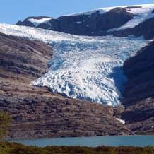 high-point looking down the ice-smoothed steep rock slope to Engabrevatnet way below, but still not having reached the glacier's edge
(Photo
25- High-point on ice-smoothed rock) (see right). Gingerly re-tracing
our steps down the bare rock slope, we considered another route but this also
crossed broken rocks and the glacier's foot was still out of sight; we
therefore satisfied ourselves with distant views, examining details of the ice
formations through binoculars
(Photo
26- Glacial ice formations), and were just able to make out a group of
escorted walkers advancing slowly in roped line up the glacier's
very steep ice-field
(Photo
27- Roped climbers on Engabreen). We returned around to the gravel
track, stopping to re-fill our water flasks from a fast-running stream
descending from the high enclosing walls of the corrie, and glancing back for
more views of Engabreen dropping down to the lake (see right). high-point looking down the ice-smoothed steep rock slope to Engabrevatnet way below, but still not having reached the glacier's edge
(Photo
25- High-point on ice-smoothed rock) (see right). Gingerly re-tracing
our steps down the bare rock slope, we considered another route but this also
crossed broken rocks and the glacier's foot was still out of sight; we
therefore satisfied ourselves with distant views, examining details of the ice
formations through binoculars
(Photo
26- Glacial ice formations), and were just able to make out a group of
escorted walkers advancing slowly in roped line up the glacier's
very steep ice-field
(Photo
27- Roped climbers on Engabreen). We returned around to the gravel
track, stopping to re-fill our water flasks from a fast-running stream
descending from the high enclosing walls of the corrie, and glancing back for
more views of Engabreen dropping down to the lake (see right).
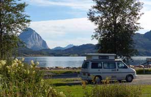 Back through the birch groves, appreciating the
sparse shade in the hot afternoon sun, we returned to the landing stage where
the boat had just arrived. The return across the fjord gave yet more distant
views of Engabreen
(Photo
28 - Ferry re-crossing Holandsfjord), the late afternoon sun now casting long shadows of the
enclosing side mountain across the glacier's steep ice-field. Further to the
west, another huge corrie came into view, its bare rock-walls now free of ice,
but once, perhaps not long ago, this would also have been entirely filled with a
glacier whose melting had scoured the rock faces bare. This was an equally
impressive spectacle. We were soon back at the Holandsfjord landing-stage, and
from the parking lay-by returned along the high shelving road to settle in again
overlooking the fjord at Furøy Camping. The afternoon sun shining down
the length of fjord lit the shapely peak of Blokktinden (see left), but cloud was beginning
to gather foreshadowing tomorrow's forecast change to rainy, unsettled weather. Back through the birch groves, appreciating the
sparse shade in the hot afternoon sun, we returned to the landing stage where
the boat had just arrived. The return across the fjord gave yet more distant
views of Engabreen
(Photo
28 - Ferry re-crossing Holandsfjord), the late afternoon sun now casting long shadows of the
enclosing side mountain across the glacier's steep ice-field. Further to the
west, another huge corrie came into view, its bare rock-walls now free of ice,
but once, perhaps not long ago, this would also have been entirely filled with a
glacier whose melting had scoured the rock faces bare. This was an equally
impressive spectacle. We were soon back at the Holandsfjord landing-stage, and
from the parking lay-by returned along the high shelving road to settle in again
overlooking the fjord at Furøy Camping. The afternoon sun shining down
the length of fjord lit the shapely peak of Blokktinden (see left), but cloud was beginning
to gather foreshadowing tomorrow's forecast change to rainy, unsettled weather.
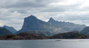 Forøy~Ågskardet ferry and re-crossing the Polar Circle on the
Jetvik~Kilboghamn ferry: the following morning, despite heavily
overcast weather, Blokktinden at the far end of the fjord still managed to look
shapely even in grey gloom. By the time we had joined other vehicles queuing at
the Forøy ferry port, the forecast rain had started in earnest, and with the
mountains surrounding the fjord totally obscured by heavy rain cloud, we sat in
the camper for the 10 minute crossing. Across at Ågskardet, with the landscape
dismal in pouring rain, we set off again across a narrow peninsula of higher
land; the conical outline of Blokktinden was just about visible in rain cloud,
its sheer western face still looking spectacular. Down to the tiny hamlet of Tjong, we rounded Tjongsfjord to the further settlement of Reppa, a few farmsteads
and small HEP plant set at the fjord-botn; Route 17 then disappeared into a 3km
long tunnel which passed through the jagged peaks of Blokktinden's massif,
emerging into a narrow valley on the Forøy~Ågskardet ferry and re-crossing the Polar Circle on the
Jetvik~Kilboghamn ferry: the following morning, despite heavily
overcast weather, Blokktinden at the far end of the fjord still managed to look
shapely even in grey gloom. By the time we had joined other vehicles queuing at
the Forøy ferry port, the forecast rain had started in earnest, and with the
mountains surrounding the fjord totally obscured by heavy rain cloud, we sat in
the camper for the 10 minute crossing. Across at Ågskardet, with the landscape
dismal in pouring rain, we set off again across a narrow peninsula of higher
land; the conical outline of Blokktinden was just about visible in rain cloud,
its sheer western face still looking spectacular. Down to the tiny hamlet of Tjong, we rounded Tjongsfjord to the further settlement of Reppa, a few farmsteads
and small HEP plant set at the fjord-botn; Route 17 then disappeared into a 3km
long tunnel which passed through the jagged peaks of Blokktinden's massif,
emerging into a narrow valley on the
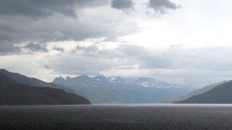 southern side. Another short tunnel and
bridge over the inner reaches of a fjord brought us around to the next ferry
port of Jetvika. The 12-50pm ferry approached, this one a larger boat which was
just as well with 3 lines of vehicles queuing, including cars, lorries, monster
camping-cars and a tour-bus, for this hour long crossing. The rain had by now
stopped, but the weather was still heavily overcast; we went straight up onto
the ferry's outer deck to observe the surrounding peaks, particularly the
shapely peak of the 973m high Telnestinden (Photo
29 - Telnestinden in rain cloud) (see above right). With dismally gloomy rain cloud
massed on the surrounding mountains, the ferry travelled down the length of the fjord, passing
the globe landmark indicating the line of the Polar Circle, set on an isolated
headland and just visible in a murky rain squall which now lashed the ferry (Photo
30 - Polar Circle globe marker). We
had originally crossed the line on our northward journey over Saltfjell's snowy
wastes on 29 May; now after almost 9 weeks spent within the Arctic, we were
crossing southwards on the Jetvik~Kilboghamn ferry. Shortly after, the ferry
passed across the broad mouth of Melfjord and along the distant length of the
fjord the huge glacier of Svartisen covering over 300 square kms of high
mountains could just be seen, the mountainous panorama looking dramatically
monochrome in the gloomy light (see left)
(Photo 31 - Monochrome cloud-scape). southern side. Another short tunnel and
bridge over the inner reaches of a fjord brought us around to the next ferry
port of Jetvika. The 12-50pm ferry approached, this one a larger boat which was
just as well with 3 lines of vehicles queuing, including cars, lorries, monster
camping-cars and a tour-bus, for this hour long crossing. The rain had by now
stopped, but the weather was still heavily overcast; we went straight up onto
the ferry's outer deck to observe the surrounding peaks, particularly the
shapely peak of the 973m high Telnestinden (Photo
29 - Telnestinden in rain cloud) (see above right). With dismally gloomy rain cloud
massed on the surrounding mountains, the ferry travelled down the length of the fjord, passing
the globe landmark indicating the line of the Polar Circle, set on an isolated
headland and just visible in a murky rain squall which now lashed the ferry (Photo
30 - Polar Circle globe marker). We
had originally crossed the line on our northward journey over Saltfjell's snowy
wastes on 29 May; now after almost 9 weeks spent within the Arctic, we were
crossing southwards on the Jetvik~Kilboghamn ferry. Shortly after, the ferry
passed across the broad mouth of Melfjord and along the distant length of the
fjord the huge glacier of Svartisen covering over 300 square kms of high
mountains could just be seen, the mountainous panorama looking dramatically
monochrome in the gloomy light (see left)
(Photo 31 - Monochrome cloud-scape).
 Polar Camping: soon after, the ferry passed along lower Sørfjord to
approach the ferry-dock at Kilboghamn. Once ashore most of the ferry traffic
continued south on Route 17; we turned left along a minor lane passing a series
of farmsteads, and 3 kms north we reached the hamlet of Hilstad and Polar
Camping, set on 3
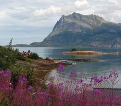
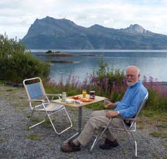
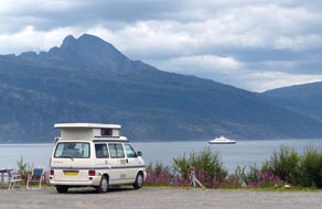
terraced levels above the fjord. We were welcomed at reception, and settled in on the middle gravelled terrace looking out across Sørfjord
towards Polar Camping: soon after, the ferry passed along lower Sørfjord to
approach the ferry-dock at Kilboghamn. Once ashore most of the ferry traffic
continued south on Route 17; we turned left along a minor lane passing a series
of farmsteads, and 3 kms north we reached the hamlet of Hilstad and Polar
Camping, set on 3
terraced levels above the fjord. We were welcomed at reception, and settled in on the middle gravelled terrace looking out across Sørfjord
towards
 the peak of Telnestinden. Polar Camping's facilities were some of the
best of the trip with included wi-fi internet, modern, well-equipped
kitchen/wash-up, well-appointed showers, and washing/drying machine which was put to immediate use. It was expensive at 270 NOK/night including showers, but
the perfect location and charming welcome more than made up for this. The
afternoon remained cool and overcast, with rainy squall-showers blowing up the
length of the fjord. After some overnight rain, we woke the following morning to a thin sun for our
day in camp at Polar Camping. The wind had dropped and air warm and still,
enabling us to sit outside for breakfast (see left)
(Photo
32- Morning coffee at Sørfjord) looking out over a small boat-landing down
at the fjord-shore and across the width of Sørfjord towards the sculpted peak of
Telnestinden with the sun picking out details on its southern face (see above
right). At its foot
on a low, isolated headland we could just make out the globe monument indicating
the line of the Polar Circle just to our north. This was such a glorious spot
for our day in camp, watching the Jetvik ferry chugging back and forth along
Sørfjord to and from Kilboghamn
(Photo
33 - Polar Camping). the peak of Telnestinden. Polar Camping's facilities were some of the
best of the trip with included wi-fi internet, modern, well-equipped
kitchen/wash-up, well-appointed showers, and washing/drying machine which was put to immediate use. It was expensive at 270 NOK/night including showers, but
the perfect location and charming welcome more than made up for this. The
afternoon remained cool and overcast, with rainy squall-showers blowing up the
length of the fjord. After some overnight rain, we woke the following morning to a thin sun for our
day in camp at Polar Camping. The wind had dropped and air warm and still,
enabling us to sit outside for breakfast (see left)
(Photo
32- Morning coffee at Sørfjord) looking out over a small boat-landing down
at the fjord-shore and across the width of Sørfjord towards the sculpted peak of
Telnestinden with the sun picking out details on its southern face (see above
right). At its foot
on a low, isolated headland we could just make out the globe monument indicating
the line of the Polar Circle just to our north. This was such a glorious spot
for our day in camp, watching the Jetvik ferry chugging back and forth along
Sørfjord to and from Kilboghamn
(Photo
33 - Polar Camping).
 Nesna~Levang ferry to Sandnessjøen: after further rain in the
night, the following morning was heavily overcast with very unsettled forecast.
Back along the lane to Kilboghamn, the now narrow Route 17 continued to the head
of Sørfjord and wound over a shoulder of high land down to the shore of
Aldersund. This narrow channel separated the shapely lump of Aldra Island which
so mirrored the outline of the mainland coast that it looked to have only
recently been heaved away by the hand of some giant troll. The lane passing a
few fishing-farming hamlets along the shore-line was uncomfortably narrow, just
a single vehicle width with passing places indicated by the familiar M Nesna~Levang ferry to Sandnessjøen: after further rain in the
night, the following morning was heavily overcast with very unsettled forecast.
Back along the lane to Kilboghamn, the now narrow Route 17 continued to the head
of Sørfjord and wound over a shoulder of high land down to the shore of
Aldersund. This narrow channel separated the shapely lump of Aldra Island which
so mirrored the outline of the mainland coast that it looked to have only
recently been heaved away by the hand of some giant troll. The lane passing a
few fishing-farming hamlets along the shore-line was uncomfortably narrow, just
a single vehicle width with passing places indicated by the familiar M
 sign for
Møte (meeting). Rounding a high headland, the view out to the
archipelago of islands would have been splendid on a fine day, but today the
islands were lost in misty gloom. Along the shore of Sjona Sound and round the
head of an inlet, the road entered the portal of a 3km long tunnel to continue
around the head of the inner fjord into a second 3km tunnel through the
mountainous headland. Around the shallow head of Sjon-botn, we reached the
junction with Route 12, the link road to the E6 at Mo-i-Rana. We continued west
on Route 17, and through a short tunnel a newly upgraded stretch of road began
the long climb over high, exposed land, the bare rock faces of the surrounding
gloomy mountains scoured smooth by glacial action. Across the high point, the
road descended very steeply by hairpins and sweeping bends and along the sound
of Litlsjona reached the tip of the peninsula at the ferry port of Nesna where
the daily Hurtigrute also stops. Here we joined other vehicles queuing for the
12-55pm ferry crossing to Levang on the far side of Ranfjord. The ferry's car
deck was full by the time we pulled out, crossing the sound to Levang past the
mountainous island of Hugla
(Photo
34 - Departing Nesna by ferry). sign for
Møte (meeting). Rounding a high headland, the view out to the
archipelago of islands would have been splendid on a fine day, but today the
islands were lost in misty gloom. Along the shore of Sjona Sound and round the
head of an inlet, the road entered the portal of a 3km long tunnel to continue
around the head of the inner fjord into a second 3km tunnel through the
mountainous headland. Around the shallow head of Sjon-botn, we reached the
junction with Route 12, the link road to the E6 at Mo-i-Rana. We continued west
on Route 17, and through a short tunnel a newly upgraded stretch of road began
the long climb over high, exposed land, the bare rock faces of the surrounding
gloomy mountains scoured smooth by glacial action. Across the high point, the
road descended very steeply by hairpins and sweeping bends and along the sound
of Litlsjona reached the tip of the peninsula at the ferry port of Nesna where
the daily Hurtigrute also stops. Here we joined other vehicles queuing for the
12-55pm ferry crossing to Levang on the far side of Ranfjord. The ferry's car
deck was full by the time we pulled out, crossing the sound to Levang past the
mountainous island of Hugla
(Photo
34 - Departing Nesna by ferry).
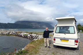 Ashore on the far side of the fjord, Route 17 crossed the width of the peninsula to the
head of Leirfjord passing the junction of Route 78, the link road to the E6 at
Mosjøen. The road continued down the length of the peninsula to cross to the
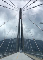
molar-shaped large island of Alsta on the wide, elegant Leirfjord suspension
bridge (see above left) and elongated causeway leading to the large port and service-centre of Sandnessjøen.
This was another stop on the Hurtigrute route, but by the time we reached there
at 2-00pm, the north-bound coastal liner had already sailed. We turned off into the outskirts of the port and found a Rema 1000 supermarket for a major
provisions stock-up. The main Route17 south passed along a high valley running
parallel with the Sju Søstre (Seven Sisters) rocky ridge of bare peaks which
lined the eastern side of the elongated island, and along the Ashore on the far side of the fjord, Route 17 crossed the width of the peninsula to the
head of Leirfjord passing the junction of Route 78, the link road to the E6 at
Mosjøen. The road continued down the length of the peninsula to cross to the
molar-shaped large island of Alsta on the wide, elegant Leirfjord suspension
bridge (see above left) and elongated causeway leading to the large port and service-centre of Sandnessjøen.
This was another stop on the Hurtigrute route, but by the time we reached there
at 2-00pm, the north-bound coastal liner had already sailed. We turned off into the outskirts of the port and found a Rema 1000 supermarket for a major
provisions stock-up. The main Route17 south passed along a high valley running
parallel with the Sju Søstre (Seven Sisters) rocky ridge of bare peaks which
lined the eastern side of the elongated island, and along the
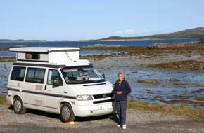 western
shore-line around the tapering tip of the SW peninsula. Rounding the southern bay, the road continued down the
narrowing projection of land to reach Offersøya where we turned off to tonight's
campsite, Offersøya Camping. western
shore-line around the tapering tip of the SW peninsula. Rounding the southern bay, the road continued down the
narrowing projection of land to reach Offersøya where we turned off to tonight's
campsite, Offersøya Camping.
Offersøya Camping: first impressions suggested a tiny place
crammed full of statics with little space for visitors, but beyond the huts where
a track-way led out to a small boat-mooring we could pitch alongside the
shore-line backing into the brisk breeze blowing off the sea. The setting was
absolutely magnificent with views looking out across the shallows to off-shore
islands and Alsta's southern-extending low peninsula, and to the north the
bottom end of the Seven Sisters Ridge
(Photo
35 - Offersøya Camping); unfortunately this afternoon this
was wrapped in murky cloud. This was an excellent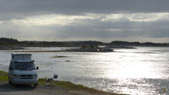 position to camp and we sat in
George sheltering from the chill breeze looking out across the mudflats as the
tide went out, listening to the oystercatchers piping across the bay. The sun
dipped giving a silvery evening light across the bay (Photo
36 - Evening light over bay) (see right). position to camp and we sat in
George sheltering from the chill breeze looking out across the mudflats as the
tide went out, listening to the oystercatchers piping across the bay. The sun
dipped giving a silvery evening light across the bay (Photo
36 - Evening light over bay) (see right).
The
Rigel Memorial and Tjøtta
war cemetery:
after a cool night we woke to a gloriously sunny morning with the southern  end
of the Seven Sisters Ridge now clear of cloud, its sculpted, craggy
details fully lit by the sun. Across the bay, the water was blue and despite
the cool breeze we sat out for breakfast watching gulls pecking in the low-tide
mudflats (Photo
37 - Breakfast at Offersøya Camping). We were away early to drive the final 7 miles along the increasingly
narrow isthmus of Tjøtta island where sheep grazed the roadside in the morning
sunshine. 3 kms from the Tjøtta ferry port, we paused at the Tjøtta war cemetery
and memorial to those killed in the Rigel disaster. The Rigel had
been a small Norwegian freighter requisitioned by the German invaders in 1940
and used as a troop ship. In November 1944, she was sailing southwards from
Narvik when, believed to be transporting German troops from Finmark, she was attacked and sunk just off Tjøtta island by Fleet Air Arm
aircraft from HMS Implacable. Unfortunately
the ship's hold was full of Russian, Polish and
Serbian POWs and over 2,500 were drowned in the sinking, the worst maritime
disaster in Norwegian waters. The dead were end
of the Seven Sisters Ridge now clear of cloud, its sculpted, craggy
details fully lit by the sun. Across the bay, the water was blue and despite
the cool breeze we sat out for breakfast watching gulls pecking in the low-tide
mudflats (Photo
37 - Breakfast at Offersøya Camping). We were away early to drive the final 7 miles along the increasingly
narrow isthmus of Tjøtta island where sheep grazed the roadside in the morning
sunshine. 3 kms from the Tjøtta ferry port, we paused at the Tjøtta war cemetery
and memorial to those killed in the Rigel disaster. The Rigel had
been a small Norwegian freighter requisitioned by the German invaders in 1940
and used as a troop ship. In November 1944, she was sailing southwards from
Narvik when, believed to be transporting German troops from Finmark, she was attacked and sunk just off Tjøtta island by Fleet Air Arm
aircraft from HMS Implacable. Unfortunately
the ship's hold was full of Russian, Polish and
Serbian POWs and over 2,500 were drowned in the sinking, the worst maritime
disaster in Norwegian waters. The dead were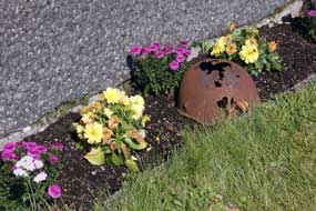 buried in an unmarked mass grave
here at Tjøtta and a cross-shaped monument raised in their memory. In a
neighbouring stone-walled enclosure, some 6,500 Russian POWs who had died in
German slave-labour camps were buried; their remains had been gathered from
regular cemeteries all around Northern Norway and re-buried in this war-cemetery
here at Tjøtta in 1953. 826 are buried in individually identified graves, and
6,725 in an unmarked mass grave, and the site is dominated by a dark granite
monument topped with the Soviet hammer and sickle emblem (Photo
38 - Rigel Memorial). We paid our respects
to these further victims of German barbarism, and continued to the ferry port at
the southern tip of Tjøtta island to join the queue of other vehicles for the
11-25am ferry across to Forvik. buried in an unmarked mass grave
here at Tjøtta and a cross-shaped monument raised in their memory. In a
neighbouring stone-walled enclosure, some 6,500 Russian POWs who had died in
German slave-labour camps were buried; their remains had been gathered from
regular cemeteries all around Northern Norway and re-buried in this war-cemetery
here at Tjøtta in 1953. 826 are buried in individually identified graves, and
6,725 in an unmarked mass grave, and the site is dominated by a dark granite
monument topped with the Soviet hammer and sickle emblem (Photo
38 - Rigel Memorial). We paid our respects
to these further victims of German barbarism, and continued to the ferry port at
the southern tip of Tjøtta island to join the queue of other vehicles for the
11-25am ferry across to Forvik.
 The Tjøtta~Forvik and Andsalsvåg~Horn ferries to Brønnøysund:
the ferry drew in (Photo
39 - Tjøtta~Forvik) and we drove aboard, going straight up onto the upper
deck on this beautiful sunny morning to photograph the magnificent northern
panorama of the full Seven Sisters Ridge line looking along Vefsnfjord beyond
the unique red serpentine island of Rødsøya (Photo
40 - Seven Sisters ridge) (see below right). During the crossing we got into
conversation with a Harley-Davidson rider, having noticed the name of Vilhelmina
MC Club on his jacket; we had visited the small town of Vilhelmina in Swedish
Lapland last year. A retired diary cattle farmer from just outside Vilhelmina,
he and his club mates were now touring Northern The Tjøtta~Forvik and Andsalsvåg~Horn ferries to Brønnøysund:
the ferry drew in (Photo
39 - Tjøtta~Forvik) and we drove aboard, going straight up onto the upper
deck on this beautiful sunny morning to photograph the magnificent northern
panorama of the full Seven Sisters Ridge line looking along Vefsnfjord beyond
the unique red serpentine island of Rødsøya (Photo
40 - Seven Sisters ridge) (see below right). During the crossing we got into
conversation with a Harley-Davidson rider, having noticed the name of Vilhelmina
MC Club on his jacket; we had visited the small town of Vilhelmina in Swedish
Lapland last year. A retired diary cattle farmer from just outside Vilhelmina,
he and his club mates were now touring Northern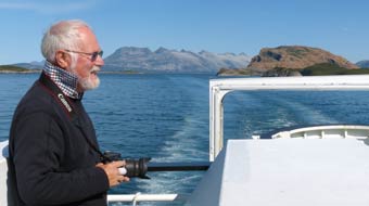 Norway on their motor bikes and
planning this evening to join the Hurtigrute mini-cruise from Brønnøysund to
Rørvik and back, the only chance on the entire Hurtigrute voyage to make such a
return trip without overnight stop. More importantly for us, we learnt from this
serendipitous meeting about the Torghatten 'hole-in-the-mountain' walk just 12
kms across the bridge south of Brønnøysund at the tip of Torget island (Photo
41 - Forvik~Tjøtta ferry crossing). Norway on their motor bikes and
planning this evening to join the Hurtigrute mini-cruise from Brønnøysund to
Rørvik and back, the only chance on the entire Hurtigrute voyage to make such a
return trip without overnight stop. More importantly for us, we learnt from this
serendipitous meeting about the Torghatten 'hole-in-the-mountain' walk just 12
kms across the bridge south of Brønnøysund at the tip of Torget island (Photo
41 - Forvik~Tjøtta ferry crossing).
The ferry docked at Forvik, giving us a half hour
to drive the 16kms down the coast to Andsalsvåg for the next in the sequence of
ferries across the fjord to Horn. This short stretch
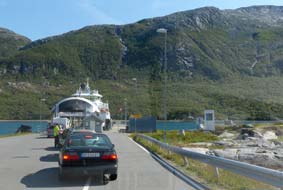 of the main Route 17
running down the coast forms the only piece of road on this huge area of
barren, uninhabited mountain wilderness between the E6 valley up to Masjøen
on the inland eastern side and the Norwegian Sea on the western side. Yet villages,
farms and a Co-op stores were set along this fertile coastal strip of land in
the shadow of the mountainous downfall. We drove in convoy with other vehicles from
the ferry down to the port at Andsalsvåg at the southern tip (see left). Here the ferry was
waiting for the shorter 20 minute crossing to Horn at the northern tip of the Sømma peninsula. There was little of interest to see on the crossing and we sat
in the camper to eat our sandwiches until the ferry docked at the opposite side.
Having caught the earlier ferries, we had time this afternoon at Brønnøysund to
investigate the Torghatten walk before seeing the south-bound Hurtigrute depart
at 5-00pm, and then driving the final 50kms down to tonight's campsite at Vennesund at the southern tip of Sømma. We drove the 10kms down into the port of Brønnøysund
to find the TIC for details of the route out to Trollhatten and a booklet on the
feature's formative geology. of the main Route 17
running down the coast forms the only piece of road on this huge area of
barren, uninhabited mountain wilderness between the E6 valley up to Masjøen
on the inland eastern side and the Norwegian Sea on the western side. Yet villages,
farms and a Co-op stores were set along this fertile coastal strip of land in
the shadow of the mountainous downfall. We drove in convoy with other vehicles from
the ferry down to the port at Andsalsvåg at the southern tip (see left). Here the ferry was
waiting for the shorter 20 minute crossing to Horn at the northern tip of the Sømma peninsula. There was little of interest to see on the crossing and we sat
in the camper to eat our sandwiches until the ferry docked at the opposite side.
Having caught the earlier ferries, we had time this afternoon at Brønnøysund to
investigate the Torghatten walk before seeing the south-bound Hurtigrute depart
at 5-00pm, and then driving the final 50kms down to tonight's campsite at Vennesund at the southern tip of Sømma. We drove the 10kms down into the port of Brønnøysund
to find the TIC for details of the route out to Trollhatten and a booklet on the
feature's formative geology.
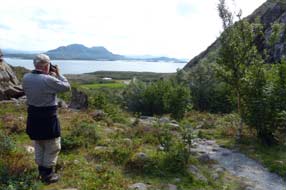 The 'hole-in-the-mountain' walk at
Torghatten: armed with a Brønnøysund street plan, we made our way
through the quiet little port-town and by the fishing harbour crossed the
high-arching bridge, under which the south-bound Hurtigrute passes, over onto
Torget Island. A further 12 kms of country lane led us to a parking area on the
inland eastern side of the conical hat-shaped peak of Torghatten. This 258m high peak
is unique in being pierced by a huge hole which passes through the entire
mountain. Legend has it that the hole was caused by an arrow shot by an evil
character called Hestmann (the Horseman). He had witnessed the Seven Sisters and
beautiful Maiden of Leka bathing in the sea and had tried to rape the maiden.
But at his approach on horseback, the girls fled. In anger the Horseman fired an
arrow from his bow to kill them, but the King of Sømma seeing what had happened
flung his hat towards the arrow, saving the girls' lives. The hat was pierced by
the arrow The 'hole-in-the-mountain' walk at
Torghatten: armed with a Brønnøysund street plan, we made our way
through the quiet little port-town and by the fishing harbour crossed the
high-arching bridge, under which the south-bound Hurtigrute passes, over onto
Torget Island. A further 12 kms of country lane led us to a parking area on the
inland eastern side of the conical hat-shaped peak of Torghatten. This 258m high peak
is unique in being pierced by a huge hole which passes through the entire
mountain. Legend has it that the hole was caused by an arrow shot by an evil
character called Hestmann (the Horseman). He had witnessed the Seven Sisters and
beautiful Maiden of Leka bathing in the sea and had tried to rape the maiden.
But at his approach on horseback, the girls fled. In anger the Horseman fired an
arrow from his bow to kill them, but the King of Sømma seeing what had happened
flung his hat towards the arrow, saving the girls' lives. The hat was pierced by
the arrow
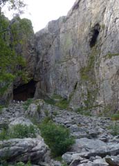 and fell to the ground at Torget, and the first rays of the dawning
sun turned all to stone, creating the Seven Sisters ridge of peaks, the Island
of Leka and the arrow-pierced hat was transformed into the holed mountain of
Torghatten. and fell to the ground at Torget, and the first rays of the dawning
sun turned all to stone, creating the Seven Sisters ridge of peaks, the Island
of Leka and the arrow-pierced hat was transformed into the holed mountain of
Torghatten.
On reaching the car park, it was clear that this
was a popular sunny weekend outing for local people. An evident path
rose steeply across the wooded slopes towards a cleft on the mountain's eastern
face (see above right). The TIC booklet gave a more prosaic but frustratingly inadequate
scientific explanation of the geological causes of this unique hole which
passed through the entire mountain. Piecing the details together, it seemed to
be a complex combination of sea wave erosion action at a time when sea levels
were some 125m higher before land-rebound at the end of the last Ice Age,
rock-falls and collapses in the granite-gneiss rock of a fracture zone, all
enlarged and pierced through by ice and melt-water scouring as the ice-cap
withdrew. A well-made and reinforced path enabled rapid progress up the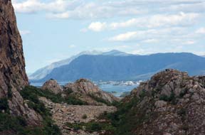 steep
slope, and within 20 minutes we had reached the huge cave-like entrance to the
eastern end of the hole just below the 200m contour line. This unique geological
phenomenon piercing the entire mountain peak is 166m in length sloping steeply
downwards from east to west, with the tunnel-hole 41m high and 18m wide. It is
now 115m above present-day sea levels at its western end which looks out across
the coastal plain towards off-shore islands. steep
slope, and within 20 minutes we had reached the huge cave-like entrance to the
eastern end of the hole just below the 200m contour line. This unique geological
phenomenon piercing the entire mountain peak is 166m in length sloping steeply
downwards from east to west, with the tunnel-hole 41m high and 18m wide. It is
now 115m above present-day sea levels at its western end which looks out across
the coastal plain towards off-shore islands.
Entering the huge cave-like entrance, it was an
unbelievable sensation to walk through and see a massive window of daylight at
the far end of the steeply downward sloping natural tunnel. Wooden steps
descended at a steep angle among a tangle of rock-fall boulders covering the
floor of the tunnel-hole. We descended to cross the rock debris at the
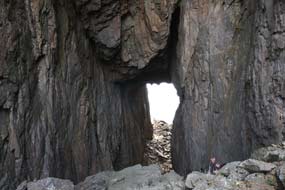 foot of
the hole, and stood in the cave-like western entrance looking out across tiny
red farm buildings on the island's flat western coastal plain way below us
towards the island-dotted sea beyond (Photo
42 - Torghatten 'hole in mountain'). Because of the harsh contrast of light and
shade, it was difficult to get photographs to give a realistic impression of
this unique setting. The fractured walls of the cave rose high above us and the
rock debris was a reminder that, in a fracture zone which had partly caused the
hole's formation, enlarged by wave action and melt-water erosion, rock-falls
were still a possibility. We stood in fascination to admire the cave-hole and
its setting; returning up the wooden steps and pausing to examine the
ice-scouring marks on the cavern's high walls and the melt-waters channels
running under the side-walls, we returned to the high eastern cave entrance. The
descent down the reinforced path took little time and just over a half hour
after setting out, we were back at the car park, not quite believing we had just
walked through a mountain! (see left). foot of
the hole, and stood in the cave-like western entrance looking out across tiny
red farm buildings on the island's flat western coastal plain way below us
towards the island-dotted sea beyond (Photo
42 - Torghatten 'hole in mountain'). Because of the harsh contrast of light and
shade, it was difficult to get photographs to give a realistic impression of
this unique setting. The fractured walls of the cave rose high above us and the
rock debris was a reminder that, in a fracture zone which had partly caused the
hole's formation, enlarged by wave action and melt-water erosion, rock-falls
were still a possibility. We stood in fascination to admire the cave-hole and
its setting; returning up the wooden steps and pausing to examine the
ice-scouring marks on the cavern's high walls and the melt-waters channels
running under the side-walls, we returned to the high eastern cave entrance. The
descent down the reinforced path took little time and just over a half hour
after setting out, we were back at the car park, not quite believing we had just
walked through a mountain! (see left).
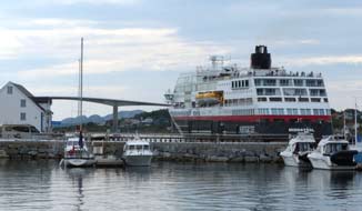
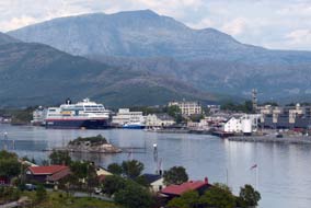 The south-bound Hurtigrute at Brønnøysund: driving back around the
lane towards Brønnøysund, we paused just before the high-arching bridge and
walked up to the apex to photograph the magnificent panorama of Brønnøysund's
sound with the afternoon south-bound Hurtigrute still standing at the harbour
quayside in the town (Photo
43 - Brønnøysund harbour). Unfortunately the afternoon sunshine of earlier had turned
hazy and the air was sultry almost threatening a storm. We drove around into the
town, parked at the dockside and with half an hour before departure, we had time
to visit the Hurtigrute before it sailed at 5-00pm. By The south-bound Hurtigrute at Brønnøysund: driving back around the
lane towards Brønnøysund, we paused just before the high-arching bridge and
walked up to the apex to photograph the magnificent panorama of Brønnøysund's
sound with the afternoon south-bound Hurtigrute still standing at the harbour
quayside in the town (Photo
43 - Brønnøysund harbour). Unfortunately the afternoon sunshine of earlier had turned
hazy and the air was sultry almost threatening a storm. We drove around into the
town, parked at the dockside and with half an hour before departure, we had time
to visit the Hurtigrute before it sailed at 5-00pm. By
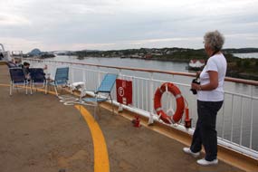 good chance it was M/S
Midnattsol, the same ship we had waved off at Trondheim over 10 weeks ago;
how many times had she sailed up and down the Norwegian coast between Bergen and
Kirkenes in the meantime? We walked up the gang-plank and asked if we could come
aboard. No problem, you are most welcome, said the attendant, and issued us with
port-visitor passes. Taking the luxury lift up to deck 9, we walked out onto the
sun deck for photographs of life aboard the new generation of Hurtigrute
luxury cruise-liners. For the fortune they had paid for the voyage, the
fare-paying passengers all looked rather bored and not particularly enjoying the
much vaunted Hurtigrute experience. We however relished our brief freeby visit,
especially the view from the high deck along the sound towards the bridge under
which the ship would sail and the distant hazy outline of Torghatten to the
south where we had been earlier (Photo
44 - Hurtigrute port visit). good chance it was M/S
Midnattsol, the same ship we had waved off at Trondheim over 10 weeks ago;
how many times had she sailed up and down the Norwegian coast between Bergen and
Kirkenes in the meantime? We walked up the gang-plank and asked if we could come
aboard. No problem, you are most welcome, said the attendant, and issued us with
port-visitor passes. Taking the luxury lift up to deck 9, we walked out onto the
sun deck for photographs of life aboard the new generation of Hurtigrute
luxury cruise-liners. For the fortune they had paid for the voyage, the
fare-paying passengers all looked rather bored and not particularly enjoying the
much vaunted Hurtigrute experience. We however relished our brief freeby visit,
especially the view from the high deck along the sound towards the bridge under
which the ship would sail and the distant hazy outline of Torghatten to the
south where we had been earlier (Photo
44 - Hurtigrute port visit).
 The drive south to Vennesund Brygge Camping:
disembarking in good time, we thanked the steward
as we handed back our visitor passes; she did her promotional bit, urging us to
make a Hurtigrute voyage. Thank you, but money could be better spent than
enforced boredom aboard a cruise-liner, but tactfully we did not tell her that!
We waited on the quayside for M/S Midnattsol to depart: just after 5-00pm,
the ship's horn sounded, the gang-planks folded up, lines were untied, and she
slipped quietly away from the quay. We continued to watch as she disappeared
from view down the sound and under the bridge we had crossed earlier (Photo
45 - Hurtigrute departing from Brønnøysund). We
returned to George to continue our drive south. Route 17 passed the junction with
Route 76, another of the E6 link roads to Mosjøen, and continued along the shore
of Skillbotnfjord, following a Tine milk tanker before it turned off to deliver
its afternoon collection to a milk-processing plant. Looking along the coast
across the sound, we could see M/S
Midnattsol just rounding Torghatten at the southern tip of the distant
Torget Island. The drive south to Vennesund Brygge Camping:
disembarking in good time, we thanked the steward
as we handed back our visitor passes; she did her promotional bit, urging us to
make a Hurtigrute voyage. Thank you, but money could be better spent than
enforced boredom aboard a cruise-liner, but tactfully we did not tell her that!
We waited on the quayside for M/S Midnattsol to depart: just after 5-00pm,
the ship's horn sounded, the gang-planks folded up, lines were untied, and she
slipped quietly away from the quay. We continued to watch as she disappeared
from view down the sound and under the bridge we had crossed earlier (Photo
45 - Hurtigrute departing from Brønnøysund). We
returned to George to continue our drive south. Route 17 passed the junction with
Route 76, another of the E6 link roads to Mosjøen, and continued along the shore
of Skillbotnfjord, following a Tine milk tanker before it turned off to deliver
its afternoon collection to a milk-processing plant. Looking along the coast
across the sound, we could see M/S
Midnattsol just rounding Torghatten at the southern tip of the distant
Torget Island.
 The road crossed an inlet to the southern part of
the Sømma peninsula across some of the richest farming countryside we had seen
in the whole of Norway. The small fields of ripening barley made us wonder where
Norway grows all her wheat and how much grain has to be imported with so little
cultivable land. Just before the larger settlement of Vik, warning signs alerted
drivers to elk hazards (Store Elgfare), and sure enough a large antlered
elk stood grazing in a field over towards woodland. Beyond Vik we continued to
the southernmost tip of Sømma to reach tonight's campsite, Vennesund Brygge
Camping set right by the Vennesund ferry dock at the narrow sound dividing off
the island of Kvaløya. A hospitable welcome, reasonable facilities, site-wide
wi-fi and good value all-inclusive price of 230 NOK/night greeted us; it was a
large campsite spread up the pine-wooded hill-side above the sound and ferry
port with 3 separate camping areas surrounded by huts. We found a peaceful and
flat grassy pitch directly overlooking the sound with the pine-wooded slopes of
Kvaløya rising beyond. It was a glorious spot from where we could watch the
ferries pass by on their way to and The road crossed an inlet to the southern part of
the Sømma peninsula across some of the richest farming countryside we had seen
in the whole of Norway. The small fields of ripening barley made us wonder where
Norway grows all her wheat and how much grain has to be imported with so little
cultivable land. Just before the larger settlement of Vik, warning signs alerted
drivers to elk hazards (Store Elgfare), and sure enough a large antlered
elk stood grazing in a field over towards woodland. Beyond Vik we continued to
the southernmost tip of Sømma to reach tonight's campsite, Vennesund Brygge
Camping set right by the Vennesund ferry dock at the narrow sound dividing off
the island of Kvaløya. A hospitable welcome, reasonable facilities, site-wide
wi-fi and good value all-inclusive price of 230 NOK/night greeted us; it was a
large campsite spread up the pine-wooded hill-side above the sound and ferry
port with 3 separate camping areas surrounded by huts. We found a peaceful and
flat grassy pitch directly overlooking the sound with the pine-wooded slopes of
Kvaløya rising beyond. It was a glorious spot from where we could watch the
ferries pass by on their way to and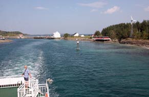 from the Vennesund Brygge (ferry-dock), and
we quickly settled in to relax outside on the grassy headland with a beer after
our long and varied day, watching another ferry come chugging in (see above
left). The sun set
behind the hill of Kvaløya opposite our camping spot, and we sat out after
supper late into the dusky evening in the still, warm air (Photo
46 - Vennesund Brygge Camping). from the Vennesund Brygge (ferry-dock), and
we quickly settled in to relax outside on the grassy headland with a beer after
our long and varied day, watching another ferry come chugging in (see above
left). The sun set
behind the hill of Kvaløya opposite our camping spot, and we sat out after
supper late into the dusky evening in the still, warm air (Photo
46 - Vennesund Brygge Camping).
The Vennesund~Holm ferry:
we woke to a breezy, sunny morning and breakfasted outside on our grassy
headland above the Kvaløya sound as the early ferry from Holm
chugged back and forth (Photo
47 - Vennesund~Holm ferry). We were packed and away in good time to drive around to
the port for the 12-00 noon ferry; from our camp, the ferry M/F Lysingen
had looked to be a small and rusty old tub, and a long line of vehicles was
already queuing at the dock; despite our fears of not getting on this crossing,
in fact the ferry had a capacity of 60 vehicles and we drove aboard
without difficulty. The Vennesund~Holm crossing was the last of the
series of 6 ferries we should have to take on our progression down the Route 17
Kystriksveien (see below left), and the total ferry fares had totted up to over £76.
Despite appearances, the ferry had a well-appointed saloon, but on such a
beautiful morning we went straight up aloft onto the outer deck to photograph
the departure from Vennesund Brygge, passing our campsite as we pulled away from
the dock (Photo
48 - Departing Vennesund).
 Inland across fjord country to Namsos: across the fjord at Holm's
small harbour (see below right), we pulled over to eat our sandwiches and allow the convoy of
ferry vehicles to pass. Beyond the small farming community of Holm, the onward
continuation of Route 17 ran along the shore-line under a high, craggy mountain
slope on the landward side, rounding a small inlet through 2 short tunnels. The
road was narrow, winding over a shoulder of high land, and we were harassed by
intolerantly speeding Norwegian drivers. The road descended to cross a short
isthmus and wound its way along the shore of a spectacularly high mountain-sided
fjord. But on such a narrow, winding road, there was no opportunity to pull over
to admire such classic fjord terrain. Into another steep-sided mountain
fjord valley, a minor lane turned off, crossing a short bridge to enter the
shack-like portal of a tunnel Inland across fjord country to Namsos: across the fjord at Holm's
small harbour (see below right), we pulled over to eat our sandwiches and allow the convoy of
ferry vehicles to pass. Beyond the small farming community of Holm, the onward
continuation of Route 17 ran along the shore-line under a high, craggy mountain
slope on the landward side, rounding a small inlet through 2 short tunnels. The
road was narrow, winding over a shoulder of high land, and we were harassed by
intolerantly speeding Norwegian drivers. The road descended to cross a short
isthmus and wound its way along the shore of a spectacularly high mountain-sided
fjord. But on such a narrow, winding road, there was no opportunity to pull over
to admire such classic fjord terrain. Into another steep-sided mountain
fjord valley, a minor lane turned off, crossing a short bridge to enter the
shack-like portal of a tunnel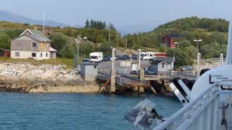 directly into the sheer mountain face opposite;
how on earth had this been constructed? Alongside the fjord in a sheer sided,
pine-forested gorge, we crossed from Nordland into the county of Nord-Trøndelag.
Reaching the inner head of the fjord, the road descended to a large village and entered a short tunnel which opened directly onto
a wide suspension bridge across another fjord. Thankfully the road now widened
as it began a gradual climb alongside the inner reaches of the fjord, gaining
height onto more open forested countryside. The road followed a wide, stony and
almost dry watercourse up onto a broad watershed, the flatter land now thickly
forested with birch and candle-spruce. directly into the sheer mountain face opposite;
how on earth had this been constructed? Alongside the fjord in a sheer sided,
pine-forested gorge, we crossed from Nordland into the county of Nord-Trøndelag.
Reaching the inner head of the fjord, the road descended to a large village and entered a short tunnel which opened directly onto
a wide suspension bridge across another fjord. Thankfully the road now widened
as it began a gradual climb alongside the inner reaches of the fjord, gaining
height onto more open forested countryside. The road followed a wide, stony and
almost dry watercourse up onto a broad watershed, the flatter land now thickly
forested with birch and candle-spruce.
Beyond the small settlement of Flått with its
attractive little campsite, we crossed farming countryside with fields of ripe
barley and wheat, and descended to the village of Høglandet where Route 775
turned off east to link across to E6 in upper Namdalen, the route of our earlier
northward journey. Route 17 continued ahead along a broad farming valley where
harvesting was taking place, to reach the village of Skogmo where Route 760
branched off along middle Namdalen to join E6 at Grong. A spur of the
Trondheim~Bodø main northern railway line also branched off at Grong winding along the meandering Namdalen valley to Namsos. We continued ahead
following Route 17 towards its southern end
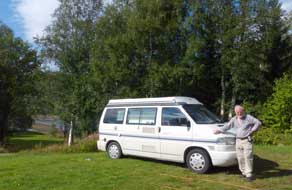 beyond Namsos towards Steinkjer.
Following the river and railway line along the broad, flat lower Namdalen, we
diverted briefly into the small town and port of Namsos, but soon realised we
need not have bothered to incur the additional tolls this involved: it was an
insignificant place, deserted on a Sunday afternoon, and having pulled in by the
estuary waterfront, we returned across the wide river to re-join Route 17. beyond Namsos towards Steinkjer.
Following the river and railway line along the broad, flat lower Namdalen, we
diverted briefly into the small town and port of Namsos, but soon realised we
need not have bothered to incur the additional tolls this involved: it was an
insignificant place, deserted on a Sunday afternoon, and having pulled in by the
estuary waterfront, we returned across the wide river to re-join Route 17.
Holmset Camping: leaving Namsos, Route 17 wound its way along the
southern side of the fjord through several villages to reach Holmset Camping.
Set on a salmon and trout fishing river, this was essentially a fishermen's
campsite, but was also ideally sited on the lower reaches of Route 17. The
young owner welcomed us hospitably: camp anywhere you like, he said in greeting;
the nightly charge was very reasonable at 210 NOK including showers and
site-wide wi-fi, and the facilities were modern and clean. We found an open space
above the river bank and settled in with the sky clearing but the air sultry as
if a storm was brewing.
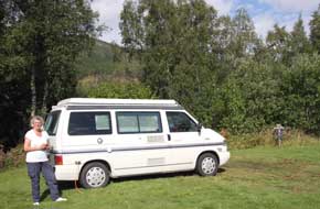 Lower
end of Route 17 into Steinkjer: the following day was Black Monday 4 August, the 100th anniversary of the start
of WW1 which launched the sequence of horrors inflicted by the Germans across
the breadth of Europe during the 20th century. Holmset Camping had been a
worthwhile staging camp on our southward journey, and having re-filled George's
fresh water tank, we set off again along the farming valley; the fields of
barley were golden ripe ready for harvesting and the hay meadows were being cut
for next winter's silage. Around a small inlet of Beitstadfjord at the very
inner reaches of Trondheimfjord, we finally reached the bottom end of Route 17
to re-join E6. Down the full length of the
Kystriksveien Coastal Road, we had experienced every form of topography:
spectacular coastal scenery, ferry crossings of fjord mouths, sheer-sided,
forested inland fjords, hill-farming countryside, and now finally rich, lowland
valley agriculture. Lower
end of Route 17 into Steinkjer: the following day was Black Monday 4 August, the 100th anniversary of the start
of WW1 which launched the sequence of horrors inflicted by the Germans across
the breadth of Europe during the 20th century. Holmset Camping had been a
worthwhile staging camp on our southward journey, and having re-filled George's
fresh water tank, we set off again along the farming valley; the fields of
barley were golden ripe ready for harvesting and the hay meadows were being cut
for next winter's silage. Around a small inlet of Beitstadfjord at the very
inner reaches of Trondheimfjord, we finally reached the bottom end of Route 17
to re-join E6. Down the full length of the
Kystriksveien Coastal Road, we had experienced every form of topography:
spectacular coastal scenery, ferry crossings of fjord mouths, sheer-sided,
forested inland fjords, hill-farming countryside, and now finally rich, lowland
valley agriculture.
Turning down E6, we drove into Steinkjer, a town
very busy with workaday traffic today compared with how peaceful it had been
when we drove through on a Sunday morning on our northward journey. Our reason
for coming into Steinkjer had been to find the gas supplier LPG Propan Norge,
whose advertisement we had seen in the Coast Road Travel Guide booklet, to
re-fill our empty cylinder. We eventually found their workshop tucked away among
industrial estates behind the Steinkjer bus garage, and re-filled our cylinder
with propane at the bargain cost of 129 NOK (£13) compared with £27 which this
now costs in UK, all ready for the low temperatures of an early start with next
year's travels.
E6 past Trondheim:
after a provisions stock-up, we re-joined E6 to continue south from Steinkjer
around the shores of Trondheimfjord. After the peacefulness of Route 17 over the
past week, E6's busy weekday traffic came as a culture shock. A short distance
further the E6 highway passed the turning for Stiklestad and the oil rig
construction industrial town of Levanger, and dropped
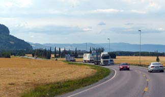 down the craggy defile to
the shore of
Fættenfjord and the Tirpitz 1941~42 anchorage visited on our northward
journey. Crossing higher ground, we could look down towards Trondheim airport
over what was today's memorably characteristic view: instead of the usual dark green
fell-sides and craggy rock, all we could see were continuous fields of golden
ripe cereal crops stretching away into the distance ready for harvesting; it was
a curiously un-Norwegian scene (see left). down the craggy defile to
the shore of
Fættenfjord and the Tirpitz 1941~42 anchorage visited on our northward
journey. Crossing higher ground, we could look down towards Trondheim airport
over what was today's memorably characteristic view: instead of the usual dark green
fell-sides and craggy rock, all we could see were continuous fields of golden
ripe cereal crops stretching away into the distance ready for harvesting; it was
a curiously un-Norwegian scene (see left).
E6 dropped steeply down past the airport to enter
the 4km long Hell Tunnel, and now motorway standard descended towards the
northern suburbs of Trondheim. With traffic busier than ever, we passed through
the city area to swing south and clear the conurbation. E6 continued ahead
towards Oppdal while we turned off onto E39, passing through a series of tunnels
by the grubby industrial and mining port-town of Orkanger. Not mentioned in any
of our guide books, you could understand why!
A night's stop at Høgkjølen Fjellcamp:
beyond
Orkanger E39 became a narrow, winding and insignificant road, climbing steeply
into hill country. With the terrain becoming wilder and the sky ahead darkening
for a storm, we reached our next staging camp Høgkjølen Fjellcamp high in the
hills. This time first impressions did not belie the forlornly unkempt nature of
the place. The owner however welcomed us in friendly manner, amazed to have
English visitors. With an overnight charge of just 180 NOK, but not a trace of
flat land on which to camp in the limited area available for visitors among the
massed statics, we made the best of it and quickly settled in as the storm
broke.
Tomorrow we should begin the next phase of the trip,
heading westwards towards Norway's much fragmented western coast, the complex
of spectacular bridges and undersea tunnel on the approach to Kristiansund and
its islands, and onwards into Fjord country at Geiranger Fjord, but that's for the next episode of our Norwegian travels. Join us
again shortly.
Next edition
to be published quite soon
|
Sheila and Paul |
Published: 7 February 2015 |
|
 CAMPING
IN NORWAY 2014: Kystriksveien Coastal Route (Route 17) - Saltstraumen,
Engabreen glacier, and south to Namsos, Steinkjer and Trondheim:
 Route 80 from Fauske led westwards along the
shore of Skjerstadsfjord and just before Bodø, we turned off onto Route 17, the
Kystriksveien (Coastal Road). This road was to be our route southwards over the next
week, weaving its tortuous way along the fretted western coastline of Norway,
running parallel with the inland E6 highway, and taking us as far as Steinkjer where we should re-join E6. It's a challenging 630km route but with
many excellent scenic rewards along its much-indented course. It's also however expensive
involving 6 ferries connecting across fjord inlets; one of the ferries has the
novelty of crossing
the Polar Circle. Many of the coastal villages along the length of the route
would once only have been accessible by boat before the creation of Route 17,
and survived by coastal fishing and subsistence farming. Having used the
E6 route on our northward journey for speed's sake to give us as much time as
possible within the Arctic for experiencing the Midnight Sun, Route 17 Kystriksveien
seemed a worthwhile route to take heading back south.
 Elvegård Camping: Route 17, the
Kystriksveien (Coastal Road), at its northern end crosses the
Saltstraumen channel on an elegantly high-arching bridge, and just beyond
 we
turned off to Elvegård Camping on the island of Straumøya. We settled into this
small, welcoming and excellent value farm-campsite on a terraced pitch overlooking the Saltstraumen channel;
with a forecast of fine weather, our plan was to
spend tomorrow watching the Saltstraumen tidal race from the vantage point of
the bridge which arches over the straits giving a perfect view down onto the mælstroms.
Late on the first afternoon at Elvegård Camping, we followed a fishermen's path
down towards the fjord, which led to flat rocky outcrops directly
overlooking the Saltstraumen channel at its western end; from here there were glorious views
along the length of the narrows towards the bridge and its mountainous backdrop,
with the evening outgoing tidal race still running, all lit by the late
afternoon sun (
 A
sunny
day to watch the spectacular Saltstraumen tidal race: on a pleasantly sunny Sunday
morning, we breakfasted outside looking across the narrows, with the bells of
Saltstraumen church ringing in the distance. With its wonderful location,
hospitable welcome, good facilities including
 wi-fi, and super value
all-inclusive price of 230 NOK, Elvegård Camping was one of the very best. The
tide-tables showed that today's mid-day in-flowing Saltstraumen tide would be at
its highest at 12-30pm. By good chance, our visit coincided with the time of the new moon when
the incoming tidal level is at its highest, creating the most spectacular levels
of turbulence as the vast quantities of tidal in-flow surging up through the
narrow 150m wide channel meet the fjord's natural down-flow below the bridge
opposite Saltstraumen village. On such a fine morning, it was a pleasant 10
minute stroll along the lane, looking out across Elvegård's hay meadows to the
blue waters of the channel against the backdrop of jagged peaks (see right). Reaching Route
17, we crossed towards the footpath over the high-arching Saltstraumen bridge (see
left) (
 high vantage point on the
bridge (
 e could fully appreciate the splendour of the eastern skyline's jagged array of
peaks which formed a backdrop to the equally spectacular display of mælstroms
below us, every detail picked out by the bright sunlight
(
 (see
right) (
 (
(
 After such a thrillingly spectacular morning,
it was a long plod back up through Saltstraumen village
(
 Island with the weather
now overcast and cloud gathering on the distant mountains. The road descended to a further fjord and, crossing a
headland through a short tunnel, emerged on the descent to the shore of Nordfjord.
A spectacular mountainous panorama opened up ahead with a high
glacier-filled corrie surrounded by a coronet of the 1,332m high pinnacles of Memaurtinden,
its lower rocky skirts scoured smooth by glacial ice (
 through
a couple of short tunnels penetrating the next high headland. Around a further
section of coast the 3.2 km Storvikskaret Tunnel passed through the neck of a mountainous peninsula (see left), the road descending around a large
bay. The far end was enclosed by a distinctively lumpy hill where the road swung
inland along a broad, flat farming valley leading to the attractive village of
Reipå. A short distance further and we reached Ørnes, a small port on the
Hurtigrute route. Sheltered from the open sea by a protective archipelago of
islands, this was a warm, sunny place even when the surrounding high mountains
were swathed in gloomy cloud. The road now passed along the length of the
increasingly gloomy Glomfjord, enclosed by fearsomely high mountains now
entirely cloud-covered, and at the inner end penetrated this massive mountainous
barrier through a succession of tunnels and with little gap entered the dismal
mouth of the 7.6 km long Svartis Tunnel which cuts directly through the high
 glacier-covered
mountains (see below right). The tunnel was poorly lit and felt scarily narrow as we passed a lot
of traffic and 2 heavy trucks with little room to spare. We emerged into the
steep-sided valley filled by Nordfjord. Part of the massive Svartisen Glacier
drains into this narrow fjord, its glacial sediment giving the fjord waters a
beautiful turquoise-aquamarine iridescence even on a gloomily overcast day like
today.
 Furøy Camping: the road shelved above the
fjord to reach the Holandsfjord Information Centre where we pulled in for
details of the boats across the fjord to the foot of the Engabreen Glacier. This
projection of Svartisen Glacier, whose icy tongue drops steeply down to
Holandsfjord, was just visible in the gloomy distance on the far side of the fjord.
Armed with information on ferry times and route of the walk up to the foot of
the glacier in readiness for tomorrow's visit to Engabreen, we continued around
to the peninsula's end at Furøy Camping. The campsite was welcoming and
had pleasant fjord-side location and spectacular mountainous outlook, but
with its monopolistic position on the Coastal Route immediately by the Furøy~Ågskardet
ferry, it was expensive at 260 NOK/night. It was also a noisy site with all the
comings and goings, and the air was pervaded by an earthy smell from a nearby
artificial fertiliser plant. But we settled in looking out to the little ferry
which chugged across the fjord to and from Ågskardet (
 Engabreen Glacier:
exactly as forecast, St Olaf's Day (29 July) was a beautiful morning with sun
glinting across the fjord lighting the shapely conical
 peak of Blokktinden (
 (
( washed down from Engabreen and reflecting the clear blue
sky. The lower slopes of the high mountains enclosing the lake were covered with
birch and alder trees with a ground-covering of juniper bushes loaded with
ripening berries
(
 (
( vegetation, the
ice-smoothed rock of the immediate enclosing basin was entirely bare and devoid
of any soil to give root to vegetation. In geological time-scale, it must have
been quite recently that the ice had covered these rocks. We hand-over-handed
ourselves up the steep rock slope, expecting the route to lead to a point on the
glacier's edge where we could look across directly at the ice formations (see
left), but at
the top of the steepest section, the route turned away leftwards: the deep chasm
of a rocky ravine now barred our direct access to the glacier's rim. The
safety-chain ended with no evident means of forward progress across the gulf; to attempt further
progress with
no idea of route would have been foolhardy. Frustratingly we halted there, taking
photos from our
 high-point looking down the ice-smoothed steep rock slope to Engabrevatnet way below, but still not having reached the glacier's edge
(
 Back through the birch groves, appreciating the
sparse shade in the hot afternoon sun, we returned to the landing stage where
the boat had just arrived. The return across the fjord gave yet more distant
views of Engabreen
(
 Forøy~Ågskardet ferry and re-crossing the Polar Circle on the
Jetvik~Kilboghamn ferry: the following morning, despite heavily
overcast weather, Blokktinden at the far end of the fjord still managed to look
shapely even in grey gloom. By the time we had joined other vehicles queuing at
the Forøy ferry port, the forecast rain had started in earnest, and with the
mountains surrounding the fjord totally obscured by heavy rain cloud, we sat in
the camper for the 10 minute crossing. Across at Ågskardet, with the landscape
dismal in pouring rain, we set off again across a narrow peninsula of higher
land; the conical outline of Blokktinden was just about visible in rain cloud,
its sheer western face still looking spectacular. Down to the tiny hamlet of Tjong, we rounded Tjongsfjord to the further settlement of Reppa, a few farmsteads
and small HEP plant set at the fjord-botn; Route 17 then disappeared into a 3km
long tunnel which passed through the jagged peaks of Blokktinden's massif,
emerging into a narrow valley on the
 southern side. Another short tunnel and
bridge over the inner reaches of a fjord brought us around to the next ferry
port of Jetvika. The 12-50pm ferry approached, this one a larger boat which was
just as well with 3 lines of vehicles queuing, including cars, lorries, monster
camping-cars and a tour-bus, for this hour long crossing. The rain had by now
stopped, but the weather was still heavily overcast; we went straight up onto
the ferry's outer deck to observe the surrounding peaks, particularly the
shapely peak of the 973m high Telnestinden (
 Polar Camping: soon after, the ferry passed along lower Sørfjord to
approach the ferry-dock at Kilboghamn. Once ashore most of the ferry traffic
continued south on Route 17; we turned left along a minor lane passing a series
of farmsteads, and 3 kms north we reached the hamlet of Hilstad and Polar
Camping, set on 3
terraced levels above the fjord. We were welcomed at reception, and settled in on the middle gravelled terrace looking out across Sørfjord
towards
 the peak of Telnestinden. Polar Camping's facilities were some of the
best of the trip with included wi-fi internet, modern, well-equipped
kitchen/wash-up, well-appointed showers, and washing/drying machine which was put to immediate use. It was expensive at 270 NOK/night including showers, but
the perfect location and charming welcome more than made up for this. The
afternoon remained cool and overcast, with rainy squall-showers blowing up the
length of the fjord. After some overnight rain, we woke the following morning to a thin sun for our
day in camp at Polar Camping. The wind had dropped and air warm and still,
enabling us to sit outside for breakfast (see left)
(
 Nesna~Levang ferry to Sandnessjøen: after further rain in the
night, the following morning was heavily overcast with very unsettled forecast.
Back along the lane to Kilboghamn, the now narrow Route 17 continued to the head
of Sørfjord and wound over a shoulder of high land down to the shore of
Aldersund. This narrow channel separated the shapely lump of Aldra Island which
so mirrored the outline of the mainland coast that it looked to have only
recently been heaved away by the hand of some giant troll. The lane passing a
few fishing-farming hamlets along the shore-line was uncomfortably narrow, just
a single vehicle width with passing places indicated by the familiar M
 sign for
Møte (meeting). Rounding a high headland, the view out to the
archipelago of islands would have been splendid on a fine day, but today the
islands were lost in misty gloom. Along the shore of Sjona Sound and round the
head of an inlet, the road entered the portal of a 3km long tunnel to continue
around the head of the inner fjord into a second 3km tunnel through the
mountainous headland. Around the shallow head of Sjon-botn, we reached the
junction with Route 12, the link road to the E6 at Mo-i-Rana. We continued west
on Route 17, and through a short tunnel a newly upgraded stretch of road began
the long climb over high, exposed land, the bare rock faces of the surrounding
gloomy mountains scoured smooth by glacial action. Across the high point, the
road descended very steeply by hairpins and sweeping bends and along the sound
of Litlsjona reached the tip of the peninsula at the ferry port of Nesna where
the daily Hurtigrute also stops. Here we joined other vehicles queuing for the
12-55pm ferry crossing to Levang on the far side of Ranfjord. The ferry's car
deck was full by the time we pulled out, crossing the sound to Levang past the
mountainous island of Hugla
(
 Ashore on the far side of the fjord, Route 17 crossed the width of the peninsula to the
head of Leirfjord passing the junction of Route 78, the link road to the E6 at
Mosjøen. The road continued down the length of the peninsula to cross to the
molar-shaped large island of Alsta on the wide, elegant Leirfjord suspension
bridge (see above left) and elongated causeway leading to the large port and service-centre of Sandnessjøen.
This was another stop on the Hurtigrute route, but by the time we reached there
at 2-00pm, the north-bound coastal liner had already sailed. We turned off into the outskirts of the port and found a Rema 1000 supermarket for a major
provisions stock-up. The main Route17 south passed along a high valley running
parallel with the Sju Søstre (Seven Sisters) rocky ridge of bare peaks which
lined the eastern side of the elongated island, and along the
 western
shore-line around the tapering tip of the SW peninsula. Rounding the southern bay, the road continued down the
narrowing projection of land to reach Offersøya where we turned off to tonight's
campsite, Offersøya Camping.
 position to camp and we sat in
George sheltering from the chill breeze looking out across the mudflats as the
tide went out, listening to the oystercatchers piping across the bay. The sun
dipped giving a silvery evening light across the bay (
 end
of the Seven Sisters Ridge now clear of cloud, its sculpted, craggy
details fully lit by the sun. Across the bay, the water was blue and despite
the cool breeze we sat out for breakfast watching gulls pecking in the low-tide
mudflats (
 buried in an unmarked mass grave
here at Tjøtta and a cross-shaped monument raised in their memory. In a
neighbouring stone-walled enclosure, some 6,500 Russian POWs who had died in
German slave-labour camps were buried; their remains had been gathered from
regular cemeteries all around Northern Norway and re-buried in this war-cemetery
here at Tjøtta in 1953. 826 are buried in individually identified graves, and
6,725 in an unmarked mass grave, and the site is dominated by a dark granite
monument topped with the Soviet hammer and sickle emblem (
 The Tjøtta~Forvik and Andsalsvåg~Horn ferries to Brønnøysund:
the ferry drew in (
 Norway on their motor bikes and
planning this evening to join the Hurtigrute mini-cruise from Brønnøysund to
Rørvik and back, the only chance on the entire Hurtigrute voyage to make such a
return trip without overnight stop. More importantly for us, we learnt from this
serendipitous meeting about the Torghatten 'hole-in-the-mountain' walk just 12
kms across the bridge south of Brønnøysund at the tip of Torget island (
 of the main Route 17
running down the coast forms the only piece of road on this huge area of
barren, uninhabited mountain wilderness between the E6 valley up to Masjøen
on the inland eastern side and the Norwegian Sea on the western side. Yet villages,
farms and a Co-op stores were set along this fertile coastal strip of land in
the shadow of the mountainous downfall. We drove in convoy with other vehicles from
the ferry down to the port at Andsalsvåg at the southern tip (see left). Here the ferry was
waiting for the shorter 20 minute crossing to Horn at the northern tip of the Sømma peninsula. There was little of interest to see on the crossing and we sat
in the camper to eat our sandwiches until the ferry docked at the opposite side.
Having caught the earlier ferries, we had time this afternoon at Brønnøysund to
investigate the Torghatten walk before seeing the south-bound Hurtigrute depart
at 5-00pm, and then driving the final 50kms down to tonight's campsite at Vennesund at the southern tip of Sømma. We drove the 10kms down into the port of Brønnøysund
to find the TIC for details of the route out to Trollhatten and a booklet on the
feature's formative geology.
  The 'hole-in-the-mountain' walk at
Torghatten: armed with a Brønnøysund street plan, we made our way
through the quiet little port-town and by the fishing harbour crossed the
high-arching bridge, under which the south-bound Hurtigrute passes, over onto
Torget Island. A further 12 kms of country lane led us to a parking area on the
inland eastern side of the conical hat-shaped peak of Torghatten. This 258m high peak
is unique in being pierced by a huge hole which passes through the entire
mountain. Legend has it that the hole was caused by an arrow shot by an evil
character called Hestmann (the Horseman). He had witnessed the Seven Sisters and
beautiful Maiden of Leka bathing in the sea and had tried to rape the maiden.
But at his approach on horseback, the girls fled. In anger the Horseman fired an
arrow from his bow to kill them, but the King of Sømma seeing what had happened
flung his hat towards the arrow, saving the girls' lives. The hat was pierced by
the arrow
 and fell to the ground at Torget, and the first rays of the dawning
sun turned all to stone, creating the Seven Sisters ridge of peaks, the Island
of Leka and the arrow-pierced hat was transformed into the holed mountain of
Torghatten.
 steep
slope, and within 20 minutes we had reached the huge cave-like entrance to the
eastern end of the hole just below the 200m contour line. This unique geological
phenomenon piercing the entire mountain peak is 166m in length sloping steeply
downwards from east to west, with the tunnel-hole 41m high and 18m wide. It is
now 115m above present-day sea levels at its western end which looks out across
the coastal plain towards off-shore islands.
 foot of
the hole, and stood in the cave-like western entrance looking out across tiny
red farm buildings on the island's flat western coastal plain way below us
towards the island-dotted sea beyond (
 The south-bound Hurtigrute at Brønnøysund: driving back around the
lane towards Brønnøysund, we paused just before the high-arching bridge and
walked up to the apex to photograph the magnificent panorama of Brønnøysund's
sound with the afternoon south-bound Hurtigrute still standing at the harbour
quayside in the town (
 good chance it was M/S
Midnattsol, the same ship we had waved off at Trondheim over 10 weeks ago;
how many times had she sailed up and down the Norwegian coast between Bergen and
Kirkenes in the meantime? We walked up the gang-plank and asked if we could come
aboard. No problem, you are most welcome, said the attendant, and issued us with
port-visitor passes. Taking the luxury lift up to deck 9, we walked out onto the
sun deck for photographs of life aboard the new generation of Hurtigrute
luxury cruise-liners. For the fortune they had paid for the voyage, the
fare-paying passengers all looked rather bored and not particularly enjoying the
much vaunted Hurtigrute experience. We however relished our brief freeby visit,
especially the view from the high deck along the sound towards the bridge under
which the ship would sail and the distant hazy outline of Torghatten to the
south where we had been earlier (
 The drive south to Vennesund Brygge Camping:
disembarking in good time, we thanked the steward
as we handed back our visitor passes; she did her promotional bit, urging us to
make a Hurtigrute voyage. Thank you, but money could be better spent than
enforced boredom aboard a cruise-liner, but tactfully we did not tell her that!
We waited on the quayside for M/S Midnattsol to depart: just after 5-00pm,
the ship's horn sounded, the gang-planks folded up, lines were untied, and she
slipped quietly away from the quay. We continued to watch as she disappeared
from view down the sound and under the bridge we had crossed earlier (
 The road crossed an inlet to the southern part of
the Sømma peninsula across some of the richest farming countryside we had seen
in the whole of Norway. The small fields of ripening barley made us wonder where
Norway grows all her wheat and how much grain has to be imported with so little
cultivable land. Just before the larger settlement of Vik, warning signs alerted
drivers to elk hazards (Store Elgfare), and sure enough a large antlered
elk stood grazing in a field over towards woodland. Beyond Vik we continued to
the southernmost tip of Sømma to reach tonight's campsite, Vennesund Brygge
Camping set right by the Vennesund ferry dock at the narrow sound dividing off
the island of Kvaløya. A hospitable welcome, reasonable facilities, site-wide
wi-fi and good value all-inclusive price of 230 NOK/night greeted us; it was a
large campsite spread up the pine-wooded hill-side above the sound and ferry
port with 3 separate camping areas surrounded by huts. We found a peaceful and
flat grassy pitch directly overlooking the sound with the pine-wooded slopes of
Kvaløya rising beyond. It was a glorious spot from where we could watch the
ferries pass by on their way to and
 from the Vennesund Brygge (ferry-dock), and
we quickly settled in to relax outside on the grassy headland with a beer after
our long and varied day, watching another ferry come chugging in (see above
left). The sun set
behind the hill of Kvaløya opposite our camping spot, and we sat out after
supper late into the dusky evening in the still, warm air (
 Inland across fjord country to Namsos: across the fjord at Holm's
small harbour (see below right), we pulled over to eat our sandwiches and allow the convoy of
ferry vehicles to pass. Beyond the small farming community of Holm, the onward
continuation of Route 17 ran along the shore-line under a high, craggy mountain
slope on the landward side, rounding a small inlet through 2 short tunnels. The
road was narrow, winding over a shoulder of high land, and we were harassed by
intolerantly speeding Norwegian drivers. The road descended to cross a short
isthmus and wound its way along the shore of a spectacularly high mountain-sided
fjord. But on such a narrow, winding road, there was no opportunity to pull over
to admire such classic fjord terrain. Into another steep-sided mountain
fjord valley, a minor lane turned off, crossing a short bridge to enter the
shack-like portal of a tunnel
 directly into the sheer mountain face opposite;
how on earth had this been constructed? Alongside the fjord in a sheer sided,
pine-forested gorge, we crossed from Nordland into the county of Nord-Trøndelag.
Reaching the inner head of the fjord, the road descended to a large village and entered a short tunnel which opened directly onto
a wide suspension bridge across another fjord. Thankfully the road now widened
as it began a gradual climb alongside the inner reaches of the fjord, gaining
height onto more open forested countryside. The road followed a wide, stony and
almost dry watercourse up onto a broad watershed, the flatter land now thickly
forested with birch and candle-spruce.
 beyond Namsos towards Steinkjer.
Following the river and railway line along the broad, flat lower Namdalen, we
diverted briefly into the small town and port of Namsos, but soon realised we
need not have bothered to incur the additional tolls this involved: it was an
insignificant place, deserted on a Sunday afternoon, and having pulled in by the
estuary waterfront, we returned across the wide river to re-join Route 17.
 Lower
end of Route 17 into Steinkjer: the following day was Black Monday 4 August, the 100th anniversary of the start
of WW1 which launched the sequence of horrors inflicted by the Germans across
the breadth of Europe during the 20th century. Holmset Camping had been a
worthwhile staging camp on our southward journey, and having re-filled George's
fresh water tank, we set off again along the farming valley; the fields of
barley were golden ripe ready for harvesting and the hay meadows were being cut
for next winter's silage. Around a small inlet of Beitstadfjord at the very
inner reaches of Trondheimfjord, we finally reached the bottom end of Route 17
to re-join E6. Down the full length of the
Kystriksveien Coastal Road, we had experienced every form of topography:
spectacular coastal scenery, ferry crossings of fjord mouths, sheer-sided,
forested inland fjords, hill-farming countryside, and now finally rich, lowland
valley agriculture.
 down the craggy defile to
the shore of
Fættenfjord and the Tirpitz 1941~42 anchorage visited on our northward
journey. Crossing higher ground, we could look down towards Trondheim airport
over what was today's memorably characteristic view: instead of the usual dark green
fell-sides and craggy rock, all we could see were continuous fields of golden
ripe cereal crops stretching away into the distance ready for harvesting; it was
a curiously un-Norwegian scene (see left).