|
 CAMPING
IN SWEDEN 2013 - across the Arctic Circle to Jokkmokk, Muddus National Park,
Porjus hydro-electric power station and Harsprånget
dam, the crash-site of WW2 Lancaster bomber Easy Elsie,
Gällivare's iron ore mines, Kiruna a town on the move, Abisko
National Park and Norwegian border: CAMPING
IN SWEDEN 2013 - across the Arctic Circle to Jokkmokk, Muddus National Park,
Porjus hydro-electric power station and Harsprånget
dam, the crash-site of WW2 Lancaster bomber Easy Elsie,
Gällivare's iron ore mines, Kiruna a town on the move, Abisko
National Park and Norwegian border:
North to Jokkmokk: in pouring rain we left Arvidsjaur to rejoin
the E45 Inlandsvägen northwards towards our next destination Jokkmokk. With
misty cloud down to tree-top level and much road spray from lying water, the
forested, hilly terrain was totally obscured and rivers running in white-water
spate. We hoped that in such driving rain and poor visibility any reindeer would
have the sense to stay off the road in the shelter of the forest, but we passed
one forlorn-looking beast grazing the road-side verge.
|
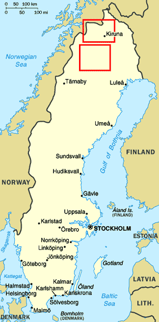
Click on the 2 highlighted areas of
the map
for
details of
Swedish Lapland |
 |
40kms north in the village of Moskosel, we
paused at at the small and unassuming museum at the Inlandsbanan railway station
where the collection of photos and memorabilia tells the story of the dreadful
conditions endured by the gangs of navvies who constructed the line and the
womenfolk who cooked for them at their rail-head encampments. Somehow driving in
such awful weather seemed comfortable compared with the hazards of advancing the
railway across such inhospitable wilderness.
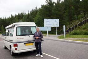 Crossing the Arctic Circle: some 4 kms south of Jokkmokk, we reached the
notional line of the Arctic Circle - Polcirkeln in Swedish, Napapiiri in
Finnish. Thankfully there was no overt over-commercialism, just an intelligently
worded information panel describing how the earth's angle of tilt causes the
Arctic Circle's movement. Defined as the southernmost latitude in the
Northern Hemisphere at which the Midnight Sun can be seen on the night of the
Summer Solstice, the Arctic Circle moves north and southwards across an area of
180 kms over a period of 40,000 years; it will reach its northernmost position
in the year 12,000, returning to its current position in AD 22,000 and reaching
its southernmost line in 32,000 and continuing to cycle north and south
thereafter if you care to hang around to witness this curious phenomenon. Tacky
as it seemed, we could not let our second 'crossing of the line' pass without a
photo, and even the rain stopped to honour the occasion (Photo 1 - Crossing the Arctic Circle). Crossing the Arctic Circle: some 4 kms south of Jokkmokk, we reached the
notional line of the Arctic Circle - Polcirkeln in Swedish, Napapiiri in
Finnish. Thankfully there was no overt over-commercialism, just an intelligently
worded information panel describing how the earth's angle of tilt causes the
Arctic Circle's movement. Defined as the southernmost latitude in the
Northern Hemisphere at which the Midnight Sun can be seen on the night of the
Summer Solstice, the Arctic Circle moves north and southwards across an area of
180 kms over a period of 40,000 years; it will reach its northernmost position
in the year 12,000, returning to its current position in AD 22,000 and reaching
its southernmost line in 32,000 and continuing to cycle north and south
thereafter if you care to hang around to witness this curious phenomenon. Tacky
as it seemed, we could not let our second 'crossing of the line' pass without a
photo, and even the rain stopped to honour the occasion (Photo 1 - Crossing the Arctic Circle).
Driving on into Jokkmokk, we were welcomed at
Skabram Stugby-Camping by the ex-pat Dutch couple who keep the small and
peacefully hospitable campsite, good value at 170kr/night. It is clustered
around the yard of a cheese farm whose products are on sale at reception, with
chickens clucking around the camping area. The surrounding forest inevitably
attracted midges, but after today's drive in appalling weather, we were thankful
to settle in.
 Fjällträdgård Botanic Gardens: Jokkmokk takes its name in the Sámi language
from its position on a bend in the Luleälven river.
The surrounding municipality through which the river runs covers an area the
size of Wales but with a population of just 3,000. On his expedition through
Lapland in 1732, Carl von Linné, the Swedish botanist, likened it to an earthly
paradise were it not for the midges; today was no exception, and the forecast
for our day in Jokkmokk was not good. Our first stop was at the Fjällträdgård
Botanic Gardens which display the wild flora of Norbotten province's fells and
mountains. Set along sheltered embankments each side of a brook which
tumbles from a small lake, the gardens are divided into sections representing
the different types of terrain with the flora of each growing in semi-wild
conditions: plants of the high fell-land where in winter the reindeer forage for
lichen under the snow and of the Taiga coniferous forest belt included familiar
species such as tiny Twin-flowers
(Photo 2 - Twin Flower - Linnaea borealis), Labrador Tea and Bog Bilberry; down by the
brook, flora of the birch forest meadows included tiny insectivorous Sundew,
One-flowered Wintergreen their heads always shyly turned away and pendent Water Avens; an area of moist ground representing cold water springs supported
pearly-pink globular Wintergreen flowers and flourishing Fjällträdgård Botanic Gardens: Jokkmokk takes its name in the Sámi language
from its position on a bend in the Luleälven river.
The surrounding municipality through which the river runs covers an area the
size of Wales but with a population of just 3,000. On his expedition through
Lapland in 1732, Carl von Linné, the Swedish botanist, likened it to an earthly
paradise were it not for the midges; today was no exception, and the forecast
for our day in Jokkmokk was not good. Our first stop was at the Fjällträdgård
Botanic Gardens which display the wild flora of Norbotten province's fells and
mountains. Set along sheltered embankments each side of a brook which
tumbles from a small lake, the gardens are divided into sections representing
the different types of terrain with the flora of each growing in semi-wild
conditions: plants of the high fell-land where in winter the reindeer forage for
lichen under the snow and of the Taiga coniferous forest belt included familiar
species such as tiny Twin-flowers
(Photo 2 - Twin Flower - Linnaea borealis), Labrador Tea and Bog Bilberry; down by the
brook, flora of the birch forest meadows included tiny insectivorous Sundew,
One-flowered Wintergreen their heads always shyly turned away and pendent Water Avens; an area of moist ground representing cold water springs supported
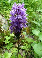
pearly-pink globular Wintergreen flowers and flourishing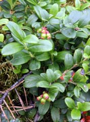 Marsh Orchids, while on
the higher ground characterising south-facing mountain slopes, lingonberries
were already forming their first unripe berries; an area representing high fell
heath-land above the tree-line supported a wealth of growth - Mountain Avens
their flowers now succeeded by feathery fruiting heads, blue-lilac harebells and
beautiful Grass of Parnassus flowers. Despite the swarming midges, we spent a
contented 3 hours photographing all these wonderful flora, and such was our
experience of the northern fell-lands after last year's Finnish trip that there
was scarcely any species which we had not previously seen growing in the wild. Marsh Orchids, while on
the higher ground characterising south-facing mountain slopes, lingonberries
were already forming their first unripe berries; an area representing high fell
heath-land above the tree-line supported a wealth of growth - Mountain Avens
their flowers now succeeded by feathery fruiting heads, blue-lilac harebells and
beautiful Grass of Parnassus flowers. Despite the swarming midges, we spent a
contented 3 hours photographing all these wonderful flora, and such was our
experience of the northern fell-lands after last year's Finnish trip that there
was scarcely any species which we had not previously seen growing in the wild.
Ájtte Sámi Museum: our next visit in Jokkmokk was to the Ájtte
Sámi Museum (Ájtte meaning storage hut in the Sámi language) whose displays aim
to illustrate both the traditional and modern ways of life of Sweden's indigenous
Sámi peoples. We had last year been impressed with the scale of engaging
displays at the equivalent Finnish Sámi Museum SIIDA in Inari; Ájtte had a lot
to live up to. Despite Ájtte's prestigious standing, the displays' commentaries
were only in Swedish and most visitors had to peer at poorly coordinated
translation booklets; in the dim light, this was an eye-wearying and tedious
distraction. One section detailed the intensely tough existence of the early
Swedish settlers in these remote northern wilderness lands, another displayed
the traditional costumes of Sweden's various Sámi areas and the contrasting
traditional and modern reindeer herding life-styles, including a detailed
account of the multiple uses of reindeer intestines and explanation of how a
Sámi's worth and status was indicated by the number of silver spoons he carried
on his belt (or perhaps we were reading the wrong translation paragraph!).
However detailed the displays at Ájtte, the absence of multi-lingual
commentary-panels at such a prestigious and expensive museum made this a
disappointingly second rate alternative to its Finnish equivalent at Inari.
 Muddus National Park: the E45 Inlandsvägen heads north from Jokkmokk with the Inlandsbanan running parallel
and the road curves past the huge Akkats dam constructed in the early 1970s amid
controversy for its environmental impact on the natural landscape of the Lilla
Luleälven river valley with a huge flooded area of the upper river forming a
reservoir for the hydro-electric generating station. For the next 25kms the E45
crossed flatter open fell with occasional glimpses of higher forested land in
the distance. Approaching the Stora Luleälven river, the road dropped steeply
down to cross the Ligga dam; the rocky gorge below the dam was now totally dry
and barren showing the degree of disruption to the river's natural state caused
by hydro-electric power (HEP) production, while upstream the reservoir lake now
flooded vast areas of fell-land. To reach the Muddus National Park, we turned
off onto an unsurfaced lane below the Ligga power station (kraft verk in
Swedish) where a maze of power lines added further to the fell-scape
contamination. The lane led uncertainly along the banks of the Luleälven river
for 10 kms ending at the car park at Skaite, the starting point for walks in the
Muddus National Park
which was set up in 1942 to conserve an area of
undisturbed primeval Taiga forest with its virgin pines, ravines and mires. Muddus National Park: the E45 Inlandsvägen heads north from Jokkmokk with the Inlandsbanan running parallel
and the road curves past the huge Akkats dam constructed in the early 1970s amid
controversy for its environmental impact on the natural landscape of the Lilla
Luleälven river valley with a huge flooded area of the upper river forming a
reservoir for the hydro-electric generating station. For the next 25kms the E45
crossed flatter open fell with occasional glimpses of higher forested land in
the distance. Approaching the Stora Luleälven river, the road dropped steeply
down to cross the Ligga dam; the rocky gorge below the dam was now totally dry
and barren showing the degree of disruption to the river's natural state caused
by hydro-electric power (HEP) production, while upstream the reservoir lake now
flooded vast areas of fell-land. To reach the Muddus National Park, we turned
off onto an unsurfaced lane below the Ligga power station (kraft verk in
Swedish) where a maze of power lines added further to the fell-scape
contamination. The lane led uncertainly along the banks of the Luleälven river
for 10 kms ending at the car park at Skaite, the starting point for walks in the
Muddus National Park
which was set up in 1942 to conserve an area of
undisturbed primeval Taiga forest with its virgin pines, ravines and mires.
Our objective today was to follow the 14km
round-trip footpath through the forests alongside the Muddusälven ravine to the
Muddusfallet where the river drops over spectacular 42m high waterfalls. With
the midges more intense than ever, we kitted up with midge-helmets spraying
ourselves with full-strength anti-midge repellent. The way-marked path gained
height steadily through the forest of ancient pine trees crossing several water
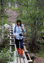
courses on board-walks. There was little by way of distinguishing features to
monitor progress in the endless, almost monotonous pine forest, and the path
twisted every-which-way both close to the gorge and away from it
(Photo
3 - Walking in the Muddus National Park); although the
way-markings were consistent, we just hoped that they were trustworthy for the
return walk. After almost 3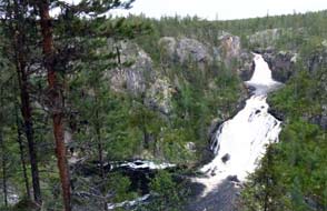 hours of walking, longer than expected, we could
hear the distant sound of rushing water although nothing was visible through the
trees. The path eventually reached a fenced look-out point overlooking a vast
basin in the canyon below into which the 2 stage falls dropped a full 42m; it
was a truly magnificent spectacle, forming a worthy climax to the
midge-ridden and featureless trek out to this lonely remote spot in the Muddus
forests. Despite the poor light, we stood at this eyrie above the canyon which
gave an unimpeded line of sight through the pines for our photos of the
Muddusfallet waterfalls (Photo 4 - Muddusfallet Waterfalls). At 3-30 we set off for the 7km return walk.
Initially route finding proceeded without difficulty, but approaching the
gorge's edge we reached a fork, unnoticed on the outward walk, with both onward
paths flagged with orange markers on the tees. A compass check confirmed the
more prominent right fork to be the correct bearing south and we continued
uncertainly since nothing seemed familiar; fortunately a distinguishing point on
the route eventually gave us confidence to proceed and after 2 hours with the midges really
bothersome we finally reached the car park. Without even removing boots, we
hastened back along the dirt to the Ligga dam road to avoid midges swarming into
the camper, and returned south to Jokkmokk for a final night at Skabram Camping.
That night despite a clear sky, the surrounding forest trees prevented our
seeing the Midnight Sun settling along the horizon; we wondered if, during the
brief period of Midnight Sun in the Swedish Arctic, we should camp at a location
with sufficiently open outlook on a clear night to witness the Midnight Sun this year. hours of walking, longer than expected, we could
hear the distant sound of rushing water although nothing was visible through the
trees. The path eventually reached a fenced look-out point overlooking a vast
basin in the canyon below into which the 2 stage falls dropped a full 42m; it
was a truly magnificent spectacle, forming a worthy climax to the
midge-ridden and featureless trek out to this lonely remote spot in the Muddus
forests. Despite the poor light, we stood at this eyrie above the canyon which
gave an unimpeded line of sight through the pines for our photos of the
Muddusfallet waterfalls (Photo 4 - Muddusfallet Waterfalls). At 3-30 we set off for the 7km return walk.
Initially route finding proceeded without difficulty, but approaching the
gorge's edge we reached a fork, unnoticed on the outward walk, with both onward
paths flagged with orange markers on the tees. A compass check confirmed the
more prominent right fork to be the correct bearing south and we continued
uncertainly since nothing seemed familiar; fortunately a distinguishing point on
the route eventually gave us confidence to proceed and after 2 hours with the midges really
bothersome we finally reached the car park. Without even removing boots, we
hastened back along the dirt to the Ligga dam road to avoid midges swarming into
the camper, and returned south to Jokkmokk for a final night at Skabram Camping.
That night despite a clear sky, the surrounding forest trees prevented our
seeing the Midnight Sun settling along the horizon; we wondered if, during the
brief period of Midnight Sun in the Swedish Arctic, we should camp at a location
with sufficiently open outlook on a clear night to witness the Midnight Sun this year.
Jokkmokk's seemingly old wooden church was in
fact only built in 1976 as a replica of the 1753 original which burnt down in
1972
(Photo 5 - Wooden church at Jokkmokk). The simple interior was painted in traditional Sámi colours and outside,
the boundary fence had openings for winter storage of coffins while waiting for
the graveyard ground to thaw for spring burial.
 Porjus hydro-electric generating station: the following day, we
returned north and across the Ligga dam the road climbed steeply uphill to reach
the Harsprånget dam, the next of the series of 15 hydro-electric generating
stations along the length of the
Luleälven, the road's gradient indicating the drop in height on the river's
course. A further 10kms uphill brought us to the huge complex of the Porjus dam
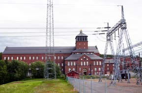
and HEP station. Signs pointed down to the visitor centre at the impressively
sized neo-Gothic building of the now redundant earlier power station
(Photo 6 - Neo-Gothic building of Porjus Old Power Station). The wooden platform of the Inlandsbanan railway stood
alongside the old power station building, and beyond that, overshadowed by
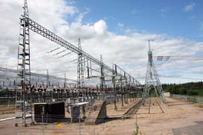
the huge network of the power distribution complex, the Porjus golf course spread
quite incongruously across the valley towards the dry river gorge below the new
Porjus earth-fill dam which filled the middle distance
(Photo 7 - Porjus dam and sluices from across the golf course). The golf course with its
artificial grass greens was 'open June~October depending on snow conditions'.
The old power station with its preserved turbines and generating equipment was
open for visits, and since we were the only visitors that afternoon, the young
fluently English-speaking guide gave us a Porjus hydro-electric generating station: the following day, we
returned north and across the Ligga dam the road climbed steeply uphill to reach
the Harsprånget dam, the next of the series of 15 hydro-electric generating
stations along the length of the
Luleälven, the road's gradient indicating the drop in height on the river's
course. A further 10kms uphill brought us to the huge complex of the Porjus dam
and HEP station. Signs pointed down to the visitor centre at the impressively
sized neo-Gothic building of the now redundant earlier power station
(Photo 6 - Neo-Gothic building of Porjus Old Power Station). The wooden platform of the Inlandsbanan railway stood
alongside the old power station building, and beyond that, overshadowed by
the huge network of the power distribution complex, the Porjus golf course spread
quite incongruously across the valley towards the dry river gorge below the new
Porjus earth-fill dam which filled the middle distance
(Photo 7 - Porjus dam and sluices from across the golf course). The golf course with its
artificial grass greens was 'open June~October depending on snow conditions'.
The old power station with its preserved turbines and generating equipment was
open for visits, and since we were the only visitors that afternoon, the young
fluently English-speaking guide gave us a
 personalised tour of the complex, with
the history of the Porjus plant's construction, technical details of the
different types of dam, physical layout and workings of a hydro-electric
generating station, and the scale of HEP exploitation along the Luleälven river. personalised tour of the complex, with
the history of the Porjus plant's construction, technical details of the
different types of dam, physical layout and workings of a hydro-electric
generating station, and the scale of HEP exploitation along the Luleälven river.
Vattenfall, the state-owned power generating and distribution company,
began building the first of Sweden's HEP plants Olidan at Trollhätten in 1909
(we had seen this earlier) and is still a state enterprise although now partly
deregulated to compete for business across the EU. It now manages all of
Sweden's power industry, hydro, nuclear and wind-power, with stakes in power
generation in Germany, Poland and Holland. 50% of Sweden's electrical supply is
generated by HEP, the other 50% from its 3 nuclear reactors. The 15 HEP stations
on the Luleälven, which drops 1000m from its source in the Norwegian mountains
down its 450km length to the Bothnian Gulf at Luleä, supply 15% of the country's
power. All of the Luleälven 15 dams are of the rock-fill type construction which
rely on steady filtering of water through the semi-permeable core and broadly
spread compacted rock and rubble build to control the pressure of water held
back in the reservoir. All 15 of the Luleälven generating stations (kraft
verks) are now remotely controlled from a central control station at
Vuollerim part-way down the river.
 The original dam at Porjus was begun in 1910 and
was a vast construction undertaking in remote wilderness terrain through the
darkness and freezing temperatures of the Arctic winter. The monumental
project's original purpose was to supply electric traction for the Malmbanan
railway taking iron ore from the mines at Gällivare and Kiruna to the ports of
Narvik and Luleä. With no roads or railways, the early building materials and
equipment to construct the dam and power station were carried in back-packs by navvies paid ½kr/kgm, along a 44kms
trackway from Gällivare. The Inlandsbanan
did not reach Porjus until 1927 and eventually followed the same route of the
navvies' track (Rollarstigen). This pioneering building project was unimaginably
harsh work and the dam/power station took 5 years to construct. King Gustav V
was due to perform the opening in 1915, but WW1 made his monarchic venture to
the Arctic too dangerous and the dam's inauguration was performed by telephone
from Stockholm. The old Porjus dam and power station The original dam at Porjus was begun in 1910 and
was a vast construction undertaking in remote wilderness terrain through the
darkness and freezing temperatures of the Arctic winter. The monumental
project's original purpose was to supply electric traction for the Malmbanan
railway taking iron ore from the mines at Gällivare and Kiruna to the ports of
Narvik and Luleä. With no roads or railways, the early building materials and
equipment to construct the dam and power station were carried in back-packs by navvies paid ½kr/kgm, along a 44kms
trackway from Gällivare. The Inlandsbanan
did not reach Porjus until 1927 and eventually followed the same route of the
navvies' track (Rollarstigen). This pioneering building project was unimaginably
harsh work and the dam/power station took 5 years to construct. King Gustav V
was due to perform the opening in 1915, but WW1 made his monarchic venture to
the Arctic too dangerous and the dam's inauguration was performed by telephone
from Stockholm. The old Porjus dam and power station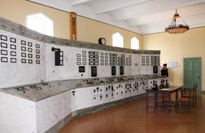 continued in operation
until 1975 when the original solid-core dam was replaced by the present massive
rock-fill dam with its underground kraft verk. The former Neo-Gothic
buidling of the former power station has been retained as a heritage site; its
machine hall 60m deep underground blasted out of solid rock still retains its
turbines serving 9 generators, 7 of the original generating units now unused as
museum pieces, and 1 replaced by a new experimental Powerformer which
generates high voltage power connected directly to the grid without the need for
step-up transformers with their inherent power loss. continued in operation
until 1975 when the original solid-core dam was replaced by the present massive
rock-fill dam with its underground kraft verk. The former Neo-Gothic
buidling of the former power station has been retained as a heritage site; its
machine hall 60m deep underground blasted out of solid rock still retains its
turbines serving 9 generators, 7 of the original generating units now unused as
museum pieces, and 1 replaced by a new experimental Powerformer which
generates high voltage power connected directly to the grid without the need for
step-up transformers with their inherent power loss.
We began our tour of the Porjus HEP station in the
control room with its array of dials, centrepiece of which was the AC frequency
metre. Our knowledgeable young guide explained the hydrodynamic working of the
dam and HEP generating station: water is fed from the reservoir-lake down intake
pipes to the turbines 60m below ground. The 2 crucial factors in determining the
quantity of electrical energy produced from the kinetic energy of the
water-driven turbines are head (the height difference between lake surface level
and turbines) and flow (the quantity of water passing the
 turbines per unit of
time), with generator power output equal to the product of head and flow. For
this reason, the turbine and generators are located 60m below the water surface
level, deep underground below the dam. After passing the turbines, used water
has therefore to be piped downhill in underground conduits for some 1.5km until
it reaches the lower level of the river's natural course, which explained why
river gorges seen below dams were dry; the dam's outflow emerges by gravity
further downstream. Donning hardhats as a token acknowledgement to health and
safety, we descended by lift 60m underground to the machine hall where one of
the turbines had been partially opened to demonstrate its working. turbines per unit of
time), with generator power output equal to the product of head and flow. For
this reason, the turbine and generators are located 60m below the water surface
level, deep underground below the dam. After passing the turbines, used water
has therefore to be piped downhill in underground conduits for some 1.5km until
it reaches the lower level of the river's natural course, which explained why
river gorges seen below dams were dry; the dam's outflow emerges by gravity
further downstream. Donning hardhats as a token acknowledgement to health and
safety, we descended by lift 60m underground to the machine hall where one of
the turbines had been partially opened to demonstrate its working.
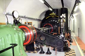
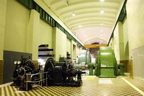 Pressured water fell down a vast shaft into the enclosed turbine chamber, the
rate of flow varied by hydraulically operated veins. The mighty steel drive
shaft connecting the turbine to the generator and turning at 250rpm was itself a
hugely impressive piece of equipment. The generator was also partly exposed to
show its workings with the rotor/alternator turning within the circular
electromagnet of the stator (Photo 8 - Generator in Porjus Old Power Station machine-hall). The noise level in the mammoth machine hall with
all this machinery operating would have have been deafening, with doubtless no
H-&-S enforced ear-protection in those days. Karin, our young guide, very
competently explained all this working and answered our many questions. She also
pointed out the manufacturer's plaque on one of the old generating sets, the ABB
company in the 1930s having a swastika as its logo; during WW2 this had
been replaced by a politically less sensitive emblem, all except this surviving
example which now had rarity value. We were certainly grateful to Karin for her
patience and impressive knowledge; doubtless the free access to the Porjus
HEP station is part of Vattenfall's image-building PR programme but our visit
had taught us much. We also leant that the following day would be the annual
Porjus Waterfall Day when the dam's sluice gates would be opened to create
a spectacular cascade temporarily re-flooding the normally dry river gorge below
the dam, just as we had earlier witnessed at Trollhätten. We decided to return
briefly tomorrow for this once-yearly event, but today we had something else
to explore beyond the dam. Pressured water fell down a vast shaft into the enclosed turbine chamber, the
rate of flow varied by hydraulically operated veins. The mighty steel drive
shaft connecting the turbine to the generator and turning at 250rpm was itself a
hugely impressive piece of equipment. The generator was also partly exposed to
show its workings with the rotor/alternator turning within the circular
electromagnet of the stator (Photo 8 - Generator in Porjus Old Power Station machine-hall). The noise level in the mammoth machine hall with
all this machinery operating would have have been deafening, with doubtless no
H-&-S enforced ear-protection in those days. Karin, our young guide, very
competently explained all this working and answered our many questions. She also
pointed out the manufacturer's plaque on one of the old generating sets, the ABB
company in the 1930s having a swastika as its logo; during WW2 this had
been replaced by a politically less sensitive emblem, all except this surviving
example which now had rarity value. We were certainly grateful to Karin for her
patience and impressive knowledge; doubtless the free access to the Porjus
HEP station is part of Vattenfall's image-building PR programme but our visit
had taught us much. We also leant that the following day would be the annual
Porjus Waterfall Day when the dam's sluice gates would be opened to create
a spectacular cascade temporarily re-flooding the normally dry river gorge below
the dam, just as we had earlier witnessed at Trollhätten. We decided to return
briefly tomorrow for this once-yearly event, but today we had something else
to explore beyond the dam.
Crash site of RAF Lancaster bomber Easy
Elsie: before the trip, Paul had researched the location of an RAF
Lancaster bomber which had crash-landed in remote Northern Swedish marshland
some 10kms from Porjus after the 1944 attack on the German battleship Tirpitz.
Setting the satnav for the site's coordinates, we crossed the Porjus dam and
continued on a narrow lane along the southern shore of Lake Stora Lulevatten in
our attempt to locate the remains of the crashed Lancaster.
 Avro Lancaster NF-920 was produced at the
Longbridge Austin works and delivered to 617 Squadron in August 1944 where it
received the designation KC-E; its crew re-christened it Easy Elsie. The
German battleship Tirpitz had been based at Kåfjord since 1943 and there
it represented a constant threat to allied convoys supplying the USSR at Murmansk
(see our log of 2012 visit to Kåfjord Tirpitz anchorage).
Tirpitz had been damaged both by the midget submarine attack in September
1943 and by Operation Paravane flown in September 1944 by 617 Squadron Lancasters after refuelling at
the Soviet airbase of Yagodnik. This was Easy Elsie's first
operational mission; she was damaged by flak on the attack at Kåfjord but
repaired and made airworthy again. Severely damaged by the air attack, Tirpitz
was moved south to Tromsø Fjord which brought the battleship within flying range
of UK. At 01-00 hours on 29 October 1944, 37 Lancasters of 617 Squadron including Easy Elsie,
each stripped of armaments, modified with extra fuel tanks and carrying one 6
ton Tallboy bomb, took off from Lossimouth on Operation Obviate to
attack
Tirpitz at Kvaløya in Tromsø Fjord. They flew in across Central Norway into neutral
Swedish airspace, turning NE over the mountains for the attack, but at the last
minute however low cloud gathered obscuring the battleship for bomb aimers.
Easy Elsie made her bombing run and her bombardier PO McLennan released his
Tallby at the battleship's assumed position. During the attack, Easy Elsie
was severely damaged by flak: the right outer engine was lost, she was losing
fuel and hydraulic fluid, and the radio was hit. Further damaged by flak
knocking out the left inner engine and losing more fuel, and with bomb doors
unable to be raised through loss of hydraulics, the resultant drag made the
aircraft difficult to fly. Avro Lancaster NF-920 was produced at the
Longbridge Austin works and delivered to 617 Squadron in August 1944 where it
received the designation KC-E; its crew re-christened it Easy Elsie. The
German battleship Tirpitz had been based at Kåfjord since 1943 and there
it represented a constant threat to allied convoys supplying the USSR at Murmansk
(see our log of 2012 visit to Kåfjord Tirpitz anchorage).
Tirpitz had been damaged both by the midget submarine attack in September
1943 and by Operation Paravane flown in September 1944 by 617 Squadron Lancasters after refuelling at
the Soviet airbase of Yagodnik. This was Easy Elsie's first
operational mission; she was damaged by flak on the attack at Kåfjord but
repaired and made airworthy again. Severely damaged by the air attack, Tirpitz
was moved south to Tromsø Fjord which brought the battleship within flying range
of UK. At 01-00 hours on 29 October 1944, 37 Lancasters of 617 Squadron including Easy Elsie,
each stripped of armaments, modified with extra fuel tanks and carrying one 6
ton Tallboy bomb, took off from Lossimouth on Operation Obviate to
attack
Tirpitz at Kvaløya in Tromsø Fjord. They flew in across Central Norway into neutral
Swedish airspace, turning NE over the mountains for the attack, but at the last
minute however low cloud gathered obscuring the battleship for bomb aimers.
Easy Elsie made her bombing run and her bombardier PO McLennan released his
Tallby at the battleship's assumed position. During the attack, Easy Elsie
was severely damaged by flak: the right outer engine was lost, she was losing
fuel and hydraulic fluid, and the radio was hit. Further damaged by flak
knocking out the left inner engine and losing more fuel, and with bomb doors
unable to be raised through loss of hydraulics, the resultant drag made the
aircraft difficult to fly.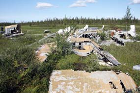
With 2 engines lost and losing fuel, there was no
way the Australian pilot, Flying Officer David Carey could get the Lancaster
back to Scotland. He and the navigator Pilot Officer Alex McKie decided to try to get over to neutral
Sweden. The rest of the squadron got back safely to Lossimouth and Easy Elsie
was reported missing in action. With maximum power on the 2 remaining engines,
Carey managed to gain sufficient height to clear the Norwegian mountains and
turned the severely damaged Lancaster south into Sweden. Between the cloud, all they could see was empty
wilderness and forest, but with fuel almost exhausted they saw a boggy clearing
in the forest near to Porjus. The crew jettisoned all weapons, ammunition and equipment to
lighten the aircraft and took up crash-landing positions for Carey to put the
aircraft down in an open space. The undercarriage cut into bog and the plane
shuddered to a halt standing on its nose and falling back into the bog. It was
11-50am. The pilot injured his knee on the instrument panel with the impact of
crash-landing, but the rest of the crew was unhurt. They destroyed all maps and
operational orders, tried to set fire to the wreckage, and carried Carey into the nearby forest. Swedish soldiers who had seen the Lancaster's
crash-landing, found the crew who were taken to Stockholm for interrogation and
later repatriated to England in November 1944.
Tirpitz was finally sunk in Tromsø Fjord in November 1944 by a further
617 and 9 Squadron Lancaster attack, Operation Catechism.
 The aircraft's engines
and radio equipment were eventually returned to
England, and the surviving wreckage left at the crash site in the marshland near
Porjus. The Porjus Archive
Committee has built a board-walk for the 2 kms leading from the lane to the
spot where Easy Elsie's wreckage remains today out in the remote Lapland
bog. Some 10kms along the narrow lane from Porjus, we reached a parking area
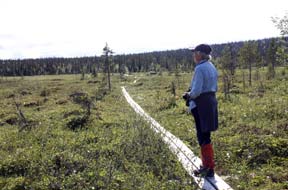
with a sign pointing into the forest 'Lancaster 2kms'. After 30 minutes' walking
out along the board-walk, the forest thinned and in the centre of a boggy
clearing we found the aircraft wreckage still at the spot where Easy Elsie
had crash-landed almost 70 years ago
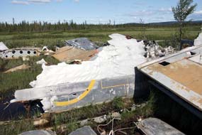
(Photo 9 - Board-walk to crash-site of RAF Lancaster Easy Elsie). Many of the aircraft's fragments were
recognisable: broken pieces of the 2 wings showing flak damage, the rear
gun-turret, sections of the Lancaster's distinctive tail-fins, engine cowlings
but of course no engines, and a section of fuselage with traces of RAF roundel.
The cockpit was destroyed when the crew had attempted to burn the aircraft. The
aircraft rested in very wet bog, but the Porjus Archive Committee's board-walk
extended around the wreckage enabling us to examine it from all angles. This was
a movingly poignant moment for us as we took our photos (Photos 10~13 - Remains of
Easy Elsie at crash-landing site),
full of admiration at this unbelievably skilful piece of navigation and flying
to put the severely damaged Lancaster down in this clearing amid almost
continuous forest without the aircraft breaking up on
hitting the bog and killing or injuring more of the crew. The aircraft's engines
and radio equipment were eventually returned to
England, and the surviving wreckage left at the crash site in the marshland near
Porjus. The Porjus Archive
Committee has built a board-walk for the 2 kms leading from the lane to the
spot where Easy Elsie's wreckage remains today out in the remote Lapland
bog. Some 10kms along the narrow lane from Porjus, we reached a parking area
with a sign pointing into the forest 'Lancaster 2kms'. After 30 minutes' walking
out along the board-walk, the forest thinned and in the centre of a boggy
clearing we found the aircraft wreckage still at the spot where Easy Elsie
had crash-landed almost 70 years ago
(Photo 9 - Board-walk to crash-site of RAF Lancaster Easy Elsie). Many of the aircraft's fragments were
recognisable: broken pieces of the 2 wings showing flak damage, the rear
gun-turret, sections of the Lancaster's distinctive tail-fins, engine cowlings
but of course no engines, and a section of fuselage with traces of RAF roundel.
The cockpit was destroyed when the crew had attempted to burn the aircraft. The
aircraft rested in very wet bog, but the Porjus Archive Committee's board-walk
extended around the wreckage enabling us to examine it from all angles. This was
a movingly poignant moment for us as we took our photos (Photos 10~13 - Remains of
Easy Elsie at crash-landing site),
full of admiration at this unbelievably skilful piece of navigation and flying
to put the severely damaged Lancaster down in this clearing amid almost
continuous forest without the aircraft breaking up on
hitting the bog and killing or injuring more of the crew.
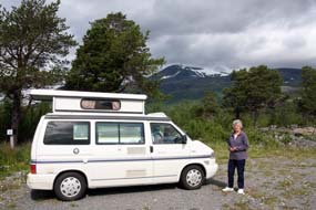 Stora Sjöfjallet
National Park: heading north on E45, we turned off onto a tarmaced
lane along the northern shore of the huge lake swollen by the Porjus dam for the
80km drive out to the Stora Sjöfjallet National Park already weary after our
long day. Apart from an occasional Sámi hut settlement, the road was deserted
and hemmed in on both sides by increasingly severe mountains the further we
progressed. An hour's drive brought us to the Stora Sjöfjallet Mountain Centre
where the greeting at reception was perfunctory verging on brusque and the
prices to camp ludicrously expensive. You needed to stay focussed on the grand
vista of snow-flecked surrounding mountains to avoid noticing the dreary
desolation of the stark open expanse of gravelled parking area that passed for a
campsite. It was late by the time we had settled in and cooked supper, wondering
why we had driven out here to camp at this unwelcoming, over-priced place. But the glorious vista of surrounding mountain peaks, the highest yet
seen in Sweden, answered our question as the sun dipped behind this monumental
mountainous backdrop (Photo 14 - Stora Sjöfjallet National Park Campsite); there
would be no Midnight Sun tonight. Stora Sjöfjallet
National Park: heading north on E45, we turned off onto a tarmaced
lane along the northern shore of the huge lake swollen by the Porjus dam for the
80km drive out to the Stora Sjöfjallet National Park already weary after our
long day. Apart from an occasional Sámi hut settlement, the road was deserted
and hemmed in on both sides by increasingly severe mountains the further we
progressed. An hour's drive brought us to the Stora Sjöfjallet Mountain Centre
where the greeting at reception was perfunctory verging on brusque and the
prices to camp ludicrously expensive. You needed to stay focussed on the grand
vista of snow-flecked surrounding mountains to avoid noticing the dreary
desolation of the stark open expanse of gravelled parking area that passed for a
campsite. It was late by the time we had settled in and cooked supper, wondering
why we had driven out here to camp at this unwelcoming, over-priced place. But the glorious vista of surrounding mountain peaks, the highest yet
seen in Sweden, answered our question as the sun dipped behind this monumental
mountainous backdrop (Photo 14 - Stora Sjöfjallet National Park Campsite); there
would be no Midnight Sun tonight.
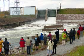 Waterfall Day at the Porjus Dam: the
following morning we returned to Porjus for the annual spectacle of the dam's
sluice gates' opening, and by the time we turned into the drive of the old power station,
the Porjus golf course was set out with stalls and children's bouncey castle
like a village fete. Just before the scheduled 2-00pm main event, we took up
position on the embankment looking directly across the now dry upper gorge
towards the dam's enormous sluice gates (Photo 15 - Porjus dam with the sluice-gates closed). An announcement over the PA system and hooter siren sounding at the dam foreshadowed the opening. Suddenly the first
small cascade of water began, swelling into a foaming, turbulent torrent
gradually filling the bed of the gorge below us (Photo 16 - Sluice-gates just opened, filling gorge below Porjus dam). What a few moments ago had been
a semi-dry rocky bed now filled into a surging, pulsing torrent advancing down
into the lower gorge (Photo 17 - Porjus dam torrent in full spate). And at 2-15, as suddenly as it had started, the foaming
flow at the sluice's downfall began to lessen then ceased, and the volume of
falling water quickly reduced as it drained down into the gorge. Within a few
minutes, the gorge bed was almost as dry as before the opening, which was almost
as impressive as the initial surging fill-up. Before leaving we walked across
the golf course past the fete's stalls to take a final look at the sturdily
impressive old power station building and the beautiful art nouveau stained
glass above the main door. Waterfall Day at the Porjus Dam: the
following morning we returned to Porjus for the annual spectacle of the dam's
sluice gates' opening, and by the time we turned into the drive of the old power station,
the Porjus golf course was set out with stalls and children's bouncey castle
like a village fete. Just before the scheduled 2-00pm main event, we took up
position on the embankment looking directly across the now dry upper gorge
towards the dam's enormous sluice gates (Photo 15 - Porjus dam with the sluice-gates closed). An announcement over the PA system and hooter siren sounding at the dam foreshadowed the opening. Suddenly the first
small cascade of water began, swelling into a foaming, turbulent torrent
gradually filling the bed of the gorge below us (Photo 16 - Sluice-gates just opened, filling gorge below Porjus dam). What a few moments ago had been
a semi-dry rocky bed now filled into a surging, pulsing torrent advancing down
into the lower gorge (Photo 17 - Porjus dam torrent in full spate). And at 2-15, as suddenly as it had started, the foaming
flow at the sluice's downfall began to lessen then ceased, and the volume of
falling water quickly reduced as it drained down into the gorge. Within a few
minutes, the gorge bed was almost as dry as before the opening, which was almost
as impressive as the initial surging fill-up. Before leaving we walked across
the golf course past the fete's stalls to take a final look at the sturdily
impressive old power station building and the beautiful art nouveau stained
glass above the main door.
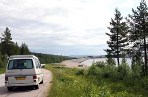 The Harsprånget dam and dry gorge: before
leaving the Luleälven we returned 10km south to see the the largest of the Luleälven
dams, the Harsprånget and its HEP generating station which with
a power output of 977MW is Sweden's largest hydro-electric plant (see right). With the
demand for electrical power from the lucrative iron ore mining industry, Harsprånget steeply downstream from Porjus was the natural site for the next
generation of HEP plants, and construction began in 1919. But the post-WW1
slump in demand for steel production halted progress and work on the new dam was
not re-started until 1945. The huge rock-fill dam was completed in 1951 and
officially opened by King Gustav VI Adolf. Driving down the road showed the
steep gradient that the Lule River must drop in the short distance from the
Porjus dam outflow. Rounding a bend, there was the massive curvature of the dam
winding across the valley. 1km beyond, we pulled into the car park signposted
for the memorial to the 10 men killed during the Harsprånget dam's
construction, and the look-out point above the now dry Harsprångetfallen canyon.
A sturdy board-walk led down over the smoothly eroded granite slabs past the
memorial into the canyon, and a spectacular viewpoint overlooking what once
would have been a torrent of waterfalls before the mighty dam further up the
valley had left the canyon high and dry (Photo 18 - Harsprånget gorge board-walk). The Harsprånget dam and dry gorge: before
leaving the Luleälven we returned 10km south to see the the largest of the Luleälven
dams, the Harsprånget and its HEP generating station which with
a power output of 977MW is Sweden's largest hydro-electric plant (see right). With the
demand for electrical power from the lucrative iron ore mining industry, Harsprånget steeply downstream from Porjus was the natural site for the next
generation of HEP plants, and construction began in 1919. But the post-WW1
slump in demand for steel production halted progress and work on the new dam was
not re-started until 1945. The huge rock-fill dam was completed in 1951 and
officially opened by King Gustav VI Adolf. Driving down the road showed the
steep gradient that the Lule River must drop in the short distance from the
Porjus dam outflow. Rounding a bend, there was the massive curvature of the dam
winding across the valley. 1km beyond, we pulled into the car park signposted
for the memorial to the 10 men killed during the Harsprånget dam's
construction, and the look-out point above the now dry Harsprångetfallen canyon.
A sturdy board-walk led down over the smoothly eroded granite slabs past the
memorial into the canyon, and a spectacular viewpoint overlooking what once
would have been a torrent of waterfalls before the mighty dam further up the
valley had left the canyon high and dry (Photo 18 - Harsprånget gorge board-walk).
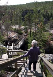 The environmental impact of hydro-power: this brought home to us the
controversial issue of the impact of supposedly environmentally friendly
hydro-electric power.
Vattenfall's web site naturally make much of HEP as a totally renewable
energy source with minimal environmental impact and zero pollution. Opponents
however point out the vast changes that the damming of natural water courses
causes and the impact on both flora and fauna: salmon can no longer follow their
powerful instinct to migrate upstream to spawn, and part of the cost of
hydro-power is the necessary annual fish re-stocking of rivers. The enlargement
of lakes caused by damming has damaging impact on reindeer grazing lands
and makes reindeer migrating routes more difficult. We had ourselves witnessed
the contrast in topographical impact of the now totally controlled Ume River
compared with the natural state of the unexploited Vindelälven valley. Of the major rivers of Northern Sweden,
only 4 now remain in their natural state unexploited by HEP, the Torne, Kalix,
Pite and Vindel Rivers. Here at Harsprånget, we could see the issue in The environmental impact of hydro-power: this brought home to us the
controversial issue of the impact of supposedly environmentally friendly
hydro-electric power.
Vattenfall's web site naturally make much of HEP as a totally renewable
energy source with minimal environmental impact and zero pollution. Opponents
however point out the vast changes that the damming of natural water courses
causes and the impact on both flora and fauna: salmon can no longer follow their
powerful instinct to migrate upstream to spawn, and part of the cost of
hydro-power is the necessary annual fish re-stocking of rivers. The enlargement
of lakes caused by damming has damaging impact on reindeer grazing lands
and makes reindeer migrating routes more difficult. We had ourselves witnessed
the contrast in topographical impact of the now totally controlled Ume River
compared with the natural state of the unexploited Vindelälven valley. Of the major rivers of Northern Sweden,
only 4 now remain in their natural state unexploited by HEP, the Torne, Kalix,
Pite and Vindel Rivers. Here at Harsprånget, we could see the issue in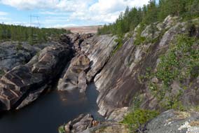 stark
terms before our very eyes: before the dam's construction, this would have been a wild torrent
flowing down the falls of the narrow canyon and subject to the natural seasonal
variations in water flow from the wild spring melt-water floods to the ice-bound
white-out of winter; the very name Harsprånget
meaning 'hare's run' was derived from the sharp turns in the rapids, similar to
a hare fleeing. Now however the gorge was entirely dry, and high above us at the
head of the canyon we could see the stark desert-like stone field of the
rock-fill dam's embankment. Having said that however, with the canyon now dry
and deprived of water by the dam, the stark natural beauty of its varied
multi-coloured rock walls were revealed in their full glory (Photo 19 - Harsprånget dry gorge with rock-fill dam at head of valley).
Modern society demands ever-increasing supplies of electricity, and
compared with the pollutant impact and short-term finiteness of expendable
fossil fuels or long-term inheritance of nuclear waste, the impact of
hydro-power seemed minimalist. Clearly there is no such thing as a free light
switch and the price to pay for hydro-power in terrain where this is feasible
seems the least damaging compared with alternative sources of energy. With this thought in mind, we clambered back up
the rocks at the look-out point marvelling at the bare rocky spectacle of this
magnificent canyon now revealed before us in all its glory thanks to the Harsprånget
dam. stark
terms before our very eyes: before the dam's construction, this would have been a wild torrent
flowing down the falls of the narrow canyon and subject to the natural seasonal
variations in water flow from the wild spring melt-water floods to the ice-bound
white-out of winter; the very name Harsprånget
meaning 'hare's run' was derived from the sharp turns in the rapids, similar to
a hare fleeing. Now however the gorge was entirely dry, and high above us at the
head of the canyon we could see the stark desert-like stone field of the
rock-fill dam's embankment. Having said that however, with the canyon now dry
and deprived of water by the dam, the stark natural beauty of its varied
multi-coloured rock walls were revealed in their full glory (Photo 19 - Harsprånget dry gorge with rock-fill dam at head of valley).
Modern society demands ever-increasing supplies of electricity, and
compared with the pollutant impact and short-term finiteness of expendable
fossil fuels or long-term inheritance of nuclear waste, the impact of
hydro-power seemed minimalist. Clearly there is no such thing as a free light
switch and the price to pay for hydro-power in terrain where this is feasible
seems the least damaging compared with alternative sources of energy. With this thought in mind, we clambered back up
the rocks at the look-out point marvelling at the bare rocky spectacle of this
magnificent canyon now revealed before us in all its glory thanks to the Harsprånget
dam.
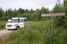 The deserted village of Harsprånget: we drove steeply uphill on the natural slope down which the Lule River flows to
reach the turning to the former settlement of Harsprånget, the village built in
this wilderness location to house the dam's construction workers and their
families. A large community developed here with all you would expect - houses,
shops, community facilities, football field - and the village was occupied until
1979, long after the dam's construction, when the last occupants moved away
transporting their houses with them on the backs of lorries. We turned in and
all that remained of the former Harsprånget village were the street name signs (Photo
20 - Site of the now abandoned village of Harsprånget).
We drove along what was once Storgatan, past the sign for the Konsum shop, and
stopped at the now weed-infested space that was once the central square. This
was an eeriily forlorn place, long bereft of its inhabitants, its memory now
preserved by the admirable Porjus Archive Committee. The deserted village of Harsprånget: we drove steeply uphill on the natural slope down which the Lule River flows to
reach the turning to the former settlement of Harsprånget, the village built in
this wilderness location to house the dam's construction workers and their
families. A large community developed here with all you would expect - houses,
shops, community facilities, football field - and the village was occupied until
1979, long after the dam's construction, when the last occupants moved away
transporting their houses with them on the backs of lorries. We turned in and
all that remained of the former Harsprånget village were the street name signs (Photo
20 - Site of the now abandoned village of Harsprånget).
We drove along what was once Storgatan, past the sign for the Konsum shop, and
stopped at the now weed-infested space that was once the central square. This
was an eeriily forlorn place, long bereft of its inhabitants, its memory now
preserved by the admirable Porjus Archive Committee.
We resumed our northward journey into Porjus,
glancing down at the span of the new Porjus dam with the Inlandsbaanan and
former navvies' track running along the near shore of the lake (Photo 21 - Porjus rock-fill dam and power station). But we still had
a long drive ahead to reach Gällivare this evening, and left Porjus for the
final time after our 2 day memorable stay.
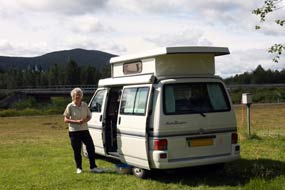 Gällivare Camping: crossing open
forested fell-land, we approached Gällivare passing Dundret Hill and the
southern side of the town, and across the river, turned into Gällivare Camping.
Here we discovered 2 choices of camping area: a grubby gravelly area crammed
with Norwegian mega-buses and their rowdy, materialist occupants, or a boggy
riverside area overwhelmed with the noise of passing mine trucks on the
nearby main E45 road. On the whole the traffic noise seemed preferable to rowdy
Norwegians and we settled in at pitch 51, the only patch of decent turf in the
whole campsite, to cook our supper of reindeer and lingonberry stew. Gällivare Camping: crossing open
forested fell-land, we approached Gällivare passing Dundret Hill and the
southern side of the town, and across the river, turned into Gällivare Camping.
Here we discovered 2 choices of camping area: a grubby gravelly area crammed
with Norwegian mega-buses and their rowdy, materialist occupants, or a boggy
riverside area overwhelmed with the noise of passing mine trucks on the
nearby main E45 road. On the whole the traffic noise seemed preferable to rowdy
Norwegians and we settled in at pitch 51, the only patch of decent turf in the
whole campsite, to cook our supper of reindeer and lingonberry stew.
The iron ore mines of Gällivare:
the
sun shone all night, although we were too tired to wait up to see the Midnight
Sun, and was still shining brightly this morning. Today we had arranged to go on
the underground tour of the LKAB deep iron ore mines at Malmberget just to the
north of Gällivare. Although it was expensive at 300kr (£30) each, you cannot come
this far north without learning something at first hand about the mining and
processing of Sweden's major export commodity, iron ore. We waited at Gällivare's
main square to be transported uphill to the mine at Malmberget by the LKAB company bus.
At the LKAB mining museum the guide gave us an outline of the history of mining
at Malmberget, a description of both the mining and processing of iron ore, and
the impact of mining subsidence on the township of Malmberget.
LKAB's mining and processing of iron ore at
Malmberget: the iron ore mine at Malmberget (Ore Mountain) is
operated by the state-owned mining company, Luossavaara-Kirunvaara
Aktiebolag (Limited Company) - LKAB - which was
formed in 1890 to exploit the huge iron ore deposits in Lapland around Gällivare
and Kiruna. It is now one of Sweden's largest industries and commodity
exporters, with LKAB products accounting for 90% of EU iron ore production and
world-wide markets, particularly the increasing China market. Late 19th/early
20th century iron ore mining at Malmberget was open cast extracting Haematite,
a form of iron oxide, and leaving a gaping chasm around which the township of
Malmberget had developed. Since the 1920s, the extraction of ore has been from
underground drifts cut ever deeper and deeper. There are a number of ore bodies
sloping down at a steep angle into the mountain under the town; at present 10
veins of the ore body are being mined with reserves of mineable ore lasting far
into the future. Mining is currently taking place at the 1,200m level making Malmberget one of the world's deepest underground iron ore mines. Most of the
ore now mined at Malmberget is in the form of Magnetitie, another variant of
iron oxide with lower proportion of oxygen than Haematite; known also as
loadstone from its naturally occurring magnetic quality which aids the iron
extraction process. The ore is extracted by a process known as sub-level caving
with horizontal drifts cut into the steeply downward-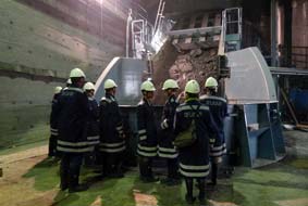 sloping ore body. Huge
fan-shaped areas are drilled and filled with explosives, blasted overnight
collapsing the ore body at that point. The following day, after dust and gases
have been cleared, the ore is transported out of the area by both
driver-controlled and remote controlled dumpers each handling up to 30 tons of
ore, and dropped via vertical chutes into storage cavities in the bed-rock. Huge
trucks then convey 90 ton loads to ore-crushers to be ground into 10cm chunks.
The crushed ore is then transported on conveyers into 40 ton skips to be hoisted
at high speed to the surface. sloping ore body. Huge
fan-shaped areas are drilled and filled with explosives, blasted overnight
collapsing the ore body at that point. The following day, after dust and gases
have been cleared, the ore is transported out of the area by both
driver-controlled and remote controlled dumpers each handling up to 30 tons of
ore, and dropped via vertical chutes into storage cavities in the bed-rock. Huge
trucks then convey 90 ton loads to ore-crushers to be ground into 10cm chunks.
The crushed ore is then transported on conveyers into 40 ton skips to be hoisted
at high speed to the surface.
Ore processing takes place on the surface. The ore
is ground into a fine powder for dressing, ie the separation of iron from
impurities and waste-rock using a magnetic process which takes advantage of Magnetitie's natural magnetic properties. After being refined into a bonded
slurry with increased iron-bearing content, the resultant mix is transformed by
a rolling process into 10mm pellets which are then sintered by a 1250º C heat
process partly melting the iron ore particles together to harden the pellets for
bulk transportation. The processed ore pellets are loaded into bulk hopper
railway wagons each carrying 100 tons of of iron ore and trains of 68 such
wagons are pulled by the world's most powerful electric locomotives from Gällivare
or Kiruna on the Malmbanan railway line to the ports of Narvik or Luleå,
depending on the ultimate customer destination, for onward sea transport to
steel works.
 Malmberget - a town under threat from mining
subsidence: we were then transported in the bus up to the township of Malmberget where we saw at first hand how the ever-deepening mining is
progressively causing subsidence and cave-ins, meaning the re-routing of roads
but more significantly the necessity for entire section of the town's housing to
be moved on the back of trucks downhill away from the mining area towards Gällivare.
The church had been moved once in the 1970s and now was to be moved again. The
guide pointed out those sections of the town listed for moving where the danger
of subsidence was greatest, monitored by 100s of listening devices in the
ground. The result was that the whole township of wooden houses had a run-down
and depressing air. At the mine's information centre, with the aid of a model
showing the ore-bodies sloping into the earth beneath Malmberget, we were told
more about the history of Malmberget's haphazard development as a mining
township, the impact of subsidence and the necessity for moving sections of the
town. The model showed the ever-increasing chasm caused by earlier open-cast
working and subsidence from modern deep-mining creeping insidiously into the
heart of the town, meaning the progressive moving of threatened homes to safer
areas. Malmberget - a town under threat from mining
subsidence: we were then transported in the bus up to the township of Malmberget where we saw at first hand how the ever-deepening mining is
progressively causing subsidence and cave-ins, meaning the re-routing of roads
but more significantly the necessity for entire section of the town's housing to
be moved on the back of trucks downhill away from the mining area towards Gällivare.
The church had been moved once in the 1970s and now was to be moved again. The
guide pointed out those sections of the town listed for moving where the danger
of subsidence was greatest, monitored by 100s of listening devices in the
ground. The result was that the whole township of wooden houses had a run-down
and depressing air. At the mine's information centre, with the aid of a model
showing the ore-bodies sloping into the earth beneath Malmberget, we were told
more about the history of Malmberget's haphazard development as a mining
township, the impact of subsidence and the necessity for moving sections of the
town. The model showed the ever-increasing chasm caused by earlier open-cast
working and subsidence from modern deep-mining creeping insidiously into the
heart of the town, meaning the progressive moving of threatened homes to safer
areas.
 The start of mining at Malmberget in 1888 resulted
in a Klondike-style 'iron rush' attracting 1000s of miners who could make make
twice the money working here than elsewhere in Sweden; a shanty town quickly
developed up on the mountain which soon grew into a haphazardly spreading
township as employees got the chance to build their own houses on free-hold land
around the mine. But as early as 1895, the mining company was already warning
that open-cast mining would soon impact on the community. By 1950 it was clear
that the ore-body deeply mined for decades extended under the township and parts
of the town centre began to be evacuated. In 1974 the church was moved to what
was believed to be a safer area but the impact of ever-deeper mining
increasingly affected the suburbs with the threat of subsidence. LKAB is now
attempting a more planned process of developing new areas of housing further
downhill towards Gällivare, but it was clear from those we spoke to later that a body of
deep resentment is felt within the community towards the necessity to move, and
the increasing degree of dilapidation in houses in the threatened areas which
will go on getting worse as the deeper mining progresses. This in spite of the
fact that without the mining, there would be no employment and no economic
future whatsoever for this one-industry dependent community. The start of mining at Malmberget in 1888 resulted
in a Klondike-style 'iron rush' attracting 1000s of miners who could make make
twice the money working here than elsewhere in Sweden; a shanty town quickly
developed up on the mountain which soon grew into a haphazardly spreading
township as employees got the chance to build their own houses on free-hold land
around the mine. But as early as 1895, the mining company was already warning
that open-cast mining would soon impact on the community. By 1950 it was clear
that the ore-body deeply mined for decades extended under the township and parts
of the town centre began to be evacuated. In 1974 the church was moved to what
was believed to be a safer area but the impact of ever-deeper mining
increasingly affected the suburbs with the threat of subsidence. LKAB is now
attempting a more planned process of developing new areas of housing further
downhill towards Gällivare, but it was clear from those we spoke to later that a body of
deep resentment is felt within the community towards the necessity to move, and
the increasing degree of dilapidation in houses in the threatened areas which
will go on getting worse as the deeper mining progresses. This in spite of the
fact that without the mining, there would be no employment and no economic
future whatsoever for this one-industry dependent community.
Underground at Malmberget iron ore mine: with this depressing story fresh in our minds, we were taken in the LKAB bus
past the closed subsidence threatened areas around a newly built section of road
to the complex of buildings by the mine's entrance to be shown firstly LKAB's
promotional video ingenuously making extravagant claims about the alleged
eco-friendly production of its 'green iron ore pellets'; it grated to think that
we had paid £30 each so far for a bus ride to see derelict housing and watch a
commercial propaganda film! But having changed into LKAB-issue overalls, boots
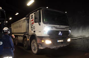
and hard-hat, it was back to the bus to be driven into the very inconspicuous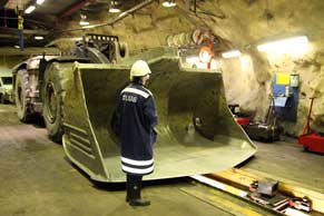 mine entrance tunnel which soon steepened to slope downwards at an alarming 10%
gradient. The bus wound down and down the steep roadway in the semi-darkness into
the mine, pausing occasionally to allow huge mine trucks to pass, and eventually
stopping when we finally reached the 1,250m working level. Amid all the noise and
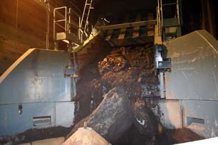
mud-slurry of a working mine, we paused to watch one these enormous trucks
conveying its 90 ton load from the drilling/cutting drifts to tip this sideways
into a chute which dropped the ore down into a gigantic ore-crusher. Back in the
bus, we descended a further level to watch the ore-crusher at work: the load of
newly extracted ore chunks fell from the chute into the crusher's slowly-turning
grinding mill and the noise was like nothing ever before experienced, a sight and
sound like something from Dante's Inferno, the air wreaking of ammonia
perhaps a residue of explosives and sparks flashing as the ore was crushed in
the hopper (Photo
22 - Underground ore-crusher at Malmberget iron ore mine). Amid all this dust, smell and din, it was back to the bus as another
of the gigantic trucks thundered past in the gloomy tunnel to be taken past the
ore conveyer to see the skip elevator which conveyed 40 ton loads of crushed ore
up to the surface for processing. Every few moments, a skip flashed past upwards
or downwards at a staggering speed, all mind-numbingly too fast to see. We were
now taken to an underground service area where in vast mechanical workshops the
bulldozers, drilling-machines and trucks of the mine were serviced. At close
quarters in better light, we could now appreciate the gigantic scale of these
massive machines (Photo 23 -
Colossal mine machinery at LKAB Malmberget iron ore mine).
 Although not able to see at first hand the ore
cutting and extraction drifts, we had spent an hour being taken around the
working tunnels, plodging around in the muddy and noisy working condition and
experiencing something of the underground methods of initial ore processing and
transportation. We re-boarded the bus for the long steeply upward drive back to
the surface. With all the gigantic dumper-trucks and mine vehicles passing at
speed along the gloomy, winding tunnels, you had to admire the guide's bravado
in taking responsibility for a bus full unruly visitors in a working mine
environment with all its hazards. Although expensive, the mine visit had given
us the chance to experience at first hand iron ore mining at depths to which
we had never before descended; we had learnt much about the ore extraction,
processing and transportation methods and its economic significance to Sweden's
economy. We had also learnt much about the impact of mining on the local
community which over the mine's 100 years of history had grown up around the Malmberget mine. Never again would we take metal for granted. Although not able to see at first hand the ore
cutting and extraction drifts, we had spent an hour being taken around the
working tunnels, plodging around in the muddy and noisy working condition and
experiencing something of the underground methods of initial ore processing and
transportation. We re-boarded the bus for the long steeply upward drive back to
the surface. With all the gigantic dumper-trucks and mine vehicles passing at
speed along the gloomy, winding tunnels, you had to admire the guide's bravado
in taking responsibility for a bus full unruly visitors in a working mine
environment with all its hazards. Although expensive, the mine visit had given
us the chance to experience at first hand iron ore mining at depths to which
we had never before descended; we had learnt much about the ore extraction,
processing and transportation methods and its economic significance to Sweden's
economy. We had also learnt much about the impact of mining on the local
community which over the mine's 100 years of history had grown up around the Malmberget mine. Never again would we take metal for granted.
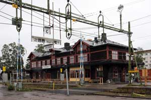
By the time we were dropped back at the centre of Gällivare,
the weather was Arctically cold and wet. In pouring rain, we walked along to the
town's railway station just to be able to say we had seen both the top and
bottom stations of the Inlandsbanan railway (Photo
24 - Gällivare station, the Inlandsbanan northern terminus); the departures board announced
departures southwards from Gällivare at 06-30 and 20-30 each day for the 1,200km
journey to Mora where we had been almost 6 weeks earlier. Back at Gällivare
Camping, one of the friendly ladies at reception had brought us samples of Magnetite iron ore and LKAB processed ore
pellets as souvenirs to remind us of our visit to the Malmberget mine.
North from Gällivare to Kiruna: the
following morning we drove up through Gällivare for the last time, the
Malmberget mine and its doomed township visible up on the hillside, and set off
northwards on the final stretch of the E45 Inlandsvägen after using this great
northern highway for much of the length of Sweden from Lake Vänern in the south.
This lonely road now passed through dense, endless spruce forests with
occasional lakes. An hour's driving brought us to the modern bridge crossing the
broad River Kalix, one of the 4 remaining unexploited rivers of Northern Sweden,
which forms the border between the Gällivare and Kiruna Communes at Lappesuanto.
Alongside the modern road bridge, the more elegant high-arching 1930s bridge
still stood which had originally replaced the former ferry-crossing of this wild
river. The road now turned NW passing more Sámi settlements, the forests now
thinner with increasing views of distant mountains, to reach the village of Svapavaara where we finally parted company with the Inlandsvägen which swung
north towards the Finnish border at Karesuando. We continued ahead on the E10
passing the huge LKAB iron ore mines of Svappavaara with their railway
ore-loading sidings. A further 20 minutes' driving brought us to the industrial
outskirts of Kiruna. As we turned off into the town, there ahead we could see
the enormous waste-rock covered gash of the Kiruna iron ore mine which cuts
across the hill of Kirunavaara dominating the town.
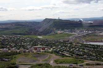 Iron ore mining at Kiruna, a city also under
threat from subsidence: Kiruna is iron ore mining, and
without it, the town simply would not exist or would still be the tiny Sámi meeting
place that it had been for centuries before 1890 when the vast underground ore
deposits had been discovered. Kiruna's name is derived from the Sámi word
Giron meaning ptarmigan. The Malmbanan railway linking Luleå to Narvik via Gällivare
and Kiruna was built in 1888, and serious mining began at Kiruna in the 1890s.
In 1900 Hjalmar Lundbohm, LKAB's first managing director founded the town of
Kiruna which, unlike Malmberget's haphazard origins, was from the start a
planned foundation developed by the LKAB company around the mines and railway.
Mining for the Magnetite iron ore was for the first half of the 20th century
open cast, cutting deep gashes across Kiruna's 2 hills of Luossovaara (meaning
Salmon Hill in Sámi) and Kiirunavaara (meaning Ptarmigan Hill). It was from the
names of these 2 hills where the original mines were dug that
Luossovaara-Kiirunavaara Aktiebolag (LKAB) got its name. But in 1950, to access
the gigantic 4km wide, 80m thick tilted disk of the Magnetite ore body which
slopes downward into the earth's crust to unknown depths beneath Kiruna's city
centre, underground mining began with the current main working level at a depth
of 1,365m. Using the sub-level caving method of extracting the ore from drifts
cut into the ore body, the area below the gash of the original open-cast working
is progressively collapsing or fracturing with the fissure zone advancing
towards the city centre. As at Malmberget, Kiruna's present city location is
therefore under threat; LKAB and Kiruna local community are now developing a
planned programme to relocate the entire central zone of the town and its
infrastructure. The LKAB company seems to have learnt the lesson about managing
the relocation project since, unlike Malmberget where community resentment is
still palpable, here at Kiruna people generally have accepted the inevitability
of moving both homes and community infrastructure; as we were told, local people
at Kiruna are asking not why the move has to take place but how, when and where? The first
phase of the move was completed in 2012 when the Malmbanan railway line through
Kiruna was relocated from the threatened area to a new route looping westwards
around the back of Kirunavaara Hill. Passenger trains from Narvik or Luleå have
now to reverse into the old railway station which will be replaced by a
temporary new station in autumn 2013, and a permanent new station will be built
when the siting of the relocated city centre has been decided after the
consultation currently taking place. Next year the E10 will be rerouted east of
the present town. Iron ore mining at Kiruna, a city also under
threat from subsidence: Kiruna is iron ore mining, and
without it, the town simply would not exist or would still be the tiny Sámi meeting
place that it had been for centuries before 1890 when the vast underground ore
deposits had been discovered. Kiruna's name is derived from the Sámi word
Giron meaning ptarmigan. The Malmbanan railway linking Luleå to Narvik via Gällivare
and Kiruna was built in 1888, and serious mining began at Kiruna in the 1890s.
In 1900 Hjalmar Lundbohm, LKAB's first managing director founded the town of
Kiruna which, unlike Malmberget's haphazard origins, was from the start a
planned foundation developed by the LKAB company around the mines and railway.
Mining for the Magnetite iron ore was for the first half of the 20th century
open cast, cutting deep gashes across Kiruna's 2 hills of Luossovaara (meaning
Salmon Hill in Sámi) and Kiirunavaara (meaning Ptarmigan Hill). It was from the
names of these 2 hills where the original mines were dug that
Luossovaara-Kiirunavaara Aktiebolag (LKAB) got its name. But in 1950, to access
the gigantic 4km wide, 80m thick tilted disk of the Magnetite ore body which
slopes downward into the earth's crust to unknown depths beneath Kiruna's city
centre, underground mining began with the current main working level at a depth
of 1,365m. Using the sub-level caving method of extracting the ore from drifts
cut into the ore body, the area below the gash of the original open-cast working
is progressively collapsing or fracturing with the fissure zone advancing
towards the city centre. As at Malmberget, Kiruna's present city location is
therefore under threat; LKAB and Kiruna local community are now developing a
planned programme to relocate the entire central zone of the town and its
infrastructure. The LKAB company seems to have learnt the lesson about managing
the relocation project since, unlike Malmberget where community resentment is
still palpable, here at Kiruna people generally have accepted the inevitability
of moving both homes and community infrastructure; as we were told, local people
at Kiruna are asking not why the move has to take place but how, when and where? The first
phase of the move was completed in 2012 when the Malmbanan railway line through
Kiruna was relocated from the threatened area to a new route looping westwards
around the back of Kirunavaara Hill. Passenger trains from Narvik or Luleå have
now to reverse into the old railway station which will be replaced by a
temporary new station in autumn 2013, and a permanent new station will be built
when the siting of the relocated city centre has been decided after the
consultation currently taking place. Next year the E10 will be rerouted east of
the present town.
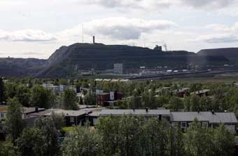 Our visit to Kiruna: we parked by
Kiruna's central square and found that LKAB had a consultation/information
display in the Folkets Hus (Community Hall) with a scale model showing clearly the
impact of the mining which created the need for the city centre's relocation (Photo
25 - Model showing mining subsidence impact on Kiruna city centre). We spent the
next half hour quizzing the LKAB staff about both mine working, impact of
subsidence and programme and options for urban relocation. With the aid of the
model, the girl patiently took us through all of this, answering our many
questions and providing us with copies of LKAB's detailed consultation documents
in English. The strange thing was that we seemed to be taking more interest in
Kiruna's problems than local people! We had been advised that the best viewpoint
from which to look across at the iron ore mines which dominated Kiruna was from
the high hill of Luossovaara. Along a neglected back road north-west of the
town, we approached the hill which still bore the gash across its face of the
earlier open-cast mining activity. Hesitantly we tackled the rough dirt road
which wound around the hillside almost to the summit from where we could look
down over the telling panorama of the township of Kiruna spread out below us (Photo
26 - LKAB iron ore mine dominating the township of Kiruna),
the railway sidings full of hopper-wagons curving round towards the mine whose
devastation was creeping ever closer towards the town. From this vantage point,
the danger zone of subsidence below the ugly gash of the former open-cast
workings which hovered over the town like a brooding Sword of Damocles was
clearly Our visit to Kiruna: we parked by
Kiruna's central square and found that LKAB had a consultation/information
display in the Folkets Hus (Community Hall) with a scale model showing clearly the
impact of the mining which created the need for the city centre's relocation (Photo
25 - Model showing mining subsidence impact on Kiruna city centre). We spent the
next half hour quizzing the LKAB staff about both mine working, impact of
subsidence and programme and options for urban relocation. With the aid of the
model, the girl patiently took us through all of this, answering our many
questions and providing us with copies of LKAB's detailed consultation documents
in English. The strange thing was that we seemed to be taking more interest in
Kiruna's problems than local people! We had been advised that the best viewpoint
from which to look across at the iron ore mines which dominated Kiruna was from
the high hill of Luossovaara. Along a neglected back road north-west of the
town, we approached the hill which still bore the gash across its face of the
earlier open-cast mining activity. Hesitantly we tackled the rough dirt road
which wound around the hillside almost to the summit from where we could look
down over the telling panorama of the township of Kiruna spread out below us (Photo
26 - LKAB iron ore mine dominating the township of Kiruna),
the railway sidings full of hopper-wagons curving round towards the mine whose
devastation was creeping ever closer towards the town. From this vantage point,
the danger zone of subsidence below the ugly gash of the former open-cast
workings which hovered over the town like a brooding Sword of Damocles was
clearly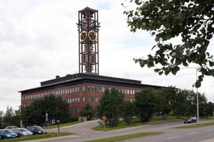 visible, the modern mine workings now over 1km below the surface
spreading the subsidence cracks insidiously towards the town centre (Photo 27 - Kiruna iron ore mine and ore-loading sidings). visible, the modern mine workings now over 1km below the surface
spreading the subsidence cracks insidiously towards the town centre (Photo 27 - Kiruna iron ore mine and ore-loading sidings).
Our next visit was to the town hall (stadhuset)
where we hoped to gain more information about plans for the town's relocation.
This featureless, block-square building with its metallic lattice clock-tower
had inexplicably won an award in 1964 as Sweden's most elegant public building (Photo
28 - Kiruna City Hall to be relocated due to mining subsidence). The vast open
space of the town hall's interior opened up before us lit by high windows; the
displays around the hall told us little more, other than a telling reproduction
of the original brief letter from LKAB's managing director to the city council
announcing 'we are going to deepen our mine so you had better move your town'
or Swedish words to that effect! To get information about the relocation of
railway line and the new station, we tried the old railway station but came away
little the wiser. Even the access road around to the LKAB mine complex had
recently been rerouted since the old road had cracked with subsidence, but we
followed this past the lines of hopper-wagons queuing in the sidings for
re-filling
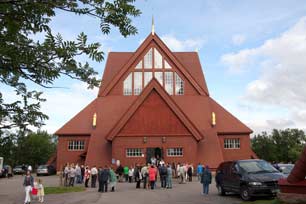 with processed ore pellets from the automated filling chutes for
onward transportation to the port of Narvik. Around at the mine complex's
entrance, security barriers prevented further progress, so we gained little more
there. Back into the town, we drove up Gruv-gatan (Mine Street - what else!) to
find Kiruna's original wooden church built in 1912 by LKAB and shaped like a
huge Sámi hut only magnified 100-fold so that the interior with all its beams
was the size of an aircraft hangar. A teenagers' confirmation service with a
congregation of proud mums and dads was just coming to an end and we waited for
the chance to take our photos
(Photo 29 - Kiruna wooden church).
This magnificent structure was another victim of the mining subsidence and was
due to be relocated plank by plank. with processed ore pellets from the automated filling chutes for
onward transportation to the port of Narvik. Around at the mine complex's
entrance, security barriers prevented further progress, so we gained little more
there. Back into the town, we drove up Gruv-gatan (Mine Street - what else!) to
find Kiruna's original wooden church built in 1912 by LKAB and shaped like a
huge Sámi hut only magnified 100-fold so that the interior with all its beams
was the size of an aircraft hangar. A teenagers' confirmation service with a
congregation of proud mums and dads was just coming to an end and we waited for
the chance to take our photos
(Photo 29 - Kiruna wooden church).
This magnificent structure was another victim of the mining subsidence and was
due to be relocated plank by plank.
Kiruna's Ripan Camping, better re-styled as
Rip-off Camping: we planned to camp overnight at Kiruna's one and only
campsite, Ripan Camping set on the hilltop above the town amid a maze of
residential streets. The glitzy marble-topped reception counter should have
alerted us to its monopolistic, over-priced 280kr/night charges. The heaped
irony of our congratulations at being the most expensive campsite in Northern
Sweden was lost on the girl at reception; her feeble attempt to justify this
excessive over-charging because of being able to see the Midnight Sun was
countered with the repost of not expecting to have to pay for that. Again there
were 2 choices of camping area: a large area crammed full of rowdy Norwegians in
their ludicrous mega-buses, or a more secluded, peaceful corner, the price for
which was a 600m trek to the one and only facilities block. You needed map and
compass to find the facilities, and when you eventually got there, neither the
card-keys nor hand-driers worked; nor did the alleged site-wide wi-fi internet.
Try as you would, there was absolutely nothing good to be said about Kiruna's
one and only campsite, which with its indefensively extortionate prices and poor
standards we renamed from Ripan Camping to Rip-off Camping.
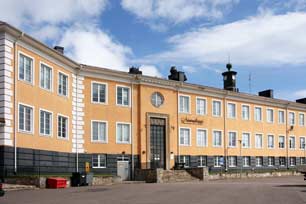 A visit to the Swedish Sámi Parliament, the
Sámediggi:
having last year visited the Finnish Sámi Parliament at Inari and the Norwegian
Sámi Parliament at Karasjok, we had telephoned the Swedish equivalent
institution in Kiruna to arrange a visit. We drove down to the
Sámediggi's grandiose building just off Adolf Hedinsvägen, (Photo 30 - Swedish Sámi Parliament Building (Sámediggi) at Kiruna)
also under threat of mining subsidence although no date or alternative
location was known, and were welcomed at reception by the young lady who had
arranged our visit. Despite her unduly modest claims to being unsure, as a
relatively junior civil servant as to how much she could contribute to our
understanding, we were in fact rewarded with over an hour's comprehensive
discussion about the history, role, constitutional status and powers of the
Swedish Sámi Parliament, the major issues facing it and its comparative standing
with the Swedish State Parliament in Stockholm. A visit to the Swedish Sámi Parliament, the
Sámediggi:
having last year visited the Finnish Sámi Parliament at Inari and the Norwegian
Sámi Parliament at Karasjok, we had telephoned the Swedish equivalent
institution in Kiruna to arrange a visit. We drove down to the
Sámediggi's grandiose building just off Adolf Hedinsvägen, (Photo 30 - Swedish Sámi Parliament Building (Sámediggi) at Kiruna)
also under threat of mining subsidence although no date or alternative
location was known, and were welcomed at reception by the young lady who had
arranged our visit. Despite her unduly modest claims to being unsure, as a
relatively junior civil servant as to how much she could contribute to our
understanding, we were in fact rewarded with over an hour's comprehensive
discussion about the history, role, constitutional status and powers of the
Swedish Sámi Parliament, the major issues facing it and its comparative standing
with the Swedish State Parliament in Stockholm.
The
Sámediggi (Sámetinget in Swedish) was established in 1993 as
supposedly the representative body for people of Sámi heritage in Sweden and an
institution of cultural autonomy for the indigenous Sámi. There are 31 members
elected for a 4 year term who meet in full forum 3 times a year in different centres across Swedish Sápmi from Kiruna, Jokkmokk, Arvidsjaur, Arjeplog to
Östersund. Sámi inhabitants can register to vote if they consider themselves
culturally or ethnically Sámi, speak the Sámi language or their
parents/grandparents spoke Sámi. Many Sámi however feel the
Sámediggi is a toothless tiger, being an agency of the State Government's
Ministry of Agriculture, largely window dressing by the Swedish State with
little or no real power directly to influence Sámi affairs or resist
encroachment by powerful interests in areas affecting the Sámi. Although under
the constitution the State Government is obliged to consult the
Sámediggi on matters affecting the Sámi, the real issue of contention
remains the continued encroachment by the powerful mining lobby into areas
traditionally associated with reindeer herding, just as previously it was
Vattenfall's building of further hydro-electric dams on the major rivers which
eroded reindeer grazing lands and migration routes. We spent our time with the
young Sámi civil servant who candidly gave us views, speaking in fluent English.
We had assumed there would be a parliamentary chamber in Kiruna as at Inari and
Karasjok, but the Sámi Parliament was itself nomadic like the people it
represented, meeting in different centres around Sápmi, and this building was just
their administrative centre. See the web site of the
Swedish Sámi Parliament
Leaving Kiruna to its unknown future: after a provisions stock-up
at the ICA modern supermarket, built on reclaimed mining land hopefully out of
the subsidence danger zone, we finally left Kiruna after our 2 day stay during
which we had come to like and admire this one-industry town. The modern centre
with its apartment blocks had no marked attractiveness but along the side
streets there were a number of the original wooden houses of the earlier town
founded by LKAB and still dominated by the mine with LKAB vehicles to be seen
everywhere. Kiruna had a likeable
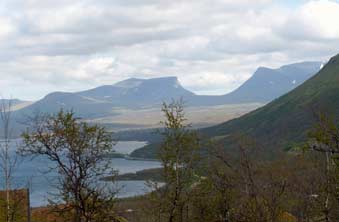 down-to-earth feel about it (almost literally
given the constant threat of mining subsidence!) and we were sorry to be
leaving. There was clearly an acceptance about the inevitability of upping
sticks and moving, and plenty of discussion, presentations and consultation
about options for relocation; but despite the threat of subsidence, there seemed
little sense of urgency and strangely little decision-taking or action other
than the enormous task of re-routing 18kms of railway line. Perhaps the wheels
of local bureaucracy grind even more slowly up here in the far north when faced
with the monumental problem of moving an entire town centre. And in the meantime LKAB go on happily digging deeper into the ore body below the town, lining the
state coffers with the proceeds. As we drove from the town out along the E10,
how many years would it be, we wondered, before the new Kiruna emerges or the
old town finally falls into the mine pit? down-to-earth feel about it (almost literally
given the constant threat of mining subsidence!) and we were sorry to be
leaving. There was clearly an acceptance about the inevitability of upping
sticks and moving, and plenty of discussion, presentations and consultation
about options for relocation; but despite the threat of subsidence, there seemed
little sense of urgency and strangely little decision-taking or action other
than the enormous task of re-routing 18kms of railway line. Perhaps the wheels
of local bureaucracy grind even more slowly up here in the far north when faced
with the monumental problem of moving an entire town centre. And in the meantime LKAB go on happily digging deeper into the ore body below the town, lining the
state coffers with the proceeds. As we drove from the town out along the E10,
how many years would it be, we wondered, before the new Kiruna emerges or the
old town finally falls into the mine pit?
Northwards to the Abisko National Park: the afternoon sun was
bright as we headed NW across the wild fell-scape towards the Norwegian border
with the west-bound Malmbanan railway running parallel. An empty ore wagon train
hauled by a pair of LKAB's powerful electric locos passed by returning empty
from Narvik for a re-fill of iron ore pellets at Kiruna. Both the road and
railway crossed several fast-running white-water rivers, and the mountain
sky-line ahead grew more and more impressive as we approached the huge 70km long
Lake Torneträsk. As we rounded huge mountains to pass along the lake shore, the
sky clouded over ominously and a chill Arctic brisk wind blew from the NW
buffeting our camper and raising white-horse crested waves across the grey
waters of the lake. The road was more narrow now with frequent heavy trucks
travelling from Norway. After a tiring drive, we reached the Absiko Mountain
Centre and pulled in to get maps and information about walks in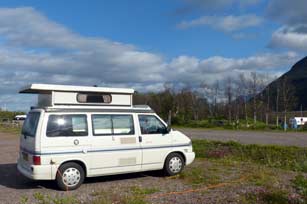 the National
Park at this northern end of the Kungsleden long-distance trek. the National
Park at this northern end of the Kungsleden long-distance trek.
Continuing along the lake-shore of Torneträsk, the road passed under a shoulder
of Njulla, a dark and foreboding 1,164m high round-topped mountain; this 2km
stretch was signed with warning alerts as an avalanche zone. We hurried past and
shortly reached the turning steeply uphill to Bjöklidens Camping, the only
remaining campsite option close to the Absiko National Park; this monopolistic
position and its attachment to a ski hotel boded ill. Check-in for the huge,
unsheltered camping area was a further 2kms uphill at the hotel reception, and
again there was little good that could be said about the place other than the
magnificent view from the terrace of the twin peaks of Lapporten (Lappish
Gate) (Photo 31 -
Lapporten,
the iconic twin peaks of Abisko National Park). We faced perfunctory
curtness from the offensively rude woman at reception who clearly had
overlooked the fact that it was guests who paid her wages and on whom her
employment depended. She was too preoccupied with enforcing the rules; no we
couldn't each have a card-key for the showers since we might steal
one - yes she actually said that! The WC/showers were dingy with non-working
light bulbs and no shower curtains, the kitchen/wash-up basic and grubby; at
240kr/night it was inhospitably poor value, but of course there was no
alternative. We shiveringly settled into the bleak camping area and a warming
supper of Swedish meatballs in a creamy lingonberry sauce cheered us up with the
camper's heater on full against the bitterly cold Arctic wind.
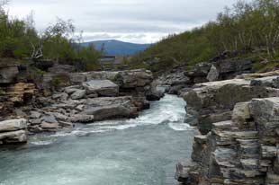 A floral walk the Abisko National Park: the following morning, we
drove back eastwards for 8kms to the Abisko Mountain Centre and kitted up for
today's walk in the
Abisko National Park on the first section of the Kungsleden trail along the Abiskojåkk
river and looping back over a nature trail past Lake Njakajaure. Family groups
with full packs were just starting out on the 450km long-distance trail, and we
followed through the ceremonial gate marking the start of the Kungsleden feeling
rather conspicuous with just our day-sacs
(Photo 32 -Northern start of the Kungsleden 450km long-distance trail). The well-used path passed through
open birch woodland badly affected by the leaf-stripping Autumnal Moth and the
river bank was lined with a wealth of wild flora including beautiful clumps of
Arctic Grass of Parnassus and tiny Twin Flowers. We found the perfect spot for
lunch sitting on the polished marble-like slabs of shale where the rushing river
had carved out a narrow channel through the outcrop to form rapids (Photo 33 - Shale slabs by Abiskojåkk river rapids at Abisko National Park). Gloomy low
cloud hovered over the tops of the surrounding high mountains. Looking back, we
could see the Malmbanan railway line crossing the river; a distant whistle
indicated a train approaching, and sure A floral walk the Abisko National Park: the following morning, we
drove back eastwards for 8kms to the Abisko Mountain Centre and kitted up for
today's walk in the
Abisko National Park on the first section of the Kungsleden trail along the Abiskojåkk
river and looping back over a nature trail past Lake Njakajaure. Family groups
with full packs were just starting out on the 450km long-distance trail, and we
followed through the ceremonial gate marking the start of the Kungsleden feeling
rather conspicuous with just our day-sacs
(Photo 32 -Northern start of the Kungsleden 450km long-distance trail). The well-used path passed through
open birch woodland badly affected by the leaf-stripping Autumnal Moth and the
river bank was lined with a wealth of wild flora including beautiful clumps of
Arctic Grass of Parnassus and tiny Twin Flowers. We found the perfect spot for
lunch sitting on the polished marble-like slabs of shale where the rushing river
had carved out a narrow channel through the outcrop to form rapids (Photo 33 - Shale slabs by Abiskojåkk river rapids at Abisko National Park). Gloomy low
cloud hovered over the tops of the surrounding high mountains. Looking back, we
could see the Malmbanan railway line crossing the river; a distant whistle
indicated a train approaching, and sure
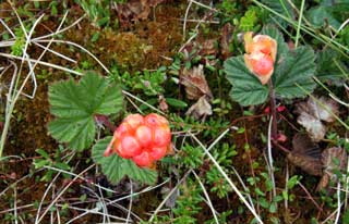 enough an LKAB
iron ore train hauled by one of the huge twin IORE electric locos trundled past across the bridge. We
continued along the Kungsleden, our progress slowed by frequent stops to
photograph the wild flora. 3kms along the river bank, the path reached a high
point looking down over the curving river which rounded a high cliff of creamy
white dolomite against a backdrop of cloud-covered mountains. The path rose to
the top of the cliff where we said farewell to the Kungsleden which descended
steeply on the southern side to continue its 450km length across the highest and wildest of Sweden's mountains to Hemavan
where we had seen its southern end. We branched off for our northward return
path on the Njakajaure nature trail. Alongside the board-walks which
crossed the wetter bogland insectivorous Butterworts flourished together with
creeping stems of Arctic Bearberry, their fruits ripening to a dark red colour
but still quite sharp in taste. Beyond this an area of drier limestone
mountain-heathland was dotted with gardens of sweet-scented Fragrant Orchids and
Creeping Lady's Tresses Orchids.
There were also lovely patches of Yellow Mountain Saxifrage and of Lapland
Rhododendron its bright red flowers still in tight bud. As we crossed a further
patch of bogland, the surrounding sphagnum moss was dotted with a broad area of
almost ripe Clouberry fruits. The bog was quite dry enabling us to venture out
from the board-walk to photograph the ripening fruits, some now almost orange
and sweetly tasting. Never before had we seen a bog surface covered with such a
profusion of Cloudberries
(Photo 34 - Cloudberry fruits growing on an Abisko sphagnum bog). This
glorious sight was the afternoon's highlight. enough an LKAB
iron ore train hauled by one of the huge twin IORE electric locos trundled past across the bridge. We
continued along the Kungsleden, our progress slowed by frequent stops to
photograph the wild flora. 3kms along the river bank, the path reached a high
point looking down over the curving river which rounded a high cliff of creamy
white dolomite against a backdrop of cloud-covered mountains. The path rose to
the top of the cliff where we said farewell to the Kungsleden which descended
steeply on the southern side to continue its 450km length across the highest and wildest of Sweden's mountains to Hemavan
where we had seen its southern end. We branched off for our northward return
path on the Njakajaure nature trail. Alongside the board-walks which
crossed the wetter bogland insectivorous Butterworts flourished together with
creeping stems of Arctic Bearberry, their fruits ripening to a dark red colour
but still quite sharp in taste. Beyond this an area of drier limestone
mountain-heathland was dotted with gardens of sweet-scented Fragrant Orchids and
Creeping Lady's Tresses Orchids.
There were also lovely patches of Yellow Mountain Saxifrage and of Lapland
Rhododendron its bright red flowers still in tight bud. As we crossed a further
patch of bogland, the surrounding sphagnum moss was dotted with a broad area of
almost ripe Clouberry fruits. The bog was quite dry enabling us to venture out
from the board-walk to photograph the ripening fruits, some now almost orange
and sweetly tasting. Never before had we seen a bog surface covered with such a
profusion of Cloudberries
(Photo 34 - Cloudberry fruits growing on an Abisko sphagnum bog). This
glorious sight was the afternoon's highlight.
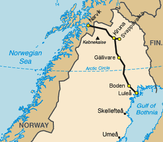 The
Malmbanan/Ofotbanen railway line: returning to the walk's start point,
we explored the Rollarstigen, the former roadway constructed by navvies to
supply building materials for the Kiruna~Narvik section of the Malmbanan railway
line. It now serves as a long-distance footpath between Abisko Östra and
Rombaksbotn in Norway. LKAB's predecessor company began mining for iron ore at
Malmberget in 1884 and 4 years later work started on the first part of the Malmbanan to transport ore down to Luleå at the head of the Bothnian Gulf. But
the English company constructing the line went bankrupt and the Swedish
government bought the line at a knock-down bargain price. Work began in
1898 on the
second half of the Malmbanan/Ofotbanen (see map right) linking Gällivare via
Kiruna to the ice-free port of Narvik on the Norwegian NW coast. This
was a monumental work of construction across high Arctic mountains, with work
going on all through the winter in appalling conditions. Rails were advanced
along the completed sections of line and materials brought by boat or
horse-drawn carts from Kiruna or Rombaksbotn, with several ports along Lake Torneträsk
including one at Abisko. In 1901 some 5,000 people were working along the length
of the new line with encampments at various points. At Abisko, to avoid the need
to construct a bridge for the line to cross the AbRel was blasted through and the course of the river
torrent diverted. A dam and power plant were built to harness the river's flow
to generate electricity to drive power The
Malmbanan/Ofotbanen railway line: returning to the walk's start point,
we explored the Rollarstigen, the former roadway constructed by navvies to
supply building materials for the Kiruna~Narvik section of the Malmbanan railway
line. It now serves as a long-distance footpath between Abisko Östra and
Rombaksbotn in Norway. LKAB's predecessor company began mining for iron ore at
Malmberget in 1884 and 4 years later work started on the first part of the Malmbanan to transport ore down to Luleå at the head of the Bothnian Gulf. But
the English company constructing the line went bankrupt and the Swedish
government bought the line at a knock-down bargain price. Work began in
1898 on the
second half of the Malmbanan/Ofotbanen (see map right) linking Gällivare via
Kiruna to the ice-free port of Narvik on the Norwegian NW coast. This
was a monumental work of construction across high Arctic mountains, with work
going on all through the winter in appalling conditions. Rails were advanced
along the completed sections of line and materials brought by boat or
horse-drawn carts from Kiruna or Rombaksbotn, with several ports along Lake Torneträsk
including one at Abisko. In 1901 some 5,000 people were working along the length
of the new line with encampments at various points. At Abisko, to avoid the need
to construct a bridge for the line to cross the AbRel was blasted through and the course of the river
torrent diverted. A dam and power plant were built to harness the river's flow
to generate electricity to drive power
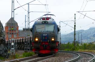 drills. At Nuolja work began in 1900 to
drive an 875m long tunnel through the shoulder of the mountain, then Sweden's
longest tunnel. We walked along part of the Navvies' Track, crossing the outflow
of the river tunnel where the torrent roared down into the deep shale canyon
flowing down towards Lake Torneträsk. drills. At Nuolja work began in 1900 to
drive an 875m long tunnel through the shoulder of the mountain, then Sweden's
longest tunnel. We walked along part of the Navvies' Track, crossing the outflow
of the river tunnel where the torrent roared down into the deep shale canyon
flowing down towards Lake Torneträsk.
To Riksgränsen on the Norwegian border: after a final and bitterly
cold night at Bjöklidens Camping with misty cloud down to ground level, we
continued westwards on the E10 for the final phase of our journey up through
Sweden towards Riksgränsen and the Norwegian border. It was a miserably
cheerless morning with low cloud still totally obscuring the surrounding fells
and the air filled with misty drizzle. In such dreary Arctic conditions, we
gained height gradually with the railway line running parallel protected by snow
fencing and avalanche sheds. It must have been an unbelievable ordeal for those
workers who constructed the line across these inhospitable mountains, with death
from disease and exposure more frequent than from industrial accidents. As we
approached the road's high point at Vassijaure, ahead in the misty drizzle we
could see the tall and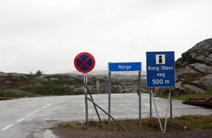 imposing tower of the brick-built railway station which
doubled as a transformer substation when the Malmbanan was electrified in 1915
with power brought by high-voltage cables the 250kms from Porjus hydro-power
plant. Transformers in the station towers at Abisko and Vassijaure dropped the
line voltage down to working levels for the railway and the advent from steam
locomotives to electric traction tripled the Malmbanan's ore transportation
capacity. As we approached Vassijaure, Sweden's northernmost station, we could
see one of the LKAB double electric IORE locomotives with a train of empty ore
hopper wagons waiting in the passing-loop for a down train to come through (Photo
35 - LKAB iron ore train from Narvik at Vassijaure on Malmbanan line).
Another LKAB train of loaded hopper wagons emerged from the snow-sheds and
roared past; the up train switched on its headlight and slowly moved forward
picking up speed with remarkable acceleration. Having watched the ore trains
passing to and from Kiruna and Narvik, we resumed our journey westwards towards
the empty, ghostly ski resort of Riksgränsen on the Swedish side of the border
to reach the open border-crossing into Norway (Photo 36 - Swedish~Norwegian border at Riksgränsen in gloomy weather). Beyond the border, leaving behind
the high fell-land plateau of Northern Sweden, the topography changed
immediately with a steep descent into severely mountainous terrain, but that's a
story for the next episode. imposing tower of the brick-built railway station which
doubled as a transformer substation when the Malmbanan was electrified in 1915
with power brought by high-voltage cables the 250kms from Porjus hydro-power
plant. Transformers in the station towers at Abisko and Vassijaure dropped the
line voltage down to working levels for the railway and the advent from steam
locomotives to electric traction tripled the Malmbanan's ore transportation
capacity. As we approached Vassijaure, Sweden's northernmost station, we could
see one of the LKAB double electric IORE locomotives with a train of empty ore
hopper wagons waiting in the passing-loop for a down train to come through (Photo
35 - LKAB iron ore train from Narvik at Vassijaure on Malmbanan line).
Another LKAB train of loaded hopper wagons emerged from the snow-sheds and
roared past; the up train switched on its headlight and slowly moved forward
picking up speed with remarkable acceleration. Having watched the ore trains
passing to and from Kiruna and Narvik, we resumed our journey westwards towards
the empty, ghostly ski resort of Riksgränsen on the Swedish side of the border
to reach the open border-crossing into Norway (Photo 36 - Swedish~Norwegian border at Riksgränsen in gloomy weather). Beyond the border, leaving behind
the high fell-land plateau of Northern Sweden, the topography changed
immediately with a steep descent into severely mountainous terrain, but that's a
story for the next episode.
Next week we shall cross into Northern Norway to visit
the port of Narvik to see the final stage of the LKAB iron ore's journey from
the deep mines of Gällivare and Kiruna to the waiting bulk carrier ships at
Narvik's ore terminal. We shall then continue northwards to visit the northern
city of Tromsø, before crossing the fjords for a return to Skibotn, a brief stay
at Kilpisjärvi in NW Finland close to the Three Borders meeting point (Treriksröset)
of Sweden, Finland and Norway, and re-entry into Northern Sweden at Karesuando.
Much fascinating journeying still to come, so join us again shortly.
Next edition
to be published quite soon
|
Sheila and Paul |
Published: 7 November 2013 |
|
 CAMPING
IN SWEDEN 2013 - across the Arctic Circle to Jokkmokk, Muddus National Park,
Porjus hydro-electric power station and Harsprånget
dam, the crash-site of WW2 Lancaster bomber Easy Elsie,
Gällivare's iron ore mines, Kiruna a town on the move, Abisko
National Park and Norwegian border:
 Crossing the Arctic Circle: some 4 kms south of Jokkmokk, we reached the
notional line of the Arctic Circle - Polcirkeln in Swedish, Napapiiri in
Finnish. Thankfully there was no overt over-commercialism, just an intelligently
worded information panel describing how the earth's angle of tilt causes the
Arctic Circle's movement. Defined as the southernmost latitude in the
Northern Hemisphere at which the Midnight Sun can be seen on the night of the
Summer Solstice, the Arctic Circle moves north and southwards across an area of
180 kms over a period of 40,000 years; it will reach its northernmost position
in the year 12,000, returning to its current position in AD 22,000 and reaching
its southernmost line in 32,000 and continuing to cycle north and south
thereafter if you care to hang around to witness this curious phenomenon. Tacky
as it seemed, we could not let our second 'crossing of the line' pass without a
photo, and even the rain stopped to honour the occasion (Photo 1 - Crossing the Arctic Circle).
 Fjällträdgård Botanic Gardens: Jokkmokk takes its name in the Sámi language
from its position on a bend in the Luleälven river.
The surrounding municipality through which the river runs covers an area the
size of Wales but with a population of just 3,000. On his expedition through
Lapland in 1732, Carl von Linné, the Swedish botanist, likened it to an earthly
paradise were it not for the midges; today was no exception, and the forecast
for our day in Jokkmokk was not good. Our first stop was at the Fjällträdgård
Botanic Gardens which display the wild flora of Norbotten province's fells and
mountains. Set along sheltered embankments each side of a brook which
tumbles from a small lake, the gardens are divided into sections representing
the different types of terrain with the flora of each growing in semi-wild
conditions: plants of the high fell-land where in winter the reindeer forage for
lichen under the snow and of the Taiga coniferous forest belt included familiar
species such as tiny Twin-flowers
(Photo 2 - Twin Flower - Linnaea borealis), Labrador Tea and Bog Bilberry; down by the
brook, flora of the birch forest meadows included tiny insectivorous Sundew,
One-flowered Wintergreen their heads always shyly turned away and pendent Water Avens; an area of moist ground representing cold water springs supported
pearly-pink globular Wintergreen flowers and flourishing
 Marsh Orchids, while on
the higher ground characterising south-facing mountain slopes, lingonberries
were already forming their first unripe berries; an area representing high fell
heath-land above the tree-line supported a wealth of growth - Mountain Avens
their flowers now succeeded by feathery fruiting heads, blue-lilac harebells and
beautiful Grass of Parnassus flowers. Despite the swarming midges, we spent a
contented 3 hours photographing all these wonderful flora, and such was our
experience of the northern fell-lands after last year's Finnish trip that there
was scarcely any species which we had not previously seen growing in the wild.
 Muddus National Park: the E45 Inlandsvägen heads north from Jokkmokk with the Inlandsbanan running parallel
and the road curves past the huge Akkats dam constructed in the early 1970s amid
controversy for its environmental impact on the natural landscape of the Lilla
Luleälven river valley with a huge flooded area of the upper river forming a
reservoir for the hydro-electric generating station. For the next 25kms the E45
crossed flatter open fell with occasional glimpses of higher forested land in
the distance. Approaching the Stora Luleälven river, the road dropped steeply
down to cross the Ligga dam; the rocky gorge below the dam was now totally dry
and barren showing the degree of disruption to the river's natural state caused
by hydro-electric power (HEP) production, while upstream the reservoir lake now
flooded vast areas of fell-land. To reach the Muddus National Park, we turned
off onto an unsurfaced lane below the Ligga power station (kraft verk in
Swedish) where a maze of power lines added further to the fell-scape
contamination. The lane led uncertainly along the banks of the Luleälven river
for 10 kms ending at the car park at Skaite, the starting point for walks in the
 hours of walking, longer than expected, we could
hear the distant sound of rushing water although nothing was visible through the
trees. The path eventually reached a fenced look-out point overlooking a vast
basin in the canyon below into which the 2 stage falls dropped a full 42m; it
was a truly magnificent spectacle, forming a worthy climax to the
midge-ridden and featureless trek out to this lonely remote spot in the Muddus
forests. Despite the poor light, we stood at this eyrie above the canyon which
gave an unimpeded line of sight through the pines for our photos of the
Muddusfallet waterfalls (Photo 4 - Muddusfallet Waterfalls). At 3-30 we set off for the 7km return walk.
Initially route finding proceeded without difficulty, but approaching the
gorge's edge we reached a fork, unnoticed on the outward walk, with both onward
paths flagged with orange markers on the tees. A compass check confirmed the
more prominent right fork to be the correct bearing south and we continued
uncertainly since nothing seemed familiar; fortunately a distinguishing point on
the route eventually gave us confidence to proceed and after 2 hours with the midges really
bothersome we finally reached the car park. Without even removing boots, we
hastened back along the dirt to the Ligga dam road to avoid midges swarming into
the camper, and returned south to Jokkmokk for a final night at Skabram Camping.
That night despite a clear sky, the surrounding forest trees prevented our
seeing the Midnight Sun settling along the horizon; we wondered if, during the
brief period of Midnight Sun in the Swedish Arctic, we should camp at a location
with sufficiently open outlook on a clear night to witness the Midnight Sun this year.
 Porjus hydro-electric generating station: the following day, we
returned north and across the Ligga dam the road climbed steeply uphill to reach
the Harsprånget dam, the next of the series of 15 hydro-electric generating
stations along the length of the
Luleälven, the road's gradient indicating the drop in height on the river's
course. A further 10kms uphill brought us to the huge complex of the Porjus dam
and HEP station. Signs pointed down to the visitor centre at the impressively
sized neo-Gothic building of the now redundant earlier power station
(Photo 6 - Neo-Gothic building of Porjus Old Power Station). The wooden platform of the Inlandsbanan railway stood
alongside the old power station building, and beyond that, overshadowed by
the huge network of the power distribution complex, the Porjus golf course spread
quite incongruously across the valley towards the dry river gorge below the new
Porjus earth-fill dam which filled the middle distance
(Photo 7 - Porjus dam and sluices from across the golf course). The golf course with its
artificial grass greens was 'open June~October depending on snow conditions'.
The old power station with its preserved turbines and generating equipment was
open for visits, and since we were the only visitors that afternoon, the young
fluently English-speaking guide gave us a
 personalised tour of the complex, with
the history of the Porjus plant's construction, technical details of the
different types of dam, physical layout and workings of a hydro-electric
generating station, and the scale of HEP exploitation along the Luleälven river.
 The original dam at Porjus was begun in 1910 and
was a vast construction undertaking in remote wilderness terrain through the
darkness and freezing temperatures of the Arctic winter. The monumental
project's original purpose was to supply electric traction for the Malmbanan
railway taking iron ore from the mines at Gällivare and Kiruna to the ports of
Narvik and Luleä. With no roads or railways, the early building materials and
equipment to construct the dam and power station were carried in back-packs by navvies paid ½kr/kgm, along a 44kms
trackway from Gällivare. The Inlandsbanan
did not reach Porjus until 1927 and eventually followed the same route of the
navvies' track (Rollarstigen). This pioneering building project was unimaginably
harsh work and the dam/power station took 5 years to construct. King Gustav V
was due to perform the opening in 1915, but WW1 made his monarchic venture to
the Arctic too dangerous and the dam's inauguration was performed by telephone
from Stockholm. The old Porjus dam and power station
 continued in operation
until 1975 when the original solid-core dam was replaced by the present massive
rock-fill dam with its underground kraft verk. The former Neo-Gothic
buidling of the former power station has been retained as a heritage site; its
machine hall 60m deep underground blasted out of solid rock still retains its
turbines serving 9 generators, 7 of the original generating units now unused as
museum pieces, and 1 replaced by a new experimental Powerformer which
generates high voltage power connected directly to the grid without the need for
step-up transformers with their inherent power loss.
 turbines per unit of
time), with generator power output equal to the product of head and flow. For
this reason, the turbine and generators are located 60m below the water surface
level, deep underground below the dam. After passing the turbines, used water
has therefore to be piped downhill in underground conduits for some 1.5km until
it reaches the lower level of the river's natural course, which explained why
river gorges seen below dams were dry; the dam's outflow emerges by gravity
further downstream. Donning hardhats as a token acknowledgement to health and
safety, we descended by lift 60m underground to the machine hall where one of
the turbines had been partially opened to demonstrate its working.
 Pressured water fell down a vast shaft into the enclosed turbine chamber, the
rate of flow varied by hydraulically operated veins. The mighty steel drive
shaft connecting the turbine to the generator and turning at 250rpm was itself a
hugely impressive piece of equipment. The generator was also partly exposed to
show its workings with the rotor/alternator turning within the circular
electromagnet of the stator (Photo 8 - Generator in Porjus Old Power Station machine-hall). The noise level in the mammoth machine hall with
all this machinery operating would have have been deafening, with doubtless no
H-&-S enforced ear-protection in those days. Karin, our young guide, very
competently explained all this working and answered our many questions. She also
pointed out the manufacturer's plaque on one of the old generating sets, the ABB
company in the 1930s having a swastika as its logo; during WW2 this had
been replaced by a politically less sensitive emblem, all except this surviving
example which now had rarity value. We were certainly grateful to Karin for her
patience and impressive knowledge; doubtless the free access to the Porjus
HEP station is part of Vattenfall's image-building PR programme but our visit
had taught us much. We also leant that the following day would be the annual
Porjus Waterfall Day when the dam's sluice gates would be opened to create
a spectacular cascade temporarily re-flooding the normally dry river gorge below
the dam, just as we had earlier witnessed at Trollhätten. We decided to return
briefly tomorrow for this once-yearly event, but today we had something else
to explore beyond the dam.
 Avro Lancaster NF-920 was produced at the
Longbridge Austin works and delivered to 617 Squadron in August 1944 where it
received the designation KC-E; its crew re-christened it Easy Elsie. The
German battleship Tirpitz had been based at Kåfjord since 1943 and there
it represented a constant threat to allied convoys supplying the USSR at Murmansk
(see our log of
 The aircraft's engines
and radio equipment were eventually returned to
England, and the surviving wreckage left at the crash site in the marshland near
Porjus. The Porjus Archive
Committee has built a board-walk for the 2 kms leading from the lane to the
spot where Easy Elsie's wreckage remains today out in the remote Lapland
bog. Some 10kms along the narrow lane from Porjus, we reached a parking area
with a sign pointing into the forest 'Lancaster 2kms'. After 30 minutes' walking
out along the board-walk, the forest thinned and in the centre of a boggy
clearing we found the aircraft wreckage still at the spot where Easy Elsie
had crash-landed almost 70 years ago
(Photo 9 - Board-walk to crash-site of RAF Lancaster Easy Elsie). Many of the aircraft's fragments were
recognisable: broken pieces of the 2 wings showing flak damage, the rear
gun-turret, sections of the Lancaster's distinctive tail-fins, engine cowlings
but of course no engines, and a section of fuselage with traces of RAF roundel.
The cockpit was destroyed when the crew had attempted to burn the aircraft. The
aircraft rested in very wet bog, but the Porjus Archive Committee's board-walk
extended around the wreckage enabling us to examine it from all angles. This was
a movingly poignant moment for us as we took our photos (Photos 10~13 - Remains of
Easy Elsie at crash-landing site),
full of admiration at this unbelievably skilful piece of navigation and flying
to put the severely damaged Lancaster down in this clearing amid almost
continuous forest without the aircraft breaking up on
hitting the bog and killing or injuring more of the crew.
 Stora Sjöfjallet
National Park: heading north on E45, we turned off onto a tarmaced
lane along the northern shore of the huge lake swollen by the Porjus dam for the
80km drive out to the Stora Sjöfjallet National Park already weary after our
long day. Apart from an occasional Sámi hut settlement, the road was deserted
and hemmed in on both sides by increasingly severe mountains the further we
progressed. An hour's drive brought us to the Stora Sjöfjallet Mountain Centre
where the greeting at reception was perfunctory verging on brusque and the
prices to camp ludicrously expensive. You needed to stay focussed on the grand
vista of snow-flecked surrounding mountains to avoid noticing the dreary
desolation of the stark open expanse of gravelled parking area that passed for a
campsite. It was late by the time we had settled in and cooked supper, wondering
why we had driven out here to camp at this unwelcoming, over-priced place. But the glorious vista of surrounding mountain peaks, the highest yet
seen in Sweden, answered our question as the sun dipped behind this monumental
mountainous backdrop (Photo 14 - Stora Sjöfjallet National Park Campsite); there
would be no Midnight Sun tonight.
 Waterfall Day at the Porjus Dam: the
following morning we returned to Porjus for the annual spectacle of the dam's
sluice gates' opening, and by the time we turned into the drive of the old power station,
the Porjus golf course was set out with stalls and children's bouncey castle
like a village fete. Just before the scheduled 2-00pm main event, we took up
position on the embankment looking directly across the now dry upper gorge
towards the dam's enormous sluice gates (Photo 15 - Porjus dam with the sluice-gates closed). An announcement over the PA system and hooter siren sounding at the dam foreshadowed the opening. Suddenly the first
small cascade of water began, swelling into a foaming, turbulent torrent
gradually filling the bed of the gorge below us (Photo 16 - Sluice-gates just opened, filling gorge below Porjus dam). What a few moments ago had been
a semi-dry rocky bed now filled into a surging, pulsing torrent advancing down
into the lower gorge (Photo 17 - Porjus dam torrent in full spate). And at 2-15, as suddenly as it had started, the foaming
flow at the sluice's downfall began to lessen then ceased, and the volume of
falling water quickly reduced as it drained down into the gorge. Within a few
minutes, the gorge bed was almost as dry as before the opening, which was almost
as impressive as the initial surging fill-up. Before leaving we walked across
the golf course past the fete's stalls to take a final look at the sturdily
impressive old power station building and the beautiful art nouveau stained
glass above the main door.
 The Harsprånget dam and dry gorge: before
leaving the Luleälven we returned 10km south to see the the largest of the Luleälven
dams, the Harsprånget and its HEP generating station which with
a power output of 977MW is Sweden's largest hydro-electric plant (see right). With the
demand for electrical power from the lucrative iron ore mining industry, Harsprånget steeply downstream from Porjus was the natural site for the next
generation of HEP plants, and construction began in 1919. But the post-WW1
slump in demand for steel production halted progress and work on the new dam was
not re-started until 1945. The huge rock-fill dam was completed in 1951 and
officially opened by King Gustav VI Adolf. Driving down the road showed the
steep gradient that the Lule River must drop in the short distance from the
Porjus dam outflow. Rounding a bend, there was the massive curvature of the dam
winding across the valley. 1km beyond, we pulled into the car park signposted
for the memorial to the 10 men killed during the Harsprånget dam's
construction, and the look-out point above the now dry Harsprångetfallen canyon.
A sturdy board-walk led down over the smoothly eroded granite slabs past the
memorial into the canyon, and a spectacular viewpoint overlooking what once
would have been a torrent of waterfalls before the mighty dam further up the
valley had left the canyon high and dry (Photo 18 - Harsprånget gorge board-walk).
 The environmental impact of hydro-power: this brought home to us the
controversial issue of the impact of supposedly environmentally friendly
hydro-electric power.
 stark
terms before our very eyes: before the dam's construction, this would have been a wild torrent
flowing down the falls of the narrow canyon and subject to the natural seasonal
variations in water flow from the wild spring melt-water floods to the ice-bound
white-out of winter; the very name Harsprånget
meaning 'hare's run' was derived from the sharp turns in the rapids, similar to
a hare fleeing. Now however the gorge was entirely dry, and high above us at the
head of the canyon we could see the stark desert-like stone field of the
rock-fill dam's embankment. Having said that however, with the canyon now dry
and deprived of water by the dam, the stark natural beauty of its varied
multi-coloured rock walls were revealed in their full glory (Photo 19 - Harsprånget dry gorge with rock-fill dam at head of valley).
Modern society demands ever-increasing supplies of electricity, and
compared with the pollutant impact and short-term finiteness of expendable
fossil fuels or long-term inheritance of nuclear waste, the impact of
hydro-power seemed minimalist. Clearly there is no such thing as a free light
switch and the price to pay for hydro-power in terrain where this is feasible
seems the least damaging compared with alternative sources of energy. With this thought in mind, we clambered back up
the rocks at the look-out point marvelling at the bare rocky spectacle of this
magnificent canyon now revealed before us in all its glory thanks to the Harsprånget
dam.
 The deserted village of Harsprånget: we drove steeply uphill on the natural slope down which the Lule River flows to
reach the turning to the former settlement of Harsprånget, the village built in
this wilderness location to house the dam's construction workers and their
families. A large community developed here with all you would expect - houses,
shops, community facilities, football field - and the village was occupied until
1979, long after the dam's construction, when the last occupants moved away
transporting their houses with them on the backs of lorries. We turned in and
all that remained of the former Harsprånget village were the street name signs (Photo
20 - Site of the now abandoned village of Harsprånget).
We drove along what was once Storgatan, past the sign for the Konsum shop, and
stopped at the now weed-infested space that was once the central square. This
was an eeriily forlorn place, long bereft of its inhabitants, its memory now
preserved by the admirable Porjus Archive Committee.
 Gällivare Camping: crossing open
forested fell-land, we approached Gällivare passing Dundret Hill and the
southern side of the town, and across the river, turned into Gällivare Camping.
Here we discovered 2 choices of camping area: a grubby gravelly area crammed
with Norwegian mega-buses and their rowdy, materialist occupants, or a boggy
riverside area overwhelmed with the noise of passing mine trucks on the
nearby main E45 road. On the whole the traffic noise seemed preferable to rowdy
Norwegians and we settled in at pitch 51, the only patch of decent turf in the
whole campsite, to cook our supper of reindeer and lingonberry stew.
 sloping ore body. Huge
fan-shaped areas are drilled and filled with explosives, blasted overnight
collapsing the ore body at that point. The following day, after dust and gases
have been cleared, the ore is transported out of the area by both
driver-controlled and remote controlled dumpers each handling up to 30 tons of
ore, and dropped via vertical chutes into storage cavities in the bed-rock. Huge
trucks then convey 90 ton loads to ore-crushers to be ground into 10cm chunks.
The crushed ore is then transported on conveyers into 40 ton skips to be hoisted
at high speed to the surface.
 Malmberget - a town under threat from mining
subsidence: we were then transported in the bus up to the township of Malmberget where we saw at first hand how the ever-deepening mining is
progressively causing subsidence and cave-ins, meaning the re-routing of roads
but more significantly the necessity for entire section of the town's housing to
be moved on the back of trucks downhill away from the mining area towards Gällivare.
The church had been moved once in the 1970s and now was to be moved again. The
guide pointed out those sections of the town listed for moving where the danger
of subsidence was greatest, monitored by 100s of listening devices in the
ground. The result was that the whole township of wooden houses had a run-down
and depressing air. At the mine's information centre, with the aid of a model
showing the ore-bodies sloping into the earth beneath Malmberget, we were told
more about the history of Malmberget's haphazard development as a mining
township, the impact of subsidence and the necessity for moving sections of the
town. The model showed the ever-increasing chasm caused by earlier open-cast
working and subsidence from modern deep-mining creeping insidiously into the
heart of the town, meaning the progressive moving of threatened homes to safer
areas.
 The start of mining at Malmberget in 1888 resulted
in a Klondike-style 'iron rush' attracting 1000s of miners who could make make
twice the money working here than elsewhere in Sweden; a shanty town quickly
developed up on the mountain which soon grew into a haphazardly spreading
township as employees got the chance to build their own houses on free-hold land
around the mine. But as early as 1895, the mining company was already warning
that open-cast mining would soon impact on the community. By 1950 it was clear
that the ore-body deeply mined for decades extended under the township and parts
of the town centre began to be evacuated. In 1974 the church was moved to what
was believed to be a safer area but the impact of ever-deeper mining
increasingly affected the suburbs with the threat of subsidence. LKAB is now
attempting a more planned process of developing new areas of housing further
downhill towards Gällivare, but it was clear from those we spoke to later that a body of
deep resentment is felt within the community towards the necessity to move, and
the increasing degree of dilapidation in houses in the threatened areas which
will go on getting worse as the deeper mining progresses. This in spite of the
fact that without the mining, there would be no employment and no economic
future whatsoever for this one-industry dependent community.
 mine entrance tunnel which soon steepened to slope downwards at an alarming 10%
gradient. The bus wound down and down the steep roadway in the semi-darkness into
the mine, pausing occasionally to allow huge mine trucks to pass, and eventually
stopping when we finally reached the 1,250m working level. Amid all the noise and
mud-slurry of a working mine, we paused to watch one these enormous trucks
conveying its 90 ton load from the drilling/cutting drifts to tip this sideways
into a chute which dropped the ore down into a gigantic ore-crusher. Back in the
bus, we descended a further level to watch the ore-crusher at work: the load of
newly extracted ore chunks fell from the chute into the crusher's slowly-turning
grinding mill and the noise was like nothing ever before experienced, a sight and
sound like something from Dante's Inferno, the air wreaking of ammonia
perhaps a residue of explosives and sparks flashing as the ore was crushed in
the hopper (Photo
22 - Underground ore-crusher at Malmberget iron ore mine). Amid all this dust, smell and din, it was back to the bus as another
of the gigantic trucks thundered past in the gloomy tunnel to be taken past the
ore conveyer to see the skip elevator which conveyed 40 ton loads of crushed ore
up to the surface for processing. Every few moments, a skip flashed past upwards
or downwards at a staggering speed, all mind-numbingly too fast to see. We were
now taken to an underground service area where in vast mechanical workshops the
bulldozers, drilling-machines and trucks of the mine were serviced. At close
quarters in better light, we could now appreciate the gigantic scale of these
massive machines (Photo 23 -
Colossal mine machinery at LKAB Malmberget iron ore mine).
 Although not able to see at first hand the ore
cutting and extraction drifts, we had spent an hour being taken around the
working tunnels, plodging around in the muddy and noisy working condition and
experiencing something of the underground methods of initial ore processing and
transportation. We re-boarded the bus for the long steeply upward drive back to
the surface. With all the gigantic dumper-trucks and mine vehicles passing at
speed along the gloomy, winding tunnels, you had to admire the guide's bravado
in taking responsibility for a bus full unruly visitors in a working mine
environment with all its hazards. Although expensive, the mine visit had given
us the chance to experience at first hand iron ore mining at depths to which
we had never before descended; we had learnt much about the ore extraction,
processing and transportation methods and its economic significance to Sweden's
economy. We had also learnt much about the impact of mining on the local
community which over the mine's 100 years of history had grown up around the Malmberget mine. Never again would we take metal for granted.
 Iron ore mining at Kiruna, a city also under
threat from subsidence: Kiruna is iron ore mining, and
without it, the town simply would not exist or would still be the tiny Sámi meeting
place that it had been for centuries before 1890 when the vast underground ore
deposits had been discovered. Kiruna's name is derived from the Sámi word
Giron meaning ptarmigan. The Malmbanan railway linking Luleå to Narvik via Gällivare
and Kiruna was built in 1888, and serious mining began at Kiruna in the 1890s.
In 1900 Hjalmar Lundbohm, LKAB's first managing director founded the town of
Kiruna which, unlike Malmberget's haphazard origins, was from the start a
planned foundation developed by the LKAB company around the mines and railway.
Mining for the Magnetite iron ore was for the first half of the 20th century
open cast, cutting deep gashes across Kiruna's 2 hills of Luossovaara (meaning
Salmon Hill in Sámi) and Kiirunavaara (meaning Ptarmigan Hill). It was from the
names of these 2 hills where the original mines were dug that
Luossovaara-Kiirunavaara Aktiebolag (LKAB) got its name. But in 1950, to access
the gigantic 4km wide, 80m thick tilted disk of the Magnetite ore body which
slopes downward into the earth's crust to unknown depths beneath Kiruna's city
centre, underground mining began with the current main working level at a depth
of 1,365m. Using the sub-level caving method of extracting the ore from drifts
cut into the ore body, the area below the gash of the original open-cast working
is progressively collapsing or fracturing with the fissure zone advancing
towards the city centre. As at Malmberget, Kiruna's present city location is
therefore under threat; LKAB and Kiruna local community are now developing a
planned programme to relocate the entire central zone of the town and its
infrastructure. The LKAB company seems to have learnt the lesson about managing
the relocation project since, unlike Malmberget where community resentment is
still palpable, here at Kiruna people generally have accepted the inevitability
of moving both homes and community infrastructure; as we were told, local people
at Kiruna are asking not why the move has to take place but how, when and where? The first
phase of the move was completed in 2012 when the Malmbanan railway line through
Kiruna was relocated from the threatened area to a new route looping westwards
around the back of Kirunavaara Hill. Passenger trains from Narvik or Luleå have
now to reverse into the old railway station which will be replaced by a
temporary new station in autumn 2013, and a permanent new station will be built
when the siting of the relocated city centre has been decided after the
consultation currently taking place. Next year the E10 will be rerouted east of
the present town.
 Our visit to Kiruna: we parked by
Kiruna's central square and found that LKAB had a consultation/information
display in the Folkets Hus (Community Hall) with a scale model showing clearly the
impact of the mining which created the need for the city centre's relocation (Photo
25 - Model showing mining subsidence impact on Kiruna city centre). We spent the
next half hour quizzing the LKAB staff about both mine working, impact of
subsidence and programme and options for urban relocation. With the aid of the
model, the girl patiently took us through all of this, answering our many
questions and providing us with copies of LKAB's detailed consultation documents
in English. The strange thing was that we seemed to be taking more interest in
Kiruna's problems than local people! We had been advised that the best viewpoint
from which to look across at the iron ore mines which dominated Kiruna was from
the high hill of Luossovaara. Along a neglected back road north-west of the
town, we approached the hill which still bore the gash across its face of the
earlier open-cast mining activity. Hesitantly we tackled the rough dirt road
which wound around the hillside almost to the summit from where we could look
down over the telling panorama of the township of Kiruna spread out below us (Photo
26 - LKAB iron ore mine dominating the township of Kiruna),
the railway sidings full of hopper-wagons curving round towards the mine whose
devastation was creeping ever closer towards the town. From this vantage point,
the danger zone of subsidence below the ugly gash of the former open-cast
workings which hovered over the town like a brooding Sword of Damocles was
clearly
 visible, the modern mine workings now over 1km below the surface
spreading the subsidence cracks insidiously towards the town centre (Photo 27 - Kiruna iron ore mine and ore-loading sidings).
 with processed ore pellets from the automated filling chutes for
onward transportation to the port of Narvik. Around at the mine complex's
entrance, security barriers prevented further progress, so we gained little more
there. Back into the town, we drove up Gruv-gatan (Mine Street - what else!) to
find Kiruna's original wooden church built in 1912 by LKAB and shaped like a
huge Sámi hut only magnified 100-fold so that the interior with all its beams
was the size of an aircraft hangar. A teenagers' confirmation service with a
congregation of proud mums and dads was just coming to an end and we waited for
the chance to take our photos
(Photo 29 - Kiruna wooden church).
This magnificent structure was another victim of the mining subsidence and was
due to be relocated plank by plank.
 A visit to the Swedish Sámi Parliament, the
Sámediggi:
having last year visited the Finnish Sámi Parliament at Inari and the Norwegian
Sámi Parliament at Karasjok, we had telephoned the Swedish equivalent
institution in Kiruna to arrange a visit. We drove down to the
Sámediggi's grandiose building just off Adolf Hedinsvägen, (Photo 30 - Swedish Sámi Parliament Building (Sámediggi) at Kiruna)
also under threat of mining subsidence although no date or alternative
location was known, and were welcomed at reception by the young lady who had
arranged our visit. Despite her unduly modest claims to being unsure, as a
relatively junior civil servant as to how much she could contribute to our
understanding, we were in fact rewarded with over an hour's comprehensive
discussion about the history, role, constitutional status and powers of the
Swedish Sámi Parliament, the major issues facing it and its comparative standing
with the Swedish State Parliament in Stockholm.
 down-to-earth feel about it (almost literally
given the constant threat of mining subsidence!) and we were sorry to be
leaving. There was clearly an acceptance about the inevitability of upping
sticks and moving, and plenty of discussion, presentations and consultation
about options for relocation; but despite the threat of subsidence, there seemed
little sense of urgency and strangely little decision-taking or action other
than the enormous task of re-routing 18kms of railway line. Perhaps the wheels
of local bureaucracy grind even more slowly up here in the far north when faced
with the monumental problem of moving an entire town centre. And in the meantime LKAB go on happily digging deeper into the ore body below the town, lining the
state coffers with the proceeds. As we drove from the town out along the E10,
how many years would it be, we wondered, before the new Kiruna emerges or the
old town finally falls into the mine pit?
 the National
Park at this northern end of the Kungsleden long-distance trek.
 A floral walk the Abisko National Park: the following morning, we
drove back eastwards for 8kms to the Abisko Mountain Centre and kitted up for
today's walk in the
 enough an LKAB
iron ore train hauled by one of the huge twin IORE electric locos trundled past across the bridge. We
continued along the Kungsleden, our progress slowed by frequent stops to
photograph the wild flora. 3kms along the river bank, the path reached a high
point looking down over the curving river which rounded a high cliff of creamy
white dolomite against a backdrop of cloud-covered mountains. The path rose to
the top of the cliff where we said farewell to the Kungsleden which descended
steeply on the southern side to continue its 450km length across the highest and wildest of Sweden's mountains to Hemavan
where we had seen its southern end. We branched off for our northward return
path on the Njakajaure nature trail. Alongside the board-walks which
crossed the wetter bogland insectivorous Butterworts flourished together with
creeping stems of Arctic Bearberry, their fruits ripening to a dark red colour
but still quite sharp in taste. Beyond this an area of drier limestone
mountain-heathland was dotted with gardens of sweet-scented Fragrant Orchids and
Creeping Lady's Tresses Orchids.
There were also lovely patches of Yellow Mountain Saxifrage and of Lapland
Rhododendron its bright red flowers still in tight bud. As we crossed a further
patch of bogland, the surrounding sphagnum moss was dotted with a broad area of
almost ripe Clouberry fruits. The bog was quite dry enabling us to venture out
from the board-walk to photograph the ripening fruits, some now almost orange
and sweetly tasting. Never before had we seen a bog surface covered with such a
profusion of Cloudberries
(Photo 34 - Cloudberry fruits growing on an Abisko sphagnum bog). This
glorious sight was the afternoon's highlight.
 The
Malmbanan/Ofotbanen railway line: returning to the walk's start point,
we explored the Rollarstigen, the former roadway constructed by navvies to
supply building materials for the Kiruna~Narvik section of the Malmbanan railway
line. It now serves as a long-distance footpath between Abisko Östra and
Rombaksbotn in Norway. LKAB's predecessor company began mining for iron ore at
Malmberget in 1884 and 4 years later work started on the first part of the Malmbanan to transport ore down to Luleå at the head of the Bothnian Gulf. But
the English company constructing the line went bankrupt and the Swedish
government bought the line at a knock-down bargain price. Work began in
1898 on the
second half of the Malmbanan/Ofotbanen (see map right) linking Gällivare via
Kiruna to the ice-free port of Narvik on the Norwegian NW coast. This
was a monumental work of construction across high Arctic mountains, with work
going on all through the winter in appalling conditions. Rails were advanced
along the completed sections of line and materials brought by boat or
horse-drawn carts from Kiruna or Rombaksbotn, with several ports along Lake Torneträsk
including one at Abisko. In 1901 some 5,000 people were working along the length
of the new line with encampments at various points. At Abisko, to avoid the need
to construct a bridge for the line to cross the AbRel was blasted through and the course of the river
torrent diverted. A dam and power plant were built to harness the river's flow
to generate electricity to drive power
 drills. At Nuolja work began in 1900 to
drive an 875m long tunnel through the shoulder of the mountain, then Sweden's
longest tunnel. We walked along part of the Navvies' Track, crossing the outflow
of the river tunnel where the torrent roared down into the deep shale canyon
flowing down towards Lake Torneträsk.
 imposing tower of the brick-built railway station which
doubled as a transformer substation when the Malmbanan was electrified in 1915
with power brought by high-voltage cables the 250kms from Porjus hydro-power
plant. Transformers in the station towers at Abisko and Vassijaure dropped the
line voltage down to working levels for the railway and the advent from steam
locomotives to electric traction tripled the Malmbanan's ore transportation
capacity. As we approached Vassijaure, Sweden's northernmost station, we could
see one of the LKAB double electric IORE locomotives with a train of empty ore
hopper wagons waiting in the passing-loop for a down train to come through (Photo
35 - LKAB iron ore train from Narvik at Vassijaure on Malmbanan line).
Another LKAB train of loaded hopper wagons emerged from the snow-sheds and
roared past; the up train switched on its headlight and slowly moved forward
picking up speed with remarkable acceleration. Having watched the ore trains
passing to and from Kiruna and Narvik, we resumed our journey westwards towards
the empty, ghostly ski resort of Riksgränsen on the Swedish side of the border
to reach the open border-crossing into Norway (Photo 36 - Swedish~Norwegian border at Riksgränsen in gloomy weather). Beyond the border, leaving behind
the high fell-land plateau of Northern Sweden, the topography changed
immediately with a steep descent into severely mountainous terrain, but that's a
story for the next episode.